 Block
From the record
One of 154 National Register listings published here for Honolulu County · listed in 2019 · category: Building.
Sources: the National Register database, National Park Service
Listed on the National Register of Historic Places in 2019.
One of 154 National Register listings published here for Honolulu County · listed in 2019 · category: Building.
Sources: the National Register database, National Park Service
Regional context, not property-specific evidence. The federal wildfire occurrence database lists 224 fires within 5 miles of Henry J. and Alyce Kaiser Estate between 2001 and 2013, burning about 762 acres in total. None started naturally. None was recorded as arson. Distance is straight-line from the map coordinates, so a fire counted here may appear on a neighbouring settlement's page as well.
| Reported cause | Fires |
|---|---|
| Missing data/not specified/undetermined | 224 |
The most recent of them, most recent first, with the day each was reported and the service that recorded it.
| Date | Cause | Size | Reported by | Name on the report |
|---|---|---|---|---|
| 9 September 2008 | Missing data/not specified/undetermined | under an acre | City and County of Honolulu | not named |
| 9 September 2002 | Missing data/not specified/undetermined | under an acre | City and County of Honolulu | not named |
| 7 September 2003 | Missing data/not specified/undetermined | under an acre | City and County of Honolulu | not named |
| 7 September 2002 | Missing data/not specified/undetermined | under an acre | City and County of Honolulu | not named |
| 30 September 2011 | Missing data/not specified/undetermined | under an acre | City and County of Honolulu | not named |
| 30 September 2010 | Missing data/not specified/undetermined | under an acre | City and County of Honolulu | not named |
| 30 September 2003 | Missing data/not specified/undetermined | 1.0 acres | City and County of Honolulu | not named |
| 3 September 2002 | Missing data/not specified/undetermined | under an acre | City and County of Honolulu | not named |
Regional context, not property-specific evidence. The federal mineral resources record lists 1 working within 5 miles of Henry J. and Alyce Kaiser Estate: 1 past producer. None of them still produces. What was taken out: Calcium. Distance is straight-line from the map coordinates, so a quarry counted here may appear on a neighbouring settlement's page as well.
| Where | Site | Commodity | Status | Recorded |
|---|---|---|---|---|
| Waimanalo Quarry and Mill | Calcium | Past Producer |
Regional context, not property-specific evidence. The National Weather Service names Honolulu, the town this property stands in, in 26 storm reports between 1996 and 2023: 7 flood, 7 flash flood, 4 heavy rain, 2 funnel cloud. No death or injury is recorded in these reports. Each account below is quoted exactly as the forecast office filed it, from the NOAA Storm Events Database, and each date opens the federal record of that event.
| When | Event | Place named | Harm | What the report says |
|---|---|---|---|---|
| March 1996 | Thunderstorm Wind | Honolulu | $2,000 | no account filed |
| April 2023 | Flood | Honolulu | - | Oahu emergency management reported the School Street onramp to H1 Freeway was|closed due to water over the roadway. |
| June 2019 | Flash Flood | Honolulu | - | Heavy runoff from showers and thunderstorms caused deep ponding on the H-1 freeway near the Liliha Street overpass. Deep ponding of precipitation also occurred along Nimitz Highway near Fort and River streets, on Ahua Street in the Mapunapuna area, and H-1 freeway westbound near the Pali Highway off-ramp. |
| September 2018 | Flash Flood | Honolulu | - | Kalihi Stream overflowed onto Dillingham Boulevard in Honolulu on Oahu, closing the roadway. |
| July 2016 | Flash Flood | Honolulu | - | H-1 Westbound at Liliha Street on Oahu closed due to flooding waters and stalled vehicles. Precipitation was associated with Tropical Storm Darby. |
| September 2015 | Flash Flood | Honolulu | - | One foot of water flooded the intersection of Liliha, Dillingham, and North King Street in Honolulu on the island of Oahu. More flash flooding was reported at the intersection of Dillingham and Alakawa, and Liliha Street was closed in both directions from King to Vineyard Boulevard because of excessive ponding on the roadway. In the Iwilei section of Honolulu, Dole Cannery and surrounding offices had to be evacuated due to flooding on the first floor, including rooms with electrical equipment. |
| December 2011 | Flash Flood | Honolulu | - | Heavy rain caused a debris flow at the westbound H-1 Freeway off ramp to School Street. This closed the roadway for a time while highway crews cleared the debris. |
| December 1996 | Flood | Honolulu | - | Scattered areas of minor street flooding reported across Oahu. |
| November 2011 | Heavy Rain | Honolulu | - | no account filed |
| November 2007 | Heavy Rain | Honolulu | - | no account filed |
| November 2007 | Heavy Rain | Honolulu | - | no account filed |
| January 2005 | Heavy Rain | Honolulu | - | no account filed |
| June 2005 | Funnel Cloud | Honolulu | - | no account filed |
| February 2004 | Flash Flood | Honolulu | - | no account filed |
| October 2002 | Wildfire | Honolulu | - | no account filed |
| September 2002 | Wildfire | Honolulu | - | no account filed |
| June 2001 | Flash Flood | Honolulu | - | no account filed |
| October 2001 | Flood | Honolulu | - | no account filed |
| January 1999 | Flood | Honolulu | - | no account filed |
| December 1998 | Waterspout | Honolulu | - | no account filed |
| January 1998 | Flood | Honolulu | - | no account filed |
| August 1997 | Flood | Honolulu | - | no account filed |
| April 1997 | Waterspout | Honolulu | - | no account filed |
| March 1997 | Flood | Honolulu | - | no account filed |
| March 1996 | Funnel Cloud | Honolulu | - | no account filed |
| March 1996 | Thunderstorm Wind | Honolulu | - | no account filed |
No historic map-sheet match is published for this property yet. That does not mean no map exists. This record needs a coordinate-quality review before it can be joined to a sheet boundary. Browse the county's mapped places while that work is pending.
Other National Register properties close enough to walk or drive between, ordered by distance from this one. Both positions come from the same geocoding pass that matched these properties to their map sheets.
| Photograph | Property | Distance | Listed |
|---|---|---|---|
| J.B. Guard House | 0.5 miles | 2015 | |
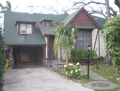 | Bartlett Cooper House | 4.5 miles | 1987 |
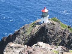 | U.S. Coast Guard Makapuu Point Light | 4.8 miles | 1977 |
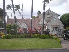 | J. Alvin Shadinger House | 4.9 miles | 1987 |
| Charles A. Simpson House | 5.2 miles | 1987 | |
| John and Kate Kelly House | 5.5 miles | 1991 |
| National Archives record | The nomination case file for reference 100004289 in Record Group 79. |
| Honolulu County | All 154 listed properties in this county. |