Block
From the record
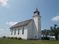
33 National Register listings published here, 1 of them a National Historic Landmark.
Sources: the National Register database, National Park Service
111 topographic sheets cover 38 settlements here, and 33 properties are on the National Register of Historic Places.
33 National Register listings published here, 1 of them a National Historic Landmark.
Sources: the National Register database, National Park Service
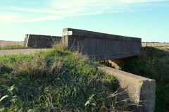
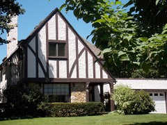
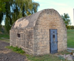
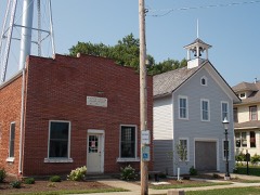
Every property in this county listed on the National Register of Historic Places, with the year it was listed and the federal nomination document.
Every wildfire the federal occurrence database records inside this county: 53 of them, burning about 251 acres. None started naturally and none was recorded as arson. Each settlement page carries the fires within five miles of it.
| Reported cause | Fires |
|---|---|
| Missing data/not specified/undetermined | 32 |
| Debris and open burning | 15 |
| Smoking | 2 |
| Equipment and vehicle use | 2 |
| Railroad operations and maintenance | 1 |
| Recreation and ceremony | 1 |
The five largest, by the area the report gives. None of them was recorded as arson.
| Date | Cause | Size | Reported by | Name on the report |
|---|---|---|---|---|
| 1 April 2010 | Missing data/not specified/undetermined | 50 acres | Iowa Department of Natural Resources | 5930 44TH AVENUE S, CLINTON, IOWA |
| 31 March 2010 | Missing data/not specified/undetermined | 35 acres | Iowa Department of Natural Resources | 4602 9TH STREET, CAMANCHE, IOWA |
| 11 April 2009 | Missing data/not specified/undetermined | 26 acres | Iowa Department of Natural Resources | not named |
| 6 January 2012 | Debris and open burning | 15 acres | Iowa Department of Natural Resources | not named |
| 13 March 2009 | Missing data/not specified/undetermined | 10 acres | Iowa Department of Natural Resources | not named |
| 9 April 2014 | Debris and open burning | 10 acres | Iowa Department of Natural Resources | not named |
| 12 April 2017 | Debris and open burning | 10 acres | Iowa Department of Natural Resources | not named |
| 11 April 2010 | Missing data/not specified/undetermined | 9.0 acres | Iowa Department of Natural Resources | 230TH AVENUE, IOWA |
Every settlement page carries the fires within five miles of it - see the settlement index below.
The NOAA Storm Events Database holds 578 reports for this county, causing 2 deaths, 30 injuries and about $45,692,600 in recorded property damage. Each settlement page carries the reports that name it.
| Kind of event | Reports |
|---|---|
| Thunderstorm Wind | 288 |
| Hail | 141 |
| Tornado | 52 |
| Flood | 43 |
| Flash Flood | 36 |
| Lightning | 6 |
| Funnel Cloud | 6 |
| Heavy Rain | 5 |
| Winter Weather | 1 |
The most serious of them, by death, then injury, then recorded damage. The accounts are quoted exactly as the forecast office filed them.
| When | Event | Place named | Harm | What the report says |
|---|---|---|---|---|
| June 1974 | Tornado (F3) | not stated | 1 killed, 20 hurt, $2,500,000 | no account filed |
| June 2000 | Flood | Clinton | 1 killed | no account filed |
| April 1965 | Tornado (F4) | not stated | 3 hurt, $2,500,000 | no account filed |
| March 2016 | Tornado (EF1) | Clinton Muni Arpt | 3 hurt, $50,000 | An EF-1 tornado with winds estimated at 90 mph hit a mobile home park, destroying at least 5 mobile homes and damaging numerous others. At least 3 people were injuried. |
| November 1975 | Tornado (F2) | not stated | 2 hurt, $250,000 | no account filed |
| August 1979 | Tornado (F1) | not stated | 1 hurt, $250,000 | no account filed |
| March 2023 | Tornado (EF2) | Grand Mound | 1 hurt | A strong tornado developed over the southeast part of Grand Mound, Iowa, and tracked through Charlotte, Iowa. A continuous damage track was noted, with several damaged houses, especially in Charlotte. The highest damage rating was located northeast of Grand Mound, where a whole house was shifted off it's foundation, and an entire house completely collapsed. Many areas noted tree damage and snapped power poles along the track of the tornado as well. Damage was also noted in Charlotte, associated with partial to complete destruction of barns and outbuildings. 3 people where trapped in the house that collapsed in Grand Mound, and one was transported to the hospital with minor injuries. The peak winds were estimated at 120 mph. |
| May 1988 | Tornado (F3) | not stated | $25,000,000 | no account filed |
| March 1991 | Tornado (F2) | not stated | $2,500,000 | no account filed |
| April 1981 | Tornado (F1) | not stated | $2,500,000 | no account filed |
| May 1996 | Thunderstorm Wind | Clinton | $1,000,000 | no account filed |
| May 1996 | Tornado (F1) | Clinton | $1,000,000 | no account filed |
| June 2008 | Flood | Toronto | $646,000 | no account filed |
| June 2010 | Flood | Toronto | $500,000 | Heavy rains during the third week of June resulted in the Wapsipinicon River at De Witt going above the moderate flood stage level of 11.5 feet on June 17 around 630 am. After briefly falling back below 11.5 feet, it crested above the major flood stage around 13.2 feet around 7 pm June 22. It fell below the moderate flood stage level around 7 pm June 28. |
| August 2009 | Flash Flood | Welton | $500,000 | Heavy rains of 3 to 6 inches resulted in some flash flooding across much of Clinton County on August 27. Some areas particularly hard hit were De Witt, Welton, and Charlotte. Several residences experienced flooded basements. Two large trees fell over due to erosion from running water in De Witt. Street flooding was also common across the area. Old Highway 61 had water over it in the Welton area. Some residences in Charlotte had to be evacuated due to the rising flood waters. An off-duty NWS employee also contributed to this report. |
| August 2009 | Flood | Toronto | $500,000 | no account filed |
| June 2010 | Thunderstorm Wind | Low Moor | $300,000 | A large grain bin and elevator were lifted slightly by severe thunderstorm winds, and then collapsed when they dropped back to the ground. |
| May 2010 | Flood | Toronto | $250,000 | Heavy rains during the second week of May resulted in the Wapsipinicon River at De Witt going above the moderate flood stage level of 11.5 feet on May 18 around 1 pm. It crested around 11.9 feet around 1 am May 21. It fell below the moderate flood stage level around 1 am May 23. |
| August 2008 | Tornado (EF0) | Charlotte | $250,000 | An EF0 tornado damaged three farmsteads along a path from 3.2 miles north northeast of Charlotte, IA to 4 miles south southwest of Goose Lake, IA between 547 pm and 605 pm August 4. Several outbuildings were damaged with the total loss of the roofing on many of them. Many trees and branches were damaged, with several large trees blown down or snapped off. |
| April 2011 | Flood | Hauntown | $250,000 | no account filed |
| July 2010 | Flood | Toronto | $250,000 | no account filed |
| July 2010 | Flood | Toronto | $250,000 | no account filed |
| July 1995 | Hail | Calamus | $250,000 | no account filed |
| March 1990 | Tornado (F1) | not stated | $250,000 | no account filed |
| August 1988 | Tornado (F0) | not stated | $250,000 | no account filed |
| July 1987 | Tornado (F1) | not stated | $250,000 | no account filed |
| January 1967 | Tornado (F2) | not stated | $250,000 | no account filed |
| July 1995 | Tornado (F2) | Elwood to | $200,000 | no account filed |
| July 1995 | Hail | Clinton Airport | $200,000 | no account filed |
| July 1995 | Hail | DeWitt | $175,000 | no account filed |
| July 2007 | Flash Flood | Charlotte | $150,000 | Three to six inches of rain fell in a short amount of time during the early morning hours of July 4th in Charlotte, IA resulting in flash flooding. Deep Creek flowed out of its banks just before 2 AM prompting the fire department to start sand-bagging residences. By 3:30 AM, Honey Creek was out of its banks, which resulted in the closure of Highway 136 in Charlotte. By 5:30 AM, fourteen residences were flooded and home evacuations were being conducted. The flood waters finally receded by evening. |
| July 2010 | Flood | Toronto | $150,000 | no account filed |
| May 2009 | Flood | Toronto | $125,000 | Heavy rains during the last week of April resulted in the Wapsipinicon River near De Witt going above the moderate flood stage level of 11.5 feet around 6 pm on May 2. It crested around 11.89 feet around 11 am on May 4. It fell back below its moderate flood stage level around 1 am May 6. |
| July 2008 | Tornado (EF0) | Welton | $125,000 | An EF0 tornado touched down just west of Welton, IA between 210 pm and 225 pm July 10. Four farms sustained damage mainly to outbuildings and a barn. Two of the outbuildings were destroyed. One residence sustained some shingle damage and another had a tree limb puncture the roof. |
| August 2010 | Flood | Toronto | $125,000 | no account filed |
| September 2016 | Flood | Lost Nation | $100,000 | Heavy rainfall of 4 to over 10 inches over significant areas from 21 to 23 September in extreme North Central and Northeast Iowa moved downstream causing the Wapsipinicon River to rise above major flood stage levels. ||De Witt rose above its major flood stage level of 12.5 feet on September 29th, 2016 around 7 AM CST. It crested around 13.9 feet at approximately 4 PM CST on October 1st, 2016. It fell below major flood stage on October 5th around 5 PM CST.||Major flooding continued into October. |
| May 2011 | Thunderstorm Wind | Calamus Eastvold Arp | $100,000 | Wind gusts estimated to be 70 mph destroyed a machine shed, blew the roof off of a grain bin and blew some trees down about 2 miles northeast of Calamus, IA around 545 pm CDT May 22. |
| July 2011 | Thunderstorm Wind | Folletts | $100,000 | Wind gusts estimated to be 75 mph from an apparent microburst blew down several trees and partially ripped the roofs off of three homes in Folletts, IA around 505 pm CDT July 23. In addition, a barn had its roof blown off. |
| July 2003 | Hail | Camanche | $100,000 | no account filed |
| July 1995 | Hail | Grand Mound | $100,000 | no account filed |
| May 2017 | Thunderstorm Wind | Low Moor | $60,000 | The county emergency manager reported many trees and branches were blown down in the town of Camanche. At least one large tree fell on a house, causing $50,000 in damage. |
| April 1995 | Thunderstorm Wind | Clinton | $60,000 | no account filed |
| July 2007 | Flash Flood | Clinton | $50,000 | Three to six inches of rain fell in a short amount of time during the early morning hours of July 4th in Clinton, IA resulting in flash flooding. A water rescue was performed on the 1200 block of S 2nd Street of a vehicle stalled in flood waters. Several other vehicles were stalled in water 1 to 2 feet deep in streets, or about halfway up the doors of cars. On the 1400 block of S 15th Street, the water was 4 feet deep in places. |
| July 2003 | Thunderstorm Wind | Camanche | $50,000 | Power lines down |
| July 2003 | Thunderstorm Wind | Camanche | $50,000 | 18 inch limbs down & power out |
| June 1994 | Thunderstorm Wind | Elvira | $50,000 | A very unstable airmass remained in place over Iowa. The upper level high pressure built over the area. Meanwhile, a weak upper level disturbance moved west into the state. During the afternoon, the combination of heating and the upper level system was enough to finally break the cap. Thunderstorms fired rapidly by the early afternoon hours. The storms were mainly over the east half of Iowa. The strongest storms were over the north-central counties. Scattered reports of gusty winds were received over east-central Iowa. Trees were downed in Cedar County, a large machine shed was destroyed in Clayton County, and wind damage was also reported in Clinton County. The storms became tornadic over north-central Iowa. The reports of funnel clouds were too numerous to mention. Several touch downs occurred. Since wind flow and shear were both weak, the tornadoes were short lived. All but one of them were very weak tornadoes that touched down briefly in fields. Although the tornadoes were weak, a report of the tornado in southern Kossuth County indicated that it was between 40 and 100 meters in width. A strong tornado touched down in Garner, then moved south for about six miles. At Garner, the tornado struck a country club. Windows and doors were blown out at the club. A cadillac was picked up and tossed 250 feet onto a green at the club. The car was demolished. Four golf carts were also lifted and thrown through the air by the tornado. Windows were also blown out of a house in a nearby residential area. After passing through the country club, the tornado caused structural damage to two other businesses. The brick wall on one building was removed. At the other, damage to the building structure was reported, though not as serious. The rest of the tornado track was through open country south of Garner. The other fairly strong tornado touched down south of Britt. It caused damage to the two farmsteads that it moved through. The first farmstead it hit was vacant, the second was not. No injuries were reported, however several farm buildings and two silos were destroyed. The tornado formed first as two separate funnel clouds. The two merged, descended, and became a tornado south of Britt. The tornado moved southwest and became stationary in a field. The tornado reported grew in size as it remained stationary. It remained for a while before dissipating after a few minutes. |
| July 2003 | Hail | Clinton | $50,000 | no account filed |
| May 1995 | Hail | Clinton | $50,000 | no account filed |
| April 1994 | Thunderstorm Wind | Elwood | $50,000 | no account filed |
| April 1994 | Thunderstorm Wind | Grand Mound | $50,000 | no account filed |
| July 2003 | Thunderstorm Wind | Clinton | $40,000 | Tree down. KCWI AWOS reported 48 knots |
| April 1997 | Tornado (F0) | Goose Lake | $40,000 | no account filed |
| April 1995 | Thunderstorm Wind | Clinton | $35,000 | The weather situation was similar to that of the past few days. A strong arctic high pressure cell was centered to the north of Iowa over southern Manitoba, Canada as a stationary front extended east to west-south of Iowa. A strong southerly flow of very unstable air rode over the top of the arctic air mass. Due to the strong gradient and directional shear, helicity values just prior to the thunderstorm development were as high as 1175 m2-s-2 in the surface to three km layer. Thunderstorms erupted rapidly during the late evening hours and quickly became severe. Hail was the main severe weather feature with the storms. Although most were just below severe criteria as the crossed from Missouri into Iowa, many areas reported a hail accumulation of up to an inch of pea- to marble-size hail. A few storms were severe over southeast and east-central Iowa. Golf ball-size hail pelted Lee County west of Fort Madison, with dime-size hail extending northeast into the Quad-Cities area. Golf ball-size hail was also reported in the western part of the city of Burlington. Considerable damage was done as the storm passed over a car dealership. Six hundred twenty cars were damaged by the hail. Strong winds accompanied the storms in Dixon, causing minor damage. High winds toppled a light pole and caused some minor damage in Clinton County at Clinton. Damage was also reported in Cedar County at Tipton when thunderstorm winds tore part of a roof off a hardware store in town. In Jefferson County, lightning struck a propane tank in Fairfield. The tank was set on fire and some damage was also reported in the house. |
| April 2004 | Tornado (F1) | Delmar | $30,000 | Rated low end F1;winds estimated at 75 mph. |
| April 1995 | Thunderstorm Wind | Delmar | $30,000 | no account filed |
| April 1995 | Thunderstorm Wind | Goose Lake | $30,000 | no account filed |
| September 2016 | Flash Flood | Bleidorn | $25,000 | Much of the county had 2.5 to 4.5 inches of rain in less than 2 hours producing numerous flooding of urban streets and water in houses. At least a half dozen roads and streets were closed for several hours due to water and road damage due to moving water. |
| June 2010 | Thunderstorm Wind | Grand Mound | $25,000 | Wind gusts estimated to be 70 mph blew down some power lines and trees about 8 miles north of Donahue, IA around 715 pm June 18. Two trees fell onto a house. A nearby garage sustained damage to the roof and another garage was knocked down. |
| June 2009 | Thunderstorm Wind | Clinton | $25,000 | Wind gusts estimated to be 70 mph blew down power lines in Clinton, IA around 540 pm June 27. |
| June 2009 | Thunderstorm Wind | Clinton | $25,000 | Wind gusts estimated to be 70 mph blew down some trees and power lines along the 3500 block of Main Avenue (Highway 136) on the north side of Clinton, IA around 540 pm June 27. |
The Survey's mineral resources record lists 39 workings inside this county. 9 still produce and 30 are closed or unrecorded. Each settlement page carries the workings within five miles of it.
| Commodity | Workings |
|---|---|
| Stone, Crushed/Broken | 24 |
| Sand and Gravel, Construction | 10 |
| Lead | 1 |
| Limestone, Dimension, Stone, Crushed/Broken | 1 |
| Stone, Crushed/Broken, Sand and Gravel, Construction | 1 |
| Sand and Gravel, Construction, Stone, Crushed/Broken | 1 |
| Limestone, Dimension | 1 |
The least common of them first, because a county's hundredth gravel pit says nothing its first ten did not.
| Where | Site | Commodity | Status | Recorded |
|---|---|---|---|---|
| Behr Quarry | Sand and Gravel, Construction, Stone, Crushed/Broken | Producer | ||
| Clinton Diggings | Lead | Occurrence | Galena | |
| Clinton Quarries | Limestone, Dimension, Stone, Crushed/Broken | Past Producer | ||
| Shaffton Quarry | Stone, Crushed/Broken, Sand and Gravel, Construction | Producer | ||
| Unknown | Limestone, Dimension | Past Producer | ||
| Acme Aggregates | Sand and Gravel, Construction | Producer | ||
| Determan Sand and Gravel Dredge | Sand and Gravel, Construction | Producer | ||
| Doyle Pit | Sand and Gravel, Construction | Past Producer | ||
| Old Rr M Jacobsn Pit | Sand and Gravel, Construction | Past Producer | ||
| Shaffton Pit | Sand and Gravel, Construction | Past Producer | ||
| Unknown | Sand and Gravel, Construction | Past Producer | ||
| Unknown | Sand and Gravel, Construction | Past Producer | ||
| Unknown | Sand and Gravel, Construction | Past Producer | ||
| Unknown | Sand and Gravel, Construction | Past Producer | ||
| Unknown | Sand and Gravel, Construction | Past Producer | ||
| Barbers Quarry | Stone, Crushed/Broken | Past Producer | ||
| Bloore Quarry | Stone, Crushed/Broken | Producer | ||
| Clark Quarry | Stone, Crushed/Broken | Past Producer | ||
| Goose Lake Quarry | Stone, Crushed/Broken | Producer | ||
| Jacobsen Quarry | Stone, Crushed/Broken | Past Producer | ||
| King Quarry | Stone, Crushed/Broken | Producer | ||
| Lyons Quarry | Stone, Crushed/Broken | Producer | ||
| M Epping | Stone, Crushed/Broken | Past Producer | ||
| Manikowski Quarry | Stone, Crushed/Broken | Producer | ||
| Murray Quarry | Stone, Crushed/Broken | Past Producer | ||
| Petersville Quarry | Stone, Crushed/Broken | Past Producer | ||
| Scott Quarry | Stone, Crushed/Broken | Past Producer | ||
| Second Avenue Quarry | Stone, Crushed/Broken | Past Producer | ||
| Techau Limestone Quarry | Stone, Crushed/Broken | Past Producer | ||
| Teeds Grove Quarry | Stone, Crushed/Broken | Past Producer | ||
| Toronto Quarry | Stone, Crushed/Broken | Past Producer | ||
| Unknown | Stone, Crushed/Broken | Past Producer | ||
| Unknown | Stone, Crushed/Broken | Past Producer | ||
| Unknown | Stone, Crushed/Broken | Past Producer | ||
| Unknown | Stone, Crushed/Broken | Past Producer | ||
| Unknown | Stone, Crushed/Broken | Past Producer | ||
| Unknown | Stone, Crushed/Broken | Past Producer | ||
| Unknown | Stone, Crushed/Broken | Past Producer | ||
| Wirth Quarry | Stone, Crushed/Broken | Past Producer |
Named settlements recorded in the Geographic Names Information System, each with the topographic sheets covering it. Villages, hamlets and abandoned places alike. Each is shown with the nearest named watercourse or landform and the survey quadrangle it falls on.
Elk River township · 52732 · Near Pomme de Terre Prairie · Clinton NW quadrangle
19 sheets, 1891 to 1984
Hampshire township · 52732 · On Silver Creek · Clinton NW quadrangle
19 sheets, 1891 to 1984
Camanche township · 52730 · Near Swan Island · Camanche quadrangle
19 sheets, 1892 to 1991
No longer a settlement
Waterford township · 52731 · On Willow Creek · Goose Lake quadrangle
16 sheets, 1892 to 1984
Clinton city · 52732 · On Mill Creek · Clinton quadrangle
19 sheets, 1891 to 1991
Elk River township · 52732 · By Bald Point · Clinton NW quadrangle
19 sheets, 1891 to 1984
Elk River township · 52070 · On Schramling Creek · Savanna quadrangle
24 sheets, 1892 to 1984
Eden township · 52742 · On Cherry Creek · Malone quadrangle
18 sheets, 1892 to 1991
No longer a settlement
Elk River township · 52732 · On Silver Creek · Clinton NW quadrangle
19 sheets, 1891 to 1984
No longer a settlement
Elk River township · 52771 · On North Branch Elk River · Savanna quadrangle
24 sheets, 1892 to 1984
Spring Rock township · 52777 · On Lizard Creek · Wheatland quadrangle
15 sheets, 1892 to 1991
The vanished settlements of Clinton County: the places named above that are no longer on the map.