 Block
Clinton, Iowa
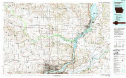
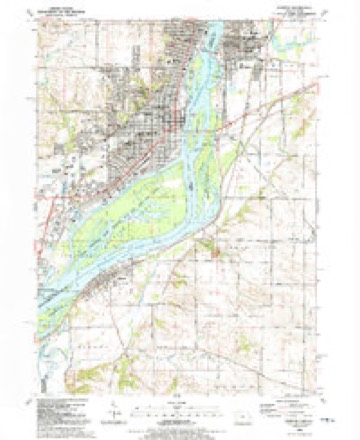
19 topographic sheets cover this place, the earliest surveyed in 1891 and the latest in 1991. It stands in Clinton City. It lies in ZIP code area 52732. It lies near Joyce Island. The Survey maps it on the Clinton quadrangle. 24,469 people lived here at the 2020 count. It stands 607 feet above sea level.
Research this city
On record in Clinton
Buildings and businesses the archive holds for this place. Each opens its own page, with the source record it came from.
On the National Register 12 of 17 shown
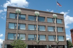 Van Allen StoreNational Historic Landmark · listed 1976
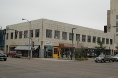 Ankeny Buildinglisted 2006
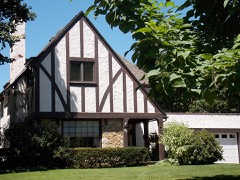 Castle Terrace Historic Districtlisted 1998
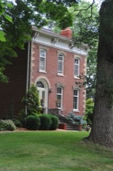 Cherry Banklisted 1999
 Clinton County Courthouselisted 1981
 Clinton High School and Public Librarylisted 2012
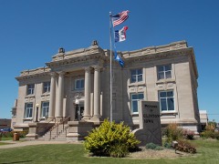 Clinton Public Librarylisted 1983
 George M. Curtis Houselisted 1979
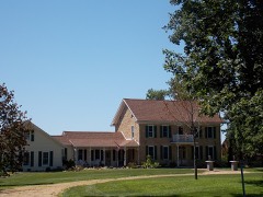 Peter Dierks Houselisted 1998
 First National Banklisted 1985
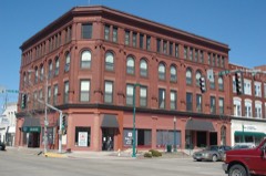 Howes Buildinglisted 2004
 Lafayette Lamb Houselisted 1979
Population over time
2 figuresClinton fell from 26,885 to 24,469 between 2010 and 2020. These are the recorded population figures Wikidata holds for this place, reached through the Geographic Names Information System number this page is keyed on rather than by name, so they belong to this place and not to another of the same name. Most are census counts, but not all are: an early figure may be a founding or settlement estimate, and an estimate published within five years of a census is left out. The change column is computed, and is left blank where more than 20 years separate a figure from the one before it, because a gap that long is not a change between two counts.
| Year | People | Change |
|---|---|---|
| 2010 | 26,885 | |
| 2020 | 24,469 | -2,416 (-9%) |
Topographic sheets covering this place
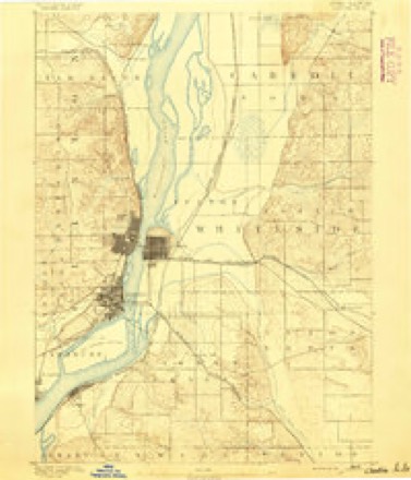
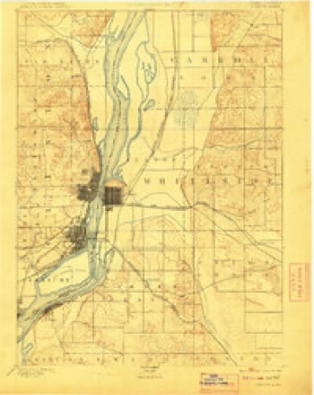
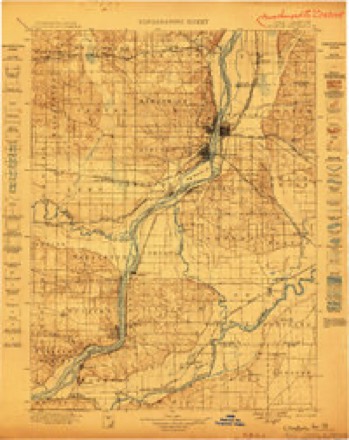
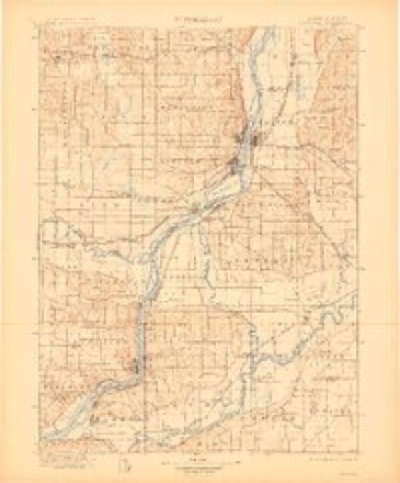
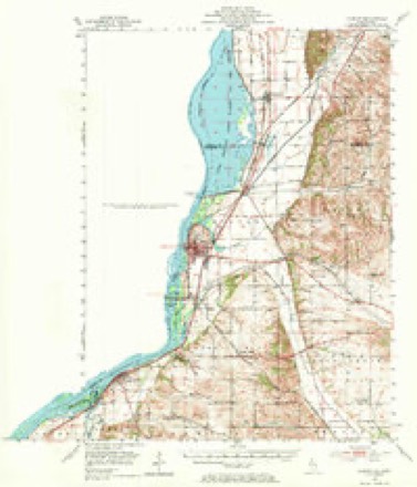
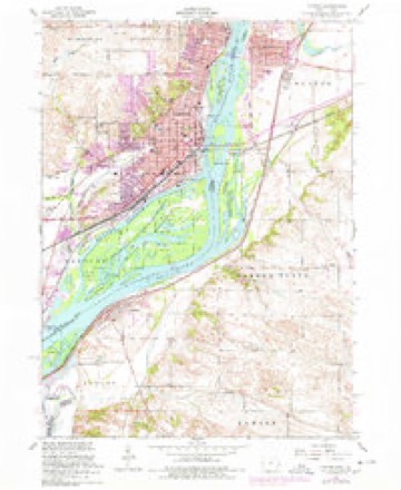
11 surveys from 19 printed sheetsMatched by testing this settlement's coordinate against the published boundary of every sheet in the United States Geological Survey's historical collection. Each opens the scanned sheet at the Survey.
- 1891 USGS Clinton quadrangle1:62500
- 1894 USGS Clinton quadrangle1:62500, 3 printings
- 1899 USGS Clinton quadrangle1:125000
- 1899 USGS Cordova quadrangle1:125000, 4 printings
- 1952 USGS Clinton quadrangle1:62500, 2 printings
- 1953 USGS Clinton quadrangle1:24000
- 1958 USGS Davenport quadrangle1:250000, 2 printings
- 1961 USGS Davenport quadrangle1:250000
- 1962 USGS Davenport quadrangle1:250000
- 1984 USGS Davenport quadrangle1:100000, 2 printings
- 1991 USGS Clinton quadrangle1:24000
Fires near this place
7 since 2005Regional context, not property-specific evidence. The federal wildfire occurrence database lists 7 fires within 5 miles of Clinton between 2005 and 2017, burning about 14 acres in total. None started naturally. None was recorded as arson. Distance is straight-line from the map coordinates, so a fire counted here may appear on a neighbouring settlement's page as well.
| Reported cause | Fires |
|---|---|
| Missing data/not specified/undetermined | 4 |
| Smoking | 1 |
| Equipment and vehicle use | 1 |
| Debris and open burning | 1 |
The most recent of them, most recent first, with the day each was reported and the service that recorded it.
| Date | Cause | Size | Reported by | Name on the report |
|---|---|---|---|---|
| 15 September 2017 | Smoking | under an acre | Iowa Department of Natural Resources | not named |
| 8 August 2005 | Missing data/not specified/undetermined | under an acre | Iowa State Fire Marshal's Office | not named |
| 7 June 2011 | Missing data/not specified/undetermined | 5.0 acres | Iowa Department of Natural Resources | REAR OF 2103 7TH AVE, CAMANCHE, IA |
| 17 May 2006 | Missing data/not specified/undetermined | under an acre | Iowa Department of Natural Resources | not named |
| 17 April 2017 | Equipment and vehicle use | 1.0 acres | Iowa Department of Natural Resources | not named |
| 17 April 2015 | Debris and open burning | 6.0 acres | Iowa Department of Natural Resources | not named |
| 27 January 2006 | Missing data/not specified/undetermined | 1.0 acres | Iowa Department of Natural Resources | not named |
Settlements close enough to share some of these fires:
Mines and quarries near this place
10 of 14 shownRegional context, not property-specific evidence. The federal mineral resources record lists 14 workings within 5 miles of Clinton: 9 past producers, 4 producers, 1 occurrence. 4 still produce. What was taken out: Stone, Crushed/Broken, Sand and Gravel, Construction, Lead, Limestone, Dimension, Stone, Crushed/Broken. Distance is straight-line from the map coordinates, so a quarry counted here may appear on a neighbouring settlement's page as well.
| Where | Site | Commodity | Status | Recorded |
|---|---|---|---|---|
| Clinton Diggings | Lead | Occurrence | Galena | |
| Clinton Quarries | Limestone, Dimension, Stone, Crushed/Broken | Past Producer | ||
| Acme Aggregates | Sand and Gravel, Construction | Producer | ||
| Determan Sand and Gravel Dredge | Sand and Gravel, Construction | Producer | ||
| Unknown | Sand and Gravel, Construction | Past Producer | ||
| Unknown | Sand and Gravel, Construction | Past Producer | ||
| Huizenga Quarry | Stone, Crushed/Broken | Producer | ||
| Jacobsen Quarry | Stone, Crushed/Broken | Past Producer | ||
| Lyons Quarry | Stone, Crushed/Broken | Producer | ||
| Second Avenue Quarry | Stone, Crushed/Broken | Past Producer |
Storms near this place
60 of 90 shownRegional context, not property-specific evidence. The National Weather Service names Clinton in 90 storm reports between 1994 and 2026: 44 thunderstorm wind, 24 hail, 9 flash flood, 4 lightning. The reports record 1 death. Each account below is quoted exactly as the forecast office filed it, from the NOAA Storm Events Database, and each date opens the federal record of that event.
| When | Event | Place named | Harm | What the report says |
|---|---|---|---|---|
| June 2000 | Flood | Clinton | 1 killed | no account filed |
| May 1996 | Thunderstorm Wind | Clinton | $1,000,000 | no account filed |
| May 1996 | Tornado (F1) | Clinton | $1,000,000 | no account filed |
| April 1995 | Thunderstorm Wind | Clinton | $60,000 | no account filed |
| July 2007 | Flash Flood | Clinton | $50,000 | Three to six inches of rain fell in a short amount of time during the early morning hours of July 4th in Clinton, IA resulting in flash flooding. A water rescue was performed on the 1200 block of S 2nd Street of a vehicle stalled in flood waters. Several other vehicles were stalled in water 1 to 2 feet deep in streets, or about halfway up the doors of cars. On the 1400 block of S 15th Street, the water was 4 feet deep in places. |
| July 2003 | Hail | Clinton | $50,000 | no account filed |
| May 1995 | Hail | Clinton | $50,000 | no account filed |
| July 2003 | Thunderstorm Wind | Clinton | $40,000 | Tree down. KCWI AWOS reported 48 knots |
| April 1995 | Thunderstorm Wind | Clinton | $35,000 | The weather situation was similar to that of the past few days. A strong arctic high pressure cell was centered to the north of Iowa over southern Manitoba, Canada as a stationary front extended east to west-south of Iowa. A strong southerly flow of very unstable air rode over the top of the arctic air mass. Due to the strong gradient and directional shear, helicity values just prior to the thunderstorm development were as high as 1175 m2-s-2 in the surface to three km layer. Thunderstorms erupted rapidly during the late evening hours and quickly became severe. Hail was the main severe weather feature with the storms. Although most were just below severe criteria as the crossed from Missouri into Iowa, many areas reported a hail accumulation of up to an inch of pea- to marble-size hail. A few storms were severe over southeast and east-central Iowa. Golf ball-size hail pelted Lee County west of Fort Madison, with dime-size hail extending northeast into the Quad-Cities area. Golf ball-size hail was also reported in the western part of the city of Burlington. Considerable damage was done as the storm passed over a car dealership. Six hundred twenty cars were damaged by the hail. Strong winds accompanied the storms in Dixon, causing minor damage. High winds toppled a light pole and caused some minor damage in Clinton County at Clinton. Damage was also reported in Cedar County at Tipton when thunderstorm winds tore part of a roof off a hardware store in town. In Jefferson County, lightning struck a propane tank in Fairfield. The tank was set on fire and some damage was also reported in the house. |
| June 2009 | Thunderstorm Wind | Clinton | $25,000 | Wind gusts estimated to be 70 mph blew down power lines in Clinton, IA around 540 pm June 27. |
| June 2009 | Thunderstorm Wind | Clinton | $25,000 | Wind gusts estimated to be 70 mph blew down some trees and power lines along the 3500 block of Main Avenue (Highway 136) on the north side of Clinton, IA around 540 pm June 27. |
| July 2006 | Thunderstorm Wind | Clinton | $20,000 | several 12 to 15 inch diameter limbs down with several trees either topped or downed. The smokestacks from the Clinton Showboat Theater were blown off. |
| April 2003 | Lightning | Clinton | $10,000 | Warehouse fire at Purina complex |
| May 1996 | Lightning | Clinton | $10,000 | no account filed |
| August 1995 | Thunderstorm Wind | Clinton | $10,000 | no account filed |
| July 2011 | Thunderstorm Wind | Clinton | $5,000 | Wind gusts estimated to be 60 mph blew down some power lines in Clinton, IA around 625 am CDT July 11. |
| June 2010 | Thunderstorm Wind | Clinton | $5,000 | Wind gusts estimated to be 65 mph blew some tree limbs down onto power lines in Clinton, IA around 510 am June 23. |
| June 2008 | Flash Flood | Clinton | $5,000 | Heavy rains resulted in flash flooding of parts of Clinton County during the late evening of June 12 and morning of June 13. Flash flood waters were up to the windows of a car stranded in a parking lot in Clinton, IA. |In addition, the flood waters forced the closure of Highway 67 near Folletts, IA. The broadcast media also contributed to this report. |
| April 1995 | Thunderstorm Wind | Clinton | $5,000 | no account filed |
| July 1994 | Hail | Clinton | $5,000 | no account filed |
| August 1994 | Hail | Clinton | $5,000 | no account filed |
| August 1994 | Hail | Clinton | $5,000 | no account filed |
| August 1994 | Thunderstorm Wind | Clinton | $5,000 | no account filed |
| June 1994 | Thunderstorm Wind | Clinton | $5,000 | no account filed |
| June 2005 | Thunderstorm Wind | Clinton | $4,000 | Trees and power lines down at 7th Avenue and North 4th Streets; also on 9th Avenue |
| August 2006 | Thunderstorm Wind | Clinton | $3,000 | City police reported trees down on the west side of town. |
| March 2006 | Thunderstorm Wind | Clinton | $2,000 | Sign down. Transformer struck by lightning |
| July 1999 | Lightning | Clinton | $2,000 | Lightning struck a transformer, which resulted in a power outage for several hours at a factory. |
| June 1998 | Thunderstorm Wind | Clinton | $1,400 | A strong thunderstorm downed trees and power lines across the city. At one point seven trees were blocking streets. No major damage was reported to homes. However, many residents were without power for more than 12 hours due to the storm. |
| March 2025 | Thunderstorm Wind | Clinton | - | Measured by wind equipement. |
| March 2025 | Hail | Clinton | - | A lot of hail fell. |
| July 2025 | Thunderstorm Wind | Clinton | - | A trained spotter reported that a couple of trees were downed. One tree was 2 to 3 feet in diameter. The time of the event was estimated using radar. |
| July 2025 | Flash Flood | Clinton | - | A trained spotter reported xix inches of flowing water on multiple roads. It is difficult for vehicles to drive in. |
| July 2025 | Flash Flood | Clinton | - | A trained spotter relayed a report of 1 to 2 feet of standing water along 16th Avenue N in Clinton. |
| July 2025 | Flash Flood | Clinton | - | A trained spotter reported 1 to 2 feet of water over the roadways in this area, some of which was flowing at the time. |
| June 2025 | Thunderstorm Wind | Clinton | - | Multiple trees blown down in the city of Clinton blocking roads. |
| June 2025 | Thunderstorm Wind | Clinton | - | A healthy 10 inch diameter tree branch down. |
| July 2025 | Thunderstorm Wind | Clinton | - | A trained spotter reported. 6-7 inch diameter healthy tree branch down on the corner of Pershing BLVD and 11th AVE. The time of the event was estimated using radar. |
| July 2025 | Thunderstorm Wind | Clinton | - | A trained spotter reported a 58 MPH and minor tree damage was also noted nearby. The time of the event was estimated using radar. |
| July 2025 | Hail | Clinton | - | The location and time of the event was estimated using radar. |
| October 2024 | Thunderstorm Wind | Clinton | - | A trained spotter measured a thunderstorm wind gust of 61 MPH. |
| July 2024 | Thunderstorm Wind | Clinton | - | A trained spotter reported an estimated 60 MPH thunderstorm wind gust. The time of the event was estimated using radar. |
| July 2024 | Thunderstorm Wind | Clinton | - | Emergency Manager reported limbs down in town. The time of the event was estimated using radar. |
| April 2023 | Flood | West Clinton | - | The Mississippi River at Camanche rose above its major flood stage of 20.5 feet during the morning hours of April 25th and continued to rise to its crest of 22.82 on the evening of April 30th. During the early morning hours of April 30th there was a minor breech of the levee near the marina at 2nd street and 4th Avenue. The breech was quickly brought under control according to media reports. |
| July 2023 | Tornado (EF0) | Clinton | - | A brief tornado developed in Clinton, IA Friday evening, and moved into Whiteside County Illinois over the Mississippi River, before dissipating near Fulton, IL. The tornado caused sporadic tree damage, including several large trees on the Clinton County courthouse lawn. The tornado was captured on webcam video at the riverfront, where it moved a boat docked near the Candlelight Inn in Clinton. Maximum winds were estimated around 75 mph. The tornado was rated EF0. |
| July 2023 | Thunderstorm Wind | Clinton | - | Trees downed throughout the city. |
| July 2023 | Thunderstorm Wind | Clinton | - | Reported heavy tree damage in downtown Clinton between 7th Street and 10th Street. Several 6 to 8 inch tree limbs down. |
| July 2022 | Thunderstorm Wind | Clinton | - | A trained spotter reported that a 6 inch diameter fruit tree was snapped off. Time of the event was estimated using radar. |
| July 2022 | Thunderstorm Wind | Clinton | - | A public report of a large tree branch down on a house. Received via social media. |
| July 2022 | Thunderstorm Wind | Clinton | - | The Emergency Manager reported that a 10 to 12 inch diameter tree branch was down at this location damaging the gutters. Time of the event was estimated using radar. |
| June 2022 | Thunderstorm Wind | Clinton | - | A tree was blown down onto a house. |
| June 2019 | Thunderstorm Wind | Clinton | - | Measured wind speed. |
| July 2019 | Flash Flood | Clinton | - | Law Enforcement reported that water was approximately 18 inches deep near Clinton Community College. Some vehicles were stuck in the water. |
| May 2019 | Flood | West Clinton | - | The Mississippi River at Camanche (CMMI4) began the month above its major flood stage of 20.5 feet and also near a crest level of 22.7 feet. The river stage was falling just after midnight on the first. The river fell below major flood stage late evening on May 7th. |
| April 2019 | Flood | Clinton | - | River levels continued to run high during the month of April. Heavy rain across the area caused the Mississippi River a Fulton Lock and Dam 13 to rise above its major flood stage of 20.5 feet early in the morning on the 25th, and it remained above its major flood stage of 20.0 feet into the month of May. During this second crest, the river crested at 21.77 feet on April 30th. Preliminarily, this is the 4th highest crest on record at Fulton Lock and Dam 13. |
| May 2018 | Hail | Clinton | - | A coop observer reported hail up to 1 inch in diameter. |
| May 2018 | Hail | Clinton | - | A trained spotter reported hail up to the size of pennies. |
| July 2018 | Thunderstorm Wind | Clinton | - | A trained spotter reported 4 to 8 inch diameter tree limbs were down. |
| February 2017 | Hail | Clinton | - | A spotter reports pea to dime size hail. |
| May 2017 | Thunderstorm Wind | Clinton | - | Local amateur radio relayed a report of winds estimated at 50 to 60 mph. |
Nearest settlements
The eight closest, with where each one stands in the county. Distances are straight-line, computed from the Geographic Names Information System coordinates.
| Map | Place | Distance | Sheets |
|---|---|---|---|
| Lyons | 1.6 miles | 19 | |
| Clinton Stock Yards | 2.6 miles | 19 | |
| Camanche | 5.3 miles | 19 | |
| Chaney (historical) | 6.1 miles | 19 | |
| Bulgers Hollow | 6.3 miles | 19 | |
| Sibyl (historical) | 7.2 miles | 19 | |
| Sixmile | 7.2 miles | 16 | |
| Elvira | 8.9 miles | 19 |
Elsewhere
Matched on this settlement's Geographic Names Information System number rather than its name, so it cannot be a different place of the same name in another state.
| Wikipedia article on Clinton | An encyclopaedic summary. Its text is share-alike, so it is linked here rather than copied. |
| Wikidata item Q676421 | The structured record the population and elevation above come from. Public domain (CC0). |
Provenance
This settlement is recorded in the Geographic Names Information System as feature 455480. The sheet list is computed by point-in-boundary test against the United States Geological Survey's historical topographic inventory. Both are works of the United States government and carry no copyright under 17 U.S.C. 105.
Wildfire. Short, Karen C. 2022. Spatial wildfire occurrence data for the United States, 1992-2020 [FPA_FOD_20221014]. 6th Edition. Fort Collins, CO: Forest Service Research Data Archive. https://doi.org/10.2737/RDS-2013-0009.6 Collected with United States Government funding and usable without additional permissions or fees.
Mines and quarries. USGS Mineral Resources Data System (MRDS) https://mrdata.usgs.gov/mrds/ A work of the United States government, no copyright under 17 U.S.C. 105.
Storms. NOAA National Centers for Environmental Information, Storm Events Database https://www.ncei.noaa.gov/stormevents/ A work of the United States government, no copyright under 17 U.S.C. 105. Narratives are quoted verbatim from the National Weather Service report and are not edited or summarised.