Block
From the record
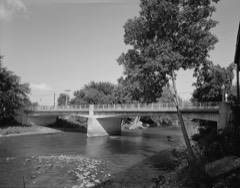
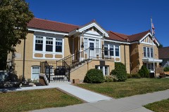
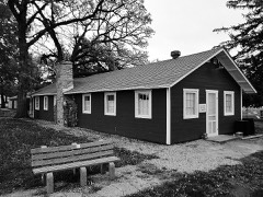
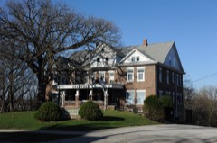
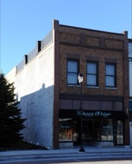
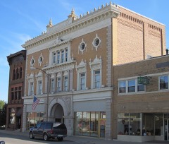
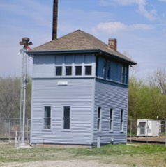
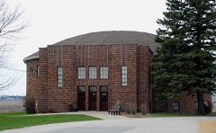
34 National Register listings published here.
Sources: the National Register database, National Park Service
24 topographic sheets cover 31 settlements here, and 34 properties are on the National Register of Historic Places.
34 National Register listings published here.
Sources: the National Register database, National Park Service
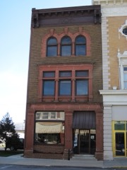
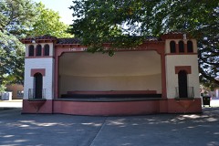
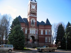
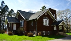
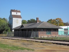
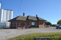
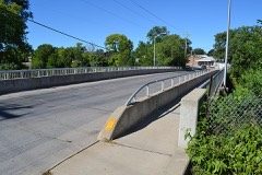
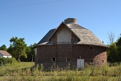
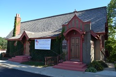
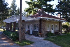
Every property in this county listed on the National Register of Historic Places, with the year it was listed and the federal nomination document.
Every wildfire the federal occurrence database records inside this county: 58 of them, burning about 854 acres. None started naturally and 6 were recorded as arson. Each settlement page carries the fires within five miles of it.
| Reported cause | Fires |
|---|---|
| Debris and open burning | 23 |
| Missing data/not specified/undetermined | 21 |
| Arson/incendiarism | 6 |
| Equipment and vehicle use | 4 |
| Smoking | 3 |
| Railroad operations and maintenance | 1 |
The five largest, by the area the report gives. None of them was recorded as arson.
| Date | Cause | Size | Reported by | Name on the report |
|---|---|---|---|---|
| 21 April 2019 | Debris and open burning | 100 acres | Iowa Department of Natural Resources | not named |
| 26 April 2014 | Debris and open burning | 90 acres | Iowa Department of Natural Resources | not named |
| 23 March 2009 | Missing data/not specified/undetermined | 85 acres | Iowa Department of Natural Resources | not named |
| 10 April 2006 | Missing data/not specified/undetermined | 75 acres | Iowa Department of Natural Resources | not named |
| 15 March 2018 | Debris and open burning | 45 acres | Iowa Department of Natural Resources | not named |
| 29 April 2018 | Debris and open burning | 45 acres | Iowa Department of Natural Resources | not named |
| 27 March 2019 | Debris and open burning | 40 acres | Iowa Department of Natural Resources | not named |
| 17 April 2011 | Missing data/not specified/undetermined | 35 acres | Iowa Department of Natural Resources | 1.5 MILES SOUTHWEST OF ELDORA, IA |
Every settlement page carries the fires within five miles of it - see the settlement index below.
The NOAA Storm Events Database holds 469 reports for this county, causing no deaths, 25 injuries and about $62,398,500 in recorded property damage. Each settlement page carries the reports that name it.
| Kind of event | Reports |
|---|---|
| Thunderstorm Wind | 186 |
| Hail | 129 |
| Tornado | 49 |
| Heavy Rain | 49 |
| Flash Flood | 21 |
| Funnel Cloud | 21 |
| Flood | 10 |
| Lightning | 4 |
The most serious of them, by death, then injury, then recorded damage. The accounts are quoted exactly as the forecast office filed them.
| When | Event | Place named | Harm | What the report says |
|---|---|---|---|---|
| August 2009 | Hail | Eldora | 22 hurt, $20,000,000 | Large hail brok windows out of a residence and caused considerable crop damage. |
| May 1989 | Tornado (F4) | not stated | 3 hurt, $2,500,000 | no account filed |
| May 1989 | Tornado (F4) | not stated | $25,000,000 | no account filed |
| March 1991 | Tornado (F3) | not stated | $2,500,000 | no account filed |
| June 1990 | Tornado (F3) | not stated | $2,500,000 | no account filed |
| August 2009 | Thunderstorm Wind | Eldora | $1,000,000 | Many Residences in town have broken windows. The Red Cross set up a shelter and treated several injuries. A communications tower was toppled by the high wind. |
| September 2011 | Thunderstorm Wind | Hubbard | $500,000 | A microburst took place on 2 farmsteads in the area with 80 to 85 MPH winds causing damage to buildings and crops. |
| August 2009 | Hail | Eldora | $500,000 | Hail of at least golf ball size resulted in broken windows. |
| August 2009 | Thunderstorm Wind | Radcliffe | $500,000 | Extensive crop damage. Several houses with broken windows from the hail on the west sides of them. Crop damage swath a mile to mile and one half wide. |
| April 2001 | Tornado (F1) | Alden | $500,000 | Short touchdown within the town of Alden. |
| May 1998 | Hail | Iowa Falls | $400,000 | no account filed |
| June 2013 | Flash Flood | Ackley | $250,000 | Parts of S56 is flooded. Several roads near Ackley were flooded. |
| March 1991 | Tornado (F2) | not stated | $250,000 | no account filed |
| March 1991 | Tornado (F1) | not stated | $250,000 | no account filed |
| April 1991 | Tornado (F1) | not stated | $250,000 | no account filed |
| May 1971 | Tornado (F2) | not stated | $250,000 | no account filed |
| March 2019 | Flash Flood | Iowa Falls | $200,000 | Emergency manager reported an ice jam in Iowa Falls has caused rapid rises along the Iowa river. At one point there was an 8 foot rise in 15 minutes. |
| May 2013 | Flash Flood | Eldora | $200,000 | Water over many county roads in the east part of the county. |
| June 1996 | Flash Flood | Hubbard | $200,000 | no account filed |
| April 2008 | Flood | Ackley Muni Arpt | $150,000 | no account filed |
| April 2018 | Thunderstorm Wind | Hubbard | $100,000 | Public reported that a building lost its roof in Hubbard, and 2 more homes between Hubbard and Iowa Falls sustained damage. |
| August 2014 | Tornado (EF1) | Buckeye | $100,000 | This tornado moved into Hardin county from Hamilton county. This short segment did primarily crop damage but hit a farmstead before dissipating causing the destruction of two grain bins and badly damaging three outbuildings. This tornado was found and rated using high resolution satellite imagery. |
| September 2011 | Thunderstorm Wind | Hubbard | $100,000 | Ten large trees snapped in half with a couple of the trees hitting and destroying two grain bins. Many large branches down, some 10 inches in diameter. A machine shed lost parts of its roof and the doors to the building were blown in. |
| April 2001 | Thunderstorm Wind | Iowa Falls | $100,000 | Microburst wind event. |
| August 2009 | Hail | Eldora | $100,000 | no account filed |
| June 2007 | Flash Flood | Hubbard | $100,000 | no account filed |
| May 1999 | Flash Flood | Iowa Falls | $100,000 | no account filed |
| May 1998 | Thunderstorm Wind | Iowa Falls | $100,000 | no account filed |
| June 2014 | Thunderstorm Wind | Union | $75,000 | Grain bins were destroyed by high winds. |
| May 2008 | Flood | Iowa Falls | $75,000 | The Mayor of Alden reported that the Alden Elementary School was closed Wednesday due to 4 feet of water in the boiler room and a foot of water in the cafeteria. The water softener, main compressor, and several chemicals have water damage in the boiler room as well. |
| November 2005 | Tornado (F1) | Garden City | $75,000 | Tornado moved into the county from Hamilton County. |
| September 2001 | Thunderstorm Wind | Hubbard | $75,000 | no account filed |
| July 2000 | Lightning | Hubbard | $75,000 | no account filed |
| July 2000 | Flash Flood | Countywide | $75,000 | no account filed |
| June 1997 | Thunderstorm Wind | Eldora | $75,000 | no account filed |
| June 1998 | Flood | Iowa Falls | $70,000 | no account filed |
| June 2019 | Flash Flood | Whitten | $50,000 | Emergency manager reported some roads washed out near the Grundy-Hardin County line, as well as some roads washed out near Owasa in Hardin County. |
| July 2019 | Thunderstorm Wind | Iowa Falls | $50,000 | Trained spotter reported many whole trees down, either snapped or uprooted, along with several smaller limbs down throughout town. Some roads were blocked from the downed trees. The local college was without power. Penny hail also occurred. |
| December 2015 | Flood | Buckeye | $50,000 | Many road closures were noted across southern portions of the county from flooding. |
| June 2014 | Tornado (EF1) | Union | $50,000 | This is a multiple segment tornado with three segments that passed through portions of Story, Marshall and Hardin counties. This is the third and final segment in Hardin county. The tornado cycled, made a hard right turn, and began to intensify again after crossing into Hardin County. EF1 damage was sustained to wooden power poles and trees along 335th St. between T and U Ave. Turning NE again after crossing U Ave, the tornado roamed through open farmland and weakened, only causing intermittent tree damage after crossing County Road S62 1.5 miles south of Union. The tornado dissipated shortly before reaching the Iowa River. |
| May 2013 | Flash Flood | Eagle City | $50,000 | P Ave washed out near 155th street. |
| September 2011 | Thunderstorm Wind | New Providence | $50,000 | Grain bin destroyed. Large tree down with crop damage. |
| May 2008 | Heavy Rain | Iowa Falls | $50,000 | The rain began around 1845 CST Tuesday evening and ended around 0115 CST Wednesday morning. A total of 6.25 inches was reported. |
| May 2008 | Flood | Iowa Falls | $50,000 | The Mayor of Alden reported that several County Roads were washed out or covered with water in and around Alden. The Alden Fire Department was pumping water out of drains due to storm drains running full and manhole covers popping. |
| June 2008 | Heavy Rain | Iowa Falls | $50,000 | Water was reported in residential basements. |
| August 2004 | Lightning | Iowa Falls | $50,000 | no account filed |
| May 1999 | Hail | Radcliffe | $50,000 | no account filed |
| July 1999 | Flash Flood | Iowa Falls | $50,000 | no account filed |
| May 1998 | Thunderstorm Wind | Radcliffe | $50,000 | no account filed |
| June 1998 | Flood | Iowa Falls | $50,000 | no account filed |
| May 1998 | Thunderstorm Wind | Eldora | $50,000 | no account filed |
| June 1998 | Flood | Iowa Falls | $50,000 | no account filed |
| June 1994 | Thunderstorm Wind | New Providence | $50,000 | no account filed |
| August 1993 | Thunderstorm Wind | Eldora | $50,000 | no account filed |
| August 1993 | Thunderstorm Wind | New Providence | $50,000 | no account filed |
| August 1993 | Thunderstorm Wind | Iowa Falls | $50,000 | no account filed |
| August 1995 | Thunderstorm Wind | Clarion | $40,000 | A very warm and unstable air mass was over Iowa as a stationarrowy front extended from central Nebraska into southern Wisconsin. CAPE values were between 3000 and 4000 J-kg-1 over the state. Thunderstorms erupted over northwest Iowa and spread into the north central and eventually the northeast counties. For the most part the storms just produced heavy rainfall and gusty winds. During the early stages of the systems development there was some severe weather. High winds were reported in Worth County. Seventy mile an hour winds blew through areas south of Mason City in Cerro Gordo County southeast to the Rockwell area a small bow echo traversed the area. Other high winds occurred in the Estherville area of Emmet County with numerous trees down and also at Marquette in Clayton County. One of the storms produced a brief spin up tornado, or gustnado, northwest of Garner. An observer reported the brief touchdown in his front yard. Damage was very minor however. The storms produced copious amounts of rain. Parts of Cerro Gordo County, south of Mason City, received between five and six inches of rain in under three hours. Two and one half inches fell in an hours time. Widespread street flooding was reported with most streets under at least six inches of water. Parts of the city reported water knee deep. The water receded fairly quickly as antecedent conditions were very dry. The storms the dumped the heavy rainfall were the result of back development from the storms that moved through earlier in the evening. One of the storms did become severe and caused damage to several cabins northeast of Clarion. High winds downed several trees in the area as well. Farther to the east and south, a thunderstorm downed trees in the Ackley area. Winds of at least 70 MPH in what appeared to be a downburst completely flattened 32 acres of a corn field northeast of town. |
| June 1997 | Thunderstorm Wind | Alden | $40,000 | no account filed |
| September 2001 | Thunderstorm Wind | Hubbard | $35,000 | no account filed |
| May 2019 | Tornado (EF0) | Eldora Muni Arpt | $30,000 | Tornado occurred southwest of Eldora and was captured on video. The tornado removed the roof of a barn but otherwise remained in open farmland. |
The Survey's mineral resources record lists 45 workings inside this county. 11 still produce and 34 are closed or unrecorded. Each settlement page carries the workings within five miles of it.
| Commodity | Workings |
|---|---|
| Sand and Gravel, Construction | 31 |
| Stone, Crushed/Broken | 10 |
| Clay | 3 |
| Calcium, Phosphorus-Phosphates | 1 |
The least common of them first, because a county's hundredth gravel pit says nothing its first ten did not.
| Where | Site | Commodity | Status | Recorded |
|---|---|---|---|---|
| Sargent Calcium Products | Calcium, Phosphorus-Phosphates | Producer | ||
| Eldora Pipe and Tile Co. | Clay | Past Producer | ||
| Iowa Falls Tile Co. | Clay | Past Producer | ||
| Jonker Brick and Tile Co. | Clay | Past Producer | ||
| Alden Plant | Stone, Crushed/Broken | Producer | ||
| Alden Quarry and Mill | Stone, Crushed/Broken | Producer | ||
| Eagle City Quarry | Stone, Crushed/Broken | Past Producer | ||
| Gifford Quarry | Stone, Crushed/Broken | Producer | ||
| Hackney Quarry | Stone, Crushed/Broken | Past Producer | ||
| Riekena Quarry | Stone, Crushed/Broken | Producer | ||
| Unknown | Stone, Crushed/Broken | Past Producer | ||
| Unknown | Stone, Crushed/Broken | Past Producer | ||
| Unknown | Stone, Crushed/Broken | Past Producer | ||
| Van Patter Quarry | Stone, Crushed/Broken | Producer | ||
| Becker Pit | Sand and Gravel, Construction | Past Producer | ||
| Bloome Pit | Sand and Gravel, Construction | Past Producer | ||
| Butler Pit | Sand and Gravel, Construction | Past Producer | ||
| Crosser Pit | Sand and Gravel, Construction | Past Producer | ||
| Frericks Pit | Sand and Gravel, Construction | Past Producer | ||
| Granzow Pit | Sand and Gravel, Construction | Past Producer | ||
| Hardin Aggregates Sand Pit & Plant | Sand and Gravel, Construction | Producer | ||
| Hardin City Pit | Sand and Gravel, Construction | Past Producer | ||
| Harms Pit | Sand and Gravel, Construction | Past Producer | ||
| Hizerbroth Pit | Sand and Gravel, Construction | Past Producer | ||
| Iowa Falls Pit | Sand and Gravel, Construction | Past Producer | ||
| Janssen Pit | Sand and Gravel, Construction | Producer | ||
| Klein Pit | Sand and Gravel, Construction | Past Producer | ||
| Last Pit | Sand and Gravel, Construction | Past Producer | ||
| Lloyd Pit | Sand and Gravel, Construction | Past Producer | ||
| Lyman Pit | Sand and Gravel, Construction | Past Producer | ||
| Mcbride Pit | Sand and Gravel, Construction | Past Producer | ||
| Mccormick Pit | Sand and Gravel, Construction | Past Producer | ||
| Nerhing Pit | Sand and Gravel, Construction | Past Producer | ||
| Penfield Pit | Sand and Gravel, Construction | Past Producer | ||
| Peterson Pit | Sand and Gravel, Construction | Past Producer | ||
| Riekena Pit | Sand and Gravel, Construction | Producer | ||
| Sievert Pit | Sand and Gravel, Construction | Past Producer | ||
| Slayton Pit | Sand and Gravel, Construction | Past Producer | ||
| Stinson Excavating Co. Pit | Sand and Gravel, Construction | Producer | ||
| Unknown | Sand and Gravel, Construction | Past Producer | ||
| Unknown | Sand and Gravel, Construction | Past Producer | ||
| Unknown | Sand and Gravel, Construction | Past Producer | ||
| Unknown | Sand and Gravel, Construction | Past Producer | ||
| Wardman Pit | Sand and Gravel, Construction | Past Producer | ||
| Weldon Sand and Gravel Plant | Sand and Gravel, Construction | Producer |
Named settlements recorded in the Geographic Names Information System, each with the topographic sheets covering it. Villages, hamlets and abandoned places alike. Each is shown with the nearest named watercourse or landform and the survey quadrangle it falls on.
Etna township · 50601 · Steamboat Rock quadrangle
9 sheets, 1954 to 1993
No longer a settlement
Alden township · 50006 · Popejoy quadrangle
9 sheets, 1954 to 1984
No longer a settlement
Union township · 50258 · On South Fork Iowa River · Eldora quadrangle
9 sheets, 1954 to 1993
Hardin township · 50126 · On Elk Run · Iowa Falls West quadrangle
9 sheets, 1954 to 1984
Eldora township · 50627 · On Cedar Creek · Eldora quadrangle
9 sheets, 1954 to 1993
No longer a settlement
Clay township · 50672 · On Elk Creek · Steamboat Rock quadrangle
9 sheets, 1954 to 1993
The vanished settlements of Hardin County: the places named above that are no longer on the map.