 Block
Ackley, Iowa
9 topographic sheets cover this place, the earliest surveyed in 1954 and the latest in 1984. It stands in Etna Township. It lies in ZIP code area 50601. The Survey maps it on the Ackley quadrangle. 1,599 people lived here at the 2020 count. It stands 1,093 feet above sea level.
On record in Ackley
Buildings and businesses the archive holds for this place. Each opens its own page, with the source record it came from.
On the National Register 1 record
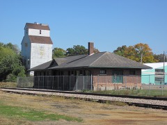 Illinois Central Combination Depot-Ackleylisted 1990
Population over time
2 figuresAckley grew from 1,589 to 1,599 between 2010 and 2020. These are the recorded population figures Wikidata holds for this place, reached through the Geographic Names Information System number this page is keyed on rather than by name, so they belong to this place and not to another of the same name. Most are census counts, but not all are: an early figure may be a founding or settlement estimate, and an estimate published within five years of a census is left out. The change column is computed, and is left blank where more than 20 years separate a figure from the one before it, because a gap that long is not a change between two counts.
| Year | People | Change |
|---|---|---|
| 2010 | 1,589 | |
| 2020 | 1,599 | +10 (+1%) |
Topographic sheets covering this place
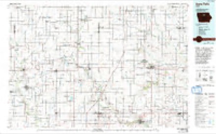
4 surveys from 9 printed sheetsMatched by testing this settlement's coordinate against the published boundary of every sheet in the United States Geological Survey's historical collection. Each opens the scanned sheet at the Survey.
- 1954 USGS Waterloo quadrangle1:250000, 4 printings
- 1955 USGS Waterloo quadrangle1:250000, 2 printings
- 1979 USGS Ackley quadrangle1:24000
- 1984 USGS Iowa Falls quadrangle1:100000, 2 printings
Mines and quarries near this place
4 within 5 milesRegional context, not property-specific evidence. The federal mineral resources record lists 4 workings within 5 miles of Ackley: 2 past producers, 1 unknown, 1 producer. 1 still produces. What was taken out: Sand and Gravel, Construction, Stone, Crushed/Broken. Distance is straight-line from the map coordinates, so a quarry counted here may appear on a neighbouring settlement's page as well.
| Where | Site | Commodity | Status | Recorded |
|---|---|---|---|---|
| Brandt Pit | Sand and Gravel, Construction | Producer | ||
| Humke Quarry | Stone, Crushed/Broken | Unknown | ||
| Park Quarry | Stone, Crushed/Broken | Past Producer | ||
| Unknown | Sand and Gravel, Construction | Past Producer |
Storms near this place
26 since 1995Regional context, not property-specific evidence. The National Weather Service names Ackley in 26 storm reports between 1995 and 2025: 11 hail, 8 thunderstorm wind, 2 tornado, 2 flash flood. No death or injury is recorded in these reports. Each account below is quoted exactly as the forecast office filed it, from the NOAA Storm Events Database, and each date opens the federal record of that event.
| When | Event | Place named | Harm | What the report says |
|---|---|---|---|---|
| June 2013 | Flash Flood | Ackley | $250,000 | Parts of S56 is flooded. Several roads near Ackley were flooded. |
| August 1995 | Thunderstorm Wind | Ackley | $30,000 | A very warm and unstable air mass was over Iowa as a stationarrowy front extended from central Nebraska into southern Wisconsin. CAPE values were between 3000 and 4000 J-kg-1 over the state. Thunderstorms erupted over northwest Iowa and spread into the north central and eventually the northeast counties. For the most part the storms just produced heavy rainfall and gusty winds. During the early stages of the systems development there was some severe weather. High winds were reported in Worth County. Seventy mile an hour winds blew through areas south of Mason City in Cerro Gordo County southeast to the Rockwell area a small bow echo traversed the area. Other high winds occurred in the Estherville area of Emmet County with numerous trees down and also at Marquette in Clayton County. One of the storms produced a brief spin up tornado, or gustnado, northwest of Garner. An observer reported the brief touchdown in his front yard. Damage was very minor however. The storms produced copious amounts of rain. Parts of Cerro Gordo County, south of Mason City, received between five and six inches of rain in under three hours. Two and one half inches fell in an hours time. Widespread street flooding was reported with most streets under at least six inches of water. Parts of the city reported water knee deep. The water receded fairly quickly as antecedent conditions were very dry. The storms the dumped the heavy rainfall were the result of back development from the storms that moved through earlier in the evening. One of the storms did become severe and caused damage to several cabins northeast of Clarion. High winds downed several trees in the area as well. Farther to the east and south, a thunderstorm downed trees in the Ackley area. Winds of at least 70 MPH in what appeared to be a downburst completely flattened 32 acres of a corn field northeast of town. |
| March 2006 | Thunderstorm Wind | Ackley | $25,000 | no account filed |
| July 2016 | Thunderstorm Wind | Ackley | $20,000 | Law Enforcement reported several power lines and large trees down throughout the town of Ackley, as well as other portions of Hardin County. |
| June 2009 | Thunderstorm Wind | Ackley | $15,000 | Large trees were down throughout town making streets impassible. Some trees were on houses. |
| June 2014 | Flash Flood | Ackley | $5,000 | Water was running over the road. County closed the road. |
| June 2005 | Thunderstorm Wind | Ackley | $5,000 | no account filed |
| August 2004 | Hail | Ackley | $5,000 | no account filed |
| June 2001 | Hail | Ackley | $5,000 | no account filed |
| August 2004 | Thunderstorm Wind | Ackley | $3,000 | no account filed |
| August 2004 | Tornado (F1) | Ackley | $2,000 | Tornado touched down in farm fields and remained in open country. It caused little damage. |
| June 2005 | Hail | Ackley | $2,000 | no account filed |
| June 2005 | Thunderstorm Wind | Ackley | $1,000 | no account filed |
| June 2005 | Hail | Ackley | $1,000 | no account filed |
| June 2005 | Hail | Ackley | $1,000 | no account filed |
| May 2024 | Hail | Ackley | - | Submitted picture of penny sized hail in Ackley. Time estimated by radar. |
| July 2018 | Funnel Cloud | Ackley | - | Hardin County Sheriff relayed public reports of a funnel cloud near Ackley. |
| August 2018 | Heavy Rain | Ackley | - | Public reported a 24 hour heavy rainfall total of 3.55 inches. |
| August 2015 | Heavy Rain | Ackley | - | USACE stream gauge reported heavy rainfall of 5.35 inches event total so far. |
| June 2011 | Thunderstorm Wind | Ackley | - | High winds blew down corn in a field. |
| August 2004 | Tornado (F0) | Ackley | - | Tornado moved from Franklin County into northern Hardin County. It was in open fields. |
| April 2025 | Hail | Ackley | - | no account filed |
| April 2014 | Hail | Ackley | - | no account filed |
| June 2006 | Hail | Ackley | - | no account filed |
| June 2006 | Hail | Ackley | - | no account filed |
| June 2002 | Hail | Ackley | - | no account filed |
Nearest settlements
The eight closest, with where each one stands in the county. Distances are straight-line, computed from the Geographic Names Information System coordinates.
| Map | Place | Distance | Sheets |
|---|---|---|---|
| Abbott Crossing (historical) | 4.3 miles | 9 | |
| Abbott | 4.8 miles | 9 | |
| Macey | 5.1 miles | 9 | |
| Robertson | 5.1 miles | 9 | |
| Cleves | 5.6 miles | 9 | |
| Eagle City | 7.5 miles | 9 | |
| Steamboat Rock | 10.0 miles | 9 | |
| Iowa Falls | 10.7 miles | 9 |
Elsewhere
Matched on this settlement's Geographic Names Information System number rather than its name, so it cannot be a different place of the same name in another state.
| Wikipedia article on Ackley | An encyclopaedic summary. Its text is share-alike, so it is linked here rather than copied. |
| Wikidata item Q669853 | The structured record the population and elevation above come from. Public domain (CC0). |
Provenance
This settlement is recorded in the Geographic Names Information System as feature 454084. The sheet list is computed by point-in-boundary test against the United States Geological Survey's historical topographic inventory. Both are works of the United States government and carry no copyright under 17 U.S.C. 105.
Mines and quarries. USGS Mineral Resources Data System (MRDS) https://mrdata.usgs.gov/mrds/ A work of the United States government, no copyright under 17 U.S.C. 105.
Storms. NOAA National Centers for Environmental Information, Storm Events Database https://www.ncei.noaa.gov/stormevents/ A work of the United States government, no copyright under 17 U.S.C. 105. Narratives are quoted verbatim from the National Weather Service report and are not edited or summarised.