 Block
From the record
8 National Register listings published here.
Sources: the National Register database, National Park Service
28 topographic sheets cover 15 settlements here, and 8 properties are on the National Register of Historic Places.
8 National Register listings published here.
Sources: the National Register database, National Park Service
Every property in this county listed on the National Register of Historic Places, with the year it was listed and the federal nomination document.
| Photograph | Property | Type | Listed | Reference |
|---|---|---|---|---|
| Broad View Ranch Historic District | district | 1994 | 94001137 | |
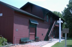 | Burlington, Cedar Rapids, and Northern Railroad-Rock Rapids Station, Railroad Track and Bridge | district | 1976 | 76000783 |
| Duncan-Duitsman Farm Historic District | district | 1994 | 94001138 | |
 | First Methodist Church | building | 1978 | 78001244 |
| Klondike Bridge | structure | 1998 | 98000510 | |
 | Lyon County Courthouse | building | 1979 | 79000913 |
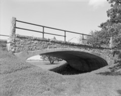 | Melan Bridge | structure | 1974 | 74000797 |
| Charles B. Reynolds Round Barn | building | 1999 | 99000737 |
Every wildfire the federal occurrence database records inside this county: 20 of them, burning about 160 acres. None started naturally and none was recorded as arson. Each settlement page carries the fires within five miles of it.
| Reported cause | Fires |
|---|---|
| Missing data/not specified/undetermined | 16 |
| Equipment and vehicle use | 2 |
| Smoking | 1 |
| Debris and open burning | 1 |
The five largest, by the area the report gives. None of them was recorded as arson.
| Date | Cause | Size | Reported by | Name on the report |
|---|---|---|---|---|
| 29 September 2020 | Equipment and vehicle use | 30 acres | Iowa Department of Natural Resources | not named |
| 29 September 2020 | Debris and open burning | 25 acres | Iowa Department of Natural Resources | not named |
| 29 March 2009 | Missing data/not specified/undetermined | 15 acres | Iowa Department of Natural Resources | not named |
| 30 May 2009 | Missing data/not specified/undetermined | 15 acres | Iowa Department of Natural Resources | not named |
| 29 September 2020 | Equipment and vehicle use | 15 acres | Iowa Department of Natural Resources | not named |
| 10 April 2006 | Missing data/not specified/undetermined | 10 acres | Iowa Department of Natural Resources | not named |
| 18 March 2009 | Missing data/not specified/undetermined | 10 acres | Iowa Department of Natural Resources | not named |
| 9 April 2009 | Missing data/not specified/undetermined | 9.0 acres | Iowa Department of Natural Resources | not named |
Every settlement page carries the fires within five miles of it - see the settlement index below.
The NOAA Storm Events Database holds 436 reports for this county, causing 1 death, 2 injuries and about $32,548,350 in recorded property damage. Each settlement page carries the reports that name it.
| Kind of event | Reports |
|---|---|
| Hail | 173 |
| Thunderstorm Wind | 119 |
| Flood | 85 |
| Tornado | 43 |
| Flash Flood | 12 |
| Funnel Cloud | 2 |
| Lightning | 1 |
| Heavy Rain | 1 |
The most serious of them, by death, then injury, then recorded damage. The accounts are quoted exactly as the forecast office filed them.
| When | Event | Place named | Harm | What the report says |
|---|---|---|---|---|
| April 1986 | Tornado (F2) | not stated | 1 killed, 2 hurt, $2,500,000 | no account filed |
| June 2024 | Flood | Beloit | $13,200,000 | Rainfall amounts across Lyon County from June 20-22 ranged from 7 to 12 inches. Widespread overland flooding ensued with additional major to record flooding along the Big Sioux, Rock, and Little Rock Rivers, and Mud Creek. ||At the peak of flooding, approximately 50 people were evacuated from Rock Rapids, Doon, and Alvord. In Rock Rapids, there were 12 swift water rescues when flood waters overwhelmed the city. County-wide 605 homes were impacted by flood waters, 15 of which were declared a total loss. In addition, six businesses were declared a total loss. Reported damage to individual property is estimated to cost 2.7 million dollars. ||County infrastructure was also severely impacted. Nearly all gravel roads had some type of washout and 12 county bridges were impacted by flood waters. Preliminary damage assessments estimate damage to public infrastructure to be 10.5 million dollars. ||The majority of overland flooding subsided by June 25, but river flooding continued through the end of the month. For additional information on river flooding, please see other flood entries for Lyon County. |
| June 2001 | Flash Flood | George | $4,000,000 | Very heavy rain caused flash flooding, forcing streams including the Kanaranzi River, Rio Grand, and Moon Creek to overflow and flood homes, garages, and storage sheds in George. Flooding of roads and other lowlands was widespread. A road washed out and at least four bridges were damaged in George. |
| April 1986 | Tornado (F2) | not stated | $2,500,000 | no account filed |
| July 1978 | Tornado (F2) | not stated | $2,500,000 | no account filed |
| June 2014 | Flood | Rock Rapids | $2,000,000 | Repeated heavy rains caused record flooding of the Rock River. Numerous homes, businesses, roads, farmland, and other low areas were flooded, forcing many people to evacuate their homes and rely on Red Cross and other volunteer assistance for several days. The flooding was especially severe in Rock Rapids, where the river crested at a record 13.98 feet above flood stage on June 17th. |
| March 2019 | Flood | Beloit | $1,940,000 | Flooding resulted in extensive damage to public infrastructure including numerous county and township roads, culverts, and some bridges. |
| June 2010 | Tornado (EF2) | Little Rock | $500,000 | A tornado destroyed two hog confinement buildings, killing about 12 hogs, numerous outbuildings, a metal farm building, tore the roof off a house and damaged at least 6 other houses, and caused damage to other farm buildings, power lines, vehicles, and trees, before moving out of Lyon County and into Osceola County. |
| April 1994 | Tornado (F1) | Doon | $500,000 | A classic spring synoptic situation was taking shape over Iowa. Intense low pressure moved across western Kansas into southern Nebraska. A warm front extended east from the low into Iowa. Warm and moist air was in place over the state. Surface dew point temperatures were in the lower to middle 60s with significant moisture extending above the 850 mb level. Meanwhile, drier air was working its way northeast aloft. Violent thunderstorms erupted during the late afternoon hours over northwest Iowa. There were several reports of tornadoes just to the north of the Iowa/Minnesota border. The storms moved into the northwest part of the state and produced hail, high winds, and funnel clouds. Winds gusted to 63 mph at the Sioux City Gateway Airport. A short time later three-quarter inch diameter hail pelted the area. High winds caused damage in Plymouth County around LeMars. Numerous trees and power lines were downed. Part of a building was destroyed south of LeMars. The local utility company recorded a wind gust of 75 mph. A funnel cloud was sighted a short time earlier west of town. The storms clipped the far northwest corner of the state as well. Winds gusted to 78 mph at Sioux Center, causing damage around town. A funnel cloud was sighted in Lyon County at Alvord. A tornado also touched down in the area, a short distance east of Alvord. It struck two farms, causing extensive damage to each. Several buildings were downed on a farm near Hull, a machine shed, garage, and brooder coop were downed north of Hull. The storms worked their way northeast. Hail the size of quarters was reported later in the evening in Kossuth County, southwest of Algona. During this time, an area of thunderstorms developed over east-central Iowa. One of them dropped hail the size of quarters at Clarence in Cedar County. In Henry County, one-inch diameter was recorded at Mt. Pleasant. |
| May 1993 | Tornado (F2) | Larchwood | $500,000 | Border Crosser, went into Minnehaha County, SD at 1500CST. Intense thunderstorms developed ahead of an approaching cold front. This line was the first wave of storms to form. The bulk of the severe weather passed to the west and north of Iowa. One very large cell formed over the northwest corner of the state. It produced a tornado northwest of Larchwood, in the northwest corner of Lyon County. Buildings were damaged on three farms. A total of 10 buildings were destroyed as well as two silos. On one of the farms, the owner watched as a 1500 pound fertilizer tank was lifted 50 feet into the air and blew past his window. Total damage to the three farmsteads affected amounted to about $200,000. The only injury that occurred was to a bull on one of the farms. The bull sustained a broken leg. The tornado passed into southeast South Dakota shortly after this damage occurred. It was a border crossing tornado. |
| August 2021 | Hail | Larchwood | $300,000 | Multiple pictures received of very large hail around Larchwood. Hail size ranged from tennis ball to as much as 4 inches in diameter. Several cars and houses reported to have all windows broken out. Property damage costs are a rough estimate. |
| April 1985 | Tornado (F1) | not stated | $250,000 | no account filed |
| April 1985 | Tornado (F0) | not stated | $250,000 | no account filed |
| July 1960 | Tornado (F1) | not stated | $250,000 | no account filed |
| August 2019 | Tornado (EF1) | Loster | $200,000 | A tornado touched down 5 miles west of Rock Rapids, just east of Fig Avenue north of 160th Street, marked by damage to a corn field. The tornado traveled in a general east-southeast direction, striking a farmstead and flattening a silo within the first half-mile of its track. Within another minute, the tornado slashed through another farmstead, causing significant damage to a grain bin, large trees, and removed roofing from a home and a livestock shed. Around three miles west-southwest of Rock Rapids, several power transmission poles were broken. As the tornado passed just south of Rock Rapids, damage was mainly to trees, with several uprooted. The final structural damage occurred south of Rock Rapids just east of U.S. Highway 75 with roof panels torn off another livestock shed. The tornado lifted just over 2 miles southeast of Rock Rapids after crossing County Road K52. The average path width was 50 yards. |
| March 2011 | Lightning | Inwood | $100,000 | Lightning started a fire on the lower level of a house which spread and destroyed the house and most of its contents. |
| June 1996 | Hail | Little Rock | $100,000 | no account filed |
| July 2010 | Flash Flood | Edna | $80,000 | Heavy rain caused flash flooding of roads in and near the town of George, with several roads and bridges washed out. Many other low areas were flooded, including several feet of water covering much of the local baseball park. A large storage garage was washed away, with a boat and some machinery destroyed or damaged. The flooding also affected many basements. |
| June 2014 | Flood | Granite | $50,000 | Persistent moderate to heavy rain caused flooding of fields and other lowlands, including several roads, homes, and businesses. This flooding lasted for almost two days, and was aggravated locally by additional storms during that time. Some roads were damaged or washed out. |
| July 2005 | Thunderstorm Wind | George | $50,000 | Thunderstorm winds caused widespread tree damage, including several trees blown down, and other trees split. Trees falling on power lines caused a power outage. Numerous streets were made impassable by tree debris. |
| April 2004 | Tornado (F1) | Inwood | $50,000 | A tornado destroyed a shed, damaged a car, tore the back off a garage, and moved a house slightly from its foundation. |
| July 2000 | Tornado (F1) | Doon | $50,000 | A tornado destroyed a machine shed and a garage. The tornado also uprooted several trees and flattened part of a corn crop. The tornado formed 5 miles east of Doon, then moved south, crossing the county line into Sioux County, where further damage occurred. |
| April 1994 | Thunderstorm Wind | George | $50,000 | A classic spring synoptic situation was taking shape over Iowa. Intense low pressure moved across western Kansas into southern Nebraska. A warm front extended east from the low into Iowa. Warm and moist air was in place over the state. Surface dew point temperatures were in the lower to middle 60s with significant moisture extending above the 850 mb level. Meanwhile, drier air was working its way northeast aloft. Violent thunderstorms erupted during the late afternoon hours over northwest Iowa. There were several reports of tornadoes just to the north of the Iowa/Minnesota border. The storms moved into the northwest part of the state and produced hail, high winds, and funnel clouds. Winds gusted to 63 mph at the Sioux City Gateway Airport. A short time later three-quarter inch diameter hail pelted the area. High winds caused damage in Plymouth County around LeMars. Numerous trees and power lines were downed. Part of a building was destroyed south of LeMars. The local utility company recorded a wind gust of 75 mph. A funnel cloud was sighted a short time earlier west of town. The storms clipped the far northwest corner of the state as well. Winds gusted to 78 mph at Sioux Center, causing damage around town. A funnel cloud was sighted in Lyon County at Alvord. A tornado also touched down in the area, a short distance east of Alvord. It struck two farms, causing extensive damage to each. Several buildings were downed on a farm near Hull, a machine shed, garage, and brooder coop were downed north of Hull. The storms worked their way northeast. Hail the size of quarters was reported later in the evening in Kossuth County, southwest of Algona. During this time, an area of thunderstorms developed over east-central Iowa. One of them dropped hail the size of quarters at Clarence in Cedar County. In Henry County, one-inch diameter was recorded at Mt. Pleasant. |
| April 1994 | Thunderstorm Wind | Doon | $50,000 | A classic spring synoptic situation was taking shape over Iowa. Intense low pressure moved across western Kansas into southern Nebraska. A warm front extended east from the low into Iowa. Warm and moist air was in place over the state. Surface dew point temperatures were in the lower to middle 60s with significant moisture extending above the 850 mb level. Meanwhile, drier air was working its way northeast aloft. Violent thunderstorms erupted during the late afternoon hours over northwest Iowa. There were several reports of tornadoes just to the north of the Iowa/Minnesota border. The storms moved into the northwest part of the state and produced hail, high winds, and funnel clouds. Winds gusted to 63 mph at the Sioux City Gateway Airport. A short time later three-quarter inch diameter hail pelted the area. High winds caused damage in Plymouth County around LeMars. Numerous trees and power lines were downed. Part of a building was destroyed south of LeMars. The local utility company recorded a wind gust of 75 mph. A funnel cloud was sighted a short time earlier west of town. The storms clipped the far northwest corner of the state as well. Winds gusted to 78 mph at Sioux Center, causing damage around town. A funnel cloud was sighted in Lyon County at Alvord. A tornado also touched down in the area, a short distance east of Alvord. It struck two farms, causing extensive damage to each. Several buildings were downed on a farm near Hull, a machine shed, garage, and brooder coop were downed north of Hull. The storms worked their way northeast. Hail the size of quarters was reported later in the evening in Kossuth County, southwest of Algona. During this time, an area of thunderstorms developed over east-central Iowa. One of them dropped hail the size of quarters at Clarence in Cedar County. In Henry County, one-inch diameter was recorded at Mt. Pleasant. |
| June 1994 | Thunderstorm Wind | Rock Rapids | $50,000 | no account filed |
| June 1994 | Hail | Little Rock | $50,000 | no account filed |
| June 1994 | Hail | Little Rock | $50,000 | no account filed |
| March 2009 | Thunderstorm Wind | Inwood | $30,000 | Thunderstorm winds destroyed a hog confinement building under construction, and blew a storage shed onto a road. The winds also caused widespread tree damage. |
| April 2001 | Thunderstorm Wind | Larchwood | $30,000 | no account filed |
| September 2019 | Flood | Rock Rapids Muni Arp | $25,000 | After excessive two-day rainfall during September 10-12 (4.72 inches at Luverne and 3.43 inches at Rock Rapids), the Rock River at Rock Rapids (gage site RAPI4) reached the third highest stage on record of 8.54 feet above flood stage on September 14. Significant agricultural land was flooded, with numerous county roads under water. |
| April 1973 | Tornado (F1) | not stated | $25,000 | no account filed |
| July 1963 | Tornado (F1) | not stated | $25,000 | no account filed |
| June 1954 | Tornado (F2) | not stated | $25,000 | no account filed |
| June 2010 | Tornado (EF1) | Little Rock | $20,000 | A tornado destroyed a garage, and caused an unknown amount of crop damage. |
| September 2005 | Thunderstorm Wind | Larchwood | $20,000 | Thunderstorm winds destroyed an empty 300,000 bushel grain storage bin, and a large wooden storage shed under construction. The winds also caused tree damage. |
| April 2004 | Thunderstorm Wind | Inwood | $20,000 | Thunderstorm winds destroyed a shed and damaged a garage. |
| June 2001 | Thunderstorm Wind | George | $20,000 | Thunderstorm winds knocked down power poles and lines, causing power outages in Lyon and Osceola Counties. |
| June 2001 | Thunderstorm Wind | Rock Rapids | $20,000 | Thunderstorm winds blew the roof off a large barn and damaged the walls of the barn. |
| September 2019 | Flood | Granite | $10,000 | After excessive two-day rainfall during September 10-12 (8.74 inches at Flandreau, 7.81 inches at Dell Rapids and generally 3 to 4 inches around Sioux Falls), the Big Sioux River near Brandon (gage site BBSS2) reached the highest stage on record of 9.53 feet above flood stage on September 14. Significant amounts of rural flooding occurred, with inundation of much of the Big Sioux Recreation Area and lower trails in Good Earth and Gitchie Manitou State Parks. Minor flooding continued at the end of the month. |
| September 2019 | Flood | Alvord | $10,000 | After excessive two-day rainfall during September 10-12 (4.72 inches at Luverne and 3.43 inches at Rock Rapids), the Rock River at Rock Valley (gage site RKVI4) reached a minor crest of 0.79 feet above flood stage on September 14. Significant agricultural land was flooded along with several county roads. |
| May 2012 | Thunderstorm Wind | Alvord | $10,000 | Thunderstorm winds blew the roof off a business, and caused tree damage. |
| August 2011 | Thunderstorm Wind | Little Rock | $10,000 | Thunderstorm winds caused tree damage, including large branches and a few trees blown down. Some trees and branches fell on homes and in yards, and some roads were blocked. The winds were accompanied by small hail. There was crop damage from the winds and hail in the area, but the amount of crop damage was not known. |
| May 2008 | Tornado (EF1) | Inwood | $10,000 | A tornado that crossed from Sioux County damaged a barbed wire fence, damaged or destroyed at least three outbuildings, caused minor damage to a home, and blew out or flattened corn stubble. |
| July 2005 | Thunderstorm Wind | George | $10,000 | Thunderstorm winds moved a hog shed a foot and a half off its foundation, and blew two large grain bins into the Little Rock River. |
| May 2004 | Thunderstorm Wind | George | $10,000 | Thunderstorm winds blew the roof off a machine shed, destroyed cattle sheds, and blew a grain bin down. |
| June 2001 | Thunderstorm Wind | George | $10,000 | Thunderstorm winds caused tree damage, including at least one tree blown down and several large branches broken off. |
| August 2000 | Thunderstorm Wind | Inwood | $10,000 | Thunderstorm winds caused tree and power line damage, resulting in a power outage. |
| July 1998 | Thunderstorm Wind | Larchwood | $10,000 | no account filed |
| October 2019 | Flood | Granite | $5,000 | A continuation of flooding from September, heavy rainfall which averaged 1.00 to 1.50 inches in areas from Dell Rapids to around Sioux Falls maintained early month minor flooding, with a crest of the Big Sioux River near Brandon (gage site BBSS2) at 0.69 feet above flood stage on October 5. There was continued inundation of agricultural lands along the river. Property damage costs are rough estimates. |
| September 2019 | Flood | Klondike | $5,000 | After excessive two-day rainfall during September 10-12 (8.74 inches at Flandreau, 7.81 inches at Dell Rapids and generally 3 to 4 inches around Sioux Falls), the Big Sioux River above Canton (gage site CBSS2) reached the second highest stage on record of 10.88 feet above flood stage on September 13. Significant amounts of rural flooding occurred, and high water forced brief closure of U.S. Highway 18 east of Canton. |
| May 2012 | Thunderstorm Wind | Rock Rapids | $5,000 | Thunderstorm winds blew over two large grain bins and caused tree damage. |
| June 2010 | Thunderstorm Wind | Inwood | $5,000 | Thunderstorm winds destroyed a machine shed and caused tree damage, including several trees blown down. |
| June 2008 | Thunderstorm Wind | Rock Rapids | $5,000 | Thunderstorm winds blew out a wall of a 50 by 50 foot machine shed. |
| June 2008 | Thunderstorm Wind | Alvord | $5,000 | Thunderstorm winds severely damaged half a machine shed. |
| April 2002 | Thunderstorm Wind | Lester | $5,000 | Thunderstorm winds blew down a 30 foot by 60 foot cattle shed and two evergreen trees. |
| April 2002 | Thunderstorm Wind | Alvord | $5,000 | Thunderstorm winds blew down and twisted the roof of a storage shed, and blew down tree limbs and branches. |
| May 2000 | Thunderstorm Wind | Rock Rapids | $5,000 | Thunderstorm winds caused tree damage, including small trees blown down. |
| May 1994 | Thunderstorm Wind | Lester | $5,000 | An area of thunderstorms moved into the northwest corner of Iowa during the late evening and early morning hours. These storms were not severe generally. One storm caused damage in Lyon County, on a farm southwest of Lester. In what appeared to be a collapsing top, high winds caused some damage on the farm. A loaded wagon was overturned and the window was blown out of one of the farm buildings. |
| July 1999 | Thunderstorm Wind | Rock Rapids | $5,000 | no account filed |
| August 1994 | Thunderstorm Wind | Little | $5,000 | no account filed |
The Survey's mineral resources record lists 91 workings inside this county. 11 still produce and 80 are closed or unrecorded. Each settlement page carries the workings within five miles of it.
| Commodity | Workings |
|---|---|
| Sand and Gravel, Construction | 91 |
The least common of them first, because a county's hundredth gravel pit says nothing its first ten did not.
| Where | Site | Commodity | Status | Recorded |
|---|---|---|---|---|
| Ackerman | Sand and Gravel, Construction | Past Producer | ||
| B Vanderschaff | Sand and Gravel, Construction | Past Producer | ||
| Bechler-Miller Pit | Sand and Gravel, Construction | Past Producer | ||
| Boggess | Sand and Gravel, Construction | Past Producer | ||
| Bouma Pit | Sand and Gravel, Construction | Past Producer | ||
| Dieters Pit | Sand and Gravel, Construction | Past Producer | ||
| Eben Pit | Sand and Gravel, Construction | Past Producer | ||
| F Stettnick | Sand and Gravel, Construction | Past Producer | ||
| Heintbrink | Sand and Gravel, Construction | Past Producer | ||
| Hilder Pit | Sand and Gravel, Construction | Past Producer | ||
| Hogan | Sand and Gravel, Construction | Past Producer | ||
| Hogan Pit | Sand and Gravel, Construction | Producer | ||
| Hogan and Faber | Sand and Gravel, Construction | Past Producer | ||
| Hogan-Welters | Sand and Gravel, Construction | Past Producer | ||
| Hogan-Winter Pit | Sand and Gravel, Construction | Producer | ||
| Holthusen Number One | Sand and Gravel, Construction | Past Producer | ||
| Hyman Const | Sand and Gravel, Construction | Past Producer | ||
| Lee and Johnson | Sand and Gravel, Construction | Past Producer | ||
| Little Rock Pit | Sand and Gravel, Construction | Producer | ||
| Lyon County-Beck Pit | Sand and Gravel, Construction | Past Producer | ||
| Lyon County-Burns Pit | Sand and Gravel, Construction | Past Producer | ||
| Lyon County-Collins Pit | Sand and Gravel, Construction | Past Producer | ||
| Lyon County-Lems Pit | Sand and Gravel, Construction | Past Producer | ||
| Lyon County-Olson Pit | Sand and Gravel, Construction | Past Producer | ||
| Lyon County-Swanson Pit | Sand and Gravel, Construction | Past Producer | ||
| Maudlin | Sand and Gravel, Construction | Past Producer | ||
| Maudlin Doon | Sand and Gravel, Construction | Producer | ||
| Maudlin Klondike | Sand and Gravel, Construction | Producer | ||
| Maudlin Little Rock | Sand and Gravel, Construction | Producer | ||
| Pettengill Rock Rapids #1 | Sand and Gravel, Construction | Producer | ||
| Pettengill Rock Rapids #2 | Sand and Gravel, Construction | Unknown | ||
| Pettengill Rock Valley | Sand and Gravel, Construction | Unknown | ||
| Pettengill-Riverside Pit | Sand and Gravel, Construction | Past Producer | ||
| Rock Valley Gravel Co | Sand and Gravel, Construction | Producer | ||
| Rohlin | Sand and Gravel, Construction | Past Producer | ||
| Stange Pit | Sand and Gravel, Construction | Past Producer | ||
| Stensland Pit | Sand and Gravel, Construction | Producer | ||
| Unknown | Sand and Gravel, Construction | Past Producer | ||
| Unknown | Sand and Gravel, Construction | Past Producer | ||
| Unknown | Sand and Gravel, Construction | Past Producer | ||
| Unknown | Sand and Gravel, Construction | Past Producer | ||
| Unknown | Sand and Gravel, Construction | Past Producer | ||
| Unknown | Sand and Gravel, Construction | Past Producer | ||
| Unknown | Sand and Gravel, Construction | Past Producer | ||
| Unknown | Sand and Gravel, Construction | Past Producer | ||
| Unknown | Sand and Gravel, Construction | Past Producer | ||
| Unknown | Sand and Gravel, Construction | Past Producer | ||
| Unknown | Sand and Gravel, Construction | Past Producer | ||
| Unknown | Sand and Gravel, Construction | Past Producer | ||
| Unknown | Sand and Gravel, Construction | Past Producer | ||
| Unknown | Sand and Gravel, Construction | Past Producer | ||
| Unknown | Sand and Gravel, Construction | Past Producer | ||
| Unknown | Sand and Gravel, Construction | Past Producer | ||
| Unknown | Sand and Gravel, Construction | Past Producer | ||
| Unknown | Sand and Gravel, Construction | Past Producer | ||
| Unknown | Sand and Gravel, Construction | Past Producer | ||
| Unknown | Sand and Gravel, Construction | Past Producer | ||
| Unknown | Sand and Gravel, Construction | Past Producer | ||
| Unknown | Sand and Gravel, Construction | Past Producer | ||
| Unknown | Sand and Gravel, Construction | Past Producer | ||
| Unknown | Sand and Gravel, Construction | Past Producer | ||
| Unknown | Sand and Gravel, Construction | Past Producer | ||
| Unknown | Sand and Gravel, Construction | Past Producer | ||
| Unknown | Sand and Gravel, Construction | Past Producer | ||
| Unknown | Sand and Gravel, Construction | Past Producer | ||
| Unknown | Sand and Gravel, Construction | Past Producer | ||
| Unknown | Sand and Gravel, Construction | Past Producer | ||
| Unknown | Sand and Gravel, Construction | Producer | ||
| Unknown | Sand and Gravel, Construction | Past Producer | ||
| Unknown | Sand and Gravel, Construction | Past Producer | ||
| Unknown | Sand and Gravel, Construction | Past Producer | ||
| Unknown | Sand and Gravel, Construction | Past Producer | ||
| Unknown | Sand and Gravel, Construction | Past Producer | ||
| Unknown | Sand and Gravel, Construction | Past Producer | ||
| Unknown | Sand and Gravel, Construction | Past Producer | ||
| Unknown | Sand and Gravel, Construction | Past Producer | ||
| Unknown | Sand and Gravel, Construction | Past Producer | ||
| Unknown | Sand and Gravel, Construction | Past Producer | ||
| Unknown | Sand and Gravel, Construction | Past Producer | ||
| Unknown | Sand and Gravel, Construction | Past Producer | ||
| Unknown | Sand and Gravel, Construction | Past Producer | ||
| Unknown | Sand and Gravel, Construction | Past Producer | ||
| Unknown | Sand and Gravel, Construction | Past Producer | ||
| Unknown | Sand and Gravel, Construction | Past Producer | ||
| Unknown | Sand and Gravel, Construction | Past Producer | ||
| Unknown | Sand and Gravel, Construction | Past Producer | ||
| Unknown | Sand and Gravel, Construction | Past Producer | ||
| Van Bemmel | Sand and Gravel, Construction | Producer | ||
| Van Roekel | Sand and Gravel, Construction | Past Producer | ||
| W G Mayfield | Sand and Gravel, Construction | Past Producer | ||
| Winter Pit | Sand and Gravel, Construction | Past Producer |
Named settlements recorded in the Geographic Names Information System, each with the topographic sheets covering it. Villages, hamlets and abandoned places alike. Each is shown with the nearest named watercourse or landform and the survey quadrangle it falls on.
Wheeler township · 51237 · On Rio Grande Creek · George West quadrangle
8 sheets, 1955 to 1985
The vanished settlements of Lyon County: the places named above that are no longer on the map.