 Block
Granite, Iowa
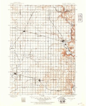
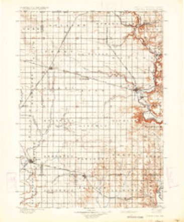
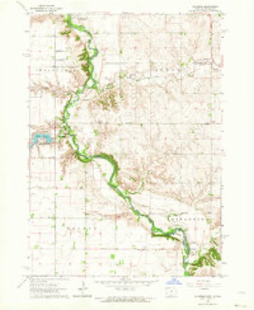
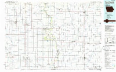
10 topographic sheets cover this place, the earliest surveyed in 1897 and the latest in 1985. It stands in Sioux Township. It lies in ZIP code area 51241. It stands on Blood Run. The Survey maps it on the Klondike quadrangle.
Topographic sheets covering this place
6 surveys from 10 printed sheetsMatched by testing this settlement's coordinate against the published boundary of every sheet in the United States Geological Survey's historical collection. Each opens the scanned sheet at the Survey.
- 1897 USGS Canton quadrangle1:125000
- 1900 USGS Canton quadrangle1:125000, 2 printings
- 1955 USGS Sioux Falls quadrangle1:250000, 3 printings
- 1958 USGS Sioux Falls quadrangle1:250000
- 1962 USGS Klondike quadrangle1:24000
- 1985 USGS Rock Rapids quadrangle1:100000, 2 printings
Fires near this place
55 since 1998Regional context, not property-specific evidence. The federal wildfire occurrence database lists 55 fires within 5 miles of Granite between 1998 and 2020, burning about 1,380 acres in total. None started naturally. 2 were recorded as arson. Distance is straight-line from the map coordinates, so a fire counted here may appear on a neighbouring settlement's page as well.
| Reported cause | Fires |
|---|---|
| Missing data/not specified/undetermined | 29 |
| Debris and open burning | 18 |
| Arson/incendiarism | 2 |
| Recreation and ceremony | 1 |
| Equipment and vehicle use | 1 |
| Fireworks | 1 |
| Smoking | 1 |
| Misuse of fire by a minor | 1 |
| Railroad operations and maintenance | 1 |
The most recent of them, most recent first, with the day each was reported and the service that recorded it.
| Date | Cause | Size | Reported by | Name on the report |
|---|---|---|---|---|
| 29 September 2012 | Missing data/not specified/undetermined | 1.0 acres | South Dakota Wildland Fire Suppression | SLACK |
| 11 September 2012 | Missing data/not specified/undetermined | 10 acres | South Dakota Wildland Fire Suppression | ALBERS |
| 9 July 2015 | Missing data/not specified/undetermined | under an acre | South Dakota Wildland Fire Suppression | HCFD10136 |
| 4 July 2005 | Missing data/not specified/undetermined | 2.0 acres | South Dakota Wildland Fire Suppression | not named |
| 30 July 2014 | Missing data/not specified/undetermined | 10 acres | South Dakota Wildland Fire Suppression | BIRD |
| 3 July 2016 | Debris and open burning | under an acre | South Dakota Wildland Fire Suppression | HCFD1610595 |
| 29 July 2014 | Missing data/not specified/undetermined | 9.0 acres | South Dakota Wildland Fire Suppression | MAYER BROTHERS |
| 19 July 2020 | Debris and open burning | under an acre | South Dakota Wildland Fire Suppression | HCFD15825 |
Mines and quarries near this place
10 of 12 shownRegional context, not property-specific evidence. The federal mineral resources record lists 12 workings within 5 miles of Granite: 10 past producers, 2 producers. 2 still produce. What was taken out: Sand and Gravel, Construction, Stone, Crushed/Broken. Distance is straight-line from the map coordinates, so a quarry counted here may appear on a neighbouring settlement's page as well.
| Where | Site | Commodity | Status | Recorded |
|---|---|---|---|---|
| Quartzite Quarry | Stone, Crushed/Broken | Past Producer | ||
| Quartzite Quarry | Stone, Crushed/Broken | Past Producer | ||
| Hogan Pit | Sand and Gravel, Construction | Producer | ||
| Lyon County-Beck Pit | Sand and Gravel, Construction | Past Producer | ||
| Lyon County-Burns Pit | Sand and Gravel, Construction | Past Producer | ||
| Maudlin | Sand and Gravel, Construction | Past Producer | ||
| Maudlin Klondike | Sand and Gravel, Construction | Producer | ||
| Rohlin | Sand and Gravel, Construction | Past Producer | ||
| Unknown | Sand and Gravel, Construction | Past Producer | ||
| Unknown | Sand and Gravel, Construction | Past Producer |
Storms near this place
33 since 2010Regional context, not property-specific evidence. The National Weather Service names Granite in 33 storm reports between 2010 and 2024: 33 flood. No death or injury is recorded in these reports. Each account below is quoted exactly as the forecast office filed it, from the NOAA Storm Events Database, and each date opens the federal record of that event.
| When | Event | Place named | Harm | What the report says |
|---|---|---|---|---|
| June 2014 | Flood | Granite | $50,000 | Persistent moderate to heavy rain caused flooding of fields and other lowlands, including several roads, homes, and businesses. This flooding lasted for almost two days, and was aggravated locally by additional storms during that time. Some roads were damaged or washed out. |
| September 2019 | Flood | Granite | $10,000 | After excessive two-day rainfall during September 10-12 (8.74 inches at Flandreau, 7.81 inches at Dell Rapids and generally 3 to 4 inches around Sioux Falls), the Big Sioux River near Brandon (gage site BBSS2) reached the highest stage on record of 9.53 feet above flood stage on September 14. Significant amounts of rural flooding occurred, with inundation of much of the Big Sioux Recreation Area and lower trails in Good Earth and Gitchie Manitou State Parks. Minor flooding continued at the end of the month. |
| October 2019 | Flood | Granite | $5,000 | A continuation of flooding from September, heavy rainfall which averaged 1.00 to 1.50 inches in areas from Dell Rapids to around Sioux Falls maintained early month minor flooding, with a crest of the Big Sioux River near Brandon (gage site BBSS2) at 0.69 feet above flood stage on October 5. There was continued inundation of agricultural lands along the river. Property damage costs are rough estimates. |
| June 2024 | Flood | Granite | - | The Big Sioux River near Brandon rose above flood stage the morning of June 21st, cresting around 8.32 feet above flood stage (1312.32 feet) on June 22nd. This crest is in the Major Stage. The river stayed above flood stage into July. For a more comprehensive description of flood damage, please see other entries for Lyon County. |
| July 2024 | Flood | Granite | - | Flooding continued from June on the Big Sioux River near Brandon, with declining river levels. The river fell below flood stage on the morning of July 4th. |
| April 2023 | Flood | Granite | - | The Big Sioux River near Brandon, SD rose above flood stage during the early morning of April 11th before cresting around 1.51 feet above flood stage (1305.51 feet) on April 11th. The river then fell below flood stage on the afternoon of April 18th. |
| March 2020 | Flood | Granite | - | The Big Sioux River at Brandon (gage site BBSS2) crested 1.23 feet above flood stage on March 15. Significant flooding of agricultural lands occurred upstream and downstream of Brandon. |
| April 2020 | Flood | Granite | - | A continuation of flooding from March, the Big Sioux River at Brandon (gage site BBSS2) began the month 0.30 feet above flood stage, before falling back below flood stage on April 4. Extensive flooding of agricultural land occurred near the river, and the north access road to the Big Sioux Recreation Area was flooded. |
| March 2020 | Flood | Granite | - | With rainfall which averaged 1.00 to 1.50 inches around the Sioux Falls area, the Big Sioux River at Brandon (gage site BBSS2) returned to flood late month. The river crested at 0.66 feet above flood stage on March 29, resulting in extensive flooding of agricultural land near the river and flooding the north access road to the Big Sioux Recreation Area. The river remained at minor flood stage at the end of the month. |
| June 2019 | Flood | Granite | - | The Big Sioux River near Brandon (gage site BBSS2) crested 0.47 feet above flood stage on June 28, causing significant flooding of crop and pasture land. |
| May 2019 | Flood | Granite | - | This is a continuation of flooding from April. The Big Sioux River near Brandon (gage site BBSS2) remained in flood through the month. After an early month crest at 3.43 feet above flood stage on May 1, the river fell back to minor flood stage before late month rains pushed the river to a crest into moderate flood stage at 4.90 feet above flood stage on May 31. Significant agricultural flooding persisted, with no opportunity for spring planting throughout the flood plain. The river remained at moderate flood stage at the end of the month. |
| June 2019 | Flood | Granite | - | A continuation of flooding from May, the Big Sioux River near Brandon (gage site BBSS2) began the month at 4.15 feet above flood stage. Significant amounts of agricultural land remained flooded, and further impeded spring planting. |
| March 2019 | Flood | Granite | - | Snow melt and heavy rainfall (measured 2.74 inches at Hartford, 2.44 inches near Renner, 1.72 inches near Larchwood and 2.49 inches at Sioux Falls) resulted in extensive flooding of agricultural land and recreational areas near Brandon. The Big Sioux River near Brandon (gage site BBSS2) reached the highest crest on record at 6.85 feet above flood stage on March 15. The river fell back to minor flood stage on March 15, but would rise back to major flood stage and crest 6.58 feet above flood stage on March 26 due to water routed from upstream melting. The river remained in major flood stage at the end of the month. |
| July 2019 | Flood | Granite | - | The Big Sioux River near Brandon (gage site BBSS2) crested 3.18 feet above flood stage on July 17. Signficant amounts of crop and pasture land were flooded. |
| April 2019 | Flood | Granite | - | Runoff from occasional precipitation in late March and April maintained significant flooding of agricultural and pasture lands near the Big Sioux River. The Big Sioux River near Brandon (gage site BBSS2) crested at 5.18 feet above flood stage on April 1. Moderate flooding continued at the end of the month. |
| April 2018 | Flood | Granite | - | Snow melt and runoff from periods of heavier rainfall produced moderate flooding which produced significant impact to lowland agricultural areas. River levels reached 3.4 feet above flood stage near Brandon (gage site BBSS2) on April 28. The river remained at minor flood stage at the end of the month. |
| July 2018 | Flood | Granite | - | Crop and pasture land near the Big Sioux River was impacted as river levels climbed to 0.6 feet above flood stage near Brandon (gage site BBSS2) on July 3. |
| September 2018 | Flood | Granite | - | Rainfall across the Sioux Falls metro area from September 18-20 totaled generally 5 to 7 inches. Moderate flooding resulted with significant flooding of crop and pasture land as the Big Sioux River at Brandon (gage site BBSS2) crested 3.3 feet above flood stage on September 21. |
| October 2018 | Flood | Granite | - | A steady moderate rainfall during October 9-10 - resulting in 1.50 to 2.00 inches of rainfall - produced yet another period of minor flooding of crop and pasture land as the Big Sioux River at Brandon (gage site BBSS2) crested 0.3 feet above flood stage on October 12. |
| June 2018 | Flood | Granite | - | A week of periodic heavy rainfall ending June 26 resulted in a widespread 3 to 7 inches of rainfall, much of which occurred on June 20 and 25. Specific weekly totals included 3.44 inches at Flandreau, 4.08 inches 6 miles north of Dell Rapids, 4.62 inches at Colton, 8.14 inches near Garretson, 5.67 inches near Hartford, 6.28 inches near Larchwood and a variety of reports from 5 to 7 inches around the Sioux Falls metro area. Minor flooding occurred with significant amounts of crop and pasture land inundated as the river crested near Brandon (gage site BBBS2) 2.8 feet above flood stage on June 22. The river dropped below flood stage on June 24, but returned above flood stage with minor flooding (0.5 feet above flood stage) again on June 28 before falling back below flood stage on June 29. |
| May 2018 | Flood | Granite | - | A slow fall through minor flood stages persisted along much of the Big Sioux River during much of the first week of May, with impacts generally limited to flooding of agricultural areas near the river. Flooding ended near Brandon (gage site BBSS2) on May 6. |
| June 2014 | Flood | Granite | - | Persistent moderate to heavy rain caused flooding of some fields and other lowlands, including several roads. This flooding lasted well into the daytime hours after the rain subsided. |
| June 2014 | Flood | Granite | - | Minor to moderate flooding of the Big Sioux River resulted from repeating heavy rains. Lowlands including some farmland and a few roads were flooded. There was more severe general flooding in the area from heavy rain that was not directly related to the river flooding. |
| May 2013 | Flood | Granite | - | Heavy rain caused minor flooding along the Big Sioux River, with lowlands including some farmland affected. |
| May 2012 | Flood | Granite | - | Minor to moderate flooding of the Big Sioux River affected some farmland, parkland, and a few roads. |
| April 2011 | Flood | Granite | - | Flooding of the Big Sioux River and of lakes, streams and lowlands, including some farmland, continued in the county through April, though flooding generally abated slowly. Several roads remained flooded. High water and groundwater levels resulting from record precipitation in the previous year was the main reason that the flooding either grew worse or improved so slowly. |
| March 2011 | Flood | Granite | - | Melting of a heavy winter snow cover caused moderate to major flooding of the Big Sioux River, as well as flooding of lowlands, lakes, and streams near to and away from the river. There was considerable flooding of farmland. Several roads in the county were flooded. Some of the roads were closed, and a few were washed out in spots. The flooding onset was rapid for a snow melt flood due to high water and groundwater levels from record precipitation in the year 2010. |
| July 2011 | Flood | Granite | - | Minor to marginally moderate flooding redeveloped along the Big Sioux River, then subsided during the month. A few lowlands along the river were flooded, including some farmland. |
| September 2010 | Flood | Granite | - | Widespread heavy rain, combined with saturated ground, caused a fairly rapid rise of the Big Sioux River to moderate to major flooding levels. Roads and numerous agricultural land near the river were flooded, as well as a few homes. |
| October 2010 | Flood | Granite | - | Minor to moderate flooding of the Big Sioux River steadily abated and ended during the first few days of the month. Some roads and riverside lowlands including agricultural land were still flooded at the start of the month. |
| August 2010 | Flood | Granite | - | Minor to moderate flooding along the Big Sioux River from late July heavy rains continued at the start of August before quickly abating. Some fields and roads along the river were flooded. |
| June 2010 | Flood | Granite | - | Recurring heavy rain cause minor to moderate flooding of the Big Sioux River. Some roads and fields along the river were flooded. |
| July 2010 | Flood | Granite | - | Runoff from late July heavy rain caused minor to moderate flooding along the Big Sioux River. Some roads and fields along the river were flooded. |
Nearest settlements
The eight closest, with where each one stands in the county. Distances are straight-line, computed from the Geographic Names Information System coordinates.
Provenance
This settlement is recorded in the Geographic Names Information System as feature 464568. The sheet list is computed by point-in-boundary test against the United States Geological Survey's historical topographic inventory. Both are works of the United States government and carry no copyright under 17 U.S.C. 105.
Wildfire. Short, Karen C. 2022. Spatial wildfire occurrence data for the United States, 1992-2020 [FPA_FOD_20221014]. 6th Edition. Fort Collins, CO: Forest Service Research Data Archive. https://doi.org/10.2737/RDS-2013-0009.6 Collected with United States Government funding and usable without additional permissions or fees.
Mines and quarries. USGS Mineral Resources Data System (MRDS) https://mrdata.usgs.gov/mrds/ A work of the United States government, no copyright under 17 U.S.C. 105.
Storms. NOAA National Centers for Environmental Information, Storm Events Database https://www.ncei.noaa.gov/stormevents/ A work of the United States government, no copyright under 17 U.S.C. 105. Narratives are quoted verbatim from the National Weather Service report and are not edited or summarised.