 Block
From the record
11 National Register listings published here.
Sources: the National Register database, National Park Service
42 topographic sheets cover 14 settlements here, and 11 properties are on the National Register of Historic Places.
11 National Register listings published here.
Sources: the National Register database, National Park Service
Every property in this county listed on the National Register of Historic Places, with the year it was listed and the federal nomination document.
| Photograph | Property | Type | Listed | Reference |
|---|---|---|---|---|
| Garretson Outlet Bridge | structure | 1999 | 99000313 | |
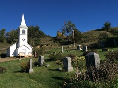 | Ingemann Danish Evangelical Lutheran Church and Cemetery | building | 2012 | 12000779 |
| Jones Creek Watershed Historic District | district | 1991 | 91001839 | |
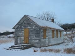 | Mann School No. 2 | building | 2001 | 00001655 |
 | Monona County Courthouse | building | 1981 | 81000257 |
 | Onawa IOOF Opera House | building | 1990 | 90001194 |
 | Onawa Public Library | building | 1979 | 79000917 |
| Round Barn, Cooper Township | building | 1986 | 86001463 | |
| South Jordan Cemetery | site | 2021 | 100006221 | |
 | Trinity Memorial Episcopal Church | building | 1990 | 90001217 |
 | Newell A. Whiting House | building | 1990 | 90001216 |
Every wildfire the federal occurrence database records inside this county: 59 of them, burning about 3,509 acres. None started naturally and 4 were recorded as arson. Each settlement page carries the fires within five miles of it.
| Reported cause | Fires |
|---|---|
| Missing data/not specified/undetermined | 34 |
| Debris and open burning | 10 |
| Arson/incendiarism | 4 |
| Smoking | 4 |
| Misuse of fire by a minor | 4 |
| Equipment and vehicle use | 2 |
| Recreation and ceremony | 1 |
The five largest, by the area the report gives. None of them was recorded as arson.
| Date | Cause | Size | Reported by | Name on the report |
|---|---|---|---|---|
| 16 March 2017 | Misuse of fire by a minor | 1,100 acres | Winnebago Agency | BLACKBIRD BEND |
| 30 April 2015 | Debris and open burning | 480 acres | Iowa Department of Natural Resources | not named |
| 30 March 2015 | Debris and open burning | 340 acres | Iowa Department of Natural Resources | not named |
| 31 March 2014 | Missing data/not specified/undetermined | 300 acres | Iowa Department of Natural Resources | not named |
| 29 April 2015 | Missing data/not specified/undetermined | 260 acres | Iowa Department of Natural Resources | not named |
| 15 March 2014 | Missing data/not specified/undetermined | 250 acres | Iowa Department of Natural Resources | not named |
| 5 April 2015 | Missing data/not specified/undetermined | 180 acres | Iowa Department of Natural Resources | not named |
| 26 March 2014 | Misuse of fire by a minor | 120 acres | Winnebago Agency | ROSALIE #002 |
Every settlement page carries the fires within five miles of it - see the settlement index below.
The NOAA Storm Events Database holds 337 reports for this county, causing 4 deaths, 64 injuries and about $263,940,250 in recorded property damage. Each settlement page carries the reports that name it.
| Kind of event | Reports |
|---|---|
| Hail | 144 |
| Thunderstorm Wind | 135 |
| Tornado | 30 |
| Flash Flood | 11 |
| Flood | 10 |
| Funnel Cloud | 7 |
The most serious of them, by death, then injury, then recorded damage. The accounts are quoted exactly as the forecast office filed them.
| When | Event | Place named | Harm | What the report says |
|---|---|---|---|---|
| June 2008 | Tornado (EF3) | Blencoe | 4 killed, 48 hurt | This tornado tragically hit a boyscout camp north of Little Sioux Iowa killing 4 young scouts. The tornado initially touched down in Burt county Nebraska, crossed into Harrison county Iowa near mile marker 97 on Interstate 29, and then finally crossed into Monona county Iowa about 4 miles north of Little Sioux. In Monona county the tornado entered the Little Sioux Scout Ranch, destroying the rangers home near the entrance of the park giving it a rating of EF3. The storm then blew down trees and destroyed bunk houses at the camp. Four scouts were killed in one bunk house when a brick chimney collapsed on them. In total 48 people were injured at the camp. The tornado continued to topple trees as it tracked into Preparation Canyon State Park. Just before it entered the park a farmstead sustained damage. The tornado hit another farmstead about 2.5 miles southwest of Moorhead where trees were blown down and sheds damaged. The tornado then began to weaken and finally lifted about 2 miles southwest of Moorhead. The total path length was around 14 miles. |
| April 2011 | Tornado (EF3) | Mapleton | 14 hurt | A tornado caused extensive damage in the Mapleton area with about 100 houses destroyed and many others severely damaged in a 12 to 15 block area on the southwest side of town. This caused the displacement of around 500 to 600 people. Most garages and stand alone structures were destroyed. In addition, large trees were uprooted and windows blown out of vehicles. Twelve to 14 people sustained minor injuries, the most severe a broken leg. The worst property damage was noted to be on the lower end of the EF3 category. The tornado started about 2 miles west southwest of Mapleton, moved into town, then turned north and ended 1 mile north of town. The path length was around 3.5 miles and the maximum width was around 3/4 of a mile. |
| July 2008 | Thunderstorm Wind | Onawa | 2 hurt | Thunderstorm wind gusts estimated at over 60 mph blew some trees down on top of campers at the Lewis and Clark State Park, causing 2 minor injuries. Some campers in the area were also rolled due to the winds. |
| July 1986 | Tornado (F4) | not stated | $250,000,000 | no account filed |
| August 2011 | Flood | Albaton | $5,000,000 | Flooding along the Missouri River gradually worsened over Monona county during June and July as record releases from Gavins Point Dam brought widespread flooding along the river. Conditions improved markedly during August as releases were reduced and the river level at Decatur dropped below flood stage late in the month. Flooding in Monona county was mainly confined to agricultural lowlands, recreation areas and roads near the river. However, Blencoe started sandbag operations in June as did other businesses from Blencoe to Onawa. The flooding forced the post office in Blencoe to move operations to a nearby town. Late in June the Highway 175 bridge over the Missouri between Decatur and Onawa was closed due to erosion of the abutment on the Iowa side of the bridge and the bridge and highway remained closed through August. The Iowa Farm Bureau Federation estimated that the flood event caused total crop and economic losses of $32.3 million in Monona county. |
| March 2019 | Flood | Mapleton Muni Arpt | $4,200,000 | This is for flooding along the Maple River. The river gage at Mapleton, operated by the USGS, peaked at 23.60 feet at 6:15 pm on March 14th. Minor flood stage is 21 feet, moderate flood stage is 24 feet . Preliminarily this peak is the 2nd highest on record. Ice jamming may have played a role in the flooding at this location. The flooding caused damage and the closure of Hwy. 183 West of Mapleton. Hwy 175 south of Mapleton and the closure of Hwy. 175 North of Mapleton. Also the local Airport was totally flooded and damaged. Flood totals are for for the County including from damage caused by flooding of the Soldier River. |
| May 2007 | Flash Flood | Onawa | $1,440,000 | Rainfall of 3 to 4 inches produce flash flooding of streets in Onawa. Other creeks across the county flooded county roads causing road, bridge and levee damage. |
| June 2024 | Flood | Albaton | $1,000,000 | River flooding from upstream excessive rain impacted the region, bringing the Missouri River to moderate flood stage. The Missouri River crested at 37.55 feet at the Decatur gauge at 03:45 CDT on 6/26. Flood stage at this gauge is 35.0 feet. Additional flooding for the same reason was observed on Little Sioux River between 6/24 and 6/28. The Little Sioux river crested at 27.33 feet. Flood stage for this river in Monona County is 25.0 feet. At 04:56 am CDT on the 25th, law enforcement reported that a levee on the Little Sioux River failed 600 yards south of Highway 141 resulting in flash flooding in the surrounding areas. Later that same day shortly after 04:00 pm CDT, law enforcement reported a second levee breach near Rodney. By this point, water had breached the levee system on both sides of the river, resulting in several road closures and evacuations of nearby homesteads. Damage to this county from the flood was estimated to be $1,298,600.00. |
| August 1994 | Thunderstorm Wind | Mapleton | $500,000 | no account filed |
| August 1994 | Thunderstorm Wind | Mapleton | $500,000 | no account filed |
| May 1991 | Tornado (F2) | not stated | $250,000 | no account filed |
| September 1965 | Tornado (F2) | not stated | $250,000 | no account filed |
| May 1999 | Tornado (F1) | Ute | $120,000 | Two homes sustained moderate to major damage, 3 grain bins and other outbuildings destroyed. Several vehicles were carried some distance. Large tree uprooted. |
| June 2024 | Flash Flood | Rodney | $100,000 | At 04:56 am CDT on the 25th, law enforcement reported that a levee on the Little Sioux River failed 600 yards south of Highway 141 resulting in flash flooding in the surrounding areas. Since this event was tied to the river flooding at the end of this month, the damage estimates for the Flood event for Monona County has the damage estimates for this levee break included in it. |
| June 2014 | Flash Flood | Mapleton | $50,000 | Heavy rainfall caused several inches of water on roads in the city of Mapleton, as well as on the county roads outside of town. Rainfall of 1.80 inches was reported in a half hour leading to the flash flooding. |
| July 2011 | Flood | Albaton | $50,000 | Flooding along the Missouri River gradually worsened over Monona county during June and continued through July as record releases from Gavins Point Dam brought widespread flooding along the River. Flooding in Monona county initially was mainly confined to agricultural lowlands, recreation areas and roads near the river but then started threatening Blencoe which started sandbag operations in June as did other businesses from Blencoe to Onawa. The flooding forced the post office in Blencoe to move operations to a nearby town and closed 2 casinos. Late in June the Highway 175 bridge over the Missouri between Decatur and Onawa was closed due to erosion of the abutment on the Iowa side of the bridge. The flooding persisted into August. |
| July 1994 | Thunderstorm Wind | Soldier | $50,000 | no account filed |
| July 1994 | Thunderstorm Wind | Mapleton | $50,000 | no account filed |
| June 1994 | Thunderstorm Wind | Ute | $50,000 | no account filed |
| October 1994 | Hail | Ute | $50,000 | no account filed |
| May 2007 | Thunderstorm Wind | Onawa | $40,000 | Thunderstorm wind gusts estimated at over 60 mph caused roof damage to a business by displacing large air-conditioning units. The winds also blew the roof canopy off of a truck stop into cars in a parking lot. |
| June 1967 | Tornado (F1) | not stated | $25,000 | no account filed |
| September 1965 | Tornado (F1) | not stated | $25,000 | no account filed |
| May 1962 | Tornado (F1) | not stated | $25,000 | no account filed |
| March 1953 | Tornado (F1) | not stated | $25,000 | no account filed |
| June 2011 | Flood | Albaton | $20,000 | Flooding along the Missouri River gradually worsened over the area during June as record releases from Gavins Point Dam brought widespread flooding along the River. In Monona county the flooding generally began during the first week of the month as the gauge at Decatur didn't surpass flood stage until around June 6th. Flooding in Monona county initially was mainly confined to agricultural lowlands, recreation areas and roads near the river but then started threatening Blencoe which started sandbag operations as did other businesses from Blencoe to Onawa. The flooding forced the post office in Blencoe to move operations to a nearby town. Late in the month the Highway 175 bridge over the Missouri between Decatur and Onawa was closed due to erosion of the abutment on the Iowa side of the bridge. The flooding persisted into July. |
| October 1994 | Hail | Soldier | $20,000 | no account filed |
| August 1996 | Thunderstorm Wind | Onawa | $12,000 | no account filed |
| June 1995 | Thunderstorm Wind | not stated | $10,000 | Damage done to trees and power lines near Whiting, Onawa, and Albaton. Damage to some farm property, irrigation system, and windows blown out of residence in Fairview Township. |
| June 2010 | Flood | Turin | $5,000 | Heavy rain during the morning of June 27th caused flooding of the Little Sioux River. The river near Turin crested at around 24.5 feet during the early morning hours of June 30. Flood stage is 20 feet. The river was above flood stage near Turin from the early evening of the 27th through July 2nd. A levee along the river protected significant flooding although some agricultural lowlands were flooded. |
| April 2001 | Thunderstorm Wind | Whiting | $5,000 | A thunderstorm wind gust estimated by the public at over 60 mph destroyed a barn near Whiting. |
| August 2001 | Tornado (F0) | Onawa | $5,000 | A tornado touched down northwest of Onawa overturning a center pivot irrigation system according to a law enforcement official. The tornado was also captured on film from someone staying at the Lewis and Clark State Park. All of the pictures taken showed that the condensation portion of the tornado was very narrow. The path of the tornado crossed I-29 before lifting around 2 miles north northwest of Onawa. |
| August 1995 | Thunderstorm Wind | Castana | $5,000 | Hail driven by thunderstorm winds did damage to a home and stripped crops. |
| August 1993 | Hail | Rodney | $5,000 | An intense thunderstorm moved into west central Iowa during the afternoon hours. As the storm passed over Monona County, nickel-size hail fell southwest of Rodney. |
| July 1994 | Thunderstorm Wind | Onawa | $5,000 | no account filed |
| August 1994 | Thunderstorm Wind | Rodney | $5,000 | no account filed |
| June 1994 | Hail | Moorhead | $5,000 | no account filed |
| June 1994 | Hail | Ute | $5,000 | no account filed |
| June 1994 | Hail | Ute | $5,000 | no account filed |
| July 1994 | Thunderstorm Wind | Blencoe | $5,000 | no account filed |
| July 1994 | Thunderstorm Wind | Whiting | $5,000 | no account filed |
| August 1994 | Thunderstorm Wind | Ticonic | $5,000 | no account filed |
| August 1994 | Thunderstorm Wind | Ute | $5,000 | no account filed |
| October 1994 | Hail | Soldier | $3,000 | no account filed |
| October 1994 | Hail | Soldier | $3,000 | no account filed |
| July 2010 | Flood | Turin | $2,000 | This flooding carried over from June when heavy rain during the morning of June 27th caused flooding of the Little Sioux River. The river near Turin crested at around 24.5 feet during the early morning hours of June 30. Flood stage is 20 feet. The river was above flood stage near Turin from the early evening of June 27th through July 2nd. A levee along the river protected significant flooding although some agricultural lowlands were flooded. |
| June 1992 | Tornado (F0) | not stated | $250 | no account filed |
| March 2026 | Hail | Blencoe | - | Trained spotter report of hail measured at 1.50 inch in diameter. |
| March 2025 | Thunderstorm Wind | Onawa | - | Public estimated wind gusts of 60 to 70 mph, lasting nearly 10 minutes. |
| August 2025 | Thunderstorm Wind | Ute | - | Law enforcement report of trees blown down. Winds gusted to an estimated 90 mph. |
| August 2025 | Thunderstorm Wind | Blencoe | - | Personal weather station measured wind gust of 73 mph. |
| May 2024 | Thunderstorm Wind | Castana | - | An 83 miles per hour wind gust was recorded on a personal weather station. |
| May 2024 | Hail | Blencoe | - | The public reported quarter sized hail on the west side of Blencoe via mPING. |
| April 2024 | Tornado (EF0) | Preparation | - | This is a continuation of the EF-1 tornado that touched down in Harrison County to the north-northwest of Magnolia, IA. The tornado was already weakening as it entered Monona County, only producing low-end EF-0 damage to trees as it crossed the county line. The tornado dissipated less than a quarter mile ENE of the intersection of Peach Avenue and 330th Street. |
| April 2024 | Tornado (EF0) | Moorhead | - | A short-lived tornado developed in an agricultural field and moved generally northeast across fields and pastureland, damaging outbuildings of farmsteads near the intersection of 280th and Poplar Roads. The tornado appeared to dissipate in pastureland before reaching State Highway 183. Peak winds were estimated at 85 miles per hour. The tornado reached a maximum width of 100 yards, with an average width estimated at 50 yards. |
| April 2024 | Tornado (EF1) | Soldier | - | A tornado developed near the intersection of 260th and 270th Streets. It produced damage to outbuildings at a farmstead near this intersection and tossed some fiberglass boats. The tornado moved across agricultural fields generally northeast paralleling State Highway 183 to the west. It produced damage to trees along Redwood Avenue and snapped a power pole at the intersection of State Highway 37 and Redwood Avenue. The tornado moved just west of the community of Soldier, producing no discernable damage to any homes or businesses on the west side of town. Radar signatures indicate the tornado continued to move northeast across agricultural lands, moving north of 245th Street, damaging trees and outbuildings, before dissipating just east of Spruce Avenue. Peak winds in this tornado were estimated at 98 miles per hour. The maximum width was measured at 250 yards, with the average width estimated at 100 yards. |
| July 2024 | Funnel Cloud | Whiting | - | The office received a delayed report of a rope funnel cloud from the public. |
| July 2024 | Funnel Cloud | Blencoe | - | The office received multiple photos of a funnel cloud via social media. |
| July 2024 | Thunderstorm Wind | Whiting | - | A Department of Highways station measured a 61 miles per hour wind gust. |
| June 2024 | Hail | Whiting | - | Golf ball sized hail was reported by a trained spotter along Interstate 29 west of Whiting. |
The Survey's mineral resources record lists 8 workings inside this county. 1 still produces and 7 are closed or unrecorded. Each settlement page carries the workings within five miles of it.
| Commodity | Workings |
|---|---|
| Sand and Gravel, Construction | 7 |
| Stone, Crushed/Broken | 1 |
The least common of them first, because a county's hundredth gravel pit says nothing its first ten did not.
| Where | Site | Commodity | Status | Recorded |
|---|---|---|---|---|
| Fishel Quarry | Stone, Crushed/Broken | Past Producer | ||
| Castana Pit | Sand and Gravel, Construction | Past Producer | ||
| Hargrave Pit | Sand and Gravel, Construction | Past Producer | ||
| Onawa Pit | Sand and Gravel, Construction | Unknown | ||
| Rodney Pit & Plant | Sand and Gravel, Construction | Producer | ||
| Rodney Pit No. Five | Sand and Gravel, Construction | Past Producer | ||
| Unknown | Sand and Gravel, Construction | Past Producer | ||
| Unknown | Sand and Gravel, Construction | Past Producer |
Named settlements recorded in the Geographic Names Information System, each with the topographic sheets covering it. Villages, hamlets and abandoned places alike. Each is shown with the nearest named watercourse or landform and the survey quadrangle it falls on.
Lincoln township · 51040 · Onawa SW quadrangle
9 sheets, 1955 to 1986
No longer a settlement
The vanished settlements of Monona County: the places named above that are no longer on the map.