 Block
From the record
36 National Register listings published here.
Sources: the National Register database, National Park Service
38 topographic sheets cover 29 settlements here, and 36 properties are on the National Register of Historic Places.
36 National Register listings published here.
Sources: the National Register database, National Park Service
Every property in this county listed on the National Register of Historic Places, with the year it was listed and the federal nomination document.
| Photograph | Property | Type | Listed | Reference |
|---|---|---|---|---|
| Big Stone Mills | building | 09000516 | ||
| Birdsall Lime Kiln | structure | 1979 | 79000948 | |
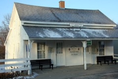 | Burr Oak House/Masters Hotel | building | 1983 | 83000410 |
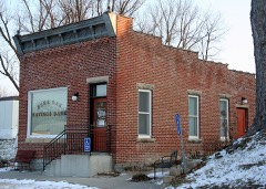 | Burr Oak Savings Bank | building | 2001 | 01000857 |
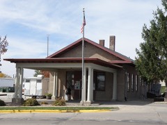 | Calmar Passenger Depot | building | 2011 | 11000137 |
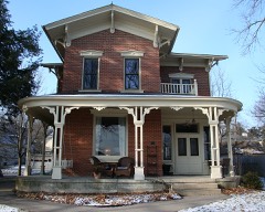 | Cooley-Whitney House | building | 1980 | 80001461 |
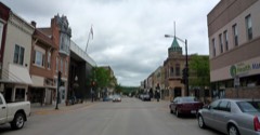 | Decorah Commercial Historic District | district | 2017 | 100001482 |
| Decorah Hospital | building | 2023 | 100009067 | |
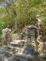 | Decorah Ice Cave | site | 1978 | 78001269 |
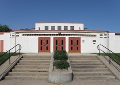 | Decorah Municipal Bathhouse and Swimming Pool | building | 2012 | 11001057 |
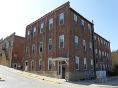 | Decorah Woolen Mill | building | 2001 | 00001681 |
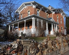 | Ellsworth-Porter House | building | 1975 | 75000702 |
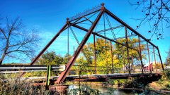 | Fort Atkinson Bridge | structure | 1998 | 98000460 |
 | Frankville School | building | 1978 | 78001272 |
| Gilliece Bridge | structure | 1998 | 98000464 | |
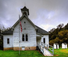 | Highlandville School | building | 2014 | 13001141 |
| Horn House | building | 1977 | 77000568 | |
| Jacobson Farm | building | 1982 | 82002645 | |
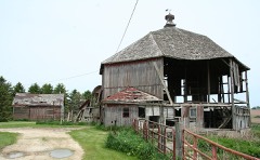 | Kinney Octagon Barn | building | 1986 | 86003191 |
 | Koren Library | building | 1984 | 84001610 |
| Lawrence Bridge | structure | 1998 | 98000462 | |
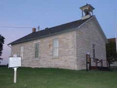 | Locust School | building | 1978 | 78001270 |
| Luther College Campus Historic District | district | 2021 | 100006184 | |
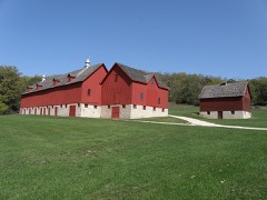 | Luther College Farm | building | 1979 | 79000949 |
| Norris Miller House | building | 1976 | 76000814 | |
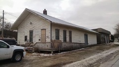 | Milwaukee and St. Paul Railway Combination Depot | building | 2016 | 16000609 |
| Ossian Opera House | building | 1979 | 79000950 | |
| Painter-Bernatz Mill | building | 1974 | 74000816 | |
 | Steyer Bridge | structure | 1983 | 83000411 |
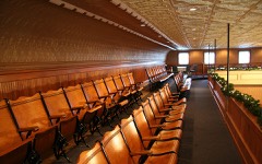 | Steyer Opera House | building | 1980 | 80001462 |
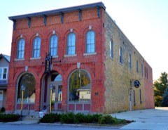 | Wenzil Taylor Building | building | 1979 | 79000951 |
| Ten Mile Creek Bridge | structure | 1998 | 98000466 | |
| Turkey River Bridge | structure | 98000468 | ||
| Upper Bluffton Bridge | structure | 1998 | 98000458 | |
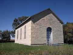 | Washington Prairie Methodist Church | building | 1980 | 80001463 |
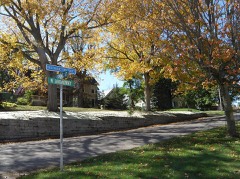 | Winnishiek County Courthouse | building | 2022 | 76000813 |
Every wildfire the federal occurrence database records inside this county: 65 of them, burning about 1,137 acres. 1 started naturally and none was recorded as arson. Each settlement page carries the fires within five miles of it.
| Reported cause | Fires |
|---|---|
| Debris and open burning | 33 |
| Missing data/not specified/undetermined | 28 |
| Equipment and vehicle use | 3 |
| Natural | 1 |
The five largest, by the area the report gives. None of them was recorded as arson.
| Date | Cause | Size | Reported by | Name on the report |
|---|---|---|---|---|
| 26 April 2018 | Debris and open burning | 300 acres | Iowa Department of Natural Resources | not named |
| 20 October 2010 | Missing data/not specified/undetermined | 100 acres | Iowa Department of Natural Resources | RANDY KUENNEN FARM. 1322 315TH AVE, FORT ATKINSON, |
| 26 March 2010 | Missing data/not specified/undetermined | 100 acres | Iowa Department of Natural Resources | 2472 175TH ST., CALMAR, IOWA |
| 3 April 2009 | Missing data/not specified/undetermined | 80 acres | Iowa Department of Natural Resources | not named |
| 26 April 2020 | Debris and open burning | 50 acres | Iowa Department of Natural Resources | not named |
| 19 April 2020 | Debris and open burning | 50 acres | Iowa Department of Natural Resources | not named |
| 5 April 2020 | Debris and open burning | 40 acres | Iowa Department of Natural Resources | not named |
| 28 April 2013 | Debris and open burning | 35 acres | Iowa Department of Natural Resources | not named |
Every settlement page carries the fires within five miles of it - see the settlement index below.
The NOAA Storm Events Database holds 440 reports for this county, causing no deaths, 4 injuries and about $26,242,750 in recorded property damage. Each settlement page carries the reports that name it.
| Kind of event | Reports |
|---|---|
| Thunderstorm Wind | 166 |
| Hail | 161 |
| Flash Flood | 32 |
| Flood | 30 |
| Tornado | 23 |
| Heavy Rain | 15 |
| Funnel Cloud | 10 |
| Lightning | 3 |
The most serious of them, by death, then injury, then recorded damage. The accounts are quoted exactly as the forecast office filed them.
| When | Event | Place named | Harm | What the report says |
|---|---|---|---|---|
| July 1994 | Thunderstorm Wind | Decorah | 2 hurt, $50,000 | no account filed |
| August 1965 | Tornado (F2) | not stated | 1 hurt, $250,000 | no account filed |
| August 1979 | Tornado (F1) | not stated | 1 hurt, $25,000 | no account filed |
| August 2016 | Flash Flood | Decorah Muni Arpt | $3,010,000 | Flood waters caused homes along Cedar Valley Road, southwest of Freeport, to be evacuated. Widespread flooding occurred in Freeport prompting the need for water rescues to be performed and for local law enforcement to not allow any travel in the area. River Road near Freeport was closed due to flooding from the Upper Iowa River that also caused a trailer court to be evacuated. The runoff from heavy rains also caused urban flooding to occur on the south side of Decorah where a vehicle was flooded in a parking lot. Numerous bridge approaches were lost in the flooding and lots of gravel was washed off roads. |
| June 2008 | Flood | Kendallville | $2,700,000 | Several civil cmergency messages were issued for evacuations in the county. Nursing homes and residences in the lower areas on the west side of the city of Decorah were evacuated. Ponding of water in Decorah could not be stopped even with pumps running. Many roads were closed in the county due to high water.||In Fort Atkinson, the supports to a train bridge gave way in addition to damage to Highway 24 near town. Mudslides were also reported on County Road B32 between Fort Atkinson and Festina.||In Spillville, flood waters covered many of the streets and the waste water treatment plant. Sand bagging efforts were haulted as flood waters condintued to rise. |The Turkey River flooded in Spillville and Fort Atkinson and damaged railroad bridges. The Highway 24 bridge over the Turkey was heavily damaged and had to be closed for repairs following the flood. |
| March 1988 | Tornado (F2) | not stated | $2,500,000 | no account filed |
| July 1987 | Tornado (F2) | not stated | $2,500,000 | no account filed |
| August 2016 | Flash Flood | Calmar | $1,800,000 | Runoff from heavy rains caused flooding to occur in and around Calmar, Fort Atkinson and Spillville. The flood waters caused the basement of one house to collapse in Calmar. Cars became stranded near U.S. Highway 52 around Calmar with one person having to stand on top of a car to get out of the flood waters. Rogers Creek near Fort Atkinson went out of its banks with water over several secondary roads. Flooding also occurred along Bohemian Creek in the western part of the county. Flood waters were knee deep in some residences and caused evacuations to occur near Ludwig County Park and County Highway B16 was closed due to the flood waters northwest of Spillville. Sandbagging efforts in Spillville had to be stopped because the water was rising too fast on Bohemian Creek and the Turkey River. The flood waters from the Turkey River isolated Spillville and prevented anyone from leaving or entering the town. One bridge near Spillville sustained damage from a tree swept up in the flood waters. Early estimates by the mayor of Spillville indicated 9 homes were seriously affected with water on the first floor and another 20 to 25 sustained less damage with water mainly in the basements. |
| June 2008 | Flash Flood | Kendallville | $1,000,000 | Rounds of thunderstorms produced flash flooding over large parts of the county. Many secondary roads were damaged including infrastructures. The Upper Iowa River also began to rise very quickly. Mudslides were also reported. The Protivin area near neighboring Howard County was also evacuated. |
| July 2009 | Hail | Ossian | $970,000 | no account filed |
| July 2009 | Hail | Castalia | $964,000 | Large hail occurred along Highway W42 going into Fayette County. |
| June 2013 | Flash Flood | Castalia | $900,000 | Heavy rain caused flash flooding to occur across Winneshiek County, especially the northern sections. Rapidly rising waters along the Upper Iowa River caused a campground in Bluffton to be evacuated and covered numerous roads in Burr Oak Township stranding residences. |
| July 2009 | Hail | Calmar | $900,000 | Hail lasted approximately 10 minutes and broke windows and damaged siding. |
| July 2022 | Thunderstorm Wind | Calmar | $840,000 | In and near Calmar, several buildings sustained wind damage and numerous trees were blown down. The roof was blown off a house, a business lost part of its roof, a system to move grain between storage silos was destroyed, a metal silo collapsed, the side of another silo was blown in, and a portion of the roof was removed from a large barn. At the community college, numerous buildings sustained roof and siding damage with doors blown in, windows broken, and a couple of vehicles were also blown over. The public schools sustained damage to their athletic fields. Metal bleachers at the softball field were blown over and pushed through a chain link fence. At the football field, the new press box was blown off the top of the stadium and two metal light poles were downed. Some rooftop air conditioning units were flipped over on the high school building. |
| July 2009 | Hail | Ft Atkinson | $810,000 | no account filed |
| July 2009 | Hail | Calmar | $770,000 | This was the second round of large hail today. |
| June 2008 | Flood | Kendallville | $750,000 | River levels on the Upper Iowa River at Decorah and Bluffton crested at record levels.||Decorah crested at about 9 a.m. CDT on June 9 at 17.9 feet. The previous record crest was 15.2 feet on May 29, 1941. Flood stage at Decorah is 12.0 feet. Sand bagging was needed along the north end of town as water approached the Law Enforcement Center. Several homes and roads were flooded on the east end of Decorah as well.||Bluffton crested at 15.49 feet about 2 a.m. on June 9. Flood stage at Bluffton is 14.0 feet. |
| May 2017 | Hail | Ft Atkinson | $500,000 | Large, wind driven hail pounded Ft. Atkinson. An estimated 70 to 80 percent of the buildings in the town sustained siding and roof damage. |
| July 1994 | Thunderstorm Wind | Ossian | $500,000 | no account filed |
| July 1994 | Thunderstorm Wind | Ossian | $500,000 | no account filed |
| June 1990 | Tornado (F1) | not stated | $250,000 | no account filed |
| July 1984 | Tornado (F1) | not stated | $250,000 | no account filed |
| June 1973 | Tornado (F2) | not stated | $250,000 | no account filed |
| August 2007 | Flood | Bluffton | $150,000 | Heavy rains led to flooding across parts of the county, mainly causing infrastructure damage. |
| April 2022 | Tornado (EF0) | Ridgeway | $125,000 | An EF0 tornado touched down just outside of Ridgeway and moved into the very northwest side of town before dissipating. A few farm outbuildings were damaged along the path, and a livestock trailer was flipped onto its top. |
| August 2007 | Flash Flood | Ridgeway | $110,000 | County Road W14 was damaged due to heavy rainfall and flash flooding. Time was estimated. |
| June 2024 | Flood | Kendallville | $108,000 | Significant rainfall later into June pushed the Upper Iowa River at Kendallville into flood stage on June 23rd. The river stage crested during the evening on the same day in major flood stage at 15.51 ft. This was a new record high river stage for the site. |
| July 1997 | Thunderstorm Wind | Decorah | $100,000 | no account filed |
| June 2013 | Flash Flood | Ft Atkinson | $75,000 | Rapidly rising waters along Krumm Creek washed out a railroad bridge west of Fort Atkinson. |
| June 2000 | Flash Flood | Countywide | $75,000 | no account filed |
| May 1996 | Thunderstorm Wind | Decorah | $70,000 | no account filed |
| May 2004 | Flash Flood | Countywide | $65,000 | no account filed |
| June 2022 | Thunderstorm Wind | Bluffton | $60,000 | Trees were blown down at a farm in rural northwest Winneshiek County. One of the trees fell onto the porch of the farm house. Metal was blown off two metal outbuildings and a livestock trailer was rolled down a hill. |
| September 2019 | Tornado (EF0) | Ossian | $60,000 | A weak tornado touched down south of Ossian. The tornado moved northeast before dissipating southeast of Ossian. Several farm buildings and numerous trees were damaged along the path of the tornado. |
| May 2012 | Thunderstorm Wind | Castalia | $60,000 | Two barns were blown down between Castalia and Ossian. One of these barns was a 114 foot by 283 foot freestall barn under construction. On the same farm, another calf barn was partially destroyed and three cattle sheds were completely destroyed. One cow was killed, 55 acres of corn was sheared off by the wind and 50 acres of alfalfa was destroyed. |
| August 2007 | Flash Flood | Bluffton | $60,000 | Scenic River Road damaged by water. Time estimated. |
| September 2016 | Flash Flood | Decorah Tatro Arpt | $56,000 | Heavy rain caused flooding to occur in the Bluffton area along the Upper Iowa River and Pine and Silver Creeks. Street flooding occurred in Decorah. |
| May 2017 | Thunderstorm Wind | Ossian | $50,000 | Southeast of Calmar, a commodity shed was destroyed with several other buildings damaged, a 30 foot travel trailer was tossed across the yard of a residence and a large pine tree was topped with the debris found a quarter of a mile away. |
| June 2015 | Flash Flood | Decorah Tatro Arpt | $50,000 | Heavy rain in the Decorah area caused a small creek on the north side of town to go out of its banks. The flood waters damaged some homes as water went into basements. |
| July 2009 | Hail | Castalia | $50,000 | This was the second round of large hail to fall in five hours, damaging many of the same fields and properties. |
| May 1993 | Thunderstorm Wind | Cresco | $50,000 | A cold front was sinking slowly southeast across Iowa. Ahead of the front was warm and unstable air with dew point temperatures in the middle to upper 60s. Thunderstorms erupted during the mid part of the day and continued through most of the afternoon. Many of them produced heavy rainfall, small hail, and winds of 40 to 50 MPH. One storm did become severe in Cedar County. Golf ball-size hail and winds of 70 MPH occurred south of Clarence. It did to damage to a farmstead there. Another storm produced high winds in Winneshiek County. The winds flattened a 60 X 65 barn on a farmstead southeast of Cresco. Spotty damage was reported elsewhere, but was not due to winds of severe strength. For example, two barn doors were ripped off by 40 to 50 MPH winds in Clinton County near Grand Mound. |
| October 2006 | Hail | Castalia | $50,000 | no account filed |
| June 2000 | Thunderstorm Wind | Decorah | $50,000 | no account filed |
| May 1996 | Hail | Decorah | $50,000 | no account filed |
| July 1994 | Thunderstorm Wind | Calmar | $50,000 | no account filed |
| July 1994 | Thunderstorm Wind | Decorah | $50,000 | no account filed |
| July 1994 | Thunderstorm Wind | Castalia | $50,000 | no account filed |
| July 1994 | Thunderstorm Wind | Frankville | $50,000 | no account filed |
| August 2007 | Flash Flood | Bluffton | $45,000 | County Road W20 suffered damage from flood waters. Time was estimated. |
| June 1998 | Thunderstorm Wind | Calmar | $45,000 | no account filed |
| June 1998 | Thunderstorm Wind | Hesper | $35,000 | no account filed |
| April 2022 | Thunderstorm Wind | Haugendale | $30,000 | A large farm outbuilding had part of the roof and walls blown off east of Ridgeway. |
| May 2020 | Thunderstorm Wind | Decorah | $30,000 | A metal machine shed was blown down just south of Decorah. |
| September 2016 | Lightning | Calmar | $30,000 | A house fire in Calmar was started by a lightning strike. The fire was contained to the attic with the house suffering moderate damage. |
| July 2000 | Flash Flood | Decorah | $30,000 | no account filed |
| May 1998 | Hail | Decorah | $30,000 | no account filed |
| May 1998 | Hail | Decorah | $27,000 | no account filed |
| August 2000 | Hail | Kendallville | $25,000 | no account filed |
| July 2000 | Thunderstorm Wind | Decorah | $25,000 | no account filed |
| June 1998 | Thunderstorm Wind | Decorah | $25,000 | no account filed |
The Survey's mineral resources record lists 88 workings inside this county. 18 still produce and 70 are closed or unrecorded. Each settlement page carries the workings within five miles of it.
| Commodity | Workings |
|---|---|
| Stone, Crushed/Broken | 71 |
| Sand and Gravel, Construction | 15 |
| Lead | 1 |
| Flagstone | 1 |
The least common of them first, because a county's hundredth gravel pit says nothing its first ten did not.
| Where | Site | Commodity | Status | Recorded |
|---|---|---|---|---|
| Squaw Creek Quarries | Flagstone | Past Producer | ||
| Unnamed Diggings | Lead | Occurrence | Galena | |
| Anderson Pit | Sand and Gravel, Construction | Past Producer | ||
| Carlson Pit & Plant | Sand and Gravel, Construction | Producer | ||
| Decorah Pit | Sand and Gravel, Construction | Past Producer | ||
| Freeport Pit | Sand and Gravel, Construction | Producer | ||
| Protivin Pit | Sand and Gravel, Construction | Past Producer | ||
| Seegmiller Pit | Sand and Gravel, Construction | Past Producer | ||
| Unknown | Sand and Gravel, Construction | Past Producer | ||
| Unknown | Sand and Gravel, Construction | Past Producer | ||
| Unknown | Sand and Gravel, Construction | Past Producer | ||
| Unknown | Sand and Gravel, Construction | Past Producer | ||
| Unknown | Sand and Gravel, Construction | Past Producer | ||
| Unknown | Sand and Gravel, Construction | Past Producer | ||
| Unknown | Sand and Gravel, Construction | Past Producer | ||
| Unknown | Sand and Gravel, Construction | Past Producer | ||
| Unknown | Sand and Gravel, Construction | Past Producer | ||
| Anderson Quarry | Stone, Crushed/Broken | Past Producer | ||
| Ask Quarry | Stone, Crushed/Broken | Producer | ||
| Bentley Quarry | Stone, Crushed/Broken | Past Producer | ||
| Bolson Quarry | Stone, Crushed/Broken | Past Producer | ||
| Borseth Quarry | Stone, Crushed/Broken | Past Producer | ||
| Broghammer Quarry | Stone, Crushed/Broken | Producer | ||
| Bullerman Quarry | Stone, Crushed/Broken | Past Producer | ||
| Burr Oak Quarry | Stone, Crushed/Broken | Unknown | ||
| Buschman Quarry | Stone, Crushed/Broken | Past Producer | ||
| Carolan Quarry | Stone, Crushed/Broken | Past Producer | ||
| Castalia Quarry | Stone, Crushed/Broken | Producer | ||
| Earl Roberts Quarry | Stone, Crushed/Broken | Producer | ||
| Englehard Quarry | Stone, Crushed/Broken | Past Producer | ||
| Estrem Quarry | Stone, Crushed/Broken | Past Producer | ||
| Ft Atkinson Quarry | Stone, Crushed/Broken | Past Producer | ||
| Fulsaas Quarry | Stone, Crushed/Broken | Producer | ||
| Hanson Quarry | Stone, Crushed/Broken | Producer | ||
| Hanson Quarry | Stone, Crushed/Broken | Producer | ||
| Highlandville Quarry | Stone, Crushed/Broken | Producer | ||
| Holthaus Quarry | Stone, Crushed/Broken | Past Producer | ||
| Horseshoe Bend Quarry | Stone, Crushed/Broken | Producer | ||
| Hovey Quarry | Stone, Crushed/Broken | Past Producer | ||
| Huey Quarry | Stone, Crushed/Broken | Past Producer | ||
| Kendallville Quarry | Stone, Crushed/Broken | Producer | ||
| Kuhns Quarry | Stone, Crushed/Broken | Past Producer | ||
| Locust Quarry | Stone, Crushed/Broken | Past Producer | ||
| Love Quarry | Stone, Crushed/Broken | Producer | ||
| Madison Quarry | Stone, Crushed/Broken | Producer | ||
| Madison Quarry | Stone, Crushed/Broken | Past Producer | ||
| Noecker Quarry | Stone, Crushed/Broken | Producer | ||
| Nordness Quarry | Stone, Crushed/Broken | Past Producer | ||
| Peterson Quarry | Stone, Crushed/Broken | Past Producer | ||
| Pilgrim Quarry | Stone, Crushed/Broken | Past Producer | ||
| Protivin Quarry | Stone, Crushed/Broken | Past Producer | ||
| Schmitz Quarry | Stone, Crushed/Broken | Producer | ||
| Schweinefus Quarry | Stone, Crushed/Broken | Past Producer | ||
| Sersland-Smorstad Quarry | Stone, Crushed/Broken | Past Producer | ||
| Sexton Quarry | Stone, Crushed/Broken | Past Producer | ||
| Shop Quarry | Stone, Crushed/Broken | Past Producer | ||
| Skyline Quarry | Stone, Crushed/Broken | Producer | ||
| Skyline Quarry | Stone, Crushed/Broken | Producer | ||
| Steinlage Quarry | Stone, Crushed/Broken | Past Producer | ||
| Stoskopf Quarry | Stone, Crushed/Broken | Past Producer | ||
| Thompson Quarry | Stone, Crushed/Broken | Past Producer | ||
| Unknonw | Stone, Crushed/Broken | Past Producer | ||
| Unknown | Stone, Crushed/Broken | Past Producer | ||
| Unknown | Stone, Crushed/Broken | Past Producer | ||
| Unknown | Stone, Crushed/Broken | Past Producer | ||
| Unknown | Stone, Crushed/Broken | Past Producer | ||
| Unknown | Stone, Crushed/Broken | Past Producer | ||
| Unknown | Stone, Crushed/Broken | Past Producer | ||
| Unknown | Stone, Crushed/Broken | Past Producer | ||
| Unknown | Stone, Crushed/Broken | Past Producer | ||
| Unknown | Stone, Crushed/Broken | Past Producer | ||
| Unknown | Stone, Crushed/Broken | Past Producer | ||
| Unknown | Stone, Crushed/Broken | Past Producer | ||
| Unknown | Stone, Crushed/Broken | Past Producer | ||
| Unknown | Stone, Crushed/Broken | Past Producer | ||
| Unknown | Stone, Crushed/Broken | Past Producer | ||
| Unknown | Stone, Crushed/Broken | Past Producer | ||
| Unknown | Stone, Crushed/Broken | Past Producer | ||
| Unknown | Stone, Crushed/Broken | Past Producer | ||
| Unknown | Stone, Crushed/Broken | Past Producer | ||
| Unknown | Stone, Crushed/Broken | Past Producer | ||
| Unknown | Stone, Crushed/Broken | Unknown | ||
| Unknown | Stone, Crushed/Broken | Past Producer | ||
| Unknown | Stone, Crushed/Broken | Past Producer | ||
| Unknown | Stone, Crushed/Broken | Past Producer | ||
| Welken Quarry | Stone, Crushed/Broken | Past Producer | ||
| Wepler Quarry | Stone, Crushed/Broken | Past Producer | ||
| Young Quarry | Stone, Crushed/Broken | Past Producer |
Named settlements recorded in the Geographic Names Information System, each with the topographic sheets covering it. Villages, hamlets and abandoned places alike. Each is shown with the nearest named watercourse or landform and the survey quadrangle it falls on.
Pleasant township · 52101 · On Coon Creek · Freeport quadrangle
12 sheets, 1906 to 1985
No longer a settlement
Washington township · 52144 · On Rogers Creek · Fort Atkinson quadrangle
12 sheets, 1906 to 1985
Bloomfield township · 52133 · Castalia quadrangle
11 sheets, 1906 to 1985
No longer a settlement
Calmar township · 52168 · On Wonder Creek · Fort Atkinson quadrangle
12 sheets, 1906 to 1985
The vanished settlements of Winneshiek County: the places named above that are no longer on the map.