 Block
Cascade, Iowa
12 topographic sheets cover this place, the earliest surveyed in 1900 and the latest in 1984. It stands in Cascade Township. It lies in ZIP code area 52033. The Survey maps it on the Cascade quadrangle.
On record in Cascade
Buildings and businesses the archive holds for this place. Each opens its own page, with the source record it came from.
On the National Register 1 record
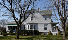 Sauser-Lane Houselisted 1983
Topographic sheets covering this place
8 surveys from 12 printed sheetsMatched by testing this settlement's coordinate against the published boundary of every sheet in the United States Geological Survey's historical collection. Each opens the scanned sheet at the Survey.
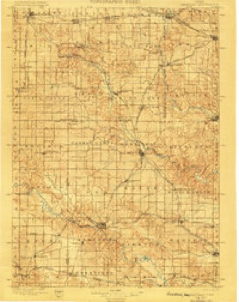
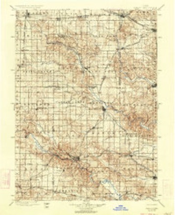
- 1900 USGS Anamosa quadrangle1:125000, 2 printings
- 1900 USGS Farley quadrangle1:125000, 2 printings
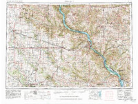
- 1959 USGS Dubuque quadrangle1:250000
- 1961 USGS Dubuque quadrangle1:250000
- 1962 USGS Dubuque quadrangle1:250000, 2 printings
- 1966 USGS Cascade quadrangle1:24000
- 1976 USGS Dubuque quadrangle1:250000
- 1984 USGS Anamosa quadrangle1:100000, 2 printings
Mines and quarries near this place
8 within 5 milesRegional context, not property-specific evidence. The federal mineral resources record lists 8 workings within 5 miles of Cascade: 6 past producers, 2 producers. 2 still produce. What was taken out: Stone, Crushed/Broken, Sand and Gravel, Construction. Distance is straight-line from the map coordinates, so a quarry counted here may appear on a neighbouring settlement's page as well.
| Where | Site | Commodity | Status | Recorded |
|---|---|---|---|---|
| Sauser Sand Pit | Sand and Gravel, Construction | Producer | ||
| Unknown | Sand and Gravel, Construction | Past Producer | ||
| Kurt Quarry | Stone, Crushed/Broken | Past Producer | ||
| Reiter Quarry | Stone, Crushed/Broken | Producer | ||
| Unknown | Stone, Crushed/Broken | Past Producer | ||
| Unknown | Stone, Crushed/Broken | Past Producer | ||
| Unknown | Stone, Crushed/Broken | Past Producer | ||
| Unknown | Stone, Crushed/Broken | Past Producer |
Storms near this place
36 since 1995Regional context, not property-specific evidence. The National Weather Service names Cascade in 36 storm reports between 1995 and 2026: 18 hail, 11 thunderstorm wind, 3 funnel cloud, 2 flash flood. No death or injury is recorded in these reports. Each account below is quoted exactly as the forecast office filed it, from the NOAA Storm Events Database, and each date opens the federal record of that event.
| When | Event | Place named | Harm | What the report says |
|---|---|---|---|---|
| July 1995 | Hail | Cascade | $10,000 | no account filed |
| July 2006 | Thunderstorm Wind | Cascade | $1,000 | very large tree down |
| April 2026 | Hail | Cascade | - | Report received from Mping. |
| April 2026 | Hail | Cascade | - | Report received from Mping. |
| April 2026 | Thunderstorm Wind | Cascade | - | The time was estimated using radar data. |
| July 2025 | Tornado (EF0) | Cascade | - | An EF-1 tornado with a maximum estimated wind speed of 95 MPH identified by satellite data and confirmed by aerial survey. This tornado damaged mainly crops along its 3.4 mile long path. Towards the end of its path it destroyed a hoop building, removed a roof of a farm outbuilding and destroyed a garage at a residence. A woman was trapped in the garage as it collapsed around her. |
| August 2023 | Funnel Cloud | Cascade | - | A trained spotter observed a funnel cloud extending halfway down from the cloud base. |
| August 2023 | Funnel Cloud | Cascade | - | Emergency Manager reported a funnel cloud near Cascade. |
| August 2023 | Tornado (EFU) | Cascade | - | Video and photo evidence indicated a brief tornado in open farm ground. The tornado was rated EF-U as there was no observable damage other than a convergent path in the corn. The tornado was the on ground for a little over a mile. |
| August 2020 | Hail | Cascade | - | This fell from storms just north of the track of the derecho path. |
| March 2017 | Thunderstorm Wind | Cascade | - | A measured wind gust of 56 kts was received from the local emergency manager. |
| May 2016 | Thunderstorm Wind | Cascade | - | The fire department reported an estimated wind gust of 60 MPH and was relayed by the Dubuque County EOC. |
| July 2016 | Thunderstorm Wind | Cascade | - | A trained spotter reported multiple trees and power lines were down within town. The time was estimated based upon radar. |
| July 2016 | Thunderstorm Wind | Cascade | - | A trained spotter reported wind gusts up to 70 MPH in Cascade. |
| May 2014 | Hail | Cascade | - | Golf ball sized hail fell in Cascade, IA at 544 pm CDT May 20. |
| May 2014 | Hail | Cascade | - | Ping pong ball sized hail fell about 1 mile north of Cascade, IA near Macomber Road at 528 pm CDT May 20. |
| April 2010 | Thunderstorm Wind | Cascade | - | A 58 mph wind gust was measured at the Cascade, IA Fire Department at 1040 pm April 5. |
| June 2010 | Thunderstorm Wind | Cascade | - | A large tree in Calvary Cemetery was blown down. |
| July 2009 | Hail | Cascade | - | Pea to quarter-sized hail covered the ground in Cascade, IA around 315 pm July 24. |
| January 2008 | Hail | Cascade | - | Law enforcement reported penny size hail covering the ground in Cascade. |
| August 2008 | Hail | Cascade | - | Nickel-sized hail fell in Cascade, IA at 648 am August 3. |
| August 2008 | Hail | Cascade | - | Nickel-sized hail fell in Cascade, IA around 550 pm August 4. |
| April 2007 | Hail | Cascade | - | Time estimated. |
| June 2002 | Flash Flood | Cascade | - | Highway 151 closed between Cascade and Monticello. Water reported to be up to the fuel tanks on semi trucks. |
| August 2002 | Flash Flood | Cascade | - | Numerous streets inundated with high water and debris. |
| March 2026 | Hail | Cascade | - | no account filed |
| March 2026 | Hail | Cascade | - | no account filed |
| March 2026 | Hail | Cascade | - | no account filed |
| April 2026 | Thunderstorm Wind | Cascade | - | no account filed |
| June 2010 | Hail | Cascade | - | no account filed |
| July 2009 | Hail | Cascade | - | no account filed |
| April 2007 | Hail | Cascade | - | no account filed |
| May 2004 | Funnel Cloud | Cascade | - | no account filed |
| May 1998 | Hail | Cascade | - | no account filed |
| August 1998 | Thunderstorm Wind | Cascade | - | no account filed |
| August 1996 | Thunderstorm Wind | Cascade | - | no account filed |
Nearest settlements
The eight closest, with where each one stands in the county. Distances are straight-line, computed from the Geographic Names Information System coordinates.
| Map | Place | Distance | Sheets |
|---|---|---|---|
| Fillmore | 5.4 miles | 15 | |
| Pleasant Grove | 7.8 miles | 14 | |
| Worthington | 8.7 miles | 12 | |
| Bernard | 9.7 miles | 15 | |
| Farley | 10.0 miles | 12 | |
| Epworth | 11.0 miles | 14 | |
| Kidder | 12.3 miles | 14 | |
| Washington Mills | 12.3 miles | 15 |
Provenance
This settlement is recorded in the Geographic Names Information System as feature 455196. The sheet list is computed by point-in-boundary test against the United States Geological Survey's historical topographic inventory. Both are works of the United States government and carry no copyright under 17 U.S.C. 105.
Mines and quarries. USGS Mineral Resources Data System (MRDS) https://mrdata.usgs.gov/mrds/ A work of the United States government, no copyright under 17 U.S.C. 105.
Storms. NOAA National Centers for Environmental Information, Storm Events Database https://www.ncei.noaa.gov/stormevents/ A work of the United States government, no copyright under 17 U.S.C. 105. Narratives are quoted verbatim from the National Weather Service report and are not edited or summarised.