 Block
Dyersville, Iowa
12 topographic sheets cover this place, the earliest surveyed in 1900 and the latest in 1984. It stands in New Wine Township. It lies in ZIP code area 52040. It stands on Hewitt Creek. The Survey maps it on the Dyersville East quadrangle.
On record in Dyersville
Buildings and businesses the archive holds for this place. Each opens its own page, with the source record it came from.
On the National Register 3 records
 Allen Houselisted 1975
 Basilica of St. Francis Xavier, Church and Rectorylisted 1999
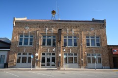 Memorial Buildinglisted 2013
Topographic sheets covering this place
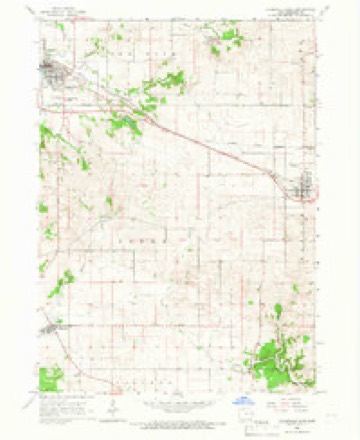
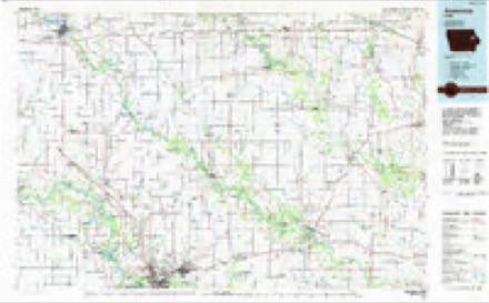
8 surveys from 12 printed sheetsMatched by testing this settlement's coordinate against the published boundary of every sheet in the United States Geological Survey's historical collection. Each opens the scanned sheet at the Survey.
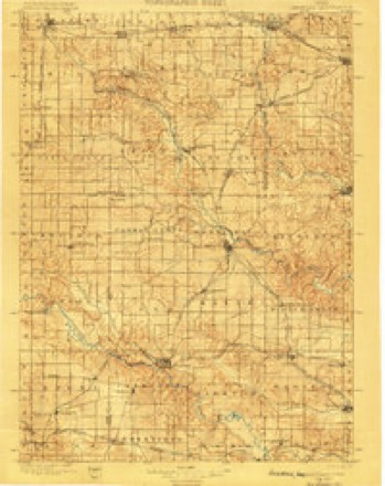
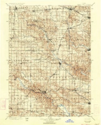
- 1900 USGS Anamosa quadrangle1:125000, 2 printings
- 1900 USGS Farley quadrangle1:125000, 2 printings
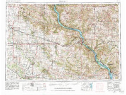
- 1959 USGS Dubuque quadrangle1:250000
- 1961 USGS Dubuque quadrangle1:250000
- 1962 USGS Dubuque quadrangle1:250000, 2 printings
- 1965 USGS Dyersville East quadrangle1:24000
- 1976 USGS Dubuque quadrangle1:250000
- 1984 USGS Anamosa quadrangle1:100000, 2 printings
Fires near this place
3 since 2006Regional context, not property-specific evidence. The federal wildfire occurrence database lists 3 fires within 5 miles of Dyersville between 2006 and 2014, burning about 4 acres in total. None started naturally. None was recorded as arson. Distance is straight-line from the map coordinates, so a fire counted here may appear on a neighbouring settlement's page as well.
| Reported cause | Fires |
|---|---|
| Missing data/not specified/undetermined | 2 |
| Debris and open burning | 1 |
The most recent of them, most recent first, with the day each was reported and the service that recorded it.
| Date | Cause | Size | Reported by | Name on the report |
|---|---|---|---|---|
| 19 April 2014 | Debris and open burning | under an acre | Iowa Department of Natural Resources | not named |
| 11 April 2009 | Missing data/not specified/undetermined | 1.0 acres | Iowa Department of Natural Resources | not named |
| 19 December 2006 | Missing data/not specified/undetermined | 2.0 acres | Iowa Department of Natural Resources | not named |
Settlements close enough to share some of these fires:
Mines and quarries near this place
10 of 18 shownRegional context, not property-specific evidence. The federal mineral resources record lists 18 workings within 5 miles of Dyersville: 13 past producers, 5 producers. 5 still produce. What was taken out: Stone, Crushed/Broken, Sand and Gravel, Construction, Lead. Distance is straight-line from the map coordinates, so a quarry counted here may appear on a neighbouring settlement's page as well.
| Where | Site | Commodity | Status | Recorded |
|---|---|---|---|---|
| Dyersville Diggings | Lead | Past Producer | Galena | |
| Ready Mix Sand Pit | Sand and Gravel, Construction | Producer | ||
| Tegeler Lake Sand Pit | Sand and Gravel, Construction | Producer | ||
| Unknown | Sand and Gravel, Construction | Past Producer | ||
| Unknown | Sand and Gravel, Construction | Past Producer | ||
| Unknown | Sand and Gravel, Construction | Past Producer | ||
| Unknown | Sand and Gravel, Construction | Past Producer | ||
| Unknown | Sand and Gravel, Construction | Past Producer | ||
| Deutmeyer Quarry | Stone, Crushed/Broken | Producer | ||
| Dyersville No. 1 Quarry | Stone, Crushed/Broken | Producer |
Storms near this place
33 since 1995Regional context, not property-specific evidence. The National Weather Service names Dyersville in 33 storm reports between 1995 and 2024: 15 thunderstorm wind, 10 hail, 7 flash flood, 1 funnel cloud. No death or injury is recorded in these reports. Each account below is quoted exactly as the forecast office filed it, from the NOAA Storm Events Database, and each date opens the federal record of that event.
| When | Event | Place named | Harm | What the report says |
|---|---|---|---|---|
| May 1999 | Flash Flood | Dyersville | $5,000,000 | Flash flooding along the The North Fork of the Maquoketa River caused extensive damage in Dyersville. Numerous businesses across town sustained major damage. The costliest damage occurred at Scale Models, which sustained an estimated $150,000 in damage. Other businesses reported flooding to depths of 7 feet in their basements. About 100 people were evacuated from 60 homes. State officials set the preliminary damage estimates from Dyersville at $3 to $5 million. |
| June 2009 | Thunderstorm Wind | Dyersville | $25,000 | Wind gusts estimated to be 70 to 80 mph damaged numerous outbuildings south of Dyersville, IA around 830 am June 19. |
| June 2008 | Flash Flood | Dyersville | $25,000 | Heavy rains caused rapid rises in river levels along the North Fork Maquoketa River resulting in some flash flooding in Dyersville, IA around 2:00 pm June 8. Some Dyersville residences along the river were evacuated. |
| July 2008 | Thunderstorm Wind | Dyersville | $5,000 | Wind gusts estimated to be 65 mph uprooted a tree and blew down power lines just east of Dyersville, IA at 435 pm July 2. |
| May 2004 | Thunderstorm Wind | Dyersville | $5,000 | Trees and power lines down with rural structural damage. |
| July 1995 | Thunderstorm Wind | Dyersville | $5,000 | no account filed |
| September 2016 | Flash Flood | Dyersville | $2,000 | The county emergency manager reported flash flooding was flowing into some homes basements. The fire department is responding to the incident. |
| July 2011 | Thunderstorm Wind | Dyersville | $1,000 | Wind gusts estimated to be 70 mph caused some tree damage in Dyersville, IA around 540 am CDT July 11. A fishing boat and fence were also damaged and utility lines were downed. |
| June 2024 | Thunderstorm Wind | Dyersville | - | Power pole leaning due to thunderstorm winds. |
| June 2023 | Thunderstorm Wind | Dyersville | - | A large tree limb was blown down. |
| August 2021 | Thunderstorm Wind | Dyersville | - | Very strong winds reported. |
| August 2021 | Thunderstorm Wind | Dyersville | - | Measured at the fire station. |
| May 2017 | Thunderstorm Wind | Dyersville | - | The county emergency manager reported a measured wind gust of 63 knots. |
| July 2012 | Thunderstorm Wind | Dyersville | - | A trained spotter reported tree limbs down near Dyersville. |
| April 2011 | Hail | Dyersville | - | Quarter sized hail fell 1 mile southeast of Dyersville, IA at 728 pm CDT April 3. |
| August 2009 | Thunderstorm Wind | Dyersville | - | Wind gusts estimated to be 65 mph were observed in Dyersville, IA around 1250 pm August 9. |
| April 2008 | Flash Flood | Dyersville | - | Law enforcement reported that some roads were closed due to high water in Dyersville. |
| May 2008 | Flash Flood | Dyersville | - | Heavy rains of 3 to 8 inches caused flash flooding of western parts of Dyersville, IA during the late evening of May 25th and early morning of May 26th. The North Fork Maquoketa River and Bear Creek were particularly affected with flooding. Some streets in town had to be closed due to the flood waters as well as Floyd Road and 180th Street in rural areas. |
| May 2008 | Hail | Dyersville | - | Quarter-sized hail fell in Dyersville, IA shortly after 10:01 pm on May 25th according to the Dyersville emergency management director. |
| May 2008 | Hail | Dyersville | - | Quarter-sized hail fell just north of Dyersville, IA around 7:48 pm. |
| April 2007 | Hail | Dyersville | - | Time estimated. |
| August 2004 | Funnel Cloud | Dyersville | - | Location is actually in Eastern Delaware County 4.2 miles northwest of Worthington. Spotters from the Dyersville Fire Department and in Worthington briefly glimpsed the Hopkinton Tornado as it roped out and dissipated on the horizon. |
| June 2002 | Flash Flood | Dyersville | - | Parts of the city evacuated due to high water. Trained spotter measured 5 inches of rain in 12 hours. |
| June 2002 | Thunderstorm Wind | Dyersville | - | Several large trees and numerous branches knocked down. |
| August 2002 | Flash Flood | Dyersville | - | Significant street flooding. |
| June 2001 | Hail | Dyersville | - | Quarter sized hail reported by law enforcement. |
| August 2021 | Hail | Dyersville | - | no account filed |
| May 2017 | Hail | Dyersville | - | no account filed |
| June 2015 | Thunderstorm Wind | Dyersville | - | no account filed |
| August 2009 | Hail | Dyersville | - | no account filed |
| April 2007 | Hail | Dyersville | - | no account filed |
| May 1998 | Thunderstorm Wind | Dyersville | - | no account filed |
| May 1997 | Hail | Dyersville | - | no account filed |
Nearest settlements
The eight closest, with where each one stands in the county. Distances are straight-line, computed from the Geographic Names Information System coordinates.
| Map | Place | Distance | Sheets |
|---|---|---|---|
| Summit Village Dyersville Park | 0.4 miles | 12 | |
| Mekee | 4.1 miles | 12 | |
| New Vienna | 4.4 miles | 12 | |
| Worthington | 6.1 miles | 12 | |
| Farley | 6.8 miles | 12 | |
| Luxemburg | 8.6 miles | 12 | |
| Bankston | 8.9 miles | 15 | |
| Kidder | 10.4 miles | 14 |
Provenance
This settlement is recorded in the Geographic Names Information System as feature 456086. The sheet list is computed by point-in-boundary test against the United States Geological Survey's historical topographic inventory. Both are works of the United States government and carry no copyright under 17 U.S.C. 105.
Wildfire. Short, Karen C. 2022. Spatial wildfire occurrence data for the United States, 1992-2020 [FPA_FOD_20221014]. 6th Edition. Fort Collins, CO: Forest Service Research Data Archive. https://doi.org/10.2737/RDS-2013-0009.6 Collected with United States Government funding and usable without additional permissions or fees.
Mines and quarries. USGS Mineral Resources Data System (MRDS) https://mrdata.usgs.gov/mrds/ A work of the United States government, no copyright under 17 U.S.C. 105.
Storms. NOAA National Centers for Environmental Information, Storm Events Database https://www.ncei.noaa.gov/stormevents/ A work of the United States government, no copyright under 17 U.S.C. 105. Narratives are quoted verbatim from the National Weather Service report and are not edited or summarised.