 Block
Keokuk, Iowa
17 topographic sheets cover this place, the earliest surveyed in 1936 and the latest in 1990. It stands in Keokuk City. It lies in ZIP code area 52632. It stands on Soap Creek. The Survey maps it on the Keokuk quadrangle. 9,900 people lived here at the 2020 count. It stands 571 feet above sea level.
Research this city
On record in Keokuk
Buildings and businesses the archive holds for this place. Each opens its own page, with the source record it came from.
On the National Register 12 of 20 shown
 GEO. M. VERITYNational Historic Landmark · listed 1989
 Gen. William Worth Belknap Houselisted 1975
 Gen. Samuel R. Curtis Houselisted 1998
 E. H. Harrison Houselisted 1984
 Hotel Iowalisted 1987
 Irwin, John N. and Mary L. (Rankin), Houselisted 1999
 C. R. Joy Houselisted 1997
 Keokuk Lock and Damlisted 1978
 Keokuk National Cemeterylisted 1997
 Keokuk Union Depotlisted 2013
 Keokuk Young Women's Christian Association Buildinglisted 2004
 Lock and Dam No. 19 Historic Districtlisted 2004
Population over time
2 figuresKeokuk fell from 10,780 to 9,900 between 2010 and 2020. These are the recorded population figures Wikidata holds for this place, reached through the Geographic Names Information System number this page is keyed on rather than by name, so they belong to this place and not to another of the same name. Most are census counts, but not all are: an early figure may be a founding or settlement estimate, and an estimate published within five years of a census is left out. The change column is computed, and is left blank where more than 20 years separate a figure from the one before it, because a gap that long is not a change between two counts.
| Year | People | Change |
|---|---|---|
| 2010 | 10,780 | |
| 2020 | 9,900 | -880 (-8%) |
Topographic sheets covering this place
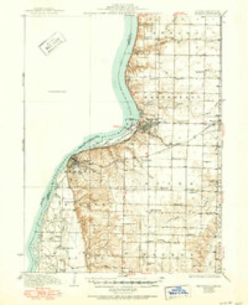
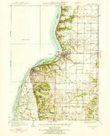
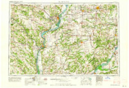
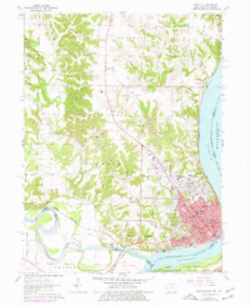
8 surveys from 17 printed sheetsMatched by testing this settlement's coordinate against the published boundary of every sheet in the United States Geological Survey's historical collection. Each opens the scanned sheet at the Survey.
- 1936 USGS Keokuk quadrangle1:62500, 3 printings
- 1950 USGS Keokuk quadrangle1:62500
- 1958 USGS Burlington quadrangle1:250000, 4 printings
- 1961 USGS Burlington quadrangle1:250000
- 1963 USGS Burlington quadrangle1:250000
- 1964 USGS Keokuk quadrangle1:24000, 3 printings
- 1986 USGS Keokuk quadrangle1:100000, 2 printings
- 1990 USGS Burlington quadrangle1:250000, 2 printings
Fires near this place
1 since 1997Regional context, not property-specific evidence. The federal wildfire occurrence database lists 1 fire within 5 miles of Keokuk in 1997, burning about 1 acre in total. None started naturally. None was recorded as arson. Distance is straight-line from the map coordinates, so a fire counted here may appear on a neighbouring settlement's page as well.
| Reported cause | Fires |
|---|---|
| Debris and open burning | 1 |
The most recent of them, most recent first, with the day each was reported and the service that recorded it.
| Date | Cause | Size | Reported by | Name on the report |
|---|---|---|---|---|
| 2 June 1997 | Debris and open burning | 1.0 acres | Missouri Department of Conservation | not named |
Settlements close enough to share some of these fires:
Mines and quarries near this place
3 within 5 milesRegional context, not property-specific evidence. The federal mineral resources record lists 3 workings within 5 miles of Keokuk: 2 past producers, 1 producer. 1 still produces. What was taken out: Stone, Crushed/Broken, Sand and Gravel, Construction. Distance is straight-line from the map coordinates, so a quarry counted here may appear on a neighbouring settlement's page as well.
| Where | Site | Commodity | Status | Recorded |
|---|---|---|---|---|
| Unknown | Sand and Gravel, Construction | Past Producer | ||
| Gray Quarry | Stone, Crushed/Broken | Producer | ||
| Mc Manus and Tucker Quarry | Stone, Crushed/Broken | Past Producer |
Storms near this place
60 of 91 shownRegional context, not property-specific evidence. The National Weather Service names Keokuk in 91 storm reports between 1995 and 2026: 45 thunderstorm wind, 31 hail, 7 flood, 6 flash flood. No death or injury is recorded in these reports. Each account below is quoted exactly as the forecast office filed it, from the NOAA Storm Events Database, and each date opens the federal record of that event.
| When | Event | Place named | Harm | What the report says |
|---|---|---|---|---|
| July 2003 | Thunderstorm Wind | Keokuk | $500,000 | Also heavy rain |
| June 2011 | Thunderstorm Wind | Keokuk | $250,000 | Wind gusts estimated to be 75 mph caused two weakened buildings to collapse in Keokuk, IA around 115 am CDT June 27. The Pallet Building on Johnson Street and the Redemption Center Building on S 4th Street and Johnson Street collapsed. In addition, several trees were uprooted or snapped near the base and several other large tree limbs were also blown down. A spotter also contributed to this report. |
| July 2003 | Thunderstorm Wind | Keokuk | $250,000 | Numerous large trees down |
| July 2003 | Thunderstorm Wind | Keokuk | $60,000 | Lock & Dam 19 |
| August 2003 | Thunderstorm Wind | Keokuk | $50,000 | Several large trees down |
| August 2010 | Flash Flood | Keokuk | $25,000 | Heavy rains resulted in flash flooding of the intersection of 10th Street and Main Street in Keokuk, IA during the late afternoon and evening of August 13. The intersection was closed due to the flooding. |
| June 2005 | Thunderstorm Wind | Keokuk | $20,000 | Tree limbs and power lines down. |
| May 2004 | Thunderstorm Wind | Keokuk | $15,000 | Numerous trees and power lines down with some street flooding. |
| July 2003 | Hail | Keokuk | $15,000 | no account filed |
| December 2017 | Thunderstorm Wind | Keokuk | $10,000 | Broadcast media relayed a report that a patio roof was removed by the winds, taking with it part of the roof of the house. The time of the event was based on radar analysis and eyewitness reports. |
| August 2010 | Thunderstorm Wind | Keokuk | $10,000 | Wind gusts estimated to be 70 mph blew down some trees in Keokuk, IA around 535 pm CDT August 20. One of the trees fell onto some power lines. Power was knocked out to hundreds of customers. In addition, a tent sheltering food vendors at the Rolling on the River blues festival on the Keokuk riverfront was destroyed. |
| September 2005 | Thunderstorm Wind | Keokuk | $10,000 | Numerous 2 to 4 inch diameter branches down throughout the city. A ham radio operator lost his antenna. |
| April 2000 | Thunderstorm Wind | Keokuk | $10,000 | Thunderstorm winds produced a swath of damage 3 blocks wide and 6 blocks long. Trees were downed and the roof was blown off a building in the downtown area. |
| October 1997 | Thunderstorm Wind | Keokuk | $8,000 | A home suffered structurial damage to roof and several rooms when a 150 ft. tree was twisted and uprooted by strong winds. |
| June 2010 | Thunderstorm Wind | Keokuk | $5,000 | Wind gusts estimated to be 65 mph uprooted some trees in Keokuk, IA around 235 am June 26. A Jon Boat sunk during the storm. |
| July 2003 | Heavy Rain | Keokuk | $5,000 | Gravel driveway partially washed away |
| July 1999 | Thunderstorm Wind | Keokuk | $5,000 | Thunderstorms winds downed trees and power lines in Keokuk. |
| November 2013 | Thunderstorm Wind | Keokuk | $3,000 | Power lines were blown down. |
| April 2006 | Hail | Keokuk | $2,000 | no account filed |
| August 2006 | Thunderstorm Wind | Keokuk | $1,500 | A spotter reported several 12 inch diameter limbs down in city. The KEOK AWOS reported 46 knot (53 mph) winds during the 0016-0026 CST time period. |
| April 1995 | Hail | Keokuk | $1,000 | A warm front extended from low pressure over eastern Nebraska, across southern Iowa. During the day, moisture streamed north from the Gulf of Mexico and interacted with the front during the late afternoon and evening hours. At the same time, a weak upper level system passed across the state. Temperatures just south of the front warmed into the lower 70s with dew point temperatures approaching 60 degrees. Due to the cold ambient temperatures aloft, convective available potential energy values (CAPE) were just over 3300 J-kg-1 over southwest Iowa. Strong shear, both directional and speed, was evident in the profile. Helicity values were just over 350 m2-s2 as well. Thunderstorms developed during the middle and later afternoon hours. The main severe weather feature was hail. There were no reports of high winds with the storms. Hail was up to golf ball-size just to the west of Iowa before they moved into the state. One-inch-diameter hail was reported in Cass County as the storms moved over. There were many reports of pea- to marble-size hail across the southwest quarter of the state. Marble-size hail covered the ground near Lenox, in Taylor County. The storms weakened just before sunset. WSR-88D VIL (vertically integrated liquid) values were quite low with this event. The highest were in the 55 kg-m-2 range, though values in the 45 kg-m-2 range did produce dime-size hail. During the early evening hours, the storms strengthened again over southeast Iowa as the low level jet strengthened. The jet interacted with an old outflow boundary left from the convection over north-central and central Iowa several hours prior. Three-quarter-inch-diameter hail clipped the southeast corner of the state near Keokuk, in Lee County. |
| April 2026 | Flash Flood | Keokuk | - | Deep water over 1 foot in lower lying downtown roads. Nearby creeks were over their banks. Some vehicles stranded. Water receded by 11 AM. |
| July 2025 | Flash Flood | Keokuk | - | Water over River Road by the Keokuk Yacht Club. |
| June 2023 | Thunderstorm Wind | Keokuk | - | Trees blown down on Rainbow Drive. |
| June 2023 | Thunderstorm Wind | Keokuk | - | Emergency Management reported widespread tree damage, with many down or snapped on houses, many buildings had damage or destroyed. Highway signs blown off, leaving posts behind. Widespread power outages. |
| June 2023 | Thunderstorm Wind | Keokuk | - | NWS storm survey found damage consistent with 100 mph straight-line winds. Damage was to dozens of large trees, downed utility poles, and a nearly destroyed outbuilding. A roof was off a home, and a couple mobile homes were severely damaged on the north side of Keokuk. |
| August 2023 | Flash Flood | Keokuk | - | Law Enforcement reported several stalled vehicles and water rescues by first responders in town in the past 2 to 3 hours. There was 4 to 5 feet of water reported on many roads and streets. |
| May 2022 | Hail | Keokuk | - | Report gathered from Mping. |
| July 2021 | Thunderstorm Wind | Keokuk | - | A trained spotter reports a tree down near 16th street. There are also several 6 to 10 inch tree limbs down. |
| December 2021 | Thunderstorm Wind | Keokuk | - | A trained spotter reported severe winds. |
| March 2019 | Flood | Keokuk | - | Heavy rain and snow melt across the region caused the Mississippi River at Keokuk to rise above major flood stage of 19.0 feet on March 19th, and remain above major flood stage through the end of the month. An initial crest of 20.79 feet occurred early in the evening of the 30th. |
| May 2019 | Flood | Keokuk | - | The Mississippi River at Keokuk Lock and Dam 19 began the month above its major flood stage of 19 feet. The river stage at the beginning of the month was 21.4 feet. The river would rise to a crest of 23.5 feet on May 2nd and another higher crest later in the month, in a later storm data entry. The river fell below major flood stage the morning of May 11th. |
| June 2019 | Thunderstorm Wind | Keokuk | - | Several trees were reported blown down around the city of Keokuk. |
| June 2019 | Flood | Keokuk | - | The Mississippi River at Keokuk began June above its major flood stage of 19 feet. The river fell below major flood stage around 5 AM on June 13th. The river has crested on May 30th and fell through the month of June. The highest level the river reached in June was 25.3 feet early on June 1st. |
| June 2019 | Hail | Keokuk | - | A trained spotter reported pea to quarter sized hail. |
| June 2019 | Thunderstorm Wind | Keokuk | - | A trained spotter reported a tree down in Keokuk along with powr bring out. |
| June 2019 | Thunderstorm Wind | Keokuk | - | A trained spotter reported hearing things snapping into the wind. There is twig and leaf litter in the air. |
| July 2019 | Flash Flood | Keokuk | - | A trained spotter reported that two inches of rain fell with passing storms. This caused isolated flash flooding in Keokuk. An intersection that normally floods during storms had water that came up much deeper than normal and was approximately 4 feet deep. The water appeared to come up 2 feet on the doors of some businesses. The water had receded by the time of the report. |
| May 2019 | Flood | Keokuk | - | The Mississippi River at Keokuk Lock and Dam 19 rose above its major flood stage of 19 feet during morning of May 22nd and continue into June. The river crested at 25.60 feet at 3 PM CST on May 30th. This was the 3rd highest crest on record. |
| September 2019 | Thunderstorm Wind | Keokuk | - | A tree was blown down. |
| April 2019 | Flood | Keokuk | - | The Mississippi River at Keokuk Lock and Dam 19 rose above its major flood stage on April 5th and fell back below major flood stage on the 16th. The river remained near a crest of 19.7 feet the 10th through the 13th. |
| June 2018 | Thunderstorm Wind | Keokuk | - | Three inch diameter tree limbs broken. |
| June 2018 | Thunderstorm Wind | Keokuk | - | Three inch diameter tree limbs were broken. |
| June 2018 | Thunderstorm Wind | Keokuk | - | A four inch diameter tree branch was broken. |
| June 2018 | Thunderstorm Wind | Keokuk | - | A tree was blown down in northern Keokuk. The time was estimated by radar. |
| June 2018 | Thunderstorm Wind | Keokuk | - | Two inch diameter tree branches broken and a basketball hoop at Hawthorn Elementary was bent. |
| August 2018 | Thunderstorm Wind | Keokuk | - | A trained spotter reported multiple trees down in Keokuk. One of them was on down on a road and was around 7 inches in diameter. The time of the event was estimated using radar. |
| June 2017 | Thunderstorm Wind | Keokuk | - | A large tree branch was reported down. The time was estimated from radar. |
| March 2016 | Hail | Keokuk | - | Hail was mostly dime and nickel sized with a few quarter sized stones. |
| March 2016 | Hail | Keokuk | - | Time was estimated by radar. |
| October 2016 | Hail | Keokuk | - | A trained spotter reported a large amount of penny to near quarter size hail. Hail was less than 1 inch in diameter according to the spotter. |
| May 2013 | Hail | Keokuk | - | Spotter reported baseball size hail knocked out sky lights at the Walmart store in northeast Keokuk. Golfball to baseball size hail was reported on the north end of the city, with nickel to quarter size hail on the south end of the city. |
| May 2013 | Thunderstorm Wind | Keokuk | - | The emergency manager reported tree limbs down eastern Lee county. |
| June 2013 | Flood | Keokuk | - | Heavy rain across the region late in the month of May led to the Mississippi River being above the major flood stage of 18 feet to begin the month. The river fell below major flood stage by mid morning on the 1st and then rose back above it shortly after midnight on the 4th. The river remained above major flood stage until late in the day on the 9th. |
| April 2012 | Hail | Keokuk | - | A trained spotter measured dime size hail near Keokuk. |
| April 2012 | Hail | Keokuk | - | The public reported dime size hail near Keokuk. |
| June 2011 | Thunderstorm Wind | Keokuk | - | Wind gusts estimated to be 70 mph blew down several trees in Keokuk, IA at 132 am CDT June 27. |
| June 2010 | Thunderstorm Wind | Keokuk | - | Wind gusts estimated to be 65 mph blew down some large tree limbs across parts of Keokuk, IA around 1140 pm June 1. One blocked the street near the intersection of 2nd St. and Carroll St. and another blocked a portion of the Highway 61 Bypass. |
| June 2009 | Thunderstorm Wind | Keokuk | - | Wind gusts estimated to be 65 mph blew some 5 inch diameter tree limbs down about 1 mile southeast of Keokuk, IA around 725 pm June 23. |
| June 2009 | Thunderstorm Wind | Keokuk | - | Wind gusts were estimated to be 65 mph about 1 mile southeast of Keokuk, IA around 725 pm June 23. |
Nearest settlements
The eight closest, with where each one stands in the county. Distances are straight-line, computed from the Geographic Names Information System coordinates.
| Map | Place | Distance | Sheets |
|---|---|---|---|
| Buena Vista (historical) | 2.7 miles | 17 | |
| Sandusky | 4.6 miles | 17 | |
| Mooar | 4.8 miles | 17 | |
| Summitville | 6.2 miles | 17 | |
| Sugar Creek (historical) | 6.4 miles | 17 | |
| Galland | 7.2 miles | 15 | |
| Bluff Park | 9.0 miles | 15 | |
| Mount Clare | 9.4 miles | 15 |
Elsewhere
Matched on this settlement's Geographic Names Information System number rather than its name, so it cannot be a different place of the same name in another state.
| Wikipedia article on Keokuk | An encyclopaedic summary. Its text is share-alike, so it is linked here rather than copied. |
| Wikidata item Q732549 | The structured record the population and elevation above come from. Public domain (CC0). |
Provenance
This settlement is recorded in the Geographic Names Information System as feature 458054. The sheet list is computed by point-in-boundary test against the United States Geological Survey's historical topographic inventory. Both are works of the United States government and carry no copyright under 17 U.S.C. 105.
Wildfire. Short, Karen C. 2022. Spatial wildfire occurrence data for the United States, 1992-2020 [FPA_FOD_20221014]. 6th Edition. Fort Collins, CO: Forest Service Research Data Archive. https://doi.org/10.2737/RDS-2013-0009.6 Collected with United States Government funding and usable without additional permissions or fees.
Mines and quarries. USGS Mineral Resources Data System (MRDS) https://mrdata.usgs.gov/mrds/ A work of the United States government, no copyright under 17 U.S.C. 105.
Storms. NOAA National Centers for Environmental Information, Storm Events Database https://www.ncei.noaa.gov/stormevents/ A work of the United States government, no copyright under 17 U.S.C. 105. Narratives are quoted verbatim from the National Weather Service report and are not edited or summarised.