 Block
Mooar, Iowa
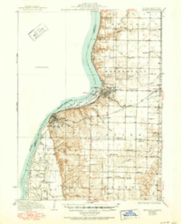
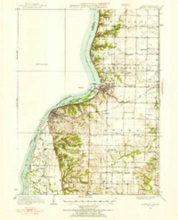
17 topographic sheets cover this place, the earliest surveyed in 1936 and the latest in 1990. It stands in Jackson Township. It lies in ZIP code area 52632. The Survey maps it on the Keokuk quadrangle.
Topographic sheets covering this place
8 surveys from 17 printed sheetsMatched by testing this settlement's coordinate against the published boundary of every sheet in the United States Geological Survey's historical collection. Each opens the scanned sheet at the Survey.
- 1936 USGS Keokuk quadrangle1:62500, 3 printings
- 1950 USGS Keokuk quadrangle1:62500
- 1958 USGS Burlington quadrangle1:250000, 4 printings
- 1961 USGS Burlington quadrangle1:250000
- 1963 USGS Burlington quadrangle1:250000
- 1964 USGS Keokuk quadrangle1:24000, 3 printings
- 1986 USGS Keokuk quadrangle1:100000, 2 printings
- 1990 USGS Burlington quadrangle1:250000, 2 printings
Mines and quarries near this place
4 within 5 milesRegional context, not property-specific evidence. The federal mineral resources record lists 4 workings within 5 miles of Mooar: 4 past producers. None of them still produces. What was taken out: Stone, Crushed/Broken, Sand and Gravel, Construction. Distance is straight-line from the map coordinates, so a quarry counted here may appear on a neighbouring settlement's page as well.
| Where | Site | Commodity | Status | Recorded |
|---|---|---|---|---|
| Mc Manus and Tucker Quarry | Stone, Crushed/Broken | Past Producer | ||
| Sandusky Quarry | Stone, Crushed/Broken | Past Producer | ||
| Unknown | Sand and Gravel, Construction | Past Producer | ||
| Unknown | Sand and Gravel, Construction | Past Producer |
Storms near this place
22 since 2010Regional context, not property-specific evidence. The National Weather Service names Mooar in 22 storm reports between 2010 and 2025: 13 thunderstorm wind, 5 hail, 2 flash flood, 2 tornado. No death or injury is recorded in these reports. Each account below is quoted exactly as the forecast office filed it, from the NOAA Storm Events Database, and each date opens the federal record of that event.
| When | Event | Place named | Harm | What the report says |
|---|---|---|---|---|
| June 2010 | Flash Flood | Mooar | $100,000 | Heavy rains resulted in significant flash flooding of several streets in Keokuk, IA during the early morning hours of June 22. The flooding severity peaked between 215 am and 315 am. |
| June 2010 | Flash Flood | Mooar | $100,000 | Heavy rains resulted in flash flooding of several parts of Keokuk, IA during the afternoon of June 12. The intersection of 11th and Main was blocked by flood waters. The intersection of 7th and Rondo was closed due to high water. In addition, some stores along Main Street had flood waters flowing into them. A portion of this report was provided by WGEM. |
| August 2025 | Tornado (EFU) | Mooar | - | Brief touchdown confirmed by video. No damage was reported or known. Time based on radar and video information. |
| July 2024 | Thunderstorm Wind | Mooar | - | A trained spotter estimated a 60 MPH wind gust with no damage noted. |
| July 2024 | Thunderstorm Wind | Mooar | - | A trained spotter reported tree limbs down. The time of the event was estimated using radar. |
| June 2024 | Thunderstorm Wind | Mooar | - | Estimated 60 to 70 mph winds, with nearby measured 70 mph wind gust. |
| June 2023 | Thunderstorm Wind | Mooar | - | Estimated 70 to 80 mph wind gusts. |
| June 2020 | Thunderstorm Wind | Mooar | - | A trained spotter reported several 3 inch tree limbs snapped. They estimated a wind speed of about 60 MPH. |
| June 2019 | Thunderstorm Wind | Mooar | - | A trained spotter reported 2 to 3 inch diameter limbs down. They estimated the wind speed to between 50 to 60 MPH. |
| June 2019 | Thunderstorm Wind | Mooar | - | A trained spotter reported that large trees were down.The time of the event was estimated using radar. |
| June 2019 | Thunderstorm Wind | Mooar | - | A trained spotter estimated thunderstorm wind gusts up to 70 MPH. |
| November 2019 | Thunderstorm Wind | Mooar | - | A trained spotter reported estimated thunderstorm winds between 55 to 65 MPH along Highway 61 near Keokuk. The time of the event was estimated by the spotter. |
| June 2018 | Thunderstorm Wind | Mooar | - | A small light pole was blown down with 2 inch diameter branches blown down nearby. |
| June 2018 | Thunderstorm Wind | Mooar | - | Six inch diameter tree branches were down. |
| July 2018 | Thunderstorm Wind | Mooar | - | There was a public report of several trees and large trees down at Keokuk High School. The time of the event was estimated by radar. |
| December 2017 | Tornado (EF1) | Mooar | - | An NWS Storm Survey team found that an EF-2 tornado touched down in an open field southwest of Wayland, Missouri damaging trees and breaking windows. The tornado then moved east northeast over rural areas damaging trees. As the tornado approached Highway 27, it strengthened, causing EF-2 damage to power poles. The tornado hit a DOT facility, destroying doors and a salt shelter. When the tornado crossed the highway, a semi was overturned, causing one injury. The tornado crossed the Des Moines River into Lee County Iowa where it caused EF-1 damage to trees before lifting about 1.1 miles north northeast of the river. The peak estimated winds along its entire path were 115 MPH. |
| May 2014 | Thunderstorm Wind | Mooar | - | Wind gusts estimated to be 60 mph blew down a few 3 to 4 inch diameter branches across streets in Keokuk, IA at 618 pm CDT May 12. |
| May 2013 | Hail | Mooar | - | Spotter reported nickel size hail. |
| July 2025 | Hail | Mooar | - | no account filed |
| September 2022 | Hail | Mooar | - | no account filed |
| June 2019 | Hail | Mooar | - | no account filed |
| March 2016 | Hail | Mooar | - | no account filed |
Nearest settlements
The eight closest, with where each one stands in the county. Distances are straight-line, computed from the Geographic Names Information System coordinates.
| Map | Place | Distance | Sheets |
|---|---|---|---|
| Summitville | 2.0 miles | 17 | |
| Sugar Creek (historical) | 3.7 miles | 17 | |
| Sandusky | 3.7 miles | 17 | |
| Buena Vista (historical) | 4.1 miles | 17 | |
| Keokuk | 4.8 miles | 17 | |
| Mount Clare | 5.5 miles | 15 | |
| Galland | 5.7 miles | 15 | |
| Bluff Park | 6.3 miles | 15 |
Provenance
This settlement is recorded in the Geographic Names Information System as feature 459201. The sheet list is computed by point-in-boundary test against the United States Geological Survey's historical topographic inventory. Both are works of the United States government and carry no copyright under 17 U.S.C. 105.
Mines and quarries. USGS Mineral Resources Data System (MRDS) https://mrdata.usgs.gov/mrds/ A work of the United States government, no copyright under 17 U.S.C. 105.
Storms. NOAA National Centers for Environmental Information, Storm Events Database https://www.ncei.noaa.gov/stormevents/ A work of the United States government, no copyright under 17 U.S.C. 105. Narratives are quoted verbatim from the National Weather Service report and are not edited or summarised.