 Block
Koszta, Iowa
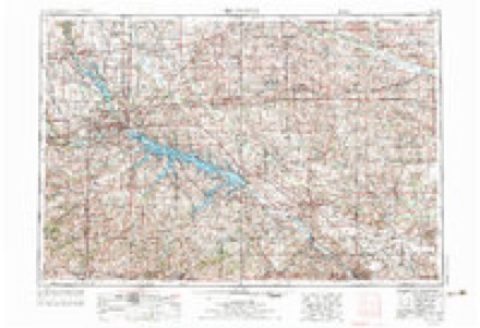
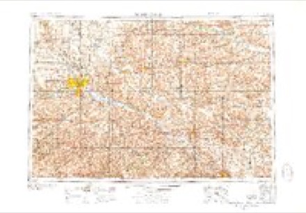
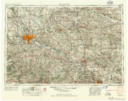
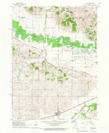
8 topographic sheets cover this place, the earliest surveyed in 1954 and the latest in 1984. It stands in Honey Creek Township. It lies in ZIP code area 52301. It stands on Buckeye Creek. The Survey maps it on the Ladora quadrangle.
Topographic sheets covering this place
6 surveys from 8 printed sheetsMatched by testing this settlement's coordinate against the published boundary of every sheet in the United States Geological Survey's historical collection. Each opens the scanned sheet at the Survey.
- 1954 USGS Des Moines quadrangle1:250000, 2 printings
- 1956 USGS Des Moines quadrangle1:250000
- 1957 USGS Des Moines quadrangle1:250000
- 1965 USGS Ladora quadrangle1:24000
- 1969 USGS Des Moines quadrangle1:250000
- 1984 USGS Grinnell quadrangle1:100000, 2 printings
Fires near this place
17 since 2005Regional context, not property-specific evidence. The federal wildfire occurrence database lists 17 fires within 5 miles of Koszta between 2005 and 2020, burning about 2,086 acres in total. None started naturally. 1 was recorded as arson. Distance is straight-line from the map coordinates, so a fire counted here may appear on a neighbouring settlement's page as well.
| Reported cause | Fires |
|---|---|
| Missing data/not specified/undetermined | 12 |
| Debris and open burning | 3 |
| Smoking | 1 |
| Arson/incendiarism | 1 |
The most recent of them, most recent first, with the day each was reported and the service that recorded it.
| Date | Cause | Size | Reported by | Name on the report |
|---|---|---|---|---|
| 6 May 2018 | Missing data/not specified/undetermined | 9.0 acres | Port Louisa National Wildlife Refuge | CAES WF |
| 3 April 2011 | Missing data/not specified/undetermined | 824 acres | Port Louisa National Wildlife Refuge | ACE AUTO |
| 24 April 2018 | Missing data/not specified/undetermined | under an acre | Port Louisa National Wildlife Refuge | CAES NW |
| 23 April 2018 | Debris and open burning | 316 acres | Port Louisa National Wildlife Refuge | SCHOTT WF |
| 21 April 2007 | Missing data/not specified/undetermined | 4.3 acres | Port Louisa National Wildlife Refuge | FOLEY 108 |
| 20 April 2005 | Missing data/not specified/undetermined | 86 acres | Port Louisa National Wildlife Refuge | ACE AUTO 2 |
| 19 April 2020 | Debris and open burning | 228 acres | Port Louisa National Wildlife Refuge | CAES NW |
| 1 April 2005 | Missing data/not specified/undetermined | 42 acres | Port Louisa National Wildlife Refuge | ACE AUTO |
Settlements close enough to share some of these fires:
Mines and quarries near this place
1 within 5 milesRegional context, not property-specific evidence. The federal mineral resources record lists 1 working within 5 miles of Koszta: 1 producer. All of them still produce. What was taken out: Sand and Gravel, Construction. Distance is straight-line from the map coordinates, so a quarry counted here may appear on a neighbouring settlement's page as well.
| Where | Site | Commodity | Status | Recorded |
|---|---|---|---|---|
| Marengo Sand Pit | Sand and Gravel, Construction | Producer |
Storms near this place
21 since 2008Regional context, not property-specific evidence. The National Weather Service names Koszta in 21 storm reports between 2008 and 2023: 15 flood, 3 flash flood, 1 tornado, 1 thunderstorm wind. No death or injury is recorded in these reports. Each account below is quoted exactly as the forecast office filed it, from the NOAA Storm Events Database, and each date opens the federal record of that event.
| When | Event | Place named | Harm | What the report says |
|---|---|---|---|---|
| June 2008 | Flood | Koszta | $747,000 | The record crest on the Iowa River at Marengo occurred on June 12, 2008 at 21.38 feet. Flood stage is 14 feet. |
| June 2010 | Flood | Koszta | $500,000 | Heavy rains during the third week of June resulted in the Iowa River at Marengo going above the moderate flood stage level of 15.5 feet on June 14th around 11 pm. It crested around 17.5 feet around 100 am June 24. It remained above the moderate flood stage level through the end of June. |
| May 2010 | Flood | Koszta | $500,000 | Heavy rains during the second week of May resulted in the Iowa River at Marengo going above the moderate flood stage level of 15.5 feet on May 13th around 800 am. It crested around 16.5 feet around 100 am May 19. It fell below the moderate flood stage level around 100 am May 22. |
| May 2009 | Flood | Koszta | $500,000 | Heavy rains during the last week of April resulted in the Iowa River at Marengo going above the moderate flood stage level of 15.5 feet on April 29th around 2 am. It crested around 17.64 feet around 9 pm April 30. It finally fell below the moderate flood stage level around 2 am May 7. |
| June 2009 | Flood | Koszta | $500,000 | Heavy rains during the middle of the month resulted in the Iowa River at Marengo going above the moderate flood stage level of 15.5 feet on June 19th around 8 pm. It crested around 16.1 feet around 4 am June 20 and again around 16.2 feet around 730 am June 24. It finally fell below the moderate flood stage level around 230 am June 26. |
| August 2009 | Flood | Koszta | $500,000 | no account filed |
| May 2011 | Tornado (EF2) | Koszta | $250,000 | A National Weather Service storm damage survey team determined that a track of EF2 damage extended from 3 miles northwest of Ladora, IA to 6 miles northwest of Marengo, IA. This path is roughly 4 miles long and 75 yards wide. This damage occurred approximately between 240 pm and 245 pm CDT May 22. ||Along the path, trees were damages, portions of a house roof were blown off, and a string of 12 power poles were snapped. Based on the damage, wind speeds were estimated at 120 mph. |
| August 2010 | Flood | Koszta | $250,000 | no account filed |
| July 2010 | Flood | Koszta | $250,000 | no account filed |
| August 2010 | Flash Flood | Koszta | $100,000 | Heavy rains resulted in flash flooding of parts of North English and surrounding areas during the early morning hours of August 3. A bridge in North English had water flowing over it. In addition, the first floor of an apartment building flooded. Just east of town, Highway F67 was closed due to water across the road. In addition, several county roads had rock washed away and were in need of repair, including the 411 bridge on M Avenue north of Marengo and the squirrel bridge near North English. |
| May 2023 | Thunderstorm Wind | Koszta | - | Estimated 70 mph winds near G Avenue and 212. |
| June 2020 | Flood | Koszta | - | Broadcast media relayed a public report that Heney Creek was over the bridge on 140th avenue southwest of Koszta. |
| September 2018 | Flood | Koszta | - | Episodes of heavy rainfall of about 5 to 15 inches in a 10 day period in much of northeast Iowa and southwest Wisconsin caused the Mississippi River to rise above major flood stage at Marengo. The extended duration between the forecast and actual lower end major river flooding occurrence allowed preparations to preclude major damage downstream. Marengo rose above major flood stage of 18.5 feet at 345 PM CST on 5 September. Then crested around 19.14 feet at 630 AM CST on September 6th and fell below 18.5 feet at approximately 715 AM CST on 7 September. |
| September 2018 | Flash Flood | Koszta | - | The county emergency manager reported many creeks and streams across the county were still out of their banks. |
| June 2014 | Flood | Koszta | - | Heavy rains during the second half of June resulted in the Iowa River at Marengo |going above the major flood stage level of 18.5 feet on June 30 around 720 pm CDT. It crested around 19.96 feet around 730 am CDT July 2. It fell below its major flood stage level around 8 pm CDT July 7. |
| May 2013 | Flash Flood | Koszta | - | A trained spotter reported water over the roadway on Highway 212 in northwest Iowa county. |
| April 2010 | Flood | Koszta | - | Heavy rains during the first week or so of April resulted in the Iowa River at Marengo going above the moderate flood stage level of 15.5 feet on April 9th around 815 am. It crested around 15.53 feet around 430 pm April 9. It fell below the moderate flood stage level around 145 am April 10. |
| April 2010 | Flood | Koszta | - | Heavy rains during the last week of April resulted in the Iowa River at Marengo going above the moderate flood stage level of 15.5 feet on April 25th around 145 pm. It crested around 15.84 feet around 745 pm April 25. It fell below the moderate flood stage level around 1115 am April 26. |
| April 2009 | Flood | Koszta | - | Heavy rains during the last week of April resulted in the Iowa River at Marengo going above the moderate flood stage level of 15.5 feet on April 29th around 2 am. It crested around 17.64 feet around 9 pm April 30. It stayed in moderate flooding through the end of the month. |
| May 2023 | Hail | Koszta | - | no account filed |
| July 2010 | Flood | Koszta | - | no account filed |
Nearest settlements
The eight closest, with where each one stands in the county. Distances are straight-line, computed from the Geographic Names Information System coordinates.
| Map | Place | Distance | Sheets |
|---|---|---|---|
| Dayton | 2.0 miles | 8 | |
| Dover (historical) | 4.9 miles | 8 | |
| Ladora | 5.1 miles | 8 | |
| Marengo | 7.4 miles | 8 | |
| Victor | 8.2 miles | 8 | |
| Genoa Bluff | 9.5 miles | 8 | |
| West Amana | 12.9 miles | 13 | |
| Conroy | 12.9 miles | 12 |
Elsewhere
Matched on this settlement's Geographic Names Information System number rather than its name, so it cannot be a different place of the same name in another state.
| Wikidata item Q122550213 | The structured record the population and elevation above come from. Public domain (CC0). |
Provenance
This settlement is recorded in the Geographic Names Information System as feature 458143. The sheet list is computed by point-in-boundary test against the United States Geological Survey's historical topographic inventory. Both are works of the United States government and carry no copyright under 17 U.S.C. 105.
Wildfire. Short, Karen C. 2022. Spatial wildfire occurrence data for the United States, 1992-2020 [FPA_FOD_20221014]. 6th Edition. Fort Collins, CO: Forest Service Research Data Archive. https://doi.org/10.2737/RDS-2013-0009.6 Collected with United States Government funding and usable without additional permissions or fees.
Mines and quarries. USGS Mineral Resources Data System (MRDS) https://mrdata.usgs.gov/mrds/ A work of the United States government, no copyright under 17 U.S.C. 105.
Storms. NOAA National Centers for Environmental Information, Storm Events Database https://www.ncei.noaa.gov/stormevents/ A work of the United States government, no copyright under 17 U.S.C. 105. Narratives are quoted verbatim from the National Weather Service report and are not edited or summarised.