 Block
Victor, Iowa
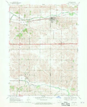
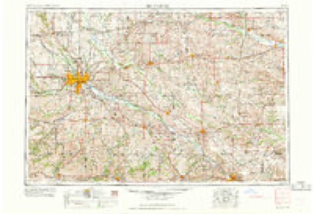
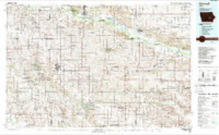
8 topographic sheets cover this place, the earliest surveyed in 1954 and the latest in 1984. It stands in Hartford Township. It lies in ZIP code area 52347. The Survey maps it on the Victor quadrangle.
Topographic sheets covering this place
6 surveys from 8 printed sheetsMatched by testing this settlement's coordinate against the published boundary of every sheet in the United States Geological Survey's historical collection. Each opens the scanned sheet at the Survey.
- 1954 USGS Des Moines quadrangle1:250000, 2 printings
- 1956 USGS Des Moines quadrangle1:250000
- 1957 USGS Des Moines quadrangle1:250000
- 1968 USGS Victor quadrangle1:24000
- 1969 USGS Des Moines quadrangle1:250000
- 1984 USGS Grinnell quadrangle1:100000, 2 printings
Fires near this place
17 since 2006Regional context, not property-specific evidence. The federal wildfire occurrence database lists 17 fires within 5 miles of Victor between 2006 and 2017, burning about 97 acres in total. None started naturally. None was recorded as arson. Distance is straight-line from the map coordinates, so a fire counted here may appear on a neighbouring settlement's page as well.
| Reported cause | Fires |
|---|---|
| Missing data/not specified/undetermined | 16 |
| Debris and open burning | 1 |
The most recent of them, most recent first, with the day each was reported and the service that recorded it.
| Date | Cause | Size | Reported by | Name on the report |
|---|---|---|---|---|
| 6 April 2011 | Missing data/not specified/undetermined | 3.0 acres | Iowa Department of Natural Resources | 400TH ST. AND HWY 21, IA |
| 5 April 2011 | Missing data/not specified/undetermined | 4.0 acres | Iowa Department of Natural Resources | 4341 235TH ST. GUERNSEY, IA |
| 5 April 2011 | Missing data/not specified/undetermined | 2.0 acres | Iowa Department of Natural Resources | HARTWICK RD & STATE HWY 21, IA |
| 20 April 2006 | Missing data/not specified/undetermined | 3.0 acres | Iowa Department of Natural Resources | not named |
| 30 March 2006 | Missing data/not specified/undetermined | 30 acres | Iowa Department of Natural Resources | not named |
| 29 March 2011 | Missing data/not specified/undetermined | 1.0 acres | Iowa Department of Natural Resources | 2162 IA/POWESHIEK RD, IA |
| 25 March 2006 | Missing data/not specified/undetermined | 10 acres | Iowa Department of Natural Resources | not named |
| 25 March 2006 | Missing data/not specified/undetermined | 2.0 acres | Iowa Department of Natural Resources | not named |
Settlements close enough to share some of these fires:
Storms near this place
31 since 2000Regional context, not property-specific evidence. The National Weather Service names Victor in 31 storm reports between 2000 and 2024: 16 thunderstorm wind, 11 hail, 3 tornado, 1 flash flood. The reports record 1 injury. Each account below is quoted exactly as the forecast office filed it, from the NOAA Storm Events Database, and each date opens the federal record of that event.
| When | Event | Place named | Harm | What the report says |
|---|---|---|---|---|
| June 2001 | Thunderstorm Wind | Victor | 1 hurt | Three semi-tractor trailers were blown over on Interstate 80 at mile marker 209. The semis were blocking all lanes and the highway was closed for a time. One of the drivers was injured. Reported by law enforcement. |
| May 2008 | Tornado (EF1) | Victor | $100,000 | A tornado moved east just south of I 80 from mile marker 205 south of Victor, IA to mile marker 211 south of Ladora, IA. Several gin bins and other farm outbuildings were either damaged or destroyed. Some utility poles and trees along the path were blown down and at least one home sustained roof damage. One tree fell onto a mobile home destroying it. |
| April 2003 | Hail | Victor | $50,000 | no account filed |
| May 2004 | Thunderstorm Wind | Victor | $7,000 | Power out |
| August 2009 | Thunderstorm Wind | Victor | $5,000 | Wind gusts estimated to be 70 mph blew down trees limbs and power lines in the vicinity of Victor, IA around 731 pm August 9. |
| August 2003 | Thunderstorm Wind | Victor | $3,000 | Signs and branches down |
| April 2024 | Hail | Victor | - | A trained spotter reported dime to quarter size hail covering the ground. |
| August 2020 | Thunderstorm Wind | Victor | - | Widespread straight-line winds that produced extensive damage were reported throughout Iowa County, associated with a derecho. These winds lasted around an hour in total at any one location, even though the initial line of storms moved out quickly. Damaging straight-line winds continued and were associated with the rear inflow jet. Maximum wind speeds were estimated to be 60 to 80 MPH for much of the county, with areas in northern Iowa County that had wind speed estimates that were 80 MPH or higher. These estimates were determined based off damage reports and photos submitted through social media. These strong winds and duration extensively damaged most trees, powerlines, crops, and some structures in their path. This also resulted in long duration power outages. |
| June 2019 | Thunderstorm Wind | Victor | - | The time was estimated by radar. |
| May 2019 | Tornado (EF0) | Victor | - | A brief tornado was captured by the public on video just southeast of Victor. The tornado remained in open fields and no damage was observed. |
| May 2019 | Tornado (EF0) | Victor | - | Emergency management observed a weak tornado develop east of Guernsey, and follow an intermittent path about 3 miles to the northeast before lifting just south of Interstate 80. The tornado caused some minor tree damage. The estimated winds were 75 MPH. |
| April 2014 | Thunderstorm Wind | Victor | - | A public report, relayed by the media, that power lines were down. |
| June 2014 | Hail | Victor | - | The emergency manager reported dime to penny size hail. |
| May 2011 | Thunderstorm Wind | Victor | - | Wind gusts estimated to be 60 mph were observed in Victor, IA at 440 pm CDT May 24. |
| August 2009 | Thunderstorm Wind | Victor | - | Wind gusts estimated to be 70 mph were observed in Victor, IA around 717 pm August 9. This report was relayed by KCRG in Cedar Rapids. |
| June 2008 | Thunderstorm Wind | Victor | - | Wind gusts estimated to be 60 mph blew down several branches in Victor, IA at 1:37 am June 10. Pea-sized hail was also observed. |
| June 2008 | Flash Flood | Victor | - | Heavy rains resulted in flash flooding of parts of Victor, IA, Ladora, IA, and Marengo, IA during the morning of June 12. Street flooding was observed in Ladora and Marengo with flood waters flowing over Highway 6 near Ladora. Near Victor, several farm fields were flooded. Torrential downpours of rain continued to aggravate the flooding problems. |
| July 2008 | Hail | Victor | - | Quarter-sized hail fell 1 mile southeast of Victor, IA at 454 pm July 2. |
| July 2008 | Thunderstorm Wind | Victor | - | Wind gusts estimated to be 65 mph blew down some 4 to 6 inch diameter branches in Victor, IA around 430 am July 21. |
| July 2008 | Thunderstorm Wind | Victor | - | A wind gust exceeding 70 knots (81 mph) was measured in Victor, IA around 430 am July 21. |
| June 2007 | Hail | Victor | - | Dime size hail fell about a half mile east of Victor, IA. |
| March 2007 | Thunderstorm Wind | Victor | - | Law enforcement reported a semi truck blown over on I80 at mile marker 205. |
| June 2002 | Thunderstorm Wind | Victor | - | Siding blown off several homes. |
| June 2001 | Thunderstorm Wind | Victor | - | Thunderstorm winds downed trees, and blew over semi-tractor trailers. Reported by trained spotter. |
| May 2001 | Hail | Victor | - | Quarter sized hail reported by law enforcement. |
| July 2020 | Hail | Victor | - | no account filed |
| May 2019 | Hail | Victor | - | no account filed |
| May 2010 | Hail | Victor | - | no account filed |
| April 2006 | Hail | Victor | - | no account filed |
| March 2002 | Thunderstorm Wind | Victor | - | no account filed |
| August 2000 | Hail | Victor | - | no account filed |
Nearest settlements
The eight closest, with where each one stands in the county. Distances are straight-line, computed from the Geographic Names Information System coordinates.
| Map | Place | Distance | Sheets |
|---|---|---|---|
| Ladora | 6.3 miles | 8 | |
| Dover (historical) | 8.0 miles | 8 | |
| Genoa Bluff | 8.1 miles | 8 | |
| Koszta | 8.2 miles | 8 | |
| Dayton | 10.2 miles | 8 | |
| Marengo | 12.9 miles | 8 | |
| Millersburg | 13.1 miles | 8 | |
| Ambrose (historical) | 14.2 miles | 8 |
Provenance
This settlement is recorded in the Geographic Names Information System as feature 462561. The sheet list is computed by point-in-boundary test against the United States Geological Survey's historical topographic inventory. Both are works of the United States government and carry no copyright under 17 U.S.C. 105.
Wildfire. Short, Karen C. 2022. Spatial wildfire occurrence data for the United States, 1992-2020 [FPA_FOD_20221014]. 6th Edition. Fort Collins, CO: Forest Service Research Data Archive. https://doi.org/10.2737/RDS-2013-0009.6 Collected with United States Government funding and usable without additional permissions or fees.
Storms. NOAA National Centers for Environmental Information, Storm Events Database https://www.ncei.noaa.gov/stormevents/ A work of the United States government, no copyright under 17 U.S.C. 105. Narratives are quoted verbatim from the National Weather Service report and are not edited or summarised.