 Block
From the record
17 National Register listings published here.
Sources: the National Register database, National Park Service
79 topographic sheets cover 46 settlements here, and 17 properties are on the National Register of Historic Places.
17 National Register listings published here.
Sources: the National Register database, National Park Service
Every property in this county listed on the National Register of Historic Places, with the year it was listed and the federal nomination document.
| Photograph | Property | Type | Listed | Reference |
|---|---|---|---|---|
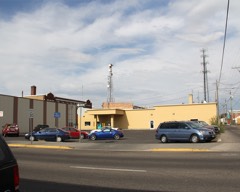 | Blackfoot I.O.O.F. Hall | building | 1979 | 79000775 |
 | Blackfoot LDS Tabernacle | building | 1977 | 77000456 |
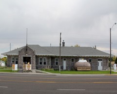 | Blackfoot Railway Depot | building | 1974 | 74000731 |
| Eastern Idaho District Fair Historic District | district | 2001 | 01000864 | |
| Fort Hall Site | site | 1974 | 74000732 | |
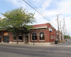 | Idaho Republican Building | building | 1979 | 79000776 |
| J. W. Jones Building | building | 1982 | 82000319 | |
| Nels and Emma Just House | building | 2020 | 100005363 | |
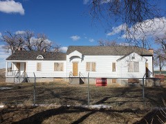 | Lincoln Creek Day School | building | 2010 | 10000174 |
| North Shilling Historic District | district | 1979 | 79000777 | |
 | Nuart Theater | building | 1978 | 78001049 |
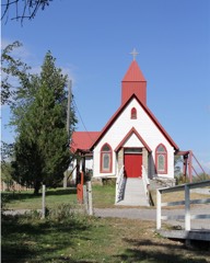 | Ross Fork Episcopal Church | building | 1983 | 83000277 |
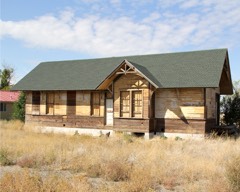 | Ross Fork Oregon Short Lines Railroad Depot | building | 1984 | 84001019 |
 | Shilling Avenue Historic District | district | 1983 | 83000278 |
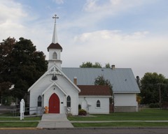 | St. Paul's Episcopal Church | building | 1979 | 79000778 |
 | Standrod Bank | building | 1979 | 79000779 |
 | US Post Office-Blackfoot Main | building | 1989 | 89000128 |
Every wildfire the federal occurrence database records inside this county: 383 of them, burning about 396,746 acres. 136 started naturally and 16 were recorded as arson. Each settlement page carries the fires within five miles of it.
| Reported cause | Fires |
|---|---|
| Natural | 136 |
| Missing data/not specified/undetermined | 104 |
| Equipment and vehicle use | 36 |
| Debris and open burning | 25 |
| Recreation and ceremony | 17 |
| Arson/incendiarism | 16 |
| Power generation/transmission/distribution | 12 |
| Fireworks | 12 |
| Railroad operations and maintenance | 11 |
| Misuse of fire by a minor | 5 |
| Smoking | 4 |
| Firearms and explosives use | 3 |
| Other causes | 2 |
The five largest, by the area the report gives. None of them was recorded as arson.
| Date | Cause | Size | Reported by | Name on the report |
|---|---|---|---|---|
| 26 July 2000 | Natural | 68,952 acres | Idaho Falls District | COFFEE PNT |
| 20 July 1999 | Natural | 49,364 acres | Idaho Falls District | CEDARBUTTE |
| 3 August 1992 | Natural | 39,562 acres | Idaho Falls District | SAGEHEN |
| 11 July 2012 | Natural | 23,051 acres | Idaho Falls District | CEDAR BUTTE WSA |
| 31 July 1998 | Natural | 22,989 acres | Idaho Falls District | TILDEN #2 |
| 2 August 2017 | Natural | 22,636 acres | Idaho Falls District | LAVA FLOW |
| 16 September 2005 | Debris and open burning | 16,892 acres | Idaho Falls District | ROUND BUTTE |
| 27 July 2012 | Natural | 16,613 acres | Idaho Falls District | RIDGE TOP |
Every settlement page carries the fires within five miles of it - see the settlement index below.
The NOAA Storm Events Database holds 285 reports for this county, causing no deaths, 5 injuries and about $9,253,410 in recorded property damage. Each settlement page carries the reports that name it.
| Kind of event | Reports |
|---|---|
| Thunderstorm Wind | 175 |
| Hail | 43 |
| Tornado | 20 |
| Funnel Cloud | 12 |
| Flood | 10 |
| Lightning | 8 |
| Wildfire | 7 |
| Heavy Rain | 5 |
| Flash Flood | 5 |
The most serious of them, by death, then injury, then recorded damage. The accounts are quoted exactly as the forecast office filed them.
| When | Event | Place named | Harm | What the report says |
|---|---|---|---|---|
| February 2000 | Thunderstorm Wind | Countywide | 2 hurt, $2,500,000 | Bingham county sustained by far the most damage from both the straight line wind and the tornadoes. Wind along I-15 near Blackfoot flipped 3 tractor trailers (1 injury) and forced a Greyhound bus (1 injury) into the median. Poles for electric lines were downed wholesale. Loss of power would idle 700 workers from potato processing plants and 350 workers from a flour mill for the remainder of the week. In Moreland and in Shelley, both the elementary and high schools suffered roof damage. A trailer home was destroyed and two more tipped over. Scores of homes suffered minor roof damage. Dozens of sheds and outbuildings were destroyed or damaged along with an airport hanger. Innumerable trees, some over 60 years old, were toppled. Damage to center pivot and wheel line irrigation systems will easily top $1 million dollars alone. |
| April 1995 | Tornado (F0) | Blackfoot | 1 hurt, $500,000 | A series of tornados touch down in Bingham County causing damage to mobile homes, highway signs, and recreational equipment. |
| February 2000 | Tornado (F1) | Firth | 1 hurt, $275,000 | Near Taylorsville a mobile home and garage were destroyed, 3 houses sustained minor roof damage and a cinder block building collapsed. Along the tornado's track, 4 center pivot and 5 wheel irrigation lines were damaged. |
| August 1995 | Thunderstorm Wind | Shelley/Firth | 1 hurt, $5,000 | no account filed |
| February 2000 | Tornado (F1) | Pingree | $2,200,000 | In the Riverside vicinity, one mobile home and two attached garages were destroyed. Near Pingree a set of grain silos were caved in. A cinder block building collapsed and a barn was destroyed near Groveland. In East Moreland 8 RVs were flipped and several damaged. Near Moreland, 3 high tension steel towers were toppled. Along the tornado's path, numerous homes sustained roof damage, many sheds and outbuildings were destroyed and large trees uprooted or pushed onto houses. Approximately 25 center pivot irrigation systems were damaged or destroyed and numerous wheel line systems twisted. |
| June 2009 | Hail | Taber | $1,000,000 | Extensive marble sized hail caused thousands of acres of wheat to be lost at a farm near Taber. |
| February 2017 | Flood | Atomic City | $917,000 | Sheet flooding from extensive snowmelt from excessive winter snow began early in the month and continued through the month. Several homes received extensive flooding damage mainly in the Shelley area. The depth of water in the sheet flooding reached as high as two feet in some areas. The worst of the flooding was from the 7th through the 15th. Ferry Butte and Riverton Roads had to be closed. In the Shelley area also the roadway on 1200 N between 1150 E and 1200 E and from 1200 E to 1150 N also had to be closed. Further flooding occurred after the 20th with several road closures in Aberdeen, Blackfoot, Shelley and Springfield. A County disaster declaration was declared for the county as well. |
| February 2000 | Tornado (F1) | Shelley | $350,000 | no account filed |
| August 2014 | Flash Flood | Blackfoot | $300,000 | Nearly 2 inches of rain in less than an hour brought extensive flooding to the city of Blackfoot. Extensive street and parking lot flooding occurred with standing water on roadways a problem throughout the city. Several cars stalled out driving through water with one truck driving into an uncovered manhole Several manhole covers in roads became uncovered as the amount of water was too much for the cities drainage system. 30 homes and 15 businesses reported damage with house basements receiving the most damage. Several roads were also damaged. Damage in Blackfoot was estimated at $300,000. |
| March 2017 | Flood | Atomic City | $215,000 | Sheet flooding from snow melt continued throughout March though there was a significant improvement over February. On March 16th significant road damage and roads washed out were reported in Taber. The main issue was road damage and some property damage that continued to run up the monetary damage. Some roads remained closed through the first two weeks of March in Aberdeen, Blackfoot, Shelley, and Springfield. |
| March 2006 | Tornado (F0) | Blackfoot | $210,000 | F0 tornado touched down in the southeastern part of Blackfoot near Robertson Street and moved up University and Schilling Streets before lifting near the State Fairgrounds. Four trees downed at St Paul's Episcopal Church on Schilling Street. Windows at private residence on Schilling Street shattered and house severely damaged by felled tree. |
| March 2006 | Thunderstorm Wind | Countywide | $150,000 | no account filed |
| July 1999 | Thunderstorm Wind | Ft Hall | $60,000 | High based dry thunderstorms produced microburst winds sustained to 60 mph and gusting at 75-90 mph through central Bingham county. The damaging wind followed a path from near Fort Hall along the I-15 corridor, through Blackfoot to Shelley. Numerous trees, with diameters up to 30 inches, snapped causing damage to a few cars, houses and businesses. Power lines were downed causing some small fires and leaving thousands of residents without power for most of the day. Sporadic shingle damage occurred. One building under construction collapsed after its roof was lifted off. One fatality resulted from the power outage which caused a home based oxygen machine to fail. |
| March 2006 | Thunderstorm Wind | Blackfoot | $60,000 | no account filed |
| April 1995 | Tornado (F0) | Fort Hall | $50,000 | A series of tornados touch down in Bingham County causing damage to mobile homes, highway signs, and recreational equipment. |
| May 1993 | Thunderstorm Wind | not stated | $50,000 | An eight-stall horse shed was lifted from the ground, twisted and dropped into the corral behind it. There were no horses in the shed at the time of the incident. |
| July 2000 | Wildfire | Countywide | $50,000 | no account filed |
| May 2017 | Flood | Atomic City | $33,000 | Minor flooding continued in Bingham County in May but the worst was over. Some fields remained covered in water early in the month causing some agricultural damage with levee repair work done. |
| July 2024 | Thunderstorm Wind | Taber | $30,000 | Bingham County reported 5 power poles snapped off near Taber and N 1400 W and US 26 with fires also reported. |
| March 2006 | Thunderstorm Wind | Pingree | $30,000 | no account filed |
| July 1989 | Tornado (F0) | not stated | $25,000 | no account filed |
| March 1959 | Tornado (F1) | not stated | $25,000 | no account filed |
| June 2013 | Lightning | Blackfoot | $20,000 | Lightning damage occurred in Blackfoot. One home on S Adams Ave had a window blown out with siding damage and damage to utility lines and appliances in the house. A telephone was knocked down near the courthouse. A trailer at the Sage Hill Travel Center was struck by lightning and destroyed. |
| June 2017 | Flood | Atomic City | $15,000 | Minor flooding continued the first part of June with agricultural damage continuing along with west nile mosquito control due to ponding water. |
| May 2015 | Hail | Ft Hall | $15,000 | Small hail began accumulating on interstate 15 in Fort Hall and many cars slid off the interstate into ditches and the median with one collision occurring. One individual received minor injuries and was transported to a hospital. |
| February 2006 | Flash Flood | East Portion | $15,000 | no account filed |
| March 2006 | Thunderstorm Wind | Blackfoot | $10,000 | no account filed |
| March 2006 | Thunderstorm Wind | Aberdeen | $10,000 | no account filed |
| March 2006 | Thunderstorm Wind | Ft Hall | $10,000 | no account filed |
| February 1999 | Thunderstorm Wind | Pingree | $10,000 | no account filed |
| September 1997 | Thunderstorm Wind | Blackfoot | $10,000 | no account filed |
| July 2024 | Thunderstorm Wind | Rockford | $8,000 | Numerous singles blown off residential roof along Idaho 39 in Rockford. |
| July 2010 | Thunderstorm Wind | Aberdeen | $8,000 | Several trees reported downed in Aberdeen by the Emergency Manager. |
| June 2011 | Tornado (EF0) | Moreland | $7,000 | An EF0 tornado hit the city of Moreland along Pioneer Road between 800 and 900 West between 6:50 and 7:00 pm MDT On June 23rd. four homes received damage. A shed at one home was destroyed and a garage to the back of another home was destroyed. A third home had wood sidign removed and damaged trees. A camper was flipped over and was on it's top at a 4th home. A storm survey was done and it was determined to be an EF0 tornado. The Jensen Grove Park near Blackfoot had 19 trees either snapped or uprooted by the storm. |
| May 2023 | Thunderstorm Wind | Ft Hall | $5,000 | Thunderstorm winds downed a tree which fell on a building near Fort Hall damaging a wall and roof. |
| August 2023 | Thunderstorm Wind | Blackfoot | $5,000 | Numerous sections of trees and large tree limbs blown down just west of interstate 15 across the Collins, Aiken, Clarkson, Riverside and Groveland communities. |
| June 2016 | Thunderstorm Wind | Moreland | $5,000 | An early morning storm moved through Bingham County and downed trees and power lines. Wind speeds of 56 mph were measured in Blackfoot with 2,100 people without power according to Rocky Mountain Power and Idaho Power. The storm moved through around 2 am in the morning with most power restored by 11 am. Several power lines were downed as well as large trees including a 70 foot spruce in Groveland. |
| June 2011 | Flood | Blackfoot | $5,000 | The Snake River at Blackfoot was above flood stage from June 1st through June 19th. It was below flood stage from June 13th through June 16th. Water levels reached moderate flood stage and crested at 11.79 feet on the evening of June 10th. There was widespread floodign in the Riverton area resulting in the closure of Riverton Road with several homes threatened. A number of homes and access roads were threatened in the Thomas area near Riverbend Road and Wilson Road. Berm construction and sandbagging appeared to have been successful in those areas. Archery Range Road near the Rose Overpass was submerged and impassable for a period. In Blackfoot, sub-water seepage into Jensens Grove caused minor flooding of the park. Flooding of lowland and agricultural fields occurred adjacent to the river between Rose and Tilden Bridge. |
| August 1995 | Thunderstorm Wind | Aberdeen | $5,000 | A thunderstorm in the Shelley Firth area produced 60 mph winds uprooting trees and breaking power lines. One 10-year-old boy was hit by a falling tree branch. In Aberdeen winds caused damage to several roofs and a power outage lasted for several hours. |
| June 1995 | Thunderstorm Wind | Springfield Area | $5,000 | no account filed |
| June 2010 | Lightning | Basalt | $4,000 | A lightning strike hit the Basalt water system destroying computer equipment and leaving 600 people without water for 2 hours. |
| July 2024 | Thunderstorm Wind | Blackfoot | $3,000 | Large tree downed on wood stockade fence knocking it down. Occurred along Pendlebury Lane. Power outage also reported. |
| August 2024 | Thunderstorm Wind | Blackfoot | $3,000 | Three large trees reported downed at Jensen Grove Park in Blackfoot. |
| August 2013 | Thunderstorm Wind | Blackfoot | $3,000 | Strong thunderstorm outflow winds on August 12th downed 3 trees at a Blackfoot home. It did damage to the roof and some storage sheds. |
| August 2023 | Thunderstorm Wind | Blackfoot | $2,200 | Two large pine trees and part of a willow tree downed on Colonial Loop just off of US Highway 26 in Blackfoot. |
| July 2025 | Thunderstorm Wind | Moreland | $2,000 | A large tree was downed at Snake River High School. |
| July 2024 | Thunderstorm Wind | Rockford | $2,000 | A large pine tree uprooted and down on a fence one mile east of Rockford. |
| July 2024 | Thunderstorm Wind | Blackfoot | $2,000 | Large tree uprooted and down on a truck near the intersection of Dennis St and Opal Str. |
| July 2024 | Thunderstorm Wind | Blackfoot | $2,000 | Two trees downed on River Ranch Rd. |
| August 2015 | Hail | Shelley | $2,000 | Potato crop damage occurred from rain, hail and wind in Shelley. |
| April 2015 | Hail | Firth | $2,000 | As much as 1 to 4 inches of small hail accumulated on interstate 15 between Firth and Shelley and several slide offs and accidents were reported by area law enforcement. No injuries occurred in the accidents. |
| May 2011 | Flood | Blackfoot | $2,000 | The Snake River at Blackfoot reached flood stage of 10 feet on May 10th and remained over flood stage the remainder of the month peaking at 12.04 feet on May 29th. The Riverton area had widespread flooding resulting in the closure of Riverton Road with several homes threatened. The Rose Levee broke on May 27th resulting in the washout of about 200 feet of levee structure. Flows occurred through the Rose Ponds recreation area flooding campgrounds and a walking path. The Archery Range Road was flooded causing the evacuation of a resident from their property. In Blackfoot, sub-water seepage into Jensen's Grove caused minor flooding of the park and an industrial storage lot behind the Super 8 Motel and Blackfoot Medical Center. Flooding of lowlands and agricultural fields occurred adjacent to the river between Rost and Tilden Bridge. The Snake River at Shelley reached flood stage on May 16th at 12 feet and peaked at 13.15 feet on May 28th which was major flood stage. County Road 700 North southwest of Firth was closed. In firth, the Riverview Arena was partially underwater and extensive flooding of lowlands and agricultural fields occurred adjacent to the river between Firth and Rose. |
| July 2010 | Thunderstorm Wind | Aberdeen | $2,000 | Power lines reported downed by thunderstorm winds 6 miles north of Aberdeen. |
| July 2010 | Thunderstorm Wind | Blackfoot | $2,000 | Trees downed in the City of Blackfoot reported by law enforcement officers. |
| June 2017 | Hail | Aberdeen | $1,500 | One and a half inch hail fell north of Aberdeen. Some vehicle damage reported and a home gutter damaged. |
| July 2004 | Thunderstorm Wind | Groveland | $1,300 | no account filed |
| July 2024 | Thunderstorm Wind | Rockford | $1,000 | A large tree downed north of Rockford at intersection of W 200 N and N 1400 W. |
| July 2024 | Thunderstorm Wind | Blackfoot | $1,000 | Large pine tree uprooted on corner of W Center St and Lansing St. |
| July 2024 | Thunderstorm Wind | Blackfoot | $1,000 | Large tree downed at Blackfoot High School. |
| August 2024 | Thunderstorm Wind | Blackfoot | $1,000 | Several reports of localized tree damage in Blackfoot. |
The Survey's mineral resources record lists 61 workings inside this county. 9 still produce and 52 are closed or unrecorded. Each settlement page carries the workings within five miles of it.
| Commodity | Workings |
|---|---|
| Sand and Gravel, Construction | 28 |
| Phosphorus-Phosphates | 14 |
| Gold | 5 |
| Pumice | 4 |
| Stone | 3 |
| Limestone, Dimension | 2 |
| Platinum | 1 |
| Titanium | 1 |
| Dolomite, Limestone, General | 1 |
| Vanadium | 1 |
| Limestone, Ultra Pure | 1 |
| Vanadium, Phosphorus-Phosphates | 1 |
| Fluorine-Fluorite | 1 |
| Phosphorus-Phosphates, Fluorine-Fluorite, Pumice | 1 |
The least common of them first, because a county's hundredth gravel pit says nothing its first ten did not.
| Where | Site | Commodity | Status | Recorded |
|---|---|---|---|---|
| Flyg Farm | Gold, Silver | Unknown | ||
| Gay Mine | Phosphorus-Phosphates, REE, Uranium, Vanadium, Fluorine-Fluorite | Past Producer | 1946 | |
| Homer Valley Limestone - Dolomite Deposit | Dolomite, Limestone, General | Occurrence | Dolomite, Limestone | |
| Miner Creek Phosphate Deposit | Phosphorus-Phosphates, Fluorine-Fluorite | Occurrence | Surface | |
| Miner Creek Travertine Occurrence | Limestone, Ultra Pure | Occurrence | Travertine | |
| Phosphate Deposit | Phosphorus-Phosphates, Fluorine-Fluorite, Pumice | Occurrence | ||
| Taylor Creek Phosphate Deposit | Vanadium, Phosphorus-Phosphates | Occurrence | ||
| Welch Ground, and Gold Point and Eagle Bend | Gold, Platinum, Titanium | Producer | 1865 | |
| Wolverine Creek Phosphate Deposit | Phosphorus-Phosphates, Vanadium | Prospect | Surface | |
| Wolverine Creek Travertine Deposit | Limestone, General | Unknown | ||
| Homer Valley | Limestone, Dimension | Unknown | ||
| Wolverine Creek Canyon Limestone Occurrence | Limestone, Dimension | Occurrence | Limestone | |
| Hell's Half Acre Decorative Stone | Stone | Producer | ||
| Stone Quarry | Stone | Past Producer | ||
| Stone Quarry | Stone | Past Producer | ||
| Blackfoot River Area Pumicite Deposit | Pumice | Occurrence | ||
| Brush Creek | Pumice | Unknown | ||
| No. 49 Pit | Pumice | Past Producer | ||
| Sheep Mountain | Pumice | Unknown | ||
| Gold Point and Eagle Bend Placer | Gold | Past Producer | Placer | |
| Snake River Placer | Gold | Past Producer | ||
| Welch Ground | Gold | Past Producer | ||
| Blackfoot Mountains Phosphate Deposit | Phosphorus-Phosphates | Occurrence | Surface | |
| Blackfoot Mountains Prospects | Phosphorus-Phosphates | Prospect | ||
| Gay Mine | Phosphorus-Phosphates | Producer | 1945, 1946 | |
| Lincoln Canyon Phosphate Deposit | Phosphorus-Phosphates | Occurrence | ||
| Phosphate Deposit | Phosphorus-Phosphates | Unknown | ||
| Phosphate Deposit | Phosphorus-Phosphates | Occurrence | ||
| Sampson #1 | Phosphorus-Phosphates | Unknown | ||
| Simplot Mine | Phosphorus-Phosphates | Unknown | ||
| South Cranes Flat Phosphate Occurrence | Phosphorus-Phosphates | Occurrence | Surface | |
| Westvaco Mine | Phosphorus-Phosphates | Occurrence | ||
| Williams Creek | Phosphorus-Phosphates | Prospect | ||
| Blackfoot Pit and Plant | Sand and Gravel, Construction | Producer | ||
| Borrow Pit | Sand and Gravel, Construction | Past Producer | ||
| Gravel Pit | Sand and Gravel, Construction | Past Producer | ||
| Gravel Pit | Sand and Gravel, Construction | Producer | ||
| Gravel Pit | Sand and Gravel, Construction | Past Producer | ||
| Gravel Pit | Sand and Gravel, Construction | Past Producer | ||
| Gravel Pit | Sand and Gravel, Construction | Producer | ||
| Gravel Pit | Sand and Gravel, Construction | Past Producer | ||
| Gravel Pit | Sand and Gravel, Construction | Past Producer | ||
| Gravel Pit | Sand and Gravel, Construction | Past Producer | ||
| Gravel Pit | Sand and Gravel, Construction | Past Producer | ||
| Gravel Pit | Sand and Gravel, Construction | Past Producer | ||
| Gravel Pit | Sand and Gravel, Construction | Past Producer | ||
| Gravel Pit | Sand and Gravel, Construction | Past Producer | ||
| Gravel Pit | Sand and Gravel, Construction | Producer | ||
| Gravel Pit | Sand and Gravel, Construction | Past Producer | ||
| Gravel Pit | Sand and Gravel, Construction | Past Producer | ||
| Gravel Pit | Sand and Gravel, Construction | Past Producer | ||
| Gravel Pit | Sand and Gravel, Construction | Past Producer | ||
| Gravel Pit | Sand and Gravel, Construction | Past Producer | ||
| Gravel Pit | Sand and Gravel, Construction | Past Producer | ||
| Idaho Falls Plant | Sand and Gravel, Construction | Producer | ||
| Miller Pit | Sand and Gravel, Construction | Past Producer |
Named settlements recorded in the Geographic Names Information System, each with the topographic sheets covering it. Villages, hamlets and abandoned places alike. Each is shown with the nearest named watercourse or landform and the survey quadrangle it falls on.
Alridge census division · 83236 · On Cedar Creek · Higham Peak quadrangle
12 sheets, 1951 to 1998
Moreland census division · 83221 · Moreland quadrangle
12 sheets, 1940 to 1978
No longer a settlement
Shelley census division · 83274 · Near The Butte · Idaho Falls South quadrangle
13 sheets, 1948 to 1978
Alridge census division · On Trail Creek · Miner Creek quadrangle
12 sheets, 1918 to 1986
No longer a settlement
The vanished settlements of Bingham County: the places named above that are no longer on the map.