 Block
Chubbuck, Idaho
15 topographic sheets cover this place, the earliest surveyed in 1937 and the latest in 1984. It stands in the Pocatello census division. It lies in ZIP code area 83202. It stands on Little Pocatello Creek. The Survey maps it on the Pocatello North quadrangle. 15,570 people lived here at the 2020 count. It stands 4,472 feet above sea level.
Population over time
2 figuresChubbuck grew from 13,922 to 15,570 between 2010 and 2020. These are the recorded population figures Wikidata holds for this place, reached through the Geographic Names Information System number this page is keyed on rather than by name, so they belong to this place and not to another of the same name. Most are census counts, but not all are: an early figure may be a founding or settlement estimate, and an estimate published within five years of a census is left out. The change column is computed, and is left blank where more than 20 years separate a figure from the one before it, because a gap that long is not a change between two counts.
| Year | People | Change |
|---|---|---|
| 2010 | 13,922 | |
| 2020 | 15,570 | +1,648 (+12%) |
Topographic sheets covering this place
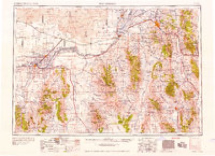
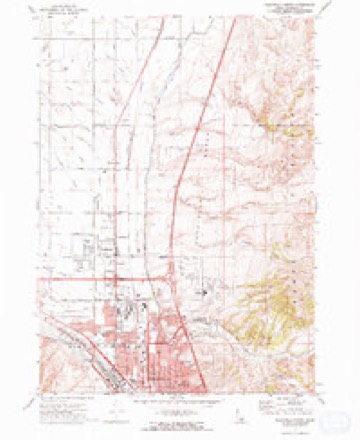
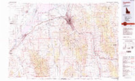
8 surveys from 15 printed sheetsMatched by testing this settlement's coordinate against the published boundary of every sheet in the United States Geological Survey's historical collection. Each opens the scanned sheet at the Survey.
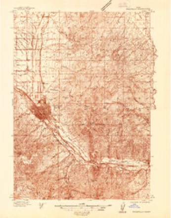
- 1937 USGS Pocatello quadrangle1:48000
- 1937 USGS Pocatello quadrangle1:62500, 2 printings
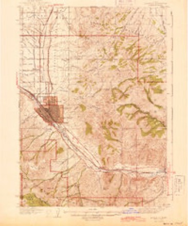
- 1944 USGS Pocatello quadrangle1:62500
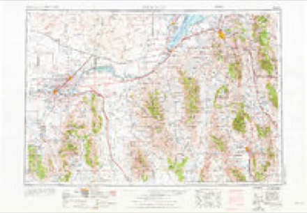
- 1954 USGS Pocatello quadrangle1:250000, 4 printings
- 1958 USGS Pocatello quadrangle1:250000, 2 printings
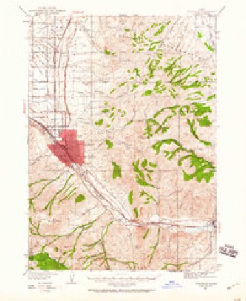
- 1971 USGS Pocatello North quadrangle1:24000, 2 printings
- 1974 USGS Pocatello North quadrangle1:24000
- 1984 USGS Pocatello quadrangle1:100000, 2 printings

Fires near this place
45 since 1992Regional context, not property-specific evidence. The federal wildfire occurrence database lists 45 fires within 5 miles of Chubbuck between 1992 and 2020, burning about 3,852 acres in total. 7 started naturally. None was recorded as arson. Distance is straight-line from the map coordinates, so a fire counted here may appear on a neighbouring settlement's page as well.
| Reported cause | Fires |
|---|---|
| Missing data/not specified/undetermined | 17 |
| Fireworks | 8 |
| Natural | 7 |
| Misuse of fire by a minor | 3 |
| Debris and open burning | 3 |
| Recreation and ceremony | 2 |
| Equipment and vehicle use | 2 |
| Power generation/transmission/distribution | 1 |
| Smoking | 1 |
| Firearms and explosives use | 1 |
The most recent of them, most recent first, with the day each was reported and the service that recorded it.
| Date | Cause | Size | Reported by | Name on the report |
|---|---|---|---|---|
| 5 September 1994 | Debris and open burning | 2.0 acres | Idaho Falls District | SWANSON |
| 4 September 1994 | Missing data/not specified/undetermined | 25 acres | Idaho Falls District | POCATELLO |
| 16 September 1992 | Misuse of fire by a minor | 225 acres | Idaho Falls District | POCATELLO |
| 15 September 1992 | Debris and open burning | 55 acres | Idaho Falls District | FMC |
| 5 August 1996 | Misuse of fire by a minor | 70 acres | Idaho Falls District | POC. CREEK |
| 5 August 1995 | Equipment and vehicle use | 1,132 acres | Idaho Falls District | TWO MILE |
| 31 August 1996 | Natural | 1.0 acres | Idaho Falls District | SATTERFLD |
| 20 August 2004 | Missing data/not specified/undetermined | 2.5 acres | Idaho Falls District | HOWARD |
Settlements close enough to share some of these fires:
Mines and quarries near this place
10 of 12 shownRegional context, not property-specific evidence. The federal mineral resources record lists 12 workings within 5 miles of Chubbuck: 5 producers, 3 past producers, 3 unknowns, 1 prospect. 5 still produce. What was taken out: Sand and Gravel, Construction, Phosphorus-Phosphates, Copper, Silver. Distance is straight-line from the map coordinates, so a quarry counted here may appear on a neighbouring settlement's page as well.
| Where | Site | Commodity | Status | Recorded |
|---|---|---|---|---|
| Lost Horse Mine | Copper, Silver | Past Producer | ||
| R L Brown | Geothermal | Prospect | ||
| FMC Elemental Phosphorus Plant | Phosphorus-Phosphates | Unknown | ||
| Simplot Don Plant | Phosphorus-Phosphates | Unknown | ||
| Baldwin and Brady | Sand and Gravel, Construction | Producer | ||
| Bengal Pit | Sand and Gravel, Construction | Unknown | ||
| Fmc Silica Pit | Sand and Gravel, Construction | Producer | ||
| Gravel Pit | Sand and Gravel, Construction | Past Producer | ||
| Gravel Pit | Sand and Gravel, Construction | Past Producer | ||
| Merrill Pit | Sand and Gravel, Construction | Producer |
Storms near this place
57 since 1996Regional context, not property-specific evidence. The National Weather Service names Chubbuck in 57 storm reports between 1996 and 2026: 26 thunderstorm wind, 16 hail, 4 lightning, 4 flood. No death or injury is recorded in these reports. Each account below is quoted exactly as the forecast office filed it, from the NOAA Storm Events Database, and each date opens the federal record of that event.
| When | Event | Place named | Harm | What the report says |
|---|---|---|---|---|
| September 2013 | Flash Flood | Chubbuck | $700,000 | One to two inches of rain was reported by spotters in Chubbuck and east areas of Pocatello. Doppler radar indicated 4 to 5 inches over a localized area of Old Town and west Pocatello. Several homes and businesses were flooded with some evacuations ordered. Roads closed in the city were Hiline Road to Griffith Road; Hiline Road to El Rancho Boulevard; the Center Street underpass; Pocatello Avenue; Oak Street westbound to Yellowstone Avenue; the intersection of Pole Line Road and Fir Street; the North Main extension at Praxair; and Garrett Way at the railroad tracks. Hawthorne Road near Interstate 86 was closed in Chubbuck. Raymond Park in Pocatello was under water. 2 to 3 feet of standing water near Costco and a roof caved in business near Center Street underpass. A mudslide was reported at West Custer Street and Highland Boulevard in Pocatello. |
| August 2013 | Flash Flood | Chubbuck | $500,000 | Heavy rain with 2 to 4 inch amounts in the Chubbuck and Pocatello area caused extensive street, business and home flooding on August 23rd. The Center Street underpass was closed. Pocatello Avenue, Seventh Street, North Main and Highway 30 at the railroad bridge, Gold Street overpass, Cedar Street, Pole Line Road, Eldredge Road were closed in Pocatello. The Interstate 86 underpass on Hawthorne Road in Chubbuck was closed. The heavy rain began at around 2 pm with the flooding continuing until about 7 pm in the two cities. |
| February 2017 | Flood | Chubbuck | $450,000 | A lot of field flooding occurred in the county as well as a house on Andrew Street in Pocatello on the 8th. Wallin Road closed on the 10th in Chubbuck due to water on the road. The Marsh Creek area had flooding as well. The Portneuf River in Pocatello reached flood stage on the 11th with flooding in Sacajawea Park. The warmup also revealed extreme damage to roads from the harsh winter as well. |
| March 2017 | Flood | Chubbuck | $125,000 | Extensive field flooding and some home damage continued across much of Bannock County especially in the Marsh Creek and Inkom areas. Extensive sandbagging required. But many back roads flooded along with the fields and homes. |
| February 2000 | Tornado (F0) | Chubbuck | $110,000 | A few homes were damaged along with several trees and a main line electrical pole downed in Chubbuck. Several wheel irrigation systems were twisted and damaged. |
| December 2025 | Thunderstorm Wind | Chubbuck | $40,000 | Five to 6 power poles snapped off in the area of Edahow Elementary School. Tree limbs and wires downed. |
| May 2005 | Thunderstorm Wind | Chubbuck | $13,000 | Thunderstorm winds blew down 3 road signs between Chubbuck and Fort Hall. |
| June 2005 | Thunderstorm Wind | Chubbuck | $10,000 | Several trees downed in Chubbuck. Power lines down with outages. Damage to a trailer from a tree falling on it. |
| March 2006 | Thunderstorm Wind | Chubbuck | $10,000 | no account filed |
| February 2012 | Flood | Chubbuck | $9,000 | Portneuf and Inkom Roads near Inkom closed due to running water on roadways with debris. Flooded sections of road destroyed and replaced. Garden Drive in Chubbuck flooded in a thousand foot stretch covered with several inches of water. |
| August 2024 | Lightning | Chubbuck | $8,000 | Lightning struck a power pole resulting in a fire and part of a tree caught in wires. |
| July 2019 | Thunderstorm Wind | Chubbuck | $8,000 | A 71 mph wind gust occurred around 9 pm MDT on July 12th on interstate 15 southbound near the Northgate interchange. It picked up a large Idaho Transportation Department portable digital sign and hurled in into traffic on Interstate 15 southbound. The sign struck a car and a SUV heavily damaging both vehicles and both had to be towed from the interstate. No injuries occurred to the drivers or passengers. |
| August 2014 | Flash Flood | Chubbuck | $6,000 | One to two inches of rain in less than an hour caused extensive street flooding in Chubbuck and Pocatello. Several inches reported at intersection of Yellowstone and Flandro roads in Pocatello. Standing water was reported at the intersection of Yellowstone Road and Cedar. The Chubbuck WalMart reported flooding inside the building with damage to merchandise. Basement flooding was reported at the intersection of Hawthorne and Homestead Roads. High Estates Trailer Park on Philbin Road in Pocatello was flooded with several inches of water. Hawthorne Road at the interstate 86 underpass in Chubbuck was closed due to extensive standing water. Garrett Way in Pocatello near Alameda was closed. |
| April 2003 | Thunderstorm Wind | Chubbuck | $6,000 | Thunderstorm winds blew over a shed on Ballard Road north of Chubbuck. |
| February 2009 | Flood | Chubbuck | $5,000 | Several basements were flooded in Chubbuck and Lava Hot Spring due to rainfall and snowmelt. |
| August 2012 | Thunderstorm Wind | Chubbuck | $4,000 | A thunderstorm downed trees onto power lines and 3 thousand people lost power in the Chubbuck area. Several branches blown off trees and a small fire started due to a transformer blowing out. Some minor damage to houses as well occurred. |
| July 2023 | Thunderstorm Wind | Chubbuck | $3,000 | Shingles removed from private residence in Chubbuck. Large tree uprooted and down blocking road near intersection of David St and Joel St. |
| July 2022 | Lightning | Chubbuck | $3,000 | A lightning strike nocked a portion of a large tree onto power lines taking them down and lit the tree on fire along Hawthorne Rd in Chubbuck. |
| April 2026 | Thunderstorm Wind | Chubbuck | $2,000 | Damage was reported in Chubbuck and Pocatello with roof shingle damage, power pole damage, power line damage, yard damage etc. |
| July 2025 | Thunderstorm Wind | Chubbuck | $2,000 | Downed power lines were reported on Philbin Road in Chubbuck. |
| December 2025 | Thunderstorm Wind | Chubbuck | $2,000 | A 60 foot tree downed on a dog kennel and fence. |
| March 2011 | Thunderstorm Wind | Chubbuck | $2,000 | Police dispatchers reported a deck blown over a house in the city of Chubbuck. |
| August 2024 | Thunderstorm Wind | Chubbuck | $1,000 | Tree limb reported down on wires. |
| August 2023 | Flash Flood | Chubbuck | $1,000 | One to two inches of rain fell in Chubbuck in a 3 hour time frame and caused some flash flooding on roads and a few basements. The interstate 86 underpass on Hawthorne Road flooded. Interstate 86 flooded with 2 feet of water standing in an active construction zone. Water was pumped off of road but traffic significantly impaired. Garage and basement flooding in the Chubbuck and Galena Road area. |
| July 2023 | Thunderstorm Wind | Chubbuck | $1,000 | Tree blown down by thunderstorm wind on Fairway Drive. |
| July 2022 | Thunderstorm Wind | Chubbuck | $1,000 | Wires downed and debris in road due to wind damage in Chubbuck near intersection of Yellowstone Ave and Ward Dr. |
| May 2019 | Thunderstorm Wind | Chubbuck | $1,000 | Thunderstorm winds caused a a tree to come down onto a power line and crews worked quickly to remove the obstruction and restore power to affected customers. The reported outage affected over 3,800 Idaho Power customers in Chubbuck for approximately 45 minutes Tuesday.||The outage occurred around 2:30 p.m. and was resolved around 3:10 p.m. |
| July 2013 | Thunderstorm Wind | Chubbuck | $1,000 | A tree was downed by winds in Chubbuck falling on two automobiles on Bonanza Avenue between Hawthorne Road and Teton Street. |
| April 2005 | Thunderstorm Wind | Chubbuck | $1,000 | no account filed |
| July 2025 | Thunderstorm Wind | Chubbuck | - | The Fort Hall mesonet site recorded a 58 mph thunderstorm outflow wind. |
| June 2024 | Hail | Chubbuck | - | One inch hail in Chubbuck. |
| August 2024 | Thunderstorm Wind | Chubbuck | - | Idaho Power reported over 2,000 customers without power due to thunderstorm winds near Chubbuck. |
| May 2023 | Hail | Chubbuck | - | One inch hail in Chubbuck. |
| May 2023 | Hail | Chubbuck | - | One and a half inch hail north of Chubbuck. |
| July 2023 | Thunderstorm Wind | Chubbuck | - | About 1,500 customers without power due to power outages caused by thunderstorm winds in the Pocatello and Chubbuck area. |
| May 2020 | Thunderstorm Wind | Chubbuck | - | A 61 mph wind gust measured just south of Fort Hall. |
| April 2017 | Hail | Chubbuck | - | One inch hail measured in Chubbuck. |
| April 2017 | Hail | Chubbuck | - | One inch hail measured on Gary St in Chubbuck. |
| June 2017 | Hail | Chubbuck | - | One inch hail reported in Chubbuck. |
| October 2016 | Funnel Cloud | Chubbuck | - | A funnel cloud was photographed at 1:58 pm MDT near Mt Putnam. |
| September 2016 | Thunderstorm Wind | Chubbuck | - | A 60 mph thunderstorm wind gust in Chubbuck. |
| June 2015 | Hail | Chubbuck | - | Several reports of large hail were received from Chubbuck with hail size ranging from 1 to 2 inches. |
| June 2013 | Hail | Chubbuck | - | One inch hail reported in city of Chubbuck. |
| June 2013 | Hail | Chubbuck | - | One inch hail reported at home of National Weather Service Employee. |
| April 2003 | Hail | Chubbuck | - | Golf ball sized hail in Chubbuck. |
| February 2000 | Hail | Chubbuck | - | Numerous reports of hail from .75 to 1.00 inches in size. In Inkom, hail of 1.00 inches was reported to a depth of 6 inches. |
| September 1998 | Lightning | Chubbuck | - | Caused house fire. |
| August 1997 | Heavy Rain | Chubbuck | - | Spotter measured 0.86 rain. |
| August 1997 | Lightning | Chubbuck | - | Lightning struck two homes causing minor damage to house appliances. |
| August 1997 | Hail | Chubbuck | - | Dime-size hail and slightly larger observed at the north end of Chubbuck. |
| April 2017 | Hail | Chubbuck | - | no account filed |
| June 2009 | Hail | Chubbuck | - | no account filed |
| August 2006 | Hail | Chubbuck | - | no account filed |
| May 2004 | Thunderstorm Wind | Chubbuck | - | no account filed |
| August 2004 | Thunderstorm Wind | Chubbuck | - | no account filed |
| July 2001 | Hail | Chubbuck | - | no account filed |
| June 1996 | Thunderstorm Wind | Chubbuck | - | no account filed |
Nearest settlements
The eight closest, with where each one stands in the county. Distances are straight-line, computed from the Geographic Names Information System coordinates.
Elsewhere
Matched on this settlement's Geographic Names Information System number rather than its name, so it cannot be a different place of the same name in another state.
| Wikipedia article on Chubbuck | An encyclopaedic summary. Its text is share-alike, so it is linked here rather than copied. |
| Wikidata item Q1515246 | The structured record the population and elevation above come from. Public domain (CC0). |
Provenance
This settlement is recorded in the Geographic Names Information System as feature 396285. The sheet list is computed by point-in-boundary test against the United States Geological Survey's historical topographic inventory. Both are works of the United States government and carry no copyright under 17 U.S.C. 105.
Wildfire. Short, Karen C. 2022. Spatial wildfire occurrence data for the United States, 1992-2020 [FPA_FOD_20221014]. 6th Edition. Fort Collins, CO: Forest Service Research Data Archive. https://doi.org/10.2737/RDS-2013-0009.6 Collected with United States Government funding and usable without additional permissions or fees.
Mines and quarries. USGS Mineral Resources Data System (MRDS) https://mrdata.usgs.gov/mrds/ A work of the United States government, no copyright under 17 U.S.C. 105.
Storms. NOAA National Centers for Environmental Information, Storm Events Database https://www.ncei.noaa.gov/stormevents/ A work of the United States government, no copyright under 17 U.S.C. 105. Narratives are quoted verbatim from the National Weather Service report and are not edited or summarised.