 Block
Pocatello, Idaho
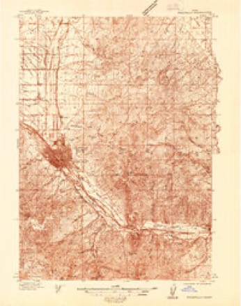
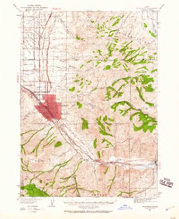
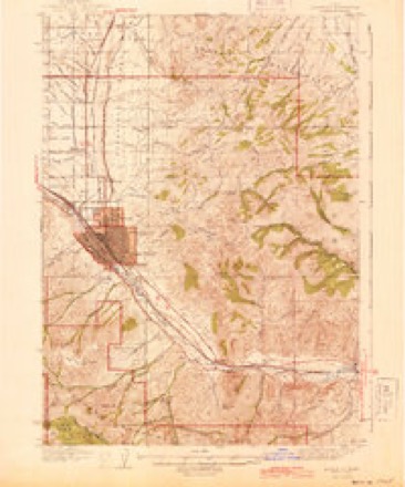
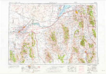
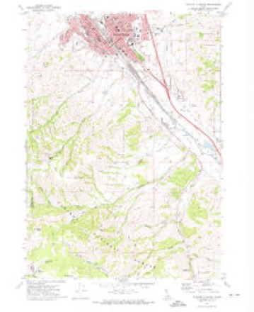
15 topographic sheets cover this place, the earliest surveyed in 1937 and the latest in 1984. It stands in the Pocatello census division. It lies in ZIP code area 83201. It stands on City Creek. The Survey maps it on the Pocatello South quadrangle. 56,320 people lived here at the 2020 count. It stands 4,462 feet above sea level.
Research this city
On record in Pocatello
Buildings and businesses the archive holds for this place. Each opens its own page, with the source record it came from.
On the National Register 12 of 23 shown
 A. F. R. Buildinglisted 1990
 Brady Memorial Chapellisted 1979
 Church of the Assumptionlisted 1979
 John Hood Houselisted 1978
 William A. Hyde Houselisted 1983
 Idaho State University Administration Buildinglisted 1993
 Pocatello Carnegie Librarylisted 1973
 Pocatello Federal Buildinglisted 1977
 Quinn Apartmentslisted 1985
 Rice-Packard Houselisted 1985
 St. Joseph's Catholic Churchlisted 1978
 Standrod Houselisted 1973
Topographic sheets covering this place
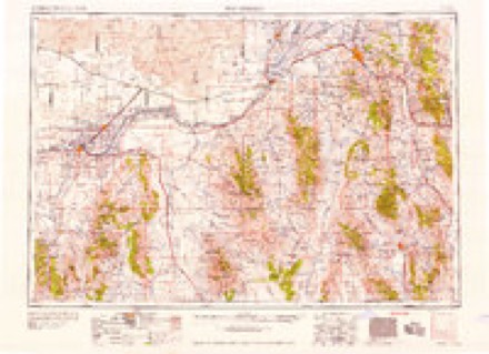
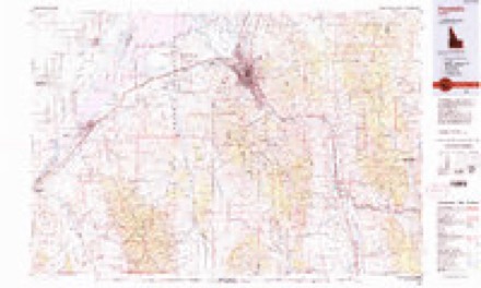
7 surveys from 15 printed sheetsMatched by testing this settlement's coordinate against the published boundary of every sheet in the United States Geological Survey's historical collection. Each opens the scanned sheet at the Survey.
- 1937 USGS Pocatello quadrangle1:48000
- 1937 USGS Pocatello quadrangle1:62500, 2 printings
- 1944 USGS Pocatello quadrangle1:62500
- 1954 USGS Pocatello quadrangle1:250000, 4 printings
- 1958 USGS Pocatello quadrangle1:250000, 2 printings
- 1971 USGS Pocatello South quadrangle1:24000, 3 printings
- 1984 USGS Pocatello quadrangle1:100000, 2 printings
What the histories say of this town
2,804 words1 chapter about Pocatello from the published histories of the county, public domain and reproduced complete.
| Chapter | From | Length |
|---|---|---|
| History | The History of Bannock County, Idaho (1915) | 2,804 words |
Fires near this place
96 since 1992Regional context, not property-specific evidence. The federal wildfire occurrence database lists 96 fires within 5 miles of Pocatello between 1992 and 2020, burning about 7,982 acres in total. 31 started naturally. 2 were recorded as arson. Distance is straight-line from the map coordinates, so a fire counted here may appear on a neighbouring settlement's page as well.
| Reported cause | Fires |
|---|---|
| Natural | 31 |
| Missing data/not specified/undetermined | 26 |
| Fireworks | 9 |
| Misuse of fire by a minor | 7 |
| Equipment and vehicle use | 6 |
| Smoking | 4 |
| Recreation and ceremony | 4 |
| Power generation/transmission/distribution | 4 |
| Debris and open burning | 2 |
| Arson/incendiarism | 2 |
| Firearms and explosives use | 1 |
The most recent of them, most recent first, with the day each was reported and the service that recorded it.
| Date | Cause | Size | Reported by | Name on the report |
|---|---|---|---|---|
| 9 September 2005 | Natural | under an acre | Idaho Falls District | AMERICAN |
| 8 September 2006 | Power generation/transmission/distribution | 3.7 acres | Idaho Falls District | MICHAUD CREEK |
| 4 September 1994 | Missing data/not specified/undetermined | 25 acres | Idaho Falls District | POCATELLO |
| 25 September 2008 | Missing data/not specified/undetermined | 7.2 acres | Idaho Falls District | BUCKSKIN ROAD |
| 21 September 2020 | Missing data/not specified/undetermined | 84 acres | Bannock County | BANNOCK COUNTY ASSIST 5 |
| 20 September 1992 | Missing data/not specified/undetermined | 1.0 acres | Caribou-Targhee National Forest | not named |
| 2 September 2007 | Equipment and vehicle use | 1.3 acres | Idaho Falls District | CHINAMAN PEAK |
| 2 September 2007 | Natural | 11 acres | Fort Hall Agency | POWERLINE |
Settlements close enough to share some of these fires:
Mines and quarries near this place
10 of 11 shownRegional context, not property-specific evidence. The federal mineral resources record lists 11 workings within 5 miles of Pocatello: 5 producers, 3 past producers, 2 unknowns, 1 occurrence. 5 still produce. What was taken out: Sand and Gravel, Construction, Copper, Stone, Crushed/Broken, Lead, Silver. Distance is straight-line from the map coordinates, so a quarry counted here may appear on a neighbouring settlement's page as well.
| Where | Site | Commodity | Status | Recorded |
|---|---|---|---|---|
| Lost Horse Mine | Copper, Silver | Past Producer | ||
| Lyonclaw Mine | Copper, Stone, Crushed/Broken, Lead, Silver | Past Producer | Sedimentary | |
| Mountain Spring Prospect | Copper, Gold | Occurrence | Replacement | |
| Simplot Don Plant | Phosphorus-Phosphates | Unknown | ||
| Baldwin and Brady | Sand and Gravel, Construction | Producer | ||
| Bengal Pit | Sand and Gravel, Construction | Unknown | ||
| Fmc Silica Pit | Sand and Gravel, Construction | Producer | ||
| Gravel Pit | Sand and Gravel, Construction | Past Producer | ||
| Merrill Pit | Sand and Gravel, Construction | Producer | ||
| Pocatello | Sand and Gravel, Construction | Producer |
Storms near this place
60 of 151 shownRegional context, not property-specific evidence. The National Weather Service names Pocatello in 151 storm reports between 1995 and 2026: 46 thunderstorm wind, 34 hail, 21 flash flood, 16 heavy rain. No death or injury is recorded in these reports. Each account below is quoted exactly as the forecast office filed it, from the NOAA Storm Events Database, and each date opens the federal record of that event.
| When | Event | Place named | Harm | What the report says |
|---|---|---|---|---|
| August 1997 | Hail | Pocatello | $1,040,000 | Hail from quarter to golfball-size occurred from Yellowstone Ave near Alameda to the lower Pocatello Creek area. Numerous vehicles (500+) and roofs(200+) in the area were damaged by hail. Specific hail reports within this area include: 1.75 inch hail 15th and Oak Street, 1.75 inch hail Maple Street and Yellowstone Ave, 1.5 inch hail near Poplar Street and Interstate 15, 1.25 inch hail at Channel 6 studio, 1.0 inch hail lower Pocatello Creek, and 1.0 inch hail Monte Vista. |
| June 1997 | Lightning | Pocatello | $1,000,000 | Lightning struck the new LDS Institute on the ISU campus. The fire which resulted caused the roof to collapse and set back construction 3 months. |
| June 2009 | Flash Flood | Pocatello | $700,000 | Flash flooding caused by as much a 2 inches of rain in a 2 hour period caused extensive flooding in the south portion of Pocatello. By 1:15 pm EDT 10th Street and Carter Avenue were completely flooded and not passable. The Juniper Hills and Riverside golf courses south of the city were completely underwater. South 5th Avenue was closed due to the water on the street. US 91 was closed from the South 5th exit to the Portneuf exit. 43 homes and several businesses were reported flooded. Water up to hoods of cars were reported on Bannock Highway near Riverside Golf Course. Water submerged cars in the Gables assisted living center on South Grant Avenue. Roads were closed throughout the Indian Hill section of Pocatello with knee deep water on most roads. A disaster area declaration was declared for Bannock County at 3:30 pm MDT. The rains created an 8 foot sink hole at Constitution Park. Sink holes developed at some local residences as deep as 12 feet. Extensive road damage occurred due to rushing debris. |
| July 2004 | Flash Flood | Pocatello | $535,000 | no account filed |
| August 1997 | Heavy Rain | Pocatello | $100,000 | Heavy rain caused considerable water damage to the Main Street Post Office roof, insulation and ceiling tiles. |
| March 2006 | Thunderstorm Wind | Pocatello | $100,000 | no account filed |
| May 2017 | Flood | Pocatello | $65,000 | The Portneuf River remained above flood stage for most of the month of May with much of the flooding occurring in the Inkom area. The Sacajawea Park in Pocatello remained flooded as well for much of the month. Fields in Inkom encountered agricultural damage with many roads and bridges in that area damaged and needing repaired. The continued ponding of water in the Inkom area required west Nile mosquito control. |
| March 2006 | Thunderstorm Wind | Pocatello | $40,000 | no account filed |
| July 1999 | Flash Flood | Pocatello | $30,000 | A thunderstorm brought intense rainfall and flash flooding to the city of Pocatello. Accumulation of 1.5 to 1.7 inches were reported for downtown Pocatello, with the suburbs reporting from 0.80 to 2.75 inches. Streets, underpasses and basements were flooded in downtown Pocatello. Some vehicles were stalled trying to drive through water up to a foot deep on city streets. Some 2000 residents suffered power outages for several hours. |
| May 2005 | Thunderstorm Wind | Pocatello | $14,000 | Thunderstorm winds uprooted large trees in Pocatello. One fell into a house causing extensive damage. |
| December 2025 | Thunderstorm Wind | Pocatello | $13,000 | A large tree was uprooted and a power pole snapped in half with wires down along Riverside Dr in Pocatello and the road was impassable. |
| August 2020 | Lightning | Pocatello | $10,000 | It is believed lightning struck transformers creating sparks that caused two fires in Pocatello. The first occurred in a field outside the School District 25 main office building on Pole Line Road. A second fire occurred at the 500 block of North Ninth Avenue. Sparks from a transformer ignited a grass fire that destroyed a car and spread to the exterior of a house destroying the attic. The home was unoccupied and was declared salvageable. About 1,000 Pocatello residents also lost power. |
| June 2017 | Flood | Pocatello | $10,000 | The Portneuf River gradually receded below flood stage and field flooding also was reduced during the month. Some minor damage to agriculture continued along with west nile mosquito control for ponding of water early in the month. |
| June 2011 | Flood | Pocatello | $10,000 | The Portneuf River at Pocatello remained above flood stage through June 18th. The river crested at 9.28 feet on June 11th. Extensive lowland flooding occurred near Inkom. Pasture and livestock corrals were flooded in the vicinity of Portneuf Gap and the Cheyenne Avenue Bridge in Pocatello. Downstream of the concrete flood control channel through Pocatello minor flooding of lowland and a city recreation trail occurred from Sacajawea Park to Pacfic Recycling Park. |
| May 1999 | Lightning | Pocatello | $10,000 | A lightning strike started a house fire which damaged the roof and attic. |
| March 2006 | Thunderstorm Wind | Pocatello | $10,000 | no account filed |
| June 2009 | Flash Flood | Pocatello | $8,000 | Heavy rains during the month of June caused exposed houses in the Hidden Valley subdivision in Pocatello to flood. As much as 4 inches of water was found in homes exposed to hillsides. |
| September 2009 | Thunderstorm Wind | Pocatello | $6,000 | A building under construction between Chile's and Costco was knocked over by strong winds. |
| July 2004 | Thunderstorm Wind | Pocatello | $5,700 | no account filed |
| September 2005 | Flash Flood | Pocatello | $5,000 | no account filed |
| December 2025 | Thunderstorm Wind | Pocatello | $3,000 | Large mature evergreen tree uprooted and blown onto power lines snapping one of them. |
| August 2021 | Thunderstorm Wind | Pocatello | $3,000 | Several trees downed in Pocatello with damage to a house and many branches in roadways. Some damage near 500 block of North Garfield Road. |
| December 2015 | Thunderstorm Wind | Pocatello | $3,000 | A thunderstorm moved through Pocatello and downed trees and power lines and thousands of people were reported without power in the Pocatello and Chubbuck area through 11 pm on the 21st. |
| June 2017 | Thunderstorm Wind | Pocatello | $2,000 | Thunderstorm winds downed a power line on Jefferson Avenue and many power outages occurred in Pocatello on the 26th. Idaho Power reported 2,000 customers without power. |
| May 2015 | Flash Flood | Pocatello | $2,000 | Heavy rain caused the closing of the Center Street underpass for several hours. Sandbags were ordered to alleviate flooding at Hayes Avenue and Halliday Street. Wyeth Street. Flooding also occurred at Wyeth Street., Main Street, Custer Street and Lincoln Avenue. Multiple weather related motor vehicle accidents were reported as well. |
| August 2007 | Thunderstorm Wind | Pocatello | $2,000 | Six inch tree limbs were reported snapped off and downed in Pocatello. |
| January 1998 | Thunderstorm Wind | Pocatello | $2,000 | High wind from thunderstorm blew 70 to 80 shingles off a roof and knocked over highway signs along Interstate 86. |
| August 1999 | Funnel Cloud | Pocatello | $2,000 | no account filed |
| July 2025 | Thunderstorm Wind | Pocatello | $1,500 | A large tree was blown over onto a fence in Pocatello. |
| December 2025 | Thunderstorm Wind | Pocatello | $1,000 | Several hundred customers without power in Pocatello due to object on power lines. |
| December 2025 | Thunderstorm Wind | Pocatello | $1,000 | Tree downed in Alameda Park. |
| December 2025 | Thunderstorm Wind | Pocatello | $1,000 | A large mature pine tree blown over blocking driveway. |
| December 2025 | Thunderstorm Wind | Pocatello | $1,000 | A large tree downed blocking a roadway. |
| September 2022 | Flood | Pocatello | $1,000 | Extensive street and road flooding occurred on the evening of the 21st in the Pocatello/Chubbuck area as rains in excess of a half inch fell. The intersection of East Oak St and Yellowstone Ave flooded. The Center Street Underpass accumulated 18 to 24 inches of water. Flooding at N 3rd Ave and E Fremont St affected a business. Hawthorne Rd flooded with deep water at the interstate 86 underpass and was closed from 830 pm to 10 pm MDT. US Route 30 also closed between Hawthorne Rd and W Cedar St. |
| May 2017 | Thunderstorm Wind | Pocatello | $1,000 | Large tree was downed in a cemetery. |
| August 2016 | Thunderstorm Wind | Pocatello | $1,000 | A strong thunderstorm wind downed a tree at the Pine Street and McKinley Avenue in Pocatello. There were reports of other downed trees in Pocatello. |
| September 2013 | Flash Flood | Pocatello | $1,000 | A heavy rain shower caused flash flooding south of Pocatello including mudslides across roads. Mudslides occurred on Mink Creek Road from Frazier Egg Farm to Bannock Highway closing the road for an hour. Some homes on Autumn Drive and Charlotte Drive had basements flooded near the Charlotte Fire burn area. |
| July 2009 | Flash Flood | Pocatello | $1,000 | Over 1 inch of rain in less than an hour caused minor street flooding throughout the city of Pocatello. The Red Lion Hotel reported standing water inside their establishment. |
| August 2009 | Flash Flood | Pocatello | $1,000 | Heavy rain caused road flooding on South Fifth Avenue, Bannock Highway and Samuel and McDougall Streets. |
| August 2009 | Flash Flood | Pocatello | $1,000 | Heavy rain caused road flooding on South Fifth Avenue, Bannock Highway and Samuel and McDougall Streets. |
| August 2007 | Thunderstorm Wind | Pocatello | $1,000 | Thunderstorm winds downed power lines and over 900 people without power until 10 pm. |
| May 2024 | Thunderstorm Wind | Pocatello | $500 | Upper third of large Pine tree snapped off along Mink Creek. |
| May 2005 | Thunderstorm Wind | Pocatello | $300 | no account filed |
| September 2016 | Thunderstorm Wind | North Pocatello | $200 | A large tree was blown down by thunderstorm winds on September 14th at Highland Golf Course in Pocatello. |
| May 1997 | Hail | Pocatello | $200 | Hail up to 3/4 inch diameter along Ranch and Plateau Streets in west bench area of Pocatello damaged porch awning. |
| April 2026 | Funnel Cloud | Pocatello | - | Photographs of a cold air funnel were reported on social media near Pocatello. |
| May 2025 | Flash Flood | Pocatello | - | Several inches of water pooled up on Garrett Way. |
| July 2025 | Flood | Pocatello | - | Areas of flooding in Pocatello: S Arthur Ave, Riverside Dr, US Highway 30 closed in the area of N Main St around 520 PM MDT, street and parking lots on west side of Pocatello. |
| July 2025 | Thunderstorm Wind | Pocatello | - | Idaho Power reported 1,000 customers without powers across the south end of Pocatello due to thunderstorm wind gust damage. |
| December 2025 | Thunderstorm Wind | Pocatello | - | An 83 mph wind gust measured near Howard Mountain at the Idaho Power mesonet site. |
| December 2025 | Thunderstorm Wind | Pocatello | - | A 59 mph wind gust measured at the Karen Road Idaho Power mesonet site. |
| December 2025 | Thunderstorm Wind | Pocatello | - | A 61 mph wind gust measured along W Pocatello Creek Rd near Nottingham Lane. |
| December 2025 | Thunderstorm Wind | Pocatello | - | Several hundreds reported without power in the Pocatello area. |
| June 2024 | Hail | Pocatello | - | One inch hail in Pocatello. |
| August 2024 | Thunderstorm Wind | Pocatello | - | A 66 mph thunderstorm outflow gust measured just northwest of Pocatello at FW4083 mesonet site. |
| August 2024 | Thunderstorm Wind | Pocatello | - | Tree limbs down in area of 13th Ave and 14th Ave. |
| May 2023 | Thunderstorm Wind | Pocatello | - | Eight inch tree branches were snapped in the Samuel and Stockman area of Pocatello. |
| May 2023 | Hail | Pocatello | - | One inch hail north of Pocatello. |
| May 2023 | Flash Flood | Pocatello | - | Extensive street flooding in Pocatello with several becoming impassable. The Center Street underpass was shut down after two feet of water collected. |
| May 2022 | Thunderstorm Wind | Pocatello | - | A 60 mph wind gust measured at station FW4083 2 miles northwest of Pocatello. |
Nearest settlements
The eight closest, with where each one stands in the county. Distances are straight-line, computed from the Geographic Names Information System coordinates.
Elsewhere
Matched on this settlement's Geographic Names Information System number rather than its name, so it cannot be a different place of the same name in another state.
| Wikipedia article on Pocatello | An encyclopaedic summary. Its text is share-alike, so it is linked here rather than copied. |
| Wikidata item Q320729 | The structured record the population and elevation above come from. Public domain (CC0). |
Provenance
This settlement is recorded in the Geographic Names Information System as feature 397053. The sheet list is computed by point-in-boundary test against the United States Geological Survey's historical topographic inventory. Both are works of the United States government and carry no copyright under 17 U.S.C. 105.
Wildfire. Short, Karen C. 2022. Spatial wildfire occurrence data for the United States, 1992-2020 [FPA_FOD_20221014]. 6th Edition. Fort Collins, CO: Forest Service Research Data Archive. https://doi.org/10.2737/RDS-2013-0009.6 Collected with United States Government funding and usable without additional permissions or fees.
Mines and quarries. USGS Mineral Resources Data System (MRDS) https://mrdata.usgs.gov/mrds/ A work of the United States government, no copyright under 17 U.S.C. 105.
Storms. NOAA National Centers for Environmental Information, Storm Events Database https://www.ncei.noaa.gov/stormevents/ A work of the United States government, no copyright under 17 U.S.C. 105. Narratives are quoted verbatim from the National Weather Service report and are not edited or summarised.