Block
From the record
30 National Register listings published here, 1 of them a National Historic Landmark.
Sources: the county history on the Internet Archive · the National Register database, National Park Service
55 topographic sheets cover 23 settlements here, and 30 properties are on the National Register of Historic Places.
30 National Register listings published here, 1 of them a National Historic Landmark.
Sources: the county history on the Internet Archive · the National Register database, National Park Service
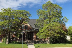
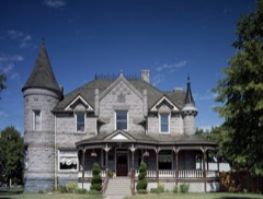
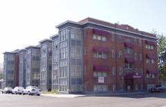
Every property in this county listed on the National Register of Historic Places, with the year it was listed and the federal nomination document.
Every wildfire the federal occurrence database records inside this county: 563 of them, burning about 58,297 acres. 229 started naturally and 17 were recorded as arson. Each settlement page carries the fires within five miles of it.
| Reported cause | Fires |
|---|---|
| Natural | 229 |
| Missing data/not specified/undetermined | 99 |
| Recreation and ceremony | 72 |
| Equipment and vehicle use | 55 |
| Fireworks | 30 |
| Arson/incendiarism | 17 |
| Debris and open burning | 17 |
| Railroad operations and maintenance | 17 |
| Misuse of fire by a minor | 8 |
| Firearms and explosives use | 7 |
| Power generation/transmission/distribution | 6 |
| Smoking | 5 |
| Other causes | 1 |
The five largest, by the area the report gives. Two of them were set deliberately.
| Date | Cause | Size | Reported by | Name on the report |
|---|---|---|---|---|
| 4 September 2005 | Natural | 8,282 acres | Idaho Falls District | SAWMILL |
| 21 July 2003 | Arson/incendiarism | 3,978 acres | Idaho Falls District | HARKNESS |
| 10 August 1998 | Natural | 3,737 acres | Idaho Falls District | LONE PINE |
| 7 August 2000 | Arson/incendiarism | 3,070 acres | Caribou-Targhee National Forest | HAWKINS |
| 31 July 1998 | Equipment and vehicle use | 2,655 acres | Idaho Falls District | I-15 |
| 16 August 2018 | Missing data/not specified/undetermined | 2,480 acres | Fort Hall Agency | ROSS FORK |
| 2 July 2003 | Fireworks | 2,232 acres | Idaho Falls District | BLACKROCK |
| 17 June 2007 | Missing data/not specified/undetermined | 1,634 acres | Idaho Falls District | HOWARD |
Every settlement page carries the fires within five miles of it - see the settlement index below.
The NOAA Storm Events Database holds 310 reports for this county, causing no deaths, 4 injuries and about $6,958,930 in recorded property damage. Each settlement page carries the reports that name it.
| Kind of event | Reports |
|---|---|
| Thunderstorm Wind | 110 |
| Hail | 80 |
| Flash Flood | 40 |
| Flood | 22 |
| Heavy Rain | 20 |
| Funnel Cloud | 14 |
| Lightning | 12 |
| Tornado | 6 |
| Wildfire | 5 |
| Dust Devil | 1 |
The most serious of them, by death, then injury, then recorded damage. The accounts are quoted exactly as the forecast office filed them.
| When | Event | Place named | Harm | What the report says |
|---|---|---|---|---|
| September 1998 | Lightning | Inkom | 3 hurt | Struck during football game injuring 3 boys. All hospitalized; one critical. All recovered. |
| September 1989 | Thunderstorm Wind | not stated | 1 hurt | no account filed |
| August 1997 | Hail | Pocatello | $1,040,000 | Hail from quarter to golfball-size occurred from Yellowstone Ave near Alameda to the lower Pocatello Creek area. Numerous vehicles (500+) and roofs(200+) in the area were damaged by hail. Specific hail reports within this area include: 1.75 inch hail 15th and Oak Street, 1.75 inch hail Maple Street and Yellowstone Ave, 1.5 inch hail near Poplar Street and Interstate 15, 1.25 inch hail at Channel 6 studio, 1.0 inch hail lower Pocatello Creek, and 1.0 inch hail Monte Vista. |
| June 1997 | Lightning | Pocatello | $1,000,000 | Lightning struck the new LDS Institute on the ISU campus. The fire which resulted caused the roof to collapse and set back construction 3 months. |
| September 2013 | Flash Flood | Chubbuck | $700,000 | One to two inches of rain was reported by spotters in Chubbuck and east areas of Pocatello. Doppler radar indicated 4 to 5 inches over a localized area of Old Town and west Pocatello. Several homes and businesses were flooded with some evacuations ordered. Roads closed in the city were Hiline Road to Griffith Road; Hiline Road to El Rancho Boulevard; the Center Street underpass; Pocatello Avenue; Oak Street westbound to Yellowstone Avenue; the intersection of Pole Line Road and Fir Street; the North Main extension at Praxair; and Garrett Way at the railroad tracks. Hawthorne Road near Interstate 86 was closed in Chubbuck. Raymond Park in Pocatello was under water. 2 to 3 feet of standing water near Costco and a roof caved in business near Center Street underpass. A mudslide was reported at West Custer Street and Highland Boulevard in Pocatello. |
| June 2009 | Flash Flood | Pocatello | $700,000 | Flash flooding caused by as much a 2 inches of rain in a 2 hour period caused extensive flooding in the south portion of Pocatello. By 1:15 pm EDT 10th Street and Carter Avenue were completely flooded and not passable. The Juniper Hills and Riverside golf courses south of the city were completely underwater. South 5th Avenue was closed due to the water on the street. US 91 was closed from the South 5th exit to the Portneuf exit. 43 homes and several businesses were reported flooded. Water up to hoods of cars were reported on Bannock Highway near Riverside Golf Course. Water submerged cars in the Gables assisted living center on South Grant Avenue. Roads were closed throughout the Indian Hill section of Pocatello with knee deep water on most roads. A disaster area declaration was declared for Bannock County at 3:30 pm MDT. The rains created an 8 foot sink hole at Constitution Park. Sink holes developed at some local residences as deep as 12 feet. Extensive road damage occurred due to rushing debris. |
| July 2004 | Flash Flood | Pocatello | $535,000 | no account filed |
| August 2013 | Flash Flood | Chubbuck | $500,000 | Heavy rain with 2 to 4 inch amounts in the Chubbuck and Pocatello area caused extensive street, business and home flooding on August 23rd. The Center Street underpass was closed. Pocatello Avenue, Seventh Street, North Main and Highway 30 at the railroad bridge, Gold Street overpass, Cedar Street, Pole Line Road, Eldredge Road were closed in Pocatello. The Interstate 86 underpass on Hawthorne Road in Chubbuck was closed. The heavy rain began at around 2 pm with the flooding continuing until about 7 pm in the two cities. |
| July 2009 | Flash Flood | Inkom | $500,000 | Over one inch of rain in less than one hour near Inkom and the runoff caused the Rapid Creek and Portneuf River to exceed their banks. Extensive flooding occurred throughout the city of Inkom. About 30 homes and businesses flooded with as much as 5 to 12 inches of standing water in them. Jackson Creek Road was washed out. Bannock County was declared a disaster area by 3 pm MDT on July 4th. |
| July 2003 | Wildfire | Mc Cammon | $500,000 | no account filed |
| February 2017 | Flood | Chubbuck | $450,000 | A lot of field flooding occurred in the county as well as a house on Andrew Street in Pocatello on the 8th. Wallin Road closed on the 10th in Chubbuck due to water on the road. The Marsh Creek area had flooding as well. The Portneuf River in Pocatello reached flood stage on the 11th with flooding in Sacajawea Park. The warmup also revealed extreme damage to roads from the harsh winter as well. |
| March 2017 | Flood | Chubbuck | $125,000 | Extensive field flooding and some home damage continued across much of Bannock County especially in the Marsh Creek and Inkom areas. Extensive sandbagging required. But many back roads flooded along with the fields and homes. |
| February 2000 | Tornado (F0) | Chubbuck | $110,000 | A few homes were damaged along with several trees and a main line electrical pole downed in Chubbuck. Several wheel irrigation systems were twisted and damaged. |
| August 1997 | Heavy Rain | Pocatello | $100,000 | Heavy rain caused considerable water damage to the Main Street Post Office roof, insulation and ceiling tiles. |
| March 2006 | Thunderstorm Wind | Pocatello | $100,000 | no account filed |
| May 2017 | Flood | Pocatello | $65,000 | The Portneuf River remained above flood stage for most of the month of May with much of the flooding occurring in the Inkom area. The Sacajawea Park in Pocatello remained flooded as well for much of the month. Fields in Inkom encountered agricultural damage with many roads and bridges in that area damaged and needing repaired. The continued ponding of water in the Inkom area required west Nile mosquito control. |
| May 1994 | Thunderstorm Wind | not stated | $50,000 | Thunderstorm winds did nearly $10,000 worth of damage to buildings in Downey, 35 miles southeast of Pocatello. The strong winds pulled a shed's metal roof from its rafters, and blew it onto the roof of a nearby house. The house sustained damage to its roof, carport, and television antenna. |
| December 2025 | Thunderstorm Wind | Chubbuck | $40,000 | Five to 6 power poles snapped off in the area of Edahow Elementary School. Tree limbs and wires downed. |
| February 2000 | Thunderstorm Wind | Mc Cammon | $40,000 | Widespread minor damage to houses and fences, along with downed trees, were reported in Chubbuck. |
| March 2006 | Thunderstorm Wind | Pocatello | $40,000 | no account filed |
| July 1999 | Flash Flood | Pocatello | $30,000 | A thunderstorm brought intense rainfall and flash flooding to the city of Pocatello. Accumulation of 1.5 to 1.7 inches were reported for downtown Pocatello, with the suburbs reporting from 0.80 to 2.75 inches. Streets, underpasses and basements were flooded in downtown Pocatello. Some vehicles were stalled trying to drive through water up to a foot deep on city streets. Some 2000 residents suffered power outages for several hours. |
| June 2009 | Flood | Swanlake | $25,000 | Extensive rainfall through the month caused flooding in Swanlake near Swan Lake. Several homes had 2 to 3 inches of water with one basement completely full with water. |
| June 1988 | Tornado (F0) | not stated | $25,000 | no account filed |
| May 2005 | Thunderstorm Wind | Pocatello | $14,000 | Thunderstorm winds uprooted large trees in Pocatello. One fell into a house causing extensive damage. |
| December 2025 | Thunderstorm Wind | Pocatello | $13,000 | A large tree was uprooted and a power pole snapped in half with wires down along Riverside Dr in Pocatello and the road was impassable. |
| May 2005 | Thunderstorm Wind | Chubbuck | $13,000 | Thunderstorm winds blew down 3 road signs between Chubbuck and Fort Hall. |
| July 2023 | Thunderstorm Wind | Lava Hot Spgs | $10,000 | Thunderstorm winds downed a power pole, and wires and multiple trees off on Bristol Park and and across Hot Springs East KOA Holiday site. |
| August 2020 | Lightning | Pocatello | $10,000 | It is believed lightning struck transformers creating sparks that caused two fires in Pocatello. The first occurred in a field outside the School District 25 main office building on Pole Line Road. A second fire occurred at the 500 block of North Ninth Avenue. Sparks from a transformer ignited a grass fire that destroyed a car and spread to the exterior of a house destroying the attic. The home was unoccupied and was declared salvageable. About 1,000 Pocatello residents also lost power. |
| June 2017 | Flood | Pocatello | $10,000 | The Portneuf River gradually receded below flood stage and field flooding also was reduced during the month. Some minor damage to agriculture continued along with west nile mosquito control for ponding of water early in the month. |
| July 2017 | Thunderstorm Wind | Downey | $10,000 | A microburst on the evening of July 6th caused extensive damage at Downata Hot Springs near Downey. 10 large trees were either downed or had large branches removed. The largest water slide at the park was hit by a large branch and it knocked a hole in it. Other branches damaged pavilions, the chain link fence, and two RVs at the park. The Downata Hot Springs manager estimated $10,000 worth of damage. |
| June 2011 | Flood | Pocatello | $10,000 | The Portneuf River at Pocatello remained above flood stage through June 18th. The river crested at 9.28 feet on June 11th. Extensive lowland flooding occurred near Inkom. Pasture and livestock corrals were flooded in the vicinity of Portneuf Gap and the Cheyenne Avenue Bridge in Pocatello. Downstream of the concrete flood control channel through Pocatello minor flooding of lowland and a city recreation trail occurred from Sacajawea Park to Pacfic Recycling Park. |
| June 2005 | Thunderstorm Wind | Chubbuck | $10,000 | Several trees downed in Chubbuck. Power lines down with outages. Damage to a trailer from a tree falling on it. |
| May 1999 | Lightning | Pocatello | $10,000 | A lightning strike started a house fire which damaged the roof and attic. |
| March 2006 | Thunderstorm Wind | Pocatello | $10,000 | no account filed |
| March 2006 | Thunderstorm Wind | Chubbuck | $10,000 | no account filed |
| March 2006 | Thunderstorm Wind | Mc Cammon | $10,000 | no account filed |
| February 2012 | Flood | Chubbuck | $9,000 | Portneuf and Inkom Roads near Inkom closed due to running water on roadways with debris. Flooded sections of road destroyed and replaced. Garden Drive in Chubbuck flooded in a thousand foot stretch covered with several inches of water. |
| August 2024 | Lightning | Chubbuck | $8,000 | Lightning struck a power pole resulting in a fire and part of a tree caught in wires. |
| July 2019 | Thunderstorm Wind | Chubbuck | $8,000 | A 71 mph wind gust occurred around 9 pm MDT on July 12th on interstate 15 southbound near the Northgate interchange. It picked up a large Idaho Transportation Department portable digital sign and hurled in into traffic on Interstate 15 southbound. The sign struck a car and a SUV heavily damaging both vehicles and both had to be towed from the interstate. No injuries occurred to the drivers or passengers. |
| June 2015 | Thunderstorm Wind | Downey | $8,000 | Severe wind reports from Downey from channel 8 news in Idaho Fall. We got a report of high wind knocking over an 80 foot tall tree last night around 7 pm on N Cambridge Road near Downey. It crippled a pickup truck, crushed a tractor and ripped a power box off a man's home. |
| June 2009 | Flash Flood | Pocatello | $8,000 | Heavy rains during the month of June caused exposed houses in the Hidden Valley subdivision in Pocatello to flood. As much as 4 inches of water was found in homes exposed to hillsides. |
| August 2014 | Flash Flood | Chubbuck | $6,000 | One to two inches of rain in less than an hour caused extensive street flooding in Chubbuck and Pocatello. Several inches reported at intersection of Yellowstone and Flandro roads in Pocatello. Standing water was reported at the intersection of Yellowstone Road and Cedar. The Chubbuck WalMart reported flooding inside the building with damage to merchandise. Basement flooding was reported at the intersection of Hawthorne and Homestead Roads. High Estates Trailer Park on Philbin Road in Pocatello was flooded with several inches of water. Hawthorne Road at the interstate 86 underpass in Chubbuck was closed due to extensive standing water. Garrett Way in Pocatello near Alameda was closed. |
| September 2009 | Thunderstorm Wind | Pocatello | $6,000 | A building under construction between Chile's and Costco was knocked over by strong winds. |
| April 2003 | Thunderstorm Wind | Chubbuck | $6,000 | Thunderstorm winds blew over a shed on Ballard Road north of Chubbuck. |
| July 2004 | Thunderstorm Wind | Pocatello | $5,700 | no account filed |
| August 2010 | Thunderstorm Wind | Arimo | $5,000 | Roof damage in Arimo reported due to thunderstorm winds. |
| February 2009 | Flood | Chubbuck | $5,000 | Several basements were flooded in Chubbuck and Lava Hot Spring due to rainfall and snowmelt. |
| September 2005 | Flash Flood | Pocatello | $5,000 | no account filed |
| August 2012 | Thunderstorm Wind | Chubbuck | $4,000 | A thunderstorm downed trees onto power lines and 3 thousand people lost power in the Chubbuck area. Several branches blown off trees and a small fire started due to a transformer blowing out. Some minor damage to houses as well occurred. |
| December 2025 | Thunderstorm Wind | Pocatello | $3,000 | Large mature evergreen tree uprooted and blown onto power lines snapping one of them. |
| July 2023 | Thunderstorm Wind | Chubbuck | $3,000 | Shingles removed from private residence in Chubbuck. Large tree uprooted and down blocking road near intersection of David St and Joel St. |
| July 2022 | Lightning | Chubbuck | $3,000 | A lightning strike nocked a portion of a large tree onto power lines taking them down and lit the tree on fire along Hawthorne Rd in Chubbuck. |
| August 2021 | Thunderstorm Wind | Pocatello | $3,000 | Several trees downed in Pocatello with damage to a house and many branches in roadways. Some damage near 500 block of North Garfield Road. |
| December 2015 | Thunderstorm Wind | Pocatello | $3,000 | A thunderstorm moved through Pocatello and downed trees and power lines and thousands of people were reported without power in the Pocatello and Chubbuck area through 11 pm on the 21st. |
| April 2026 | Thunderstorm Wind | Chubbuck | $2,000 | Damage was reported in Chubbuck and Pocatello with roof shingle damage, power pole damage, power line damage, yard damage etc. |
| May 2025 | Thunderstorm Wind | Lava Hot Spgs | $2,000 | Wires down on E Maughan Road in Lava Hot Springs and on W Main St. Multiple large power outages reported across the area. |
| July 2025 | Thunderstorm Wind | Chubbuck | $2,000 | Downed power lines were reported on Philbin Road in Chubbuck. |
| December 2025 | Thunderstorm Wind | Chubbuck | $2,000 | A 60 foot tree downed on a dog kennel and fence. |
| June 2017 | Thunderstorm Wind | Pocatello | $2,000 | Thunderstorm winds downed a power line on Jefferson Avenue and many power outages occurred in Pocatello on the 26th. Idaho Power reported 2,000 customers without power. |
| May 2015 | Flash Flood | Pocatello | $2,000 | Heavy rain caused the closing of the Center Street underpass for several hours. Sandbags were ordered to alleviate flooding at Hayes Avenue and Halliday Street. Wyeth Street. Flooding also occurred at Wyeth Street., Main Street, Custer Street and Lincoln Avenue. Multiple weather related motor vehicle accidents were reported as well. |
The Survey's mineral resources record lists 113 workings inside this county. 12 still produce and 101 are closed or unrecorded. Each settlement page carries the workings within five miles of it.
| Commodity | Workings |
|---|---|
| Sand and Gravel, Construction | 59 |
| Copper | 9 |
| Gold | 6 |
| Magnesite | 5 |
| Silica | 4 |
| Stone, Crushed/Broken | 4 |
| Stone | 4 |
| Geothermal | 4 |
| Lead | 3 |
| Aluminum | 3 |
| Manganese | 3 |
| Phosphorus-Phosphates | 2 |
| Silver, Gold | 2 |
| Silver | 2 |
The least common of them first, because a county's hundredth gravel pit says nothing its first ten did not.
| Where | Site | Commodity | Status | Recorded |
|---|---|---|---|---|
| Ash Grove West Inc. | Limestone, General, Clay | Past Producer | ||
| Bell Marsh Queen Mine | Copper, Silver | Past Producer | Chalcocite, Chalcopyrite, Malachite | |
| Belle Marsh Queen | Gold, Silver, Lead, Copper, Zinc | Past Producer | ||
| Black Beetle Occurrence | Uranium | Occurrence | ||
| Dwms Prospect | Lead, Copper | Occurrence | Vein | |
| Fort Hall Mine | Copper, Lead, Gold, Silver | Past Producer | Replacement | |
| High Noon Prospect | Copper, Lead | Occurrence | 1956 | |
| Idaho Portland Cement Co. Quarry | Volcanic Materials | Past Producer | ||
| Inkom (Silica) Quarry | Quartz, Silica | Producer | ||
| Inkom Quarry | Limestone, General, Stone, Crushed/Broken, Calcium | Producer | Sedimentary | |
| Kopper King Mine | Copper, Lead, Gold, Silver | Past Producer | Chalcopyrite, Copper, Galena | |
| Leadbelle Mine | Lead, Silver, Copper | Past Producer | 1914 | |
| Lyonclaw Mine | Copper, Stone, Crushed/Broken, Lead, Silver | Past Producer | Sedimentary | |
| Marble Deposit | Marble, Dimension | Occurrence | Metamorphic | |
| Marsh Creek Peat Deposit | Peat | Producer | ||
| Mountain Spring Prospect | Copper, Gold | Occurrence | Replacement | |
| Neney Prospect | Gold, Silver, Uranium | Occurrence | Underground | |
| Simplot Silica | Quartz | Unknown | ||
| Fort Hall Indian Reservation Phosphate Occurrence | Phosphorus-Phosphates | Occurrence | ||
| Lead Draw | Clay, Aluminum | Unknown | ||
| Lost Horse Mine | Copper, Silver | Past Producer | ||
| Moonlight Mine | Copper, Silver, Gold, Lead | Past Producer | 1904 | |
| Old Mine Workings | Silver, Gold | Occurrence | Vein | |
| Unnamed Phosphate | Phosphorus-Phosphates | Prospect | ||
| Evans Mine | Lead | Occurrence | Replacement | |
| Gilbert Group | Aluminum | Unknown | ||
| Lava Hot Springs | Manganese | Past Producer | 1955 | |
| Vanza Mine | Manganese | Past Producer | Psilomelane, Pyrolusite | |
| Vanza Mine | Manganese | Past Producer | ||
| Wonder Insulation Building Stone Quarry | Silica, Aluminum | Occurrence | ||
| Bowen Ranch | Geothermal | Occurrence | ||
| Daisy Mard Prospect | Stone, Crushed/Broken | Occurrence | Sedimentary | |
| Downata Hot Spring | Geothermal | Occurrence | ||
| Garden City Dolomite | Stone, Magnesite | Prospect | ||
| Garden City Limestone | Stone, Magnesite | Prospect | ||
| Gravel Pit | Stone | Past Producer | ||
| Jack R Parsons Construction Co. | Stone, Crushed/Broken | Producer | ||
| Laketown Dolomite | Stone, Magnesite | Prospect | ||
| Lava Hot Spring | Geothermal | Occurrence | ||
| Mink Creek Slate Quarry | Stone, Crushed/Broken | Past Producer | Sedimentary | |
| R L Brown | Geothermal | Prospect | ||
| Saturday Group Occurrence | Silica | Occurrence | ||
| Sunday Group Occurrence | Silica | Occurrence | ||
| Wells Cargo Quartzite | Silica | Past Producer | ||
| Fish Haven Dolomite | Magnesite | Occurrence | ||
| Topaz Dolomite Mining Claim | Magnesite | Occurrence | Dolomite | |
| Cherry Creek | Gold | Prospect | ||
| Crystal Dome Placer | Gold | Occurrence | ||
| Horse Island Placer Deposit | Gold | Past Producer | ||
| Mink Creek | Gold | Prospect | ||
| Inman Creek Copper Prospect | Copper | Occurrence | Vein | |
| Papoose Creek | Copper | Unknown | ||
| Siebert Nichols Prospect | Copper | Prospect | ||
| Weaver Aluminum Claims | Copper | Prospect | ||
| Baldwin and Brady | Sand and Gravel, Construction | Producer | ||
| Bannock County Engineer Dept. | Sand and Gravel, Construction | Producer | ||
| Bengal Pit | Sand and Gravel, Construction | Unknown | ||
| Borrow Pit | Sand and Gravel, Construction | Past Producer | ||
| Borrow Pit | Sand and Gravel, Construction | Past Producer | ||
| Borrow Pit | Sand and Gravel, Construction | Past Producer | ||
| Borrow Pit | Sand and Gravel, Construction | Past Producer | ||
| Borrow Pit | Sand and Gravel, Construction | Past Producer | ||
| Borrow Pit | Sand and Gravel, Construction | Past Producer | ||
| Borrow Pit | Sand and Gravel, Construction | Past Producer | ||
| Borrow Pit | Sand and Gravel, Construction | Past Producer | ||
| Borrow Pit | Sand and Gravel, Construction | Past Producer | ||
| Borrow Pit | Sand and Gravel, Construction | Past Producer | ||
| Borrow Pit | Sand and Gravel, Construction | Past Producer | ||
| Borrow Pit | Sand and Gravel, Construction | Past Producer | ||
| Chilton Pit | Sand and Gravel, Construction | Producer | ||
| Fmc Silica Pit | Sand and Gravel, Construction | Producer | ||
| Gravel Pit | Sand and Gravel, Construction | Past Producer | ||
| Gravel Pit | Sand and Gravel, Construction | Past Producer | ||
| Gravel Pit | Sand and Gravel, Construction | Past Producer | ||
| Gravel Pit | Sand and Gravel, Construction | Past Producer | ||
| Gravel Pit | Sand and Gravel, Construction | Past Producer | ||
| Gravel Pit | Sand and Gravel, Construction | Past Producer | ||
| Gravel Pit | Sand and Gravel, Construction | Past Producer | ||
| Gravel Pit | Sand and Gravel, Construction | Past Producer | ||
| Gravel Pit | Sand and Gravel, Construction | Past Producer | ||
| Gravel Pit | Sand and Gravel, Construction | Past Producer | ||
| Gravel Pit | Sand and Gravel, Construction | Past Producer | ||
| Gravel Pit | Sand and Gravel, Construction | Past Producer | ||
| Gravel Pit | Sand and Gravel, Construction | Past Producer | ||
| Gravel Pit | Sand and Gravel, Construction | Past Producer | ||
| Gravel Pit | Sand and Gravel, Construction | Past Producer | ||
| Gravel Pit | Sand and Gravel, Construction | Past Producer | ||
| Gravel Pit | Sand and Gravel, Construction | Past Producer | ||
| Gravel Pit | Sand and Gravel, Construction | Past Producer | ||
| Gravel Pit | Sand and Gravel, Construction | Past Producer | ||
| Gravel Pit | Sand and Gravel, Construction | Past Producer | ||
| Gravel Pit | Sand and Gravel, Construction | Past Producer | ||
| Gravel Pit | Sand and Gravel, Construction | Past Producer | ||
| Gravel Pit | Sand and Gravel, Construction | Unknown | ||
| Gravel Pit | Sand and Gravel, Construction | Past Producer | ||
| Gravel Pit | Sand and Gravel, Construction | Past Producer | ||
| Gravel Pit | Sand and Gravel, Construction | Past Producer | ||
| Gravel Pit | Sand and Gravel, Construction | Past Producer | ||
| Gravel Pit | Sand and Gravel, Construction | Producer | ||
| Gravel Pit | Sand and Gravel, Construction | Past Producer | ||
| Gravel Pit | Sand and Gravel, Construction | Past Producer | ||
| Gravel Pit | Sand and Gravel, Construction | Past Producer | ||
| Gravel Pit | Sand and Gravel, Construction | Past Producer | ||
| Gravel Pit | Sand and Gravel, Construction | Past Producer | ||
| Gravel Pit | Sand and Gravel, Construction | Past Producer | ||
| Gravel Pit | Sand and Gravel, Construction | Past Producer | ||
| Gravel Pit | Sand and Gravel, Construction | Past Producer | ||
| Gravel Pit | Sand and Gravel, Construction | Past Producer | ||
| Gravel Pit | Sand and Gravel, Construction | Past Producer | ||
| Henery Commack Pit | Sand and Gravel, Construction | Past Producer | ||
| Merrill Pit | Sand and Gravel, Construction | Producer | ||
| Pocatello | Sand and Gravel, Construction | Producer | ||
| Pocatello Pit | Sand and Gravel, Construction | Producer |
The part of each published history that is about one town: 1 chapter, each reproduced complete.
| Town | Chapter | From | Length |
|---|---|---|---|
| Pocatello | History | The History of Bannock County, Idaho (1915) | 2,804 words |
One book written about this county, cut here where the book itself is cut, at its printed chapters: 10 chapters in all. Every chapter is public domain, machine-read from the scan and reproduced complete. A chapter already given under one of the county's towns is not repeated in this list.
| Chapter | Length |
|---|---|
| Chapter 1: Preliminary History | 1,887 words |
| Chapter 2: Some Natural History | 4,479 words |
| Chapter 4: The Cowboy | 1,661 words |
| Chapter 5: Fort Hall | 2,061 words |
| Chapter 6 | 1,902 words |
| Chapter with an unread heading (no. 6 of those read) | 2,285 words |
| Chapter 8 | 2,449 words |
| Chapter 9: The Railroad | 2,126 words |
| Chapter 10: General Conditions and Development | 2,155 words |
| Conclusion | 1,563 words |
Named settlements recorded in the Geographic Names Information System, each with the topographic sheets covering it. Villages, hamlets and abandoned places alike. Each is shown with the nearest named watercourse or landform and the survey quadrangle it falls on.
Pocatello census division · 83201 · On Pocatello Creek · Pocatello North quadrangle
15 sheets, 1937 to 1984
South Bannock census division · 83214 · On Arkansas Creek · Arimo quadrangle
10 sheets, 1954 to 1984
Inkom census division · 83245 · On Papoose Creek · Inkom quadrangle
14 sheets, 1937 to 1984
South Bannock census division · 83234 · On Brush Creek · Downey East quadrangle
10 sheets, 1954 to 1984
Pocatello census division · 83202 · On Little Pocatello Creek · Pocatello North quadrangle
15 sheets, 1937 to 1984
South Bannock census division · 83246 · On Fish Creek · Sedgwick Peak quadrangle
12 sheets, 1948 to 1982
No longer a settlement
South Bannock census division · 83234 · On Coalpit Creek · Downey East quadrangle
10 sheets, 1954 to 1984
South Bannock census division · 83214 · On Yellow Dog Creek · Hawkins quadrangle
10 sheets, 1954 to 1984
South Bannock census division · 83246 · On Fish Creek · Lava Hot Springs quadrangle
10 sheets, 1954 to 1984
South Bannock census division · 83234 · On Peck Creek · Arimo quadrangle
10 sheets, 1954 to 1984
South Bannock census division · 83250 · On Harkness Creek · McCammon quadrangle
10 sheets, 1954 to 1984
Pocatello census division · 83201 · On City Creek · Pocatello South quadrangle
15 sheets, 1937 to 1984
Inkom census division · 83204 · Near Fort Hall Canyon · Inkom quadrangle
14 sheets, 1937 to 1984
South Bannock census division · 83234 · On Sand Creek · Oxford quadrangle
9 sheets, 1954 to 1984
South Bannock census division · 83214 · On Lawrence Creek · Arimo quadrangle
10 sheets, 1954 to 1984
South Bannock census division · 83281 · On Chicken Creek · Swan Lake quadrangle
13 sheets, 1915 to 1983
South Bannock census division · 83281 · On Swan Lake Creek · Oxford quadrangle
9 sheets, 1954 to 1984
South Bannock census division · 83246 · On East Bob Smith Creek · Haystack Mountain quadrangle
9 sheets, 1954 to 1984
No longer a settlement
Pocatello census division · 83202 · On Buffalo Creek · Pocatello North quadrangle
15 sheets, 1937 to 1984
South Bannock census division · 83234 · On Yago Creek · Downey West quadrangle
10 sheets, 1954 to 1984
South Bannock census division · 83234 · On Coalpit Creek · Downey East quadrangle
10 sheets, 1954 to 1984
The vanished settlements of Bannock County: the places named above that are no longer on the map.