 Block
From the record
4 National Register listings published here.
Sources: the National Register database, National Park Service
50 topographic sheets cover 16 settlements here, and 4 properties are on the National Register of Historic Places.
4 National Register listings published here.
Sources: the National Register database, National Park Service
Every property in this county listed on the National Register of Historic Places, with the year it was listed and the federal nomination document.
| Photograph | Property | Type | Listed | Reference |
|---|---|---|---|---|
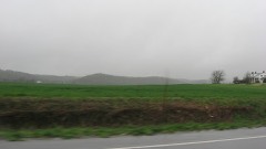 | Camp Mather-Camp Logan | building | 1998 | 98000983 |
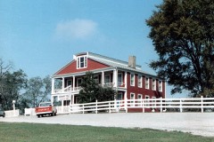 | Crenshaw House | building | 1985 | 85001164 |
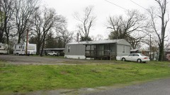 | Robert and John McKee Peeples Houses | building | 1983 | 83000317 |
 | State Bank | building | 1972 | 72000459 |
Every wildfire the federal occurrence database records inside this county: 33 of them, burning about 586 acres. None started naturally and 6 were recorded as arson. Each settlement page carries the fires within five miles of it.
| Reported cause | Fires |
|---|---|
| Missing data/not specified/undetermined | 14 |
| Debris and open burning | 6 |
| Arson/incendiarism | 6 |
| Smoking | 3 |
| Recreation and ceremony | 2 |
| Power generation/transmission/distribution | 1 |
| Equipment and vehicle use | 1 |
The five largest, by the area the report gives. Two of them were set deliberately.
| Date | Cause | Size | Reported by | Name on the report |
|---|---|---|---|---|
| 21 October 2020 | Equipment and vehicle use | 178 acres | Illinois Division of Forestry Resources | 202048 |
| 14 October 2020 | Missing data/not specified/undetermined | 176 acres | Shawnee National Forest | KEDRON WF |
| 8 November 2001 | Arson/incendiarism | 55 acres | Shawnee National Forest | HILL CEMETARY |
| 3 March 2020 | Debris and open burning | 50 acres | Illinois Division of Forestry Resources | 202012 |
| 26 February 1995 | Debris and open burning | 42 acres | Shawnee National Forest | BROUILETTE |
| 10 April 2000 | Debris and open burning | 11 acres | Shawnee National Forest | ROSE CREEK |
| 25 February 1995 | Arson/incendiarism | 10 acres | Shawnee National Forest | STACEY |
| 15 August 2007 | Missing data/not specified/undetermined | 10 acres | Shawnee National Forest | OTHER FIRE 2 |
Every settlement page carries the fires within five miles of it - see the settlement index below.
The NOAA Storm Events Database holds 240 reports for this county, causing no deaths, 13 injuries and about $7,672,030 in recorded property damage. Each settlement page carries the reports that name it.
| Kind of event | Reports |
|---|---|
| Flood | 96 |
| Thunderstorm Wind | 65 |
| Hail | 31 |
| Flash Flood | 22 |
| Tornado | 12 |
| Heavy Rain | 9 |
| Funnel Cloud | 3 |
| Lightning | 2 |
The most serious of them, by death, then injury, then recorded damage. The accounts are quoted exactly as the forecast office filed them.
| When | Event | Place named | Harm | What the report says |
|---|---|---|---|---|
| February 2012 | Tornado (EF4) | Equality | 13 hurt, $1,000,000 | The tornado crossed into Gallatin County from Saline County in the vicinity of Illinois Highway 142. The tornado moved east-northeast through very sparsely populated farm country before striking Ridgway directly. In Ridgway, the tornado damaged about 140 homes and businesses, causing one critical injury and about a dozen relatively minor injuries. Numerous cars were tossed around, mainly on the east side of Ridgway. A large historic church was completely destroyed. Hundreds of large trees were snapped or uprooted, along with many power lines down. A half dozen grain bins were destroyed. The tornado lifted about 4 miles east-northeast of Ridgway. The average path width was 275 yards. Peak winds were estimated near 180 mph. |
| April 2011 | Thunderstorm Wind | Ridgway | $2,000,000 | A large swath of very damaging straight-line winds, associated with a bow echo on radar, affected north and east Gallatin County. The damage swath was mostly over sparsely populated farm country, except where it struck New Haven. Winds were estimated around 90 mph over much of the area. Some barns were destroyed or damaged, including partial loss of roofs and walls. Grain storage equipment was damaged, including upending and destruction of several grain bins. One grain bin was blown into vehicles and onto a house, damaging the house roof. Some metal storage sheds were damaged or destroyed. Many large trees were uprooted, and a number of large tree trunks were snapped. There was shingle, siding, and antenna damage at some residences. One mobile home was shifted off piers and one was overturned. Utility pole crossarms were snapped, and poles were blown over. |
| March 2008 | Flood | Ridgway | $1,200,000 | Much of the flooding was due to a combination of backwater from the Ohio River and tremendous runoff from inland areas. The emergency management director reported that flooding in Old Shawneetown was the worst since 1964. All but the eastern part of town was flooded. About 20 families evacuated flooded parts of the county. Near Ridgway, firefighters rescued three children who were boating in floodwaters. The boat was taking on water, and the children were bailing water. Sandbagging was done to protect property in Equality and Junction. The Saline River was the primary cause of flooding there. A State of Emergency was declared for the county. Old Shaweetown was closed to all traffic except emergency local traffic. |
| May 2011 | Flood | Shawneetown | $400,000 | Major flooding continued on the Ohio River from April. At the Shawneetown river gage, the flood crest of 56.37 feet on the afternoon of May 6 was about two feet higher than the 1997 flood. This was still over nine feet lower than the record crest set in 1937. Sandbagging operations and some evacuations were conducted in Old Shawneetown, Equality, Junction, and New Haven. These communities are all affected by the Ohio River or its backwater coming up the Saline River. In Equality, floodwaters were four feet high in a church. At least several homes were inundated. In Junction, water was three to four feet deep in one house. About a dozen other homes in Junction were under one to three feet of water. The sewer plants in New Haven and Equality were endangered by flooding. Pumps in Old Shawneetown were overwhelmed by rainwater runoff collecting on the dry side of the levee. This was responsible for considerable flooding in Old Shawneetown even before the Ohio River crested. A number of roads were closed, including the main road into Junction and Route 1. All roads into Old Shawneetown were blocked by authorities to prevent looting and interference from sightseers. A Red Cross shelter was opened in Shawneetown. |
| May 2011 | Thunderstorm Wind | Equality | $400,000 | A microburst with estimated peak winds near 90 mph struck the south side of Equality and continued northeast to the intersection of Highways 13 and 1. The path width averaged about one-half mile. Two mobile homes were destroyed and a barn was levelled on the south side of Equality. A section of metal roof about 250 feet long was blown off the county high school near the intersection of Illinois Routes 13 and 1. Several other homes sustained mainly minor roof damage. Trees and tree limbs were blown down throughout the area. |
| March 2018 | Flood | Shawneetown | $300,000 | Moderate flooding continued on the Ohio River from late February. At the Shawneetown river gage, the river crested at 52.10 feet on March 4. Flood stage there is 33 feet. This flood crest was within a couple of inches of the January, 2005 flood. Isolated evacuations of some lowland residents were conducted. The community of Old Shawneetown was threatened, resulting in sandbagging and levee patrols. Very little if any structural flooding was reported in Old Shawneetown. A tributary of the Ohio River, the Saline River, experienced major backwater flooding extending across Gallatin County to Saline County. Isolated homes were accessible only by boat in areas around Junction, Equality, and New Haven. Isolated barns and outbuildings were flooded in the Junction and Equality areas. The Junction post office was temporarily moved to Shawneetown. About 40 roads were closed in Gallatin County, including Illinois Route 1 south of Route 13. |
| May 2011 | Tornado (EF1) | Equality | $250,000 | Several homes and buildings sustained minor to moderate damage in the Junction and Shawneetown areas. Several barns or sheds were destroyed, and many dozens of trees were uprooted or snapped. Several trained spotters reported seeing a funnel cloud in the Shawneetown area. Peak winds were estimated near 105 mph. The average path width was 150 yards. |
| May 2004 | Thunderstorm Wind | Countywide | $250,000 | no account filed |
| April 2011 | Flood | Shawneetown | $200,000 | Sandbagging operations and some evacuations were conducted in Old Shawneetown, Equality, Junction, and New Haven. These communities are all affected by the Ohio River or its backwater coming up the Saline River. Pumps in Old Shawneetown were overwhelmed by rainwater runoff collecting on the dry side of the levee. This was responsible for considerable flooding in Old Shawneetown even before the Ohio River crested. A number of roads were closed, including the main road into Junction and Route 1. All roads into Old Shawneetown were blocked by authorities to prevent looting and interference from sightseers. A Red Cross shelter was opened in Shawneetown. |
| April 2024 | Tornado (EF1) | Cottonwood | $110,000 | An EF-1 tornado impacted far northeast Gallatin County, IL during the early morning hours of Tuesday, April 2nd. The tornado began in the Cottonwood community along Noel Road. Here, several large trees were uprooted, one crushing a small brick building. One manufactured home was severely damaged and a nearby outbuilding had a part of its roof removed. Moving eastward the tornado did mainly tree damage as it passed south of the community of New Haven. The tornado crossed the Wabash River into Posey County, IN, just south of the confluence of the Little Wabash and Wabash Rivers. Estimated peak winds for this tornado path as a whole and for Gallatin County were 100 mph. |
| June 2018 | Thunderstorm Wind | Omaha | $100,000 | Widespread wind damage occurred across the county. Numerous trees and power lines were down. The roof was blown off the county high school. |
| June 2011 | Lightning | Shawneetown | $100,000 | A lightning strike was suspected as the cause of a fertilizer warehouse fire in Old Shawneetown. The building was a total loss. Lightning was the prime suspect because a power pole next to the building appeared to have been struck. |
| May 1996 | Flash Flood | Shawneetown | $100,000 | no account filed |
| April 1996 | Flash Flood | Shawneetown | $100,000 | no account filed |
| April 2024 | Tornado (EF1) | Inman | $80,000 | A brief EF-1 tornado occurred in eastern Gallatin County during the early morning hours of Tuesday, April 2nd. The tornado began about five miles east of Ridgway along Maloney Road. A couple of large farm outbuildings had significant portions of their roofs removed, with debris tossed hundreds of feet. A cattle feed barn was knocked down. One home on Maloney Road suffered shingle damage. After crossing Big Hill Road, the tornado lifted just west of the intersection of Hulda Lake Road and Sand Road. Several trees along the path were uprooted or had large limbs broken. Peak winds were estimated at 95 mph. |
| April 2024 | Tornado (EF1) | Ridgway | $80,000 | A brief EF-1 tornado impacted the west side of Ridgway, IL, during the early morning hours of Tuesday, April 2nd. The tornado began just south of Main Street along St. Joseph Road, where one home suffered minor roof damage and several large tree limbs were downed. Moving northeast, the tornado damaged a grain bin just south of Main Street and collapsed an outbuilding just north of Main Street. The tornado did limited tree damage in the city park before lifting near the intersection of City Park Drive and Murphy Street. Peak winds were estimated at 90 mph. |
| April 2006 | Thunderstorm Wind | Ridgway | $60,000 | The roofs of several buildings were damaged, including those of a funeral home and a gym. At a church downtown, about a third of the parish center roof was blown off, and several windows and doors were blown out. A board that was blown through a window was impaled in the wall of a Sunday school room. The siding was ripped off one side of a hardware store. Scattered trees and large tree limbs were down on the properties of the damaged buildings. |
| May 1999 | Thunderstorm Wind | Shawneetown | $60,000 | In Shawneetown, thunderstorm winds downed several large trees measuring 12 to 14 inches in diameter. Some of the trees fell on homes and a truck. Siding and roofing damage occurred to a few houses. The damage occurred over a three-block area. Six miles northeast of Ridgway, several large trees were down. Power poles were down at Old Shawneetown and Junction. |
| January 2008 | Thunderstorm Wind | Shawneetown | $50,000 | The roof was blown off of a tool shop in the community of Shawneetown. At Ridgway, power lines were down, and a mobile home was blown off its foundation. |
| July 2006 | Thunderstorm Wind | Countywide | $50,000 | Trees and power lines were down throughout the county. The worst damage was in New Haven, where lots of trees were down, including many on roads. A power pole was down. Siding was torn off a house. |
| November 2005 | Flash Flood | Countywide | $50,000 | Flooding of roads occurred, including a few that were washed out. |
| July 1994 | Thunderstorm Wind | not stated | $50,000 | A rapidly moving thunderstorm produced widespread damage. Numerous trees were blown down with several reports of power outages. |
| March 2011 | Flood | Shawneetown | $50,000 | no account filed |
| May 2024 | Thunderstorm Wind | Ridgway | $45,000 | Significant tree damage occurred in Ridgway with roof damage to multiple homes as a result of straight-line winds moving through Gallatin County. |
| June 2021 | Thunderstorm Wind | Cottonwood | $40,000 | Several power poles were downed off Highway 141 west of New Haven. Widespread crop damage from wind and some hail was observed across eastern parts of Gallatin County between Highway 1 and the Ohio River. |
| May 2018 | Thunderstorm Wind | Junction | $40,000 | Several power poles were blown down. Multiple trees were down. A pivot irrigation unit was blown over. |
| May 2025 | Tornado (EF2) | Kedron | $35,000 | An EF-2 tornado, with estimated peak winds of 115mph for the Gallatin County portion of the tornado and the tornado as a whole, began in far southeast Saline County and then crossed into southern Gallatin County along a 10 mile path. The most severe damage occurred near the start of the path along Gape Hollow Road, Forest Road, and Barrett Cemetery Roads, where several trees were snapped and wooden power poles were broken. The tornado then weakened to EF-0 intensity as it moved east across|IL-1 near the Gibsonia community. The tornado lifted shy of of the Ohio River at Jester Road. This was the third tornado to be produced by the supercell that had developed the Williamson County EF-4 tornado earlier in the evening. |
| May 2011 | Flood | Equality | $30,000 | no account filed |
| August 2023 | Thunderstorm Wind | Ridgway | $25,000 | There were numerous reports of trees and power lines down. Nearly 900 customers were without power. |
| June 2021 | Thunderstorm Wind | Shawneetown | $25,000 | In and just south of Shawneetown, at least a half dozen trees were snapped or uprooted. Two large trees fell over power lines. Numerous large limbs were blown down. One 30-foot limb grazed a garage. |
| January 2016 | Flood | Shawneetown | $25,000 | Moderate flooding along the Ohio River continued into January. At the Shawneetown gage, the river crested at 45.25 feet on the 4th. This flood was very similar to the flood of May, 2002, when the crest was 45.42 feet. Flood stage there is 33 feet. The main consequence was numerous flooded secondary roads. There was considerable flooding of low-lying agricultural land. Since the land was mostly unplanted, crop damage was insignificant. Levees protect large parts of the county. Seepage water was pumped out of Old Shawneetown, which has been largely vacated in recent decades after major floods caused heavy damage. |
| April 2015 | Thunderstorm Wind | Equality | $25,000 | Numerous trees and power lines were down between the communities of Equality and Shawneetown. This swath of wind damage was associated with a small bow echo on radar. |
| April 1972 | Tornado (F1) | not stated | $25,000 | no account filed |
| March 1963 | Tornado (F3) | not stated | $25,000 | no account filed |
| May 2024 | Thunderstorm Wind | Cottonwood | $20,000 | Significant tree damage occurred in New Haven as evening storms moved through Gallatin County. |
| July 2020 | Lightning | Shawneetown | $20,000 | A house was struck by lightning, starting a fire. |
| February 2019 | Flood | Shawneetown | $20,000 | Moderate flooding of the Ohio River occurred. At the Shawneetown gage, the river crested at 48.96 feet on February 20. Flood stage there is 33 feet, and moderate flooding begins at 43 feet. The community of Old Shawneetown was threatened, but most of this community has been abandoned since the devastating flood of 2011. Very little if any structural flooding was reported in Old Shawneetown. There was considerable flooding of low-lying agricultural land. Numerous county roads were closed. Backwater flooding extended up the Saline River, affecting low ground from Junction to Equality. |
| September 2001 | Thunderstorm Wind | Shawneetown | $20,000 | Roofs were peeled off three businesses, including a tavern and convenience store. Numerous trees were blown down. |
| November 1998 | Tornado (F0) | Junction | $20,000 | A weak, short-lived tornado was witnessed by a sheriff deputy and two residents of the community. The damage path, which was 800 feet long and 400 feet wide, was marked by uprooted trees and overturned campers. |
| July 1996 | Thunderstorm Wind | Junction | $20,000 | no account filed |
| June 2018 | Thunderstorm Wind | Omaha | $15,000 | Trees and power lines were down across far northern Gallatin County from Omaha eastward to the Wabash River. |
| May 2011 | Thunderstorm Wind | Ridgway | $10,000 | Several power poles were blown down. |
| March 2006 | Thunderstorm Wind | Equality | $10,000 | Downed power poles were reported on Route 1 just south of Route 13. |
| May 2006 | Thunderstorm Wind | Ridgway | $10,000 | In New Haven Township, a half dozen irrigation units were blown over and damaged or destroyed. |
| October 2001 | Thunderstorm Wind | Omaha | $10,000 | Roofs and barns were damaged in the northern part of the county, near Omaha. |
| June 1998 | Flash Flood | Shawneetown | $10,000 | no account filed |
| July 2016 | Thunderstorm Wind | Junction | $7,000 | Some trees and power lines were down in Junction and Shawneetown. |
| May 2000 | Thunderstorm Wind | Ridgway | $7,000 | Five power poles were snapped off. |
| February 2025 | Flood | Inman | $5,000 | Minor flooding of bottomland and surrounding low-lying areas occurred near Shawneetown continuously through the end of the month and into early March. Moderate flooding closed several county roads from the 21st through the 26th, when the river rose to a crest of 44.7 feet which was above the moderate flood stage of 43 feet. |
| July 2016 | Flash Flood | Equality | $5,000 | Highway 142 was impassable near the Saline County line. A car was stuck in floodwater on Illinois Route 142 near Equality. Numerous state roads in Gallatin County were partially covered with water. |
| July 2012 | Thunderstorm Wind | Ridgway | $5,000 | Power lines were blown down. |
| May 1999 | Thunderstorm Wind | Ridgway | $5,000 | Gusts to 60 MPH downed tree limbs and power lines. |
| June 1999 | Thunderstorm Wind | Countywide | $5,000 | Large branches were down across the county. |
| July 1997 | Thunderstorm Wind | Omaha | $5,000 | Trees and power lines were down in northwest Gallatin County. |
| March 2021 | Flood | Saline Mines | $4,000 | Moderate flooding occurred on the Ohio River. At the Shawneetown river gage, the river crested at 45.25 feet. Flood stage is 33 feet. Considerable flooding of fields occurred, and some rural secondary roads were affected in the flood plain. |
| June 2011 | Thunderstorm Wind | Ridgway | $4,000 | A large pine tree was blown over. Another small tree was blown down. A dog pen and lawn furniture were blown over. |
| May 2006 | Thunderstorm Wind | Shawneetown | $4,000 | Several trees and power lines were down. |
| August 2005 | Thunderstorm Wind | Countywide | $4,000 | Several trees and power lines were blown down across the county. |
| April 1997 | Thunderstorm Wind | Shawneetown | $4,000 | no account filed |
| July 2023 | Thunderstorm Wind | Shawneetown | $3,000 | A large tree fell down onto a road. Minor damage occurred to a canopy near Ridgway. |
The Survey's mineral resources record lists 7 workings inside this county. 1 still produces and 6 are closed or unrecorded. Each settlement page carries the workings within five miles of it.
| Commodity | Workings |
|---|---|
| Sand and Gravel, Construction | 5 |
| Stone, Crushed/Broken | 2 |
The least common of them first, because a county's hundredth gravel pit says nothing its first ten did not.
| Where | Site | Commodity | Status | Recorded |
|---|---|---|---|---|
| High Knob Sandstone Exposure | Stone, Crushed/Broken | Prospect | ||
| Limestone Prospect | Stone, Crushed/Broken | Occurrence | ||
| Delta Dredge | Sand and Gravel, Construction | Producer | ||
| Gallatin County Pit | Sand and Gravel, Construction | Past Producer | ||
| Shawnee High Interest Sand and Gravel Deposit | Sand and Gravel, Construction | Occurrence | Sand and Gravel | |
| Tradewater Dredge 1 & 2 | Sand and Gravel, Construction | Past Producer | ||
| Wentzel Pit | Sand and Gravel, Construction | Past Producer |
Named settlements recorded in the Geographic Names Information System, each with the topographic sheets covering it. Villages, hamlets and abandoned places alike. Each is shown with the nearest named watercourse or landform and the survey quadrangle it falls on.
Bowlesville township · 62984 · Near Gold Hill · Shawneetown quadrangle
23 sheets, 1916 to 1996
No longer a settlement
Equality township · 62934 · On Cockerel Branch · Equality quadrangle
22 sheets, 1916 to 1996
Bowlesville township · 62954 · On Eagle Creek · Equality quadrangle
22 sheets, 1916 to 1996
Eagle Creek township · 62934 · Near Burnt Shanty Hollow · Equality quadrangle
22 sheets, 1916 to 1996
Eagle Creek township · 62954 · On Hutt Creek · Equality quadrangle
22 sheets, 1916 to 1996
Ridgway township · 62979 · New Haven SW quadrangle
19 sheets, 1905 to 1987
No longer a settlement
Shawnee township · 62984 · On Millrace Slough · Shawneetown quadrangle
23 sheets, 1916 to 1996
The vanished settlements of Gallatin County: the places named above that are no longer on the map.