 Block
Algonquin, Illinois
19 topographic sheets cover this place, the earliest surveyed in 1925 and the latest in 1992. It stands in Algonquin Township. It lies in ZIP code area 60102. It stands on Crystal Lake Outlet. The Survey maps it on the Crystal Lake quadrangle. 29,700 people lived here at the 2020 count. It stands 883 feet above sea level.
On record in Algonquin
Buildings and businesses the archive holds for this place. Each opens its own page, with the source record it came from.
On the National Register 1 record
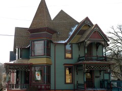 Christian Geister Houselisted 2007
Population over time
2 figuresAlgonquin fell from 30,046 to 29,700 between 2010 and 2020. These are the recorded population figures Wikidata holds for this place, reached through the Geographic Names Information System number this page is keyed on rather than by name, so they belong to this place and not to another of the same name. Most are census counts, but not all are: an early figure may be a founding or settlement estimate, and an estimate published within five years of a census is left out. The change column is computed, and is left blank where more than 20 years separate a figure from the one before it, because a gap that long is not a change between two counts.
| Year | People | Change |
|---|---|---|
| 2010 | 30,046 | |
| 2020 | 29,700 | -346 (-1%) |
Topographic sheets covering this place
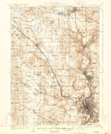
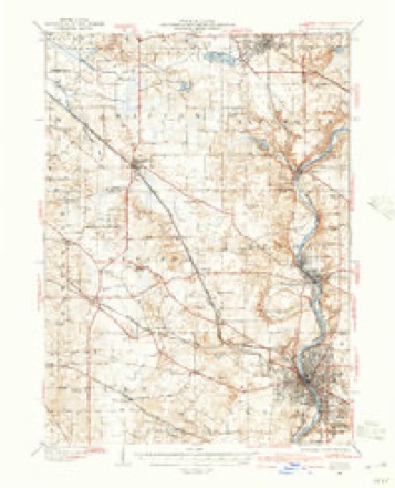
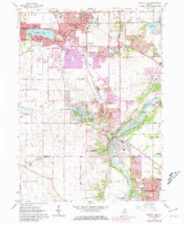
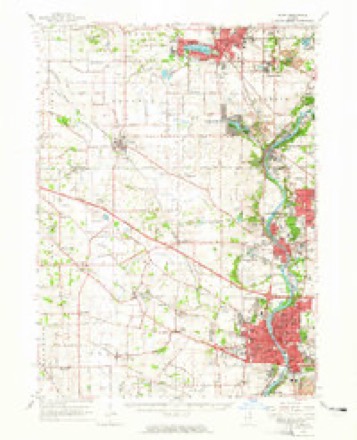
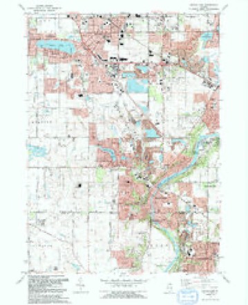
10 surveys from 19 printed sheetsMatched by testing this settlement's coordinate against the published boundary of every sheet in the United States Geological Survey's historical collection. Each opens the scanned sheet at the Survey.
- 1925 USGS Elgin quadrangle1:62500, 4 printings
- 1940 USGS Elgin quadrangle1:62500
- 1954 USGS Rockford quadrangle1:250000
- 1955 USGS Rockford quadrangle1:250000
- 1958 USGS Rockford quadrangle1:250000, 4 printings
- 1962 USGS Crystal Lake quadrangle1:24000, 4 printings
- 1962 USGS Elgin quadrangle1:62500
- 1963 USGS Rockford quadrangle1:250000
- 1981 USGS Elgin quadrangle1:100000
- 1992 USGS Crystal Lake quadrangle1:24000





In the county-history sources
16,941 words on this townshipHistory of McHenry County, Illinois : Together with Sketches of Its Cities, Villages and Towns : Educational, Religious, Civil, Military, and Political History : Portraits of Prominent Persons, and Biographies of Representative Citizens, Also a Condensed History of Illinois .., published 1885 names this settlement in its chapter on Algonquin Township. These are the passages that mention it, exactly as the scans read.
This township is perhaps more broken than any other in the county. While its general surface features are comparatively level there are many bluffs and hills to be found in the vicinity of Algonquin Village and along the Fox River. The township is nearly equally divided in prairie, timber and bottom lands, thus furnishing alike advantages to the stock and grain grower. In section 6 lies the noted Crystal Lake which extends across into Grafton Township. The outlet to this lake furnishes quite a valuable stream which courses its way through the township in a southeasterly direction till it joins the Fox River at Algonquin Village. Big Spring Creek running across the southeast corner of the township, also furnishes fine water privileges for stock. The placid stream known as Fox River, with its low banks, resembling the River Nile in its calm, steady flow through the low lands, passes through this township in a southwesterly direction, entering on section 17, range 8, and passing out on section 3L
Passage source: History of McHenry County, Illinois : Together with Sketches of Its Cities, Villages and Towns : Educational, Religious, Civil, Military, and Political History : Portraits of Prominent Persons, and Biographies of Representative Citizens, Also a Condensed History of Illinois .., published 1885.
This township has more miles of railroad than any other in the county. The main line of the Chicago & Northwestern, crosses it in almost a direct northwesterly direction, crossing six sections. The Fox River branch of the same road runs through the west side of the township, running the entire length of it.
Passage source: History of McHenry County, Illinois : Together with Sketches of Its Cities, Villages and Towns : Educational, Religious, Civil, Military, and Political History : Portraits of Prominent Persons, and Biographies of Representative Citizens, Also a Condensed History of Illinois .., published 1885.
The name Algonquin was suggested as being appropriate by Samuel Edwards, from Philadelphia, who had at one time been a sailor on a boat called the Algonquin. This name was accepted by the citizens of that township, at a meeting held for that purpose. Prior to this it was called Fox Precinct.
Passage source: History of McHenry County, Illinois : Together with Sketches of Its Cities, Villages and Towns : Educational, Religious, Civil, Military, and Political History : Portraits of Prominent Persons, and Biographies of Representative Citizens, Also a Condensed History of Illinois .., published 1885.
Machine-read from a century-old scan, so expect the errors a machine makes: misspelled names, dropped words, stray characters.
Read the whole chapter on Algonquin Township - it names this place 34 more 34 times.
Fires near this place
1 since 2009Regional context, not property-specific evidence. The federal wildfire occurrence database lists 1 fire within 5 miles of Algonquin in 2009, burning about 3 acres in total. None started naturally. None was recorded as arson. Distance is straight-line from the map coordinates, so a fire counted here may appear on a neighbouring settlement's page as well.
| Reported cause | Fires |
|---|---|
| Missing data/not specified/undetermined | 1 |
The most recent of them, most recent first, with the day each was reported and the service that recorded it.
| Date | Cause | Size | Reported by | Name on the report |
|---|---|---|---|---|
| 17 February 2009 | Missing data/not specified/undetermined | 3.0 acres | Illinois Division of Forestry Resources | D |
Settlements close enough to share some of these fires:
Mines and quarries near this place
10 within 5 milesRegional context, not property-specific evidence. The federal mineral resources record lists 10 workings within 5 miles of Algonquin: 6 producers, 4 past producers. 6 still produce. What was taken out: Sand and Gravel, Construction. Distance is straight-line from the map coordinates, so a quarry counted here may appear on a neighbouring settlement's page as well.
| Where | Site | Commodity | Status | Recorded |
|---|---|---|---|---|
| Algonquin Pit #5 | Sand and Gravel, Construction | Producer | ||
| Algonquin Plant | Sand and Gravel, Construction | Past Producer | ||
| Algonquin Sand & Gravel | Sand and Gravel, Construction | Producer | ||
| Carpentersville Pit #25 | Sand and Gravel, Construction | Producer | ||
| Cary Plant & Portable Mill | Sand and Gravel, Construction | Past Producer | ||
| Crystal Lake Sand & Gravel Pit | Sand and Gravel, Construction | Producer | ||
| Dundee Pit Meyer Material | Sand and Gravel, Construction | Producer | ||
| Dundee Pit Road Mat'Ls Corp | Sand and Gravel, Construction | Producer | ||
| Hoffman Pit | Sand and Gravel, Construction | Past Producer | ||
| Steffen Brothers Pit | Sand and Gravel, Construction | Past Producer |
Storms near this place
31 since 1997Regional context, not property-specific evidence. The National Weather Service names Algonquin in 31 storm reports between 1997 and 2025: 17 thunderstorm wind, 13 hail, 1 funnel cloud. No death or injury is recorded in these reports. Each account below is quoted exactly as the forecast office filed it, from the NOAA Storm Events Database, and each date opens the federal record of that event.
| When | Event | Place named | Harm | What the report says |
|---|---|---|---|---|
| July 2008 | Hail | Algonquin | $50,000 | Extensive siding damage to homes was reported from wind blown hail. |
| June 2017 | Thunderstorm Wind | Algonquin | $1,000 | Trees and power lines were blown down. |
| August 2025 | Thunderstorm Wind | Algonquin | - | A tree was down onto 3 cars along Webster St in Algonquin. |
| August 2025 | Thunderstorm Wind | Algonquin | - | Large branches were broken from the tops of trees near Main St and Cary Rd in Algonquin. |
| July 2024 | Thunderstorm Wind | Algonquin | - | Tree damage was reported north of Algonquin. |
| July 2024 | Thunderstorm Wind | Algonquin | - | A tree was uprooted in the Algonquin Lakes Subdivision near Algonquin Road and Lake Cook Road. |
| August 2024 | Thunderstorm Wind | Algonquin | - | Photos shared via social media showed several trees and a light pole down around the Algonquin and Lake of the Hills area including one large tree that fell onto a shed. Minor roofing and siding damage to one building was also noted. |
| March 2022 | Thunderstorm Wind | Algonquin | - | An 8 inch diameter tree limb was blown down. |
| July 2022 | Thunderstorm Wind | Algonquin | - | A tree was snapped. |
| July 2021 | Thunderstorm Wind | Algonquin | - | A photo shared on social media showed large tree limbs blown down across a driveway. |
| August 2021 | Thunderstorm Wind | Algonquin | - | Numerous trees and power lines were blown down. |
| August 2021 | Thunderstorm Wind | Algonquin | - | A tree was uprooted and another tree was snapped. |
| May 2020 | Funnel Cloud | Algonquin | - | A funnel cloud was reported near Algonquin. |
| June 2020 | Thunderstorm Wind | Algonquin | - | Large tree limbs were blown down onto a car. |
| November 2020 | Thunderstorm Wind | Algonquin | - | Trees, tree limbs and power lines were blown down across portions of southeast McHenry County. |
| June 2017 | Thunderstorm Wind | Algonquin | - | Wind gusts were estimated to 60 mph. |
| April 2016 | Hail | Algonquin | - | Quarter to half dollar size hail was reported in Algonquin, including quarter size hail near the intersection of Route 31 and Algonquin Road. |
| April 2014 | Hail | Algonquin | - | Several reports of one to two inch diameter hail came in from Algonquin. |
| September 2005 | Hail | Algonquin | - | Penny to quarter size hail reported near Route 31 and Route 62. |
| May 2004 | Thunderstorm Wind | Algonquin | - | A 6-inch diameter tree limb was blown down and blocking traffic on Route 62. |
| August 2025 | Thunderstorm Wind | Algonquin | - | no account filed |
| April 2023 | Hail | Algonquin | - | no account filed |
| August 2015 | Hail | Algonquin | - | no account filed |
| August 2011 | Hail | Algonquin | - | no account filed |
| June 2008 | Hail | Algonquin | - | no account filed |
| May 2003 | Hail | Algonquin | - | no account filed |
| October 2001 | Hail | Algonquin | - | no account filed |
| September 2000 | Thunderstorm Wind | Algonquin | - | no account filed |
| May 2000 | Hail | Algonquin | - | no account filed |
| May 1998 | Hail | Algonquin | - | no account filed |
| August 1997 | Hail | Algonquin | - | no account filed |
Nearest settlements
The eight closest, with where each one stands in the county. Distances are straight-line, computed from the Geographic Names Information System coordinates.
| Map | Place | Distance | Sheets |
|---|---|---|---|
| Camp Algonquin | 1.8 miles | 19 | |
| Lake in the Hills | 2.2 miles | 19 | |
| Haegers Bend | 2.4 miles | 19 | |
| Turner Camp | 2.8 miles | 19 | |
| Trout Valley | 3.1 miles | 19 | |
| Crystal Manor | 4.0 miles | 19 | |
| Cary | 4.4 miles | 19 | |
| Fox River Grove | 4.9 miles | 19 |
Elsewhere
Matched on this settlement's Geographic Names Information System number rather than its name, so it cannot be a different place of the same name in another state.
| Wikipedia article on Algonquin | An encyclopaedic summary. Its text is share-alike, so it is linked here rather than copied. |
| Wikidata item Q328446 | The structured record the population and elevation above come from. Public domain (CC0). |
Provenance
This settlement is recorded in the Geographic Names Information System as feature 403406. The sheet list is computed by point-in-boundary test against the United States Geological Survey's historical topographic inventory. Both are works of the United States government and carry no copyright under 17 U.S.C. 105.
Wildfire. Short, Karen C. 2022. Spatial wildfire occurrence data for the United States, 1992-2020 [FPA_FOD_20221014]. 6th Edition. Fort Collins, CO: Forest Service Research Data Archive. https://doi.org/10.2737/RDS-2013-0009.6 Collected with United States Government funding and usable without additional permissions or fees.
Mines and quarries. USGS Mineral Resources Data System (MRDS) https://mrdata.usgs.gov/mrds/ A work of the United States government, no copyright under 17 U.S.C. 105.
Storms. NOAA National Centers for Environmental Information, Storm Events Database https://www.ncei.noaa.gov/stormevents/ A work of the United States government, no copyright under 17 U.S.C. 105. Narratives are quoted verbatim from the National Weather Service report and are not edited or summarised.