| April 1965 | Tornado (F4) | not stated | 6 killed, 75 hurt | no account filed |
| October 1958 | Tornado (F2) | not stated | 1 killed, $2,500,000 | no account filed |
| April 1967 | Tornado (F4) | not stated | 40 hurt, $25,000,000 | no account filed |
| April 1967 | Tornado (F4) | not stated | 3 hurt, $2,500,000 | no account filed |
| July 1992 | Thunderstorm Wind | not stated | 2 hurt | no account filed |
| January 2008 | Tornado (EF3) | Chemung | 1 hurt, $2,000,000 | A tornado touched down at 330 pm CST about 1.2 miles north of Poplar Grove in Boone County and ended at 348 pm about 3.2 miles north northeast of Harvard in McHenry County. The tornado crossed the Boone McHenry County line near Hunter Road, about 2.1 miles west northwest of Chemung. The tornado crossed Hunter Road into McHenry County and continued to track northeast across Ryan Road as an EF0 and caused mainly minor tree damage. It crossed White Oaks Road then it uprooted a hardwood tree and snapped off pine trees at their base along Maxon Road. This damage continued to be EF0 damage with winds estimated to 80 mph. The tornado intensified as it moved toward the town of Lawrence, where it produced the worst damage in McHenry County. Significant damage occurred in the town of Lawrence, particularly at a house that had more than half of its roof ripped off and garage blown down. The tornado then moved across the Chicago and Northwestern Railroad where it blew 12 railroad freight cars off of the track. The train was moving at the time the tornado hit it, so as the main engine stopped, the remaining cars on the track continued along it and slammed into the front part of the train. This caused a few more cars to derail, including one containing hazardous materials that caused the evacuation of the town of Lawrence. The damage in Lawrence was rated as EF2 with winds up to 110 mph. As the tornado moved east of Lawrence it once again started to weaken with some tree damage and shingles off of a few houses on the northeast side of town. It then ran along Oak Grove Road for a stretch where it produced EF1 damage with a hardwood tree snapped at its base and knocked over an old, weakly structured barn. The tornado headed across farm fields and headed for Highway 14 where it damaged a metal barn and sheared a few trees. As it crossed Highway 14, it flipped a semi-trailer and injured the driver at a truck stop weigh station. It continued across Oak Grove Road where it lifted. The maximum width of the tornado in McHenry County was around 50 yards. One injury was reported in McHenry County. |
| October 1959 | Tornado (F2) | not stated | 1 hurt, $250,000 | no account filed |
| June 2024 | Lightning | Marengo | 1 hurt | An employee of Nichols Farm and Orchard in Marengo was injured when he was struck by lightning. It's believed that lightning struck a tree and then traveled through the man who was nearby. He was transported to the hospital with minor to moderate injuries. |
| July 2017 | Flood | Mc Cullom Lake | $3,900,000 | Heavy rain fell across McHenry County and southeast Wisconsin between July 11th and July 13th which lead to major flooding along the Fox River. The river gage at the McHenry Lock & Dam crested at 7.60 feet on July 22nd, the second highest crest on record. Flood stage at the McHenry Lock & Dam is 4 feet. The river gage at the Algonquin Tailwater measured a record crest of 13.15 feet on July 24th. Flood stage at the Algonquin Tailwater is 9.5 feet. There were 557 homes affected with some amount of water from the river flooding. |
| August 2007 | Flash Flood | Woodstock | $500,000 | Intersection of Route 47 and 120 closed due to two feet of standing water. Willow and Clay Streets closed due to waist deep water. Police conducting rescues from stranded vehicles. Basement flooding was reported throughout Woodstock, and as many as 10 properties were flooded as a creek overflowed its banks in McHenry, IL. |
| August 2007 | Flood | Union | $500,000 | Flooding continued from heavy rain and flash flooding from earlier on August 7th. Boot Creek overflowed at Hemmingson Road. Picnic tables floating near a car barn in three feet of water. Water flowing over the railway station platform. Many streets are closed due to flooding in Union. Marengo measured 5.10 inches of rain and Woodstock measured 4.35 inches of rain. |
| June 2008 | Flood | Spring Grove | $250,000 | no account filed |
| August 1978 | Tornado (F2) | not stated | $250,000 | no account filed |
| April 1963 | Tornado (F2) | not stated | $250,000 | no account filed |
| July 2006 | Thunderstorm Wind | Crystal Lake | $200,000 | Extensive tree damage was reported across Crystal Lake. Numerous trees, tree limbs and power lines were blown down. One home on Crystal Beach Avenue was deemed uninhabitable because of tree damage. |
| August 1996 | Lightning | Woodstock | $200,000 | no account filed |
| July 2011 | Lightning | Fox River Grove | $175,000 | Lightning started a fire which destroyed the rood of a 2200 square foot home on Glenhurst Court. |
| July 2011 | Lightning | Fox River Grove | $175,000 | Lightning started a fire which destroyed the roof of a 2200 square foot home on Glenhurst Court. |
| April 2014 | Thunderstorm Wind | Marengo | $100,000 | Large grain augers were ripped from the top of grain bins, shingles were peeled off roofs, irrigation systems were blown over, and barns were blown down. A tree branch was reportedly lodged into the side of a house. |
| July 2007 | Lightning | Marengo | $100,000 | Lightning struck a two-story house starting a fire which caused signficant damage. |
| June 2009 | Tornado (EF1) | Woodstock | $75,000 | A tornado touched down near Highway 14 and Davis Road. At this location, several pine trees had large branches sheared and topped off with two of the trees partially uprooted. At this point the tornado was rated EF0 with winds estimated near 85 mph and a path width of 20 yards. The tornado continued northeast, crossing Highway 14, into a neighborhood where it increased in intensity and produced damage to structures and trees. Damage in the area was to a garage adjacent to a main house. This well built and fairly new garage was lifted and turned off of its foundation, which was securely bolted to a concrete finish. Damage at this location was rated EF1 with winds estimated near 100 mph and a path width of 75 yards. The tornado proceeded to move northeast through the neighborhood where it uprooted four old but healthy soft and hard wood trees. Just to the northeast of this neighborhood is a commercial district where the tornado produced damage to two buildings. Damage occurred to the roof of one building with the other building sustaining damage to one of its exterior walls. The wall was partially collasped but it was an older structure. EF1 damage was produced at this point with winds estimated near 100 mph and a path width of 30 yards. The tornado weakened as it moved northeast, producing damage to trees near and along Lake Road. The tornado appeared to have lifted with no other damage evident beyond this point. |
| October 2006 | Hail | Marengo | $75,000 | Walnut size hail dented houses and cars in Marengo. |
| June 2014 | Lightning | Oakwood Hills | $65,000 | Lightning struck a house and caused a fire in the attic on Ned Drive. |
| September 2018 | Lightning | Coral | $50,000 | A large barn in the 20000 block of Beck Road was burned to the ground after being struck by lightning. |
| September 2018 | Lightning | Huntley | $50,000 | A house in the 12000 block of Illinois Street was left uninhabitable after an attic fire was started by lightning. |
| July 2011 | Thunderstorm Wind | Huntley | $50,000 | In the Meadowbrook neighborhood, there were numerous houses with the siding ripped off. Multiple trees were uprooted or snapped at the base. One house on Waterford Lake had the chimney blown off. |
| June 2009 | Lightning | Crystal Lake | $50,000 | Lightning struck a house along Canterbury Drive and started a fire in the bathroom. The house was declared uninhabitable. |
| July 2008 | Hail | Algonquin | $50,000 | Extensive siding damage to homes was reported from wind blown hail. |
| August 2007 | Flash Flood | Union | $50,000 | Railway Museum flooded and evacuated, a trailer park and campground area was also flooded and evacuated. Water rose one foot in 20 minutes. |
| July 2007 | Lightning | Lake In The Hills | $50,000 | Lightning struck a house causing a fire in the attic, which sustained extensive damage. The rest of the house was uninhabitable. |
| July 2011 | Thunderstorm Wind | Terre Cotta | $30,000 | Large tree limbs and power lines were blown down north of Crystal Lake on Fox Trail and at Route 31 and Half Mile Road. Power lines were blown down in Bull Valley. Trees were also blown down in the Squaw Creek Ridge subdivision north of Hillside Road. Trees came down on two houses. |
| June 2008 | Thunderstorm Wind | Crystal Lake | $30,000 | An 80 foot tall tree was blown down near Everett Avenue. The tree severely damaged a garage with minor damage to its contents, including two motorcycles and a pickup truck. Numerous tree limbs were blown down across Crystal Lake. |
| August 2007 | Thunderstorm Wind | Woodstock | $30,000 | A 90 foot tall, 45 inch diameter tree was blown onto a house, causing significant damage to the roof, attic, a bathroom and a bedroom. |
| April 2010 | Thunderstorm Wind | Marengo | $25,000 | A barn was blown down. |
| June 2008 | Thunderstorm Wind | Lawrence | $25,000 | A barn was blown down with debris scattered across Lawrence Road. A 2-by-4 was stuck in the ground like a spear. |
| July 2011 | Thunderstorm Wind | Harvard | $20,000 | Numerous 12-inch diameter trees and power lines were blown down. Some trees were snapped. One tree fall onto a house. |
| July 2006 | Lightning | Crystal Lake | $20,000 | A home on Sadle Ridge Road was struck by lightning, which started a fire in the attic. |
| July 2011 | Thunderstorm Wind | Wonder Lake | $15,000 | A large limb was dislogded from a tree and broke through the siding of a house going into the master bedroom. No one was injured. |
| September 2018 | Thunderstorm Wind | Huntley | $10,000 | Hundreds of trees were blown down or damaged in southern McHenry County from Huntley to Cary including Lake In The Hills and Algonquin. There were at least 50 reports of power lines blown down and another 50 reports of trees or tree limbs blocking roads. |
| June 2011 | Lightning | Wonder Lake | $10,000 | Lightning struck a house in the 5300 block of East Wonder Lake Road and started a fire in the attic. |
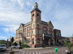
| July 2011 | Lightning | Woodstock | $10,000 | Lightning knocked ornamental stonework from the bell tower of the Woodstock Opera House. |
| July 2011 | Lightning | Richmond | $10,000 | Lightning struck a village pump house on Valley Drive melting wiring and destroying the water pump. |
| July 2011 | Lightning | Ringwood | $10,000 | Lightning struck a 40-foot oak tree which then fell onto a car, blowing out the rear window and heavily damaging the trunk and vinyl roof of the convertible. The tree also caused some damage to the roof and gutter of a garage. |
| July 2011 | Lightning | Richmond | $10,000 | A lightning strike ignited a fire in the steeple of a former church on Hill Road. There was slight damage to the roof and some water damage. |
| April 2010 | Thunderstorm Wind | Crystal Lake | $10,000 | Numerous trees, tree limbs, utility poles and power lines were blown down in many areas of Crystal Lake. |
| September 2001 | Lightning | Marengo | $10,000 | no account filed |
| September 2018 | Lightning | Highland Shrs | $5,000 | Lightning struck the attic of a duplex in the 600 block of Schubert Street with only very minor damage reported. |
| March 2012 | Lightning | Woodstock | $5,000 | Lightning struck a satellite dish on the roof of a building of condos, which started a fire in the attic. Only minor damage was reported and the condo remained habitable. |
| May 2011 | Hail | Crystal Lake | $5,000 | Walnut size hail was reported at the intersection of Main Street and Route 14 causing damage to cars. |
| April 2010 | Thunderstorm Wind | Huntley | $5,000 | A gust to 59 mph was measured in Huntley. Tree limbs, utility poles and power lines were blown down. |
| June 2008 | Lightning | Lake In The Hills | $5,000 | A house was struck by lightning on Heavens Gate Street. |
| July 2007 | Thunderstorm Wind | Huntley | $5,000 | A tree was blown down on a car at Route 20 and Harmony Road. |
| April 2006 | Hail | Marengo | $5,000 | Quarter size hail dented siding on a house and a vehicle. |
| July 2008 | Thunderstorm Wind | Cary | $3,000 | A light pole was blown down in a parking lot along Northwest Highway. The light pole struck four parked cars. |
| July 2012 | Thunderstorm Wind | Woodstock | $2,000 | Utility poles were snapped at Kimball Avenue and Bunker Street. |
| July 2011 | Thunderstorm Wind | Mc Henry | $2,000 | Downed trees caused damage to fences in some parts of McHenry. A Chevrolet Traverse had its windshield smashed. |
| June 2008 | Thunderstorm Wind | Marengo | $2,000 | Trees and power lines were blown down near Route 23 and Route 176. Some roads were impassible because of debris. |
| August 2018 | Thunderstorm Wind | Cary | $1,000 | Tree limbs and power lines were blown down. Some limbs were partially blocking roads. One tree limb was tangled in power lines. |
| June 2017 | Thunderstorm Wind | Mchenry | $1,000 | Trees and power lines were blown down. |
| June 2017 | Thunderstorm Wind | Algonquin | $1,000 | Trees and power lines were blown down. |
 Block