 Block
Arrowsmith, Illinois
12 topographic sheets cover this place, the earliest surveyed in 1952 and the latest in 1990. It stands in Arrowsmith Township. It lies in ZIP code area 61722. The Survey maps it on the Arrowsmith quadrangle. 276 people lived here at the 2020 count. It stands 882 feet above sea level.
Population over time
2 figuresArrowsmith fell from 294 to 276 between 2010 and 2020. These are the recorded population figures Wikidata holds for this place, reached through the Geographic Names Information System number this page is keyed on rather than by name, so they belong to this place and not to another of the same name. Most are census counts, but not all are: an early figure may be a founding or settlement estimate, and an estimate published within five years of a census is left out. The change column is computed, and is left blank where more than 20 years separate a figure from the one before it, because a gap that long is not a change between two counts.
| Year | People | Change |
|---|---|---|
| 2010 | 294 | |
| 2020 | 276 | -18 (-6%) |
Topographic sheets covering this place
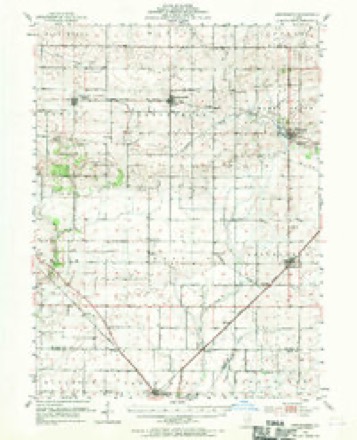
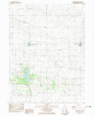
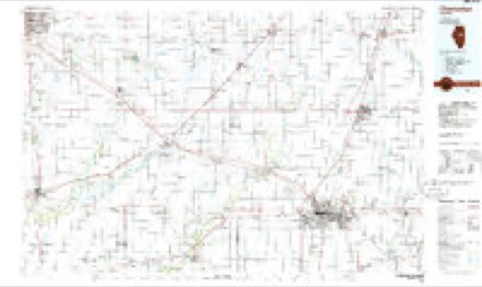
7 surveys from 12 printed sheetsMatched by testing this settlement's coordinate against the published boundary of every sheet in the United States Geological Survey's historical collection. Each opens the scanned sheet at the Survey.
- 1952 USGS Arrowsmith quadrangle1:62500, 2 printings
- 1958 USGS Peoria quadrangle1:250000, 4 printings
- 1961 USGS Peoria quadrangle1:250000
- 1963 USGS Peoria quadrangle1:250000
- 1983 USGS Arrowsmith quadrangle1:24000
- 1985 USGS Champaign quadrangle1:100000, 2 printings
- 1990 USGS Peoria quadrangle1:250000




In the county-history sources
15,513 words on this townshipTransactions of the McLean County Historical Society, published 1899 names this settlement in its chapter on Arrowsmith Township. These are the passages that mention it, exactly as the scans read.
Many of the prettiest and most striking floats represented outside townships: Arrowsmith by a stockade from the famous Indian battlefield in that township; Danvers, log cabin and rail splitter; Dale, old fashioned carriage drawn by horses; Funk's Grove, an old Victoria carriage; Dry Grove, pioneer camping scene in the woods; Towanda, corn display and golf girls; Mt. Hope, a huge milk bottle representing its dairy interest; Dawson, two ancient fiddlers; Anchor, Indian boy in canoe; Downs, float decorated in natural flowers; Blue Mound, group of farmers in typical attire representing agriculture, religion and military life; Old Town and Gridley, finely decorated floats.
Passage source: Transactions of the McLean County Historical Society, published 1899.
On the Jacob Smith farm two and one-half miles southeast of the village of Arrowsmith, McLean County, Illinois, are a few scattered trees. This is the remainder of what was formerly known as Little Grove, and is now known as Smith's Grove. The head waters of the Sangamon River flow along the south and southeast of this group of trees. To the north and northwest, there is a hill which rises to an elevation of about twenty feet above the level of the river. The first settlers of this community noticed that there were many depressions and ridges on the top of this knoll, and they were then supposed to be remains of Indian pits or caches. These were said to be irregularly shaped and irregularly placed with the greatest depth not over two and one-half feet from the tops of the ridges to the deepest part of the depressions.
Passage source: Transactions of the McLean County Historical Society, published 1899.
The following is an excerpt from a discussion of "The Arrowsmith Battle Ground" written by Captain John H. Burnham and published in the Transactions of the Illinois State Historical Society in 1908: "One beautiful day in May, 1897, a party consisting of several pioneers of eastern McLean County and a few of the members of the McLean County Historical Society made a very interesting exploration of the central attraction of the grove, and we shall never forget our intense interest as we made our discoveries. We dug into four or five of the dozen or fifteen of the pits or depressions, which were scattered irregularly over the acre of land at the top of the little knoll, and found the apparent bottoms of these pits at depths not exceeding three feet, and mostly two feet from
Passage source: Transactions of the McLean County Historical Society, published 1899.
Machine-read from a century-old scan, so expect the errors a machine makes: misspelled names, dropped words, stray characters.
Read the whole chapter on Arrowsmith Township - it names this place 9 more 9 times.
Fires near this place
2 since 2020Regional context, not property-specific evidence. The federal wildfire occurrence database lists 2 fires within 5 miles of Arrowsmith in 2020, burning about 5 acres in total. None started naturally. None was recorded as arson. Distance is straight-line from the map coordinates, so a fire counted here may appear on a neighbouring settlement's page as well.
| Reported cause | Fires |
|---|---|
| Debris and open burning | 1 |
| Missing data/not specified/undetermined | 1 |
The most recent of them, most recent first, with the day each was reported and the service that recorded it.
| Date | Cause | Size | Reported by | Name on the report |
|---|---|---|---|---|
| 30 July 2020 | Debris and open burning | under an acre | Illinois Division of Forestry Resources | 2020-0000012 |
| 2 November 2020 | Missing data/not specified/undetermined | 5.0 acres | Illinois Division of Forestry Resources | 2020-0000111 |
Settlements close enough to share some of these fires:
Mines and quarries near this place
1 within 5 milesRegional context, not property-specific evidence. The federal mineral resources record lists 1 working within 5 miles of Arrowsmith: 1 past producer. None of them still produces. What was taken out: Sand and Gravel, Construction. Distance is straight-line from the map coordinates, so a quarry counted here may appear on a neighbouring settlement's page as well.
| Where | Site | Commodity | Status | Recorded |
|---|---|---|---|---|
| Riddle Pit | Sand and Gravel, Construction | Past Producer |
Storms near this place
5 since 1999Regional context, not property-specific evidence. The National Weather Service names Arrowsmith in 5 storm reports between 1999 and 2024: 3 thunderstorm wind, 1 tornado, 1 hail. No death or injury is recorded in these reports. Each account below is quoted exactly as the forecast office filed it, from the NOAA Storm Events Database, and each date opens the federal record of that event.
| When | Event | Place named | Harm | What the report says |
|---|---|---|---|---|
| June 1999 | Thunderstorm Wind | Arrowsmith | $35,000 | As a line of severe storms moved northeast across eastern McLean County, numerous trees and power lines were blown down. Also, two sheds were destroyed near Anchor. Damage to the sheds was estimated around $35,000. |
| June 2024 | Thunderstorm Wind | Arrowsmith | - | Numerous trees were damaged and one large tree was blown down. |
| October 2021 | Thunderstorm Wind | Arrowsmith | - | An outbuilding was damaged, with wood and sheet metal strewn downstream. Corn crops next to the shed and up a nearby road were flattened as well. |
| April 2006 | Tornado (F1) | Arrowsmith | - | The tornado destroyed a barn and tore the metal roof off another barn. It also demolished three concrete grain silos. |
| April 2023 | Hail | Arrowsmith | - | no account filed |
Nearest settlements
The eight closest, with where each one stands in the county. Distances are straight-line, computed from the Geographic Names Information System coordinates.
Elsewhere
Matched on this settlement's Geographic Names Information System number rather than its name, so it cannot be a different place of the same name in another state.
| Wikipedia article on Arrowsmith | An encyclopaedic summary. Its text is share-alike, so it is linked here rather than copied. |
| Wikidata item Q2536565 | The structured record the population and elevation above come from. Public domain (CC0). |
Provenance
This settlement is recorded in the Geographic Names Information System as feature 403642. The sheet list is computed by point-in-boundary test against the United States Geological Survey's historical topographic inventory. Both are works of the United States government and carry no copyright under 17 U.S.C. 105.
Wildfire. Short, Karen C. 2022. Spatial wildfire occurrence data for the United States, 1992-2020 [FPA_FOD_20221014]. 6th Edition. Fort Collins, CO: Forest Service Research Data Archive. https://doi.org/10.2737/RDS-2013-0009.6 Collected with United States Government funding and usable without additional permissions or fees.
Mines and quarries. USGS Mineral Resources Data System (MRDS) https://mrdata.usgs.gov/mrds/ A work of the United States government, no copyright under 17 U.S.C. 105.
Storms. NOAA National Centers for Environmental Information, Storm Events Database https://www.ncei.noaa.gov/stormevents/ A work of the United States government, no copyright under 17 U.S.C. 105. Narratives are quoted verbatim from the National Weather Service report and are not edited or summarised.