 Block
Atkinson, Illinois
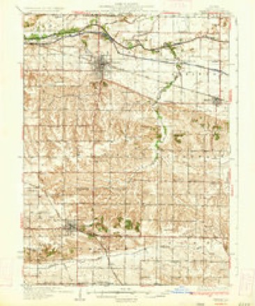
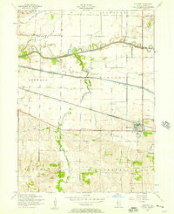
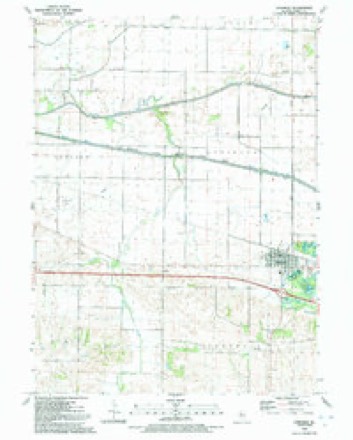
11 topographic sheets cover this place, the earliest surveyed in 1934 and the latest in 1991. It stands in Atkinson Township. It lies in ZIP code area 61235. The Survey maps it on the Atkinson quadrangle. 965 people lived here at the 2020 count. It stands 653 feet above sea level.
Population over time
2 figuresAtkinson fell from 972 to 965 between 2010 and 2020. These are the recorded population figures Wikidata holds for this place, reached through the Geographic Names Information System number this page is keyed on rather than by name, so they belong to this place and not to another of the same name. Most are census counts, but not all are: an early figure may be a founding or settlement estimate, and an estimate published within five years of a census is left out. The change column is computed, and is left blank where more than 20 years separate a figure from the one before it, because a gap that long is not a change between two counts.
| Year | People | Change |
|---|---|---|
| 2010 | 972 | |
| 2020 | 965 | -7 (-1%) |
Topographic sheets covering this place
8 surveys from 11 printed sheetsMatched by testing this settlement's coordinate against the published boundary of every sheet in the United States Geological Survey's historical collection. Each opens the scanned sheet at the Survey.
- 1934 USGS Geneseo quadrangle1:62500, 2 printings
- 1953 USGS Atkinson quadrangle1:24000, 2 printings
- 1958 USGS Davenport quadrangle1:250000, 2 printings
- 1961 USGS Davenport quadrangle1:250000
- 1962 USGS Davenport quadrangle1:250000
- 1984 USGS Aledo quadrangle1:100000
- 1989 USGS Aledo quadrangle1:100000
- 1991 USGS Atkinson quadrangle1:24000





In the county-history sources
4,100 words on this townshipHistory of Henry County, Illinois : It's Taxpayers and Voters; Containing Also, a Biographical Directory, a Condensed History of the State; Map of the County; a Business Directory...etc, published 1877 names this settlement in its chapter on Atkinson Township. These are the passages that mention it, exactly as the scans read.
BASS HENRY, Farmer, Sec. 14, P.O. Atkinson; born in Windham, Conn. Nov. 24, 1817; came to this county in 1853; Rep; Meth; first wife was Mary Crandall, born in Conn; second wife was Mary J. Clark, born in Ireland, June 4, 1836; married first, March 9, 1854; second, March 2, 1876; has four children; 160 acres, val. $7,200.
Passage source: History of Henry County, Illinois : It's Taxpayers and Voters; Containing Also, a Biographical Directory, a Condensed History of the State; Map of the County; a Business Directory...etc, published 1877.
BOOMER HENRY, Farmer, Sec. 28; P.O. Atkinson; born in Jefferson Co., N.Y., July 23. 1826; came to this Co. in 1862; Rep; owns 249 acres land, valued at $13,600; wife was Julia Wood, born in Jefferson Co., N.Y., Aug. 10, 1828; has four children, Emma, Herbert, Gertie, and Jay.
Passage source: History of Henry County, Illinois : It's Taxpayers and Voters; Containing Also, a Biographical Directory, a Condensed History of the State; Map of the County; a Business Directory...etc, published 1877.
BROWN JOHN M. Farmer, Atkinson; born in Knox Co., Ohio, Feb. 13, 1832; came to this Co. in 1858; Dem; is Supervisor of the Township, and Justice of the Peace; wife was R. J. Barnes, born in Fail-field Co., Conn., Sept. 27, 1831; married Sept. 18, 1860; has two children, Nellie and Jennie.
Passage source: History of Henry County, Illinois : It's Taxpayers and Voters; Containing Also, a Biographical Directory, a Condensed History of the State; Map of the County; a Business Directory...etc, published 1877.
Machine-read from a century-old scan, so expect the errors a machine makes: misspelled names, dropped words, stray characters.
Read the whole chapter on Atkinson Township - it names this place 44 more 44 times.
Mines and quarries near this place
2 within 5 milesRegional context, not property-specific evidence. The federal mineral resources record lists 2 workings within 5 miles of Atkinson: 2 past producers. None of them still produces. What was taken out: Sand and Gravel, Construction. Distance is straight-line from the map coordinates, so a quarry counted here may appear on a neighbouring settlement's page as well.
| Where | Site | Commodity | Status | Recorded |
|---|---|---|---|---|
| A. Moens Pit | Sand and Gravel, Construction | Past Producer | ||
| Decausemaker Pit | Sand and Gravel, Construction | Past Producer |
Storms near this place
41 since 1996Regional context, not property-specific evidence. The National Weather Service names Atkinson in 41 storm reports between 1996 and 2024: 25 thunderstorm wind, 8 hail, 5 tornado, 3 flash flood. No death or injury is recorded in these reports. Each account below is quoted exactly as the forecast office filed it, from the NOAA Storm Events Database, and each date opens the federal record of that event.
| When | Event | Place named | Harm | What the report says |
|---|---|---|---|---|
| March 2006 | Thunderstorm Wind | Atkinson | $300,000 | A bow echo interacted with a surface boundary over Atkinson and produced a ducted downburst over a narrow path of about 1 mile. About 12 homes sustained varying amounts of damage with many trees either uprooted or damaged. An RV wasflipped onto its side.At the Atkinson Grain & Fertilizer plant a 100 foot leg was torn away and dropped on the railroad tracks where it was hit by a slow moving train several hours later. |
| June 2013 | Tornado (EF1) | Atkinson | $50,000 | The tornado snapped several tree trunks, destroyed a grain bin, downed large limbs, and damaged the roof of one residence. |
| April 2006 | Thunderstorm Wind | Atkinson | $30,000 | A grain bin was destroyed when it was tossed over a corn crib on the Steve Carton farm by a downburst or possible microburst. Radar data indicated a bowing segment of thunderstorms and the farm was just to the right of the bow apex. |
| March 2006 | Thunderstorm Wind | Atkinson | $12,000 | A bow echo moved across Henry County at around 52 knots (60 mph) and produced a downburst that destroyed a farm outbuilding (that doubled as a garage) and scattered it across a nearby field. Time estimated based on radar. |
| July 2008 | Thunderstorm Wind | Atkinson | $5,000 | Wind gusts estimated to be 75 mph snapped an 18 inch diameter spruce tree in half about 10 feet above the ground and damaged a chimney about 2 miles north northeast of Atkinson, IL at 635 am July 21. |
| March 2006 | Hail | Atkinson | $2,000 | Based on pictures from WQAD-TV web site. |
| May 2004 | Thunderstorm Wind | Atkinson | $1,000 | Very large branches down from a walnut tree |
| May 2012 | Thunderstorm Wind | Atkinson | $500 | A barn was destroyed, resulting in a number of cattle killed. The time coincided with a microburst that was observed by a trained spotter. |
| February 2024 | Hail | Atkinson | - | Pictures received through social media. |
| February 2024 | Hail | Atkinson | - | Pictures received through social media. |
| February 2024 | Tornado (EF1) | Atkinson | - | A high end EF1 tornado formed about 4 miles west of Annawan, IL at 556 PM CST. The tornado initially caused damage to tree limbs before intensifying as it approached Highway 6. At this point the tornado hit two homesteads causing damaging to siding and shingles at each homestead. One of the homesteads saw a shed|destroyed. The tornado reached peak intensity just north of Highway 6, where a well constructed shop was destroyed by the tornado. This damage was rated at 110 MPH winds. The tornado then started to occlude and move more to the left as it crossed I-80. A semi was flipped around I-80 mile marker 31. A couple of branches were broken on the other side of I-80. Around 604 PM CST, the tornado dissipated just north of I-80. The overall path was 2.8 miles and the max width of the tornado was around 425 yards. |
| July 2024 | Thunderstorm Wind | Atkinson | - | The local newspaper reported a tree limb down on powerlines. The time of the event was estimated using radar. |
| June 2024 | Thunderstorm Wind | Atkinson | - | Trees downed by the thunderstorm winds at this intersection. |
| June 2024 | Thunderstorm Wind | Atkinson | - | Tree downed by thunderstorm winds. |
| April 2023 | Thunderstorm Wind | Atkinson | - | A public report of a semi trailer blown over 3 miles west of Atkinson on Interstate 80. |
| July 2023 | Thunderstorm Wind | Atkinson | - | Multiple power lines and tree branches blown down between Geneseo and Annawan. |
| March 2023 | Tornado (EF2) | Atkinson | - | An EF2 tornado developed north of Atkinson, in Henry County, and tracked northeast towards Hooppole, then tracking more easterly for another mile where it ended in western Bureau County as an EF1. For the most part, this tornado was around 200 yards wide, but maxed out at 440 yards just south of Hooppole. At the start of the path, a house sustained siding and window damage, with more damage done to the brick grain silo and outbuilding. As the tornado tracked northeast, additional barns, outbuildings, and trees were damaged. As the tornado moved just south of Hooppole, more outbuildings and barns were damaged, and a house sustained substantial damage, losing its entire roof. Near the end of the path, another grain silo collapsed. The peak estimated winds were 120 mph in Henry County. The tornado crossed into Bureau County about a third of a mile north of Highway 23, on 00 E St, then lifted about one mile to the E/NE. |
| March 2023 | Tornado (EF2) | Atkinson | - | A brief, yet strong tornado tracked north of Atkinson, IL for a few miles, leading to tree damage and damage to farmsteads. Total destruction was noted on one of the outbuildings, with debris scattered throughout the nearby fields. Peak winds estimated at 110 mph. |
| May 2023 | Hail | Atkinson | - | Delayed report. Time estimated by radar. |
| June 2022 | Thunderstorm Wind | Atkinson | - | Pine tree and farm windmill knocked over. Time estimated with radar data. |
| November 2020 | Tornado (EF1) | Atkinson | - | Brief tornado touchdown southwest of Atkinson, IL. Rated EF1 with peak winds at 100 mph, a path length of 0.3 miles, and a path width 30 yards. The roof of a large outbuilding was significantly damaged and the debris was scattered over a quarter mile to the northeast. |
| June 2020 | Thunderstorm Wind | Atkinson | - | A public report of a large tree blown down. |
| June 2019 | Thunderstorm Wind | Atkinson | - | A tree blow down onto a house. |
| June 2017 | Thunderstorm Wind | Atkinson | - | A few large trees were blown down. |
| May 2016 | Thunderstorm Wind | Atkinson | - | Report of tree branches down of up to the size of 5 inches in diameter along with numerous smaller limbs. |
| July 2015 | Thunderstorm Wind | Atkinson | - | Smaller trees were blowing sideways. |
| November 2015 | Thunderstorm Wind | Atkinson | - | A public report of a large tree blown over and a large door blown off a a steel building. |
| May 2013 | Flash Flood | Atkinson | - | Law enforcement closed Interstate 80 in both directions near Atkinson for several hours due to water flowing over the roadway. |
| May 2013 | Flash Flood | Atkinson | - | Law enforcement reported that Interstate 80 remained closed at mile marker 26 in both directions due to runoff from fields and ditches flowing over the roadway near Atkinson. |
| June 2013 | Thunderstorm Wind | Atkinson | - | An off duty NWS employee estimated a thunderstorm wind gust of 70 mph. |
| May 2012 | Thunderstorm Wind | Atkinson | - | An NWS employee reported a 7 inch diameter tree trunk snapped off about 12 feet above ground. The employee also saw pea to dime sized hail around the time of the damaging microburst wind gust. |
| April 2010 | Thunderstorm Wind | Atkinson | - | Wind gusts estimated to be 60 mph blew down some branches about 2 miles north northeast of Atkinson, IL at 558 pm April 30. |
| April 2010 | Thunderstorm Wind | Atkinson | - | Wind gusts estimated to be 60 mph were observed for 5 minutes about 2 miles north northeast of Atkinson, IL between 557 pm and 602 pm April 30. Heavy rain was also observed. |
| March 2007 | Hail | Atkinson | - | Law enforcement estimated hail the size of pennies. |
| March 2006 | Hail | Atkinson | - | Dime to nickel sized hail covering the ground at mile marker 25 on I-80. Time is estimated based on radar. |
| March 2002 | Thunderstorm Wind | Atkinson | - | Large tree toppled, and 20 foot boat overturned. |
| June 2002 | Flash Flood | Atkinson | - | Water over low lying portions of many streets. |
| July 2002 | Thunderstorm Wind | Atkinson | - | Corn crop damaged. |
| July 2020 | Hail | Atkinson | - | no account filed |
| April 2019 | Hail | Atkinson | - | no account filed |
| October 1996 | Thunderstorm Wind | Atkinson | - | no account filed |
Nearest settlements
The eight closest, with where each one stands in the county. Distances are straight-line, computed from the Geographic Names Information System coordinates.
| Map | Place | Distance | Sheets |
|---|---|---|---|
| Annawan | 6.1 miles | 10 | |
| Geneseo | 7.6 miles | 11 | |
| Kedron (historical) | 8.0 miles | 10 | |
| German Corner | 8.8 miles | 11 | |
| Hooppole | 8.9 miles | 11 | |
| Aliceville | 11.6 miles | 11 | |
| Brandenburg Corners | 11.9 miles | 10 | |
| Cambridge | 12.4 miles | 11 |
Elsewhere
Matched on this settlement's Geographic Names Information System number rather than its name, so it cannot be a different place of the same name in another state.
| Wikipedia article on Atkinson | An encyclopaedic summary. Its text is share-alike, so it is linked here rather than copied. |
| Wikidata item Q576062 | The structured record the population and elevation above come from. Public domain (CC0). |
Provenance
This settlement is recorded in the Geographic Names Information System as feature 403699. The sheet list is computed by point-in-boundary test against the United States Geological Survey's historical topographic inventory. Both are works of the United States government and carry no copyright under 17 U.S.C. 105.
Mines and quarries. USGS Mineral Resources Data System (MRDS) https://mrdata.usgs.gov/mrds/ A work of the United States government, no copyright under 17 U.S.C. 105.
Storms. NOAA National Centers for Environmental Information, Storm Events Database https://www.ncei.noaa.gov/stormevents/ A work of the United States government, no copyright under 17 U.S.C. 105. Narratives are quoted verbatim from the National Weather Service report and are not edited or summarised.