| July 2008 | Thunderstorm Wind | Green River | 2 killed, 4 hurt | Wind gusts estimated to be 90 mph toppled over 100 trees at the Indian Trails Resort in Colona, IL around 615 am July 21. One tree fell onto a tent killing a 4 year old boy and a 9 month old girl and injuring four other children. A family pet (dog) was also killed. |
| April 1996 | Tornado (F3) | Bishop Hill | 4 hurt, $10,000,000 | no account filed |
| April 1996 | Tornado (F0) | Galva | 4 hurt, $10,000,000 | no account filed |
| May 2017 | Tornado (EF2) | Galva | 1 hurt, $40,000 | Tornado was rated EF-2 with peak winds of 120 mph, a path length of 1.29 miles and a max width 50 yards. Damage was to two snapped power poles, one home with significant damage to shingles. Another house had had roof completely removed and blew out doors with one minor injury at this location. |
| July 2009 | Thunderstorm Wind | Green Rock | 1 hurt, $25,000 | Wind gusts estimated to be 70 mph blew a tree down onto a van in Colona, IL around 921 pm July 24. One person was injured which required transport to the hospital. |
| June 2002 | Lightning | Geneseo | 1 hurt | Lightning struck a semi truck on Interstate 80. The driver of the truck received minor burns to his right side. |
| June 1999 | Thunderstorm Wind | Kewanee | 1 hurt | Straight line winds blew a truck over in Kewanee. The driver escaped with only minor injuries. The sheriff's department received many calls regarding power lines being downed. Winds also ripped the top off a grain elevator and blew part of a roof off a building. A tree was also blown over onto a car at Lexington and Fourth street. |
| July 2003 | Thunderstorm Wind | Countywide | $50,000,000 | Also reported by law enforcement, spotters, and emergency managers in the southern part of the county. Extensive damage in Woodhull, Alpha, Nekoma, and Galva. Law enforcement reported zero visibility at the height of the storm on I-74 with cars blown into the ditches. |
| April 2003 | Flash Flood | Countywide | $10,000,000 | no account filed |
| May 2010 | Flash Flood | Green Rock | $5,000,000 | Heavy rains resulted in widespread flash flooding of roads and highways across all of Henry County, especially the northwest half during the morning of May 13. |
| April 1973 | Tornado (F2) | not stated | $2,500,000 | no account filed |
| April 2003 | Hail | Galva | $500,000 | no account filed |
| April 2003 | Thunderstorm Wind | Annawan | $400,000 | Barn destroyed & house damaged |
| May 2003 | Thunderstorm Wind | Galva | $400,000 | no account filed |
| May 2003 | Tornado (F0) | Galva | $400,000 | no account filed |
| March 2006 | Thunderstorm Wind | Atkinson | $300,000 | A bow echo interacted with a surface boundary over Atkinson and produced a ducted downburst over a narrow path of about 1 mile. About 12 homes sustained varying amounts of damage with many trees either uprooted or damaged. An RV wasflipped onto its side.At the Atkinson Grain & Fertilizer plant a 100 foot leg was torn away and dropped on the railroad tracks where it was hit by a slow moving train several hours later. |
| June 2009 | Flood | Green Rock | $250,000 | Heavy rains during the middle of the month resulted in the Rock River at Joslin going above the moderate flood stage level of 14 feet on June 22nd around 12 am. It crested around 14.73 feet around 830 pm on June 23. It fell below the moderate flood stage level around 5 pm June 24. |
| September 2008 | Flash Flood | Cambridge | $250,000 | Heavy rains caused flash flooding of parts of Henry County during the afternoon of September 13.||East of Galva, flood waters were flowing over Highway 34.||Near Cambridge, several basements were flooded. |
| April 2003 | Flash Flood | Kewanee | $250,000 | 6 inches water over roads |
| April 2003 | Flash Flood | Galva | $250,000 | IL 17 & US 34 flooded |
| June 1974 | Tornado (F0) | not stated | $250,000 | no account filed |
| April 1967 | Tornado (F2) | not stated | $250,000 | no account filed |
| April 1965 | Tornado (F1) | not stated | $250,000 | no account filed |
| May 1962 | Tornado (F2) | not stated | $250,000 | no account filed |
| September 1959 | Tornado (F2) | not stated | $250,000 | no account filed |
| April 1956 | Tornado (F2) | not stated | $250,000 | no account filed |
| May 2009 | Flood | Sunny Hill | $166,670 | Heavy rains during the last week of April resulted in the Rock River at Joslin and Moline going above their respective moderate flood stage levels during the first few days of May.||The Rock River at Joslin surpassed its moderate flood stage level of 14 feet on May 1 around 6 pm. It crested around 14.5 feet around 12 am May 3. It fell back below its moderate flood stage level around 6 pm on May 4.||The Rock River at Moline surpassed its moderate flood stage level of 13 feet on May 2 around 3 pm. It crested around 13.14 feet around 3 pm May 3. It fell back below its moderate flood stage level around 9 am on May 4. |
| July 2010 | Flood | Green Rock | $125,000 | no account filed |
| July 2024 | Tornado (EF1) | Kewanee Muni Arpt | $100,000 | An NWS Storm Survey found that an EF-1 tornado with peak winds of 100 MPH and was 200 yards wide caused extensive tree damage occurred through the city of Kewanee. Many homesteads had minor roof damage. A couple of the homes had large sections of the roofs removed. |
| May 2010 | Flood | Sunny Hill | $100,000 | Heavy rains during the second week of May resulted in moderate flooding on the Rock River.||At Joslin, the river level surpassed the moderate flood stage level of 14 feet on May 15 around 10 am. It crested around 14.5 feet around 1 pm May 16. It fell below the moderate flood stage level around 1 pm May 17.||At Moline, the river level surpassed the moderate flood stage level of 13 feet on May 15 around 7 am. It crested around 13.3 feet around 7 am May 16. It fell below the moderate flood stage level around 1 am May 18. |
| June 2009 | Thunderstorm Wind | Kewanee Muni Arpt | $100,000 | Wind gusts estimated to be 70 mph blew down some trees about 4 miles west of Kewanee, IL around 115 pm June 18. One large tree fell onto a house. |
| July 2010 | Flood | Sunny Hill | $100,000 | no account filed |
| July 2003 | Hail | Galva | $100,000 | no account filed |
| July 2024 | Tornado (EF1) | Kewanee | $50,000 | An NWS Storm Survey found a second tornado in Kewanee. The tornado was 50 yards wide with peak winds of 105 MPH, which caused damage on the north side of Kewanee. Damage was noted to several large trees including large ones snapped in a park and golf course. There was also some roof damage to a couple of businesses and a storage building. |
| June 2013 | Tornado (EF1) | Atkinson | $50,000 | The tornado snapped several tree trunks, destroyed a grain bin, downed large limbs, and damaged the roof of one residence. |
| September 2010 | Lightning | Cambridge | $50,000 | Lightning struck a building in Cambridge, IL around 940 pm CDT September 18. Some bricks were knocked out of the building. |
| August 2010 | Flash Flood | German Corner | $50,000 | Heavy rains resulted in flash flooding of some streets in the Kewanee, IL area during the morning of August 10. |
| November 2010 | Thunderstorm Wind | Galva | $50,000 | A supercell tracked across portions of Henry county producing a swath of straight-line downburst winds as the thunderstorm moved rapidly to the northeast at 60 mph.|Tree damage was first noted at the Galva cemetery near the county line, where roughly 10 pine trees were either snapped at the base or uprooted. The largest of which was 2 feet in diameter and tossed 25 yards to the east. About a dozen of the taller headstones were toppled from their bases. Farther to the northeast, sheet metal was torn from the roof of a Tyson building, and scattered into the surrounding fields a quarter mile to the east. Off of Route 78 southeast of Kewanee, a half dozen pine trees were snapped at the trunk with surrounding tall grass matted down to the east. Farther down the road to the east a corn crib was destroyed when it shifted off it's foundation. Continuing to the east, there were roughly 40 trees in a 35 year old wind break that were snapped at the trunks. There was also hail damage noted with chipped paint on west facing walls and scarred tree trunks. Ending 3 miles east southeast of Kewanee a barn roof was mostly ripped off, scattering debris a couple hundred yards to the east. Based on the damage, winds were estimated to be between 80 to 100 mph. At some locations the damage swath was one-half mile wide in southeast Henry county, Illinois. |
| June 2010 | Flash Flood | Sunny Hill | $50,000 | Heavy rains resulted in flash flooding in the Cambridge, Kewanee, and Orion, IL areas during the late afternoon and evening of June 23. Streets just west of Cambridge, IL were flooded. Highway 78 going into Kewanee had 8 to 10 inches of water covering it. The intersection of E 200th Street and N 1200th Avenue about 2 miles south southwest of Orion, IL was covered with flood waters from runoff from nearby farm fields. |
| July 2008 | Thunderstorm Wind | Geneseo | $50,000 | Wind gusts estimated to be 75 mph blew down several large trees and damaged business signs and roofs mainly on the west side of Geneseo, IL around 625 am July 21. |
| July 2003 | Thunderstorm Wind | Colona | $50,000 | Trees down in town & on BNSF tracks |
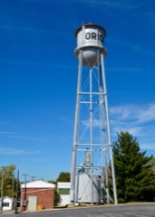
| October 2000 | Thunderstorm Wind | Orion | $50,000 | Strong winds downed numerous trees, several grain bins and a corn crib along a path from Orion to Atkinson. |
| April 2003 | Hail | Galva | $50,000 | no account filed |
| April 2003 | Hail | Cambridge | $50,000 | no account filed |
| April 2003 | Hail | Kewanee | $50,000 | no account filed |
| April 2003 | Hail | Galva | $50,000 | no account filed |
| May 2000 | Thunderstorm Wind | Cambridge | $50,000 | no account filed |
| May 2006 | Thunderstorm Wind | Kewanee | $35,000 | Numerous large tree limbs and power lines downed on the east side of the city. One garage was pushed 10 feet off its foundation and collapsed. The car inside was not damaged. |
| June 2010 | Thunderstorm Wind | Cambridge | $30,000 | Severe thunderstorm winds damaged tents, concession booths, fences, and large trees at the county fairgrounds, where the annual county fair was underway. |
| April 2006 | Thunderstorm Wind | Atkinson | $30,000 | A grain bin was destroyed when it was tossed over a corn crib on the Steve Carton farm by a downburst or possible microburst. Radar data indicated a bowing segment of thunderstorms and the farm was just to the right of the bow apex. |
| June 2009 | Thunderstorm Wind | German Corner | $25,000 | Wind gusts estimated to be 70 mph blew down several 5 inch diameter tree branches, flattened some area corn fields, ripped part of a roof and some siding off a house, and snapped an evergreen tree 12 feet off the ground about 10 miles south of Atkinson, IL around 1258 pm June 18. |
| April 1987 | Tornado (F0) | not stated | $25,000 | no account filed |
| August 1981 | Tornado (F1) | not stated | $25,000 | no account filed |
| March 1979 | Tornado | not stated | $25,000 | no account filed |
| June 1979 | Tornado | not stated | $25,000 | no account filed |
| April 1967 | Tornado (F2) | not stated | $25,000 | no account filed |
| April 1965 | Tornado (F2) | not stated | $25,000 | no account filed |
| May 1995 | Tornado (F0) | Geneseo | $20,000 | A small tornado briefly touched down near the Ebenezer Church north of Geneseo at about 1800 CDT. Gordon Sammons' mobile home was blown over on its side against a utility pole which apparently prevented it from continuing its role. As Mr. Sammons crawled up and out of his home he looked skyward and saw the funnel dipping down from the clouds. |
| September 1996 | Lightning | Andover | $20,000 | no account filed |
| May 2017 | Tornado (EF1) | Mineral | $15,000 | Tornado was rated a higher end EF-1 with peak winds 105 mph, a path length of 2.38 miles with a max path width of 150 yards. This higher end EF-1 tornado caused damage to numerous farm outbuildings, a few homes and trees across Mercer and Henry counties. One house partially lost a roof while another was impelled by flying debris. Approximately 30 to 40 trees were snapped at the trunks, a couple of dozen were uprooted, with about 50 trees experiencing limb damage. This tornado is a continuation of the tornado that touched down in Mercer county. |
 Block