 Block
Basco, Illinois
14 topographic sheets cover this place, the earliest surveyed in 1933 and the latest in 1990. It stands in Bear Creek Township. It lies in ZIP code area 62313. It stands on West Fork Bear Creek. The Survey maps it on the West Point quadrangle. 80 people lived here at the 2020 count. It stands 633 feet above sea level.
Population over time
2 figuresBasco fell from 98 to 80 between 2010 and 2020. These are the recorded population figures Wikidata holds for this place, reached through the Geographic Names Information System number this page is keyed on rather than by name, so they belong to this place and not to another of the same name. Most are census counts, but not all are: an early figure may be a founding or settlement estimate, and an estimate published within five years of a census is left out. The change column is computed, and is left blank where more than 20 years separate a figure from the one before it, because a gap that long is not a change between two counts.
| Year | People | Change |
|---|---|---|
| 2010 | 98 | |
| 2020 | 80 | -18 (-18%) |
Topographic sheets covering this place
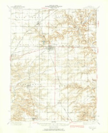
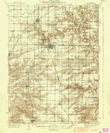
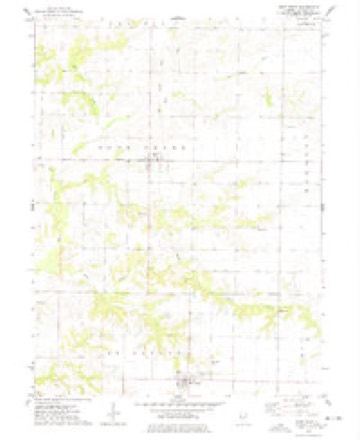
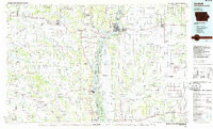
8 surveys from 14 printed sheetsMatched by testing this settlement's coordinate against the published boundary of every sheet in the United States Geological Survey's historical collection. Each opens the scanned sheet at the Survey.
- 1933 USGS Carthage quadrangle1:62500
- 1937 USGS Carthage quadrangle1:62500, 2 printings
- 1958 USGS Burlington quadrangle1:250000, 4 printings
- 1961 USGS Burlington quadrangle1:250000
- 1963 USGS Burlington quadrangle1:250000
- 1974 USGS West Point quadrangle1:24000
- 1986 USGS Keokuk quadrangle1:100000, 2 printings
- 1990 USGS Burlington quadrangle1:250000, 2 printings




In the county-history sources
7,644 words on this townshipHistory of Hancock County, Illinois, Together with an Outline History of the State, and a Digest of State Laws, published 1880 names this settlement in its chapter on Bear Creek Township. These are the passages that mention it, exactly as the scans read.
Township 4 - 7 received its name from a crooked and ugly stream which meanders through it, heading in the township above and passing into Walker, enters Adams county, emptying into the Mississippi above Quinc^'. This, like St. Alban's, is about half prairie and half timbered lands. The C, B. & Q. railroad passes about centrally through it from north to sonth. It contains its one village, Basco, lying on said road, near the center of the township, laid out Feb., 1871, by Wm. S. Woods. It occupies the same, or nearly the same, site as Somerset, a town laid out in 1853 by Abraham Baldwin, and since vacated.
Passage source: History of Hancock County, Illinois, Together with an Outline History of the State, and a Digest of State Laws, published 1880.
We have but a meager report of religious matters for Bear Creek township. The town of Basco contains its solitaiT church edifice, built by the L^uited Presbyterians, now owned and occupied by the Methodist Episcopal, who have for their pastor Bev. Mr. Madison, who has been preaching several years in that and the adjacent townships. On the east line, near the noi'theast corner, stands another church belonging to the Baptist denomination, which has been in existence somewhere near thirty years. We know of no other Church organizations in the township.
Passage source: History of Hancock County, Illinois, Together with an Outline History of the State, and a Digest of State Laws, published 1880.
William H. Allen, carpenter, was born in Steubenville, Ohio, in 1833; remained at home until his marriage to Eleanora McGinnis 1854; she was a native of West Virginia; aliout six months afterward Mr. Allen moved to Portage City, Columbia county. Wis., where he remained one year; he then lived in Clarke county. Mo., two years, then in Fulton county. 111., one year, then in Bushnell a few years, which place he helped to found; after moving around elsewhere he finally located at Carthage, 111., where he has helped to build many of the fine residences and publicbuildings to be seen there. In 1878 he moved to Basco, where he now resides and works at his chosen profession. His children are, Lorilla R., William D., Elmer M. (dec), Frank W., Charles G. and Louisa M. (dec). Mr. Allen served in the army during the war, being engaged in many hard-fought battles to save his country, as Pittsburg Landing, Vicksburg. Fort Donelson, etc. He enlisted at Fountain Green, this
Passage source: History of Hancock County, Illinois, Together with an Outline History of the State, and a Digest of State Laws, published 1880.
Machine-read from a century-old scan, so expect the errors a machine makes: misspelled names, dropped words, stray characters.
Read the whole chapter on Bear Creek Township - it names this place 23 more 23 times.
Fires near this place
3 since 2003Regional context, not property-specific evidence. The federal wildfire occurrence database lists 3 fires within 5 miles of Basco between 2003 and 2004, burning about 12 acres in total. None started naturally. None was recorded as arson. Distance is straight-line from the map coordinates, so a fire counted here may appear on a neighbouring settlement's page as well.
| Reported cause | Fires |
|---|---|
| Equipment and vehicle use | 2 |
| Missing data/not specified/undetermined | 1 |
The most recent of them, most recent first, with the day each was reported and the service that recorded it.
| Date | Cause | Size | Reported by | Name on the report |
|---|---|---|---|---|
| 6 April 2004 | Missing data/not specified/undetermined | 1.0 acres | Illinois State Fire Marshal's Office | not named |
| 30 October 2003 | Equipment and vehicle use | 1.0 acres | Illinois State Fire Marshal's Office | not named |
| 28 October 2003 | Equipment and vehicle use | 10 acres | Illinois State Fire Marshal's Office | not named |
Settlements close enough to share some of these fires:
Storms near this place
7 since 1999Regional context, not property-specific evidence. The National Weather Service names Basco in 7 storm reports between 1999 and 2026: 4 thunderstorm wind, 1 funnel cloud, 1 tornado, 1 hail. No death or injury is recorded in these reports. Each account below is quoted exactly as the forecast office filed it, from the NOAA Storm Events Database, and each date opens the federal record of that event.
| When | Event | Place named | Harm | What the report says |
|---|---|---|---|---|
| April 2008 | Tornado (EF0) | Basco | $20,000 | An EF0 tornado moved to the northeast beginning just east of Elderville. A roof to a house and a tree were damaged. Time estimated. |
| April 2026 | Thunderstorm Wind | Basco | - | Home damaged and 3 power poles leaned over. |
| March 2025 | Thunderstorm Wind | Basco | - | A tree was blown down. |
| May 2019 | Thunderstorm Wind | Basco | - | Power lines reported blown down. |
| June 2009 | Hail | Basco | - | Quarter-sized hail fell about 1 mile west of Basco, IL around 525 pm June 1. |
| February 2000 | Thunderstorm Wind | Basco | - | Roof blown off barn. |
| April 1999 | Funnel Cloud | Basco | - | no account filed |
Nearest settlements
The eight closest, with where each one stands in the county. Distances are straight-line, computed from the Geographic Names Information System coordinates.
| Map | Place | Distance | Sheets |
|---|---|---|---|
| Bentley | 4.8 miles | 14 | |
| Elderville | 5.0 miles | 16 | |
| West Point | 5.1 miles | 14 | |
| Elvaston | 5.3 miles | 14 | |
| Denver | 5.6 miles | 14 | |
| Carthage | 7.0 miles | 14 | |
| Breckenridge | 7.4 miles | 14 | |
| Stillwell | 7.6 miles | 14 |
Elsewhere
Matched on this settlement's Geographic Names Information System number rather than its name, so it cannot be a different place of the same name in another state.
| Wikipedia article on Basco | An encyclopaedic summary. Its text is share-alike, so it is linked here rather than copied. |
| Wikidata item Q2183830 | The structured record the population and elevation above come from. Public domain (CC0). |
Provenance
This settlement is recorded in the Geographic Names Information System as feature 403952. The sheet list is computed by point-in-boundary test against the United States Geological Survey's historical topographic inventory. Both are works of the United States government and carry no copyright under 17 U.S.C. 105.
Wildfire. Short, Karen C. 2022. Spatial wildfire occurrence data for the United States, 1992-2020 [FPA_FOD_20221014]. 6th Edition. Fort Collins, CO: Forest Service Research Data Archive. https://doi.org/10.2737/RDS-2013-0009.6 Collected with United States Government funding and usable without additional permissions or fees.
Storms. NOAA National Centers for Environmental Information, Storm Events Database https://www.ncei.noaa.gov/stormevents/ A work of the United States government, no copyright under 17 U.S.C. 105. Narratives are quoted verbatim from the National Weather Service report and are not edited or summarised.