 Block
Big Rock, Illinois
9 topographic sheets cover this place, the earliest surveyed in 1937 and the latest in 1985. It stands in Big Rock Township. It lies in ZIP code area 60511. It stands on East Branch Big Rock Creek. The Survey maps it on the Big Rock quadrangle. 1,104 people lived here at the 2020 count. It stands 709 feet above sea level.
Population over time
2 figuresBig Rock fell from 1,126 to 1,104 between 2010 and 2020. These are the recorded population figures Wikidata holds for this place, reached through the Geographic Names Information System number this page is keyed on rather than by name, so they belong to this place and not to another of the same name. Most are census counts, but not all are: an early figure may be a founding or settlement estimate, and an estimate published within five years of a census is left out. The change column is computed, and is left blank where more than 20 years separate a figure from the one before it, because a gap that long is not a change between two counts.
| Year | People | Change |
|---|---|---|
| 2010 | 1,126 | |
| 2020 | 1,104 | -22 (-2%) |
Topographic sheets covering this place
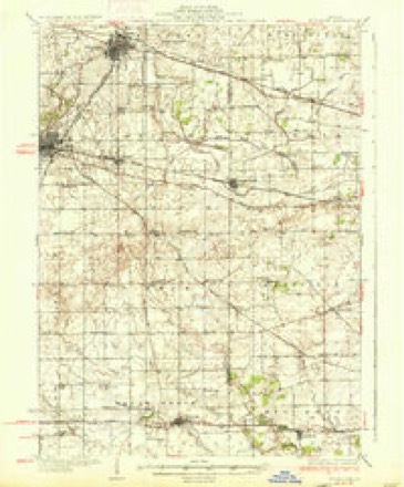
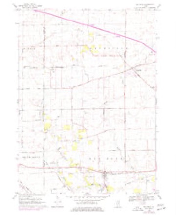
5 surveys from 9 printed sheetsMatched by testing this settlement's coordinate against the published boundary of every sheet in the United States Geological Survey's historical collection. Each opens the scanned sheet at the Survey.
- 1937 USGS Sycamore quadrangle1:62500, 2 printings
- 1958 USGS Aurora quadrangle1:250000, 3 printings
- 1961 USGS Aurora quadrangle1:250000
- 1968 USGS Big Rock quadrangle1:24000, 2 printings
- 1985 USGS Aurora quadrangle1:100000



In the county-history sources
514 words on this townshipHistory of Kane County, Ill., published 1908 names this settlement in its chapter on Big Rock Township. These are the passages that mention it, exactly as the scans read.
This township derives its name from Big Rock creek. The first settler was a man named "Shanty" Cook, who came with his family in 1835. Justice Anient came in the fall of 1835: John Pierce in 1836; J. L. Lamson in 1837. He came from Chicago by stage, his ticket being to Big Rock creek, where he was dropped about dark and not a house or civilized being within sight. He finally found the Cook cabin, but also found the floor all occupied by "guests" who had stopped over for the night. Every cabin was a hotel in those days.
Passage source: History of Kane County, Ill., published 1908.
William Coon was the first blacksmith, and a man named Walby opened the first store in the township. A sawmill was built by Coon & Massey on Big Rock creek in 1837. a short distance below Rockville. then Catsville. The first railroad, the Chicago & Iowa Railroad, ran through the township in 1871.
Passage source: History of Kane County, Ill., published 1908.
In 1842 Rev. George Lewis preached to the Congregationalists. and a society was formed at Pierce's house in 1853. The Welsh Congregational church was dedicated in 1854, with Rev. John Daniel as pastor. Another society was formed in 1858. and the Big Rock Congregational church erected. The Baptists built in 1874.
Passage source: History of Kane County, Ill., published 1908.
Machine-read from a century-old scan, so expect the errors a machine makes: misspelled names, dropped words, stray characters.
Read the whole chapter on Big Rock Township - it names this place 2 more 2 times.
Mines and quarries near this place
6 within 5 milesRegional context, not property-specific evidence. The federal mineral resources record lists 6 workings within 5 miles of Big Rock: 3 past producers, 2 producers, 1 plant. 3 still produce. What was taken out: Sand and Gravel, Construction, Stone, Crushed/Broken. Distance is straight-line from the map coordinates, so a quarry counted here may appear on a neighbouring settlement's page as well.
| Where | Site | Commodity | Status | Recorded |
|---|---|---|---|---|
| Big Rock Quarry | Stone, Crushed/Broken | Producer | ||
| Harker Pit | Sand and Gravel, Construction | Past Producer | ||
| Kane Sand & Gravel | Sand and Gravel, Construction | Producer | ||
| Kaneville Plant & Pit | Sand and Gravel, Construction | Plant | ||
| Kuglee Pit | Sand and Gravel, Construction | Past Producer | ||
| Long Pit | Sand and Gravel, Construction | Past Producer |
Storms near this place
14 since 2007Regional context, not property-specific evidence. The National Weather Service names Big Rock in 14 storm reports between 2007 and 2026: 7 thunderstorm wind, 3 tornado, 2 hail, 1 flash flood. No death or injury is recorded in these reports. Each account below is quoted exactly as the forecast office filed it, from the NOAA Storm Events Database, and each date opens the federal record of that event.
| When | Event | Place named | Harm | What the report says |
|---|---|---|---|---|
| August 2007 | Flash Flood | Big Rock | $250,000 | The Aurora Airport measured 3.22 inches in 84 minutes. Significant flooding was reported at the intersections of Patricia and Snow Streets as well as Main Street and Highway 47. Businesses and basements flooded in Big Rock, along with water over roads. |
| February 2024 | Tornado (EF0) | Big Rock | - | Storm chasers documented a tornado touching down in a field south of Hinckley near Somonauk Road and Bastian Road. High resolution satellite imagery showed that this tornado first moved to the northeast mostly in open fields, but likely caused tree damage to properties just north of Bastian Road as it crossed into Kane County. The tornado then turned to the east and caused damage to multiple farm outbuildings, peeled shingles off of roofs, and caused tree damage before lifting as it tracked into Big Rock. |
| February 2024 | Thunderstorm Wind | Big Rock | - | An NWS storm survey found damage to trees and a farm outbuilding along McDermott Rd just east of the Kane-DeKalb county line. Time was estimated using radar. |
| July 2024 | Thunderstorm Wind | Big Rock | - | A light pole was leaning over Granart Road. |
| July 2024 | Tornado (EF1) | Big Rock | - | A tornado with estimated peak winds of 95 mph touched down just inside the entrance to the Big Rock Campground near Granart Road. Extensive, primarily EF-0, tree damage occurred along the path of this tornado. The tornado was likely at peak intensity as it moved through Sugar Grove, just south of Route 30. Several homes had minor roof damage near Ridgeview Lane. Several healthy trees were uprooted and snapped. The tornado passed over the Sugar Grove Fire Department building near Municipal Drive which suffered minor structural damage, some of which appeared to be caused by flying tree debris. An approximately 2,000 pound partial roof for firefighter training was lifted and moved a couple of feet. Additional minor structural damage occurred at some residences in nearby subdivisions. The tornado continued moving east northeast, crossing Route 56 twice, before moving into the west side of Aurora. The tornado crossed Route 83 where it produced sporadic shingle and fascia damage along with continued tree damage. Several fences were also blown down. The tornado appeared to end just east of Edgelawn Drive. |
| July 2023 | Thunderstorm Wind | Big Rock | - | A picture shared via social media shows a large tree branch that had fallen onto a house. Time and wind speed were estimated using radar. |
| November 2022 | Tornado (EF0) | Big Rock | - | A tornado with peak winds of 80 mph touched down near Little Rock in Kendall County and moved north into Kane County. The tornado produced sporadic tree and power line damage along its path. Roof damage occurred to a barn near Jericho Road. The tornado moved across parts of northwest Big Rock and lifted just north of Route 30. |
| November 2022 | Thunderstorm Wind | Big Rock | - | Numerous trees and power lines were blown down near Big Rock. |
| June 2019 | Thunderstorm Wind | Big Rock | - | A trained spotter provided video and a detailed description of two well defined gustnadoes at the corner of Scott and Dauberman Roads. Debris was blown over 3/4 of a mile to the south. |
| May 2018 | Flood | Big Rock | - | Flowing water was reported at Jericho and Garnart Roads. Rapid rising water was filling ditches and fields. Rainfall of 1.63 inches was measured at the Sugar Grove (KARR) Airport. |
| June 2010 | Thunderstorm Wind | Big Rock | - | A large oak tree was snapped in half and fell across a street. |
| June 2007 | Thunderstorm Wind | Big Rock | - | A tree was blown down near Route 30 and Big Rock. |
| March 2026 | Hail | Big Rock | - | no account filed |
| May 2019 | Hail | Big Rock | - | no account filed |
Nearest settlements
The eight closest, with where each one stands in the county. Distances are straight-line, computed from the Geographic Names Information System coordinates.
| Map | Place | Distance | Sheets |
|---|---|---|---|
| Kaneville | 5.1 miles | 9 | |
| Blackberry Woods | 5.5 miles | 13 | |
| Sugar Grove | 5.5 miles | 13 | |
| Troxel | 5.5 miles | 9 | |
| Nottingham Woods | 6.3 miles | 13 | |
| Blackberry Acres | 6.3 miles | 13 | |
| Willow Creek | 6.5 miles | 13 | |
| Prestbury | 7.0 miles | 13 |
Elsewhere
Matched on this settlement's Geographic Names Information System number rather than its name, so it cannot be a different place of the same name in another state.
| Wikipedia article on Big Rock | An encyclopaedic summary. Its text is share-alike, so it is linked here rather than copied. |
| Wikidata item Q2224881 | The structured record the population and elevation above come from. Public domain (CC0). |
Provenance
This settlement is recorded in the Geographic Names Information System as feature 404432. The sheet list is computed by point-in-boundary test against the United States Geological Survey's historical topographic inventory. Both are works of the United States government and carry no copyright under 17 U.S.C. 105.
Mines and quarries. USGS Mineral Resources Data System (MRDS) https://mrdata.usgs.gov/mrds/ A work of the United States government, no copyright under 17 U.S.C. 105.
Storms. NOAA National Centers for Environmental Information, Storm Events Database https://www.ncei.noaa.gov/stormevents/ A work of the United States government, no copyright under 17 U.S.C. 105. Narratives are quoted verbatim from the National Weather Service report and are not edited or summarised.