 Block
Bismarck, Illinois
13 topographic sheets cover this place, the earliest surveyed in 1933 and the latest in 1987. It stands in Newell Township. It lies in ZIP code area 61814. It stands on Painter Creek. The Survey maps it on the Bismarck quadrangle. 582 people lived here at the 2020 count. It stands 646 feet above sea level.
Population over time
2 figuresBismarck grew from 579 to 582 between 2010 and 2020. These are the recorded population figures Wikidata holds for this place, reached through the Geographic Names Information System number this page is keyed on rather than by name, so they belong to this place and not to another of the same name. Most are census counts, but not all are: an early figure may be a founding or settlement estimate, and an estimate published within five years of a census is left out. The change column is computed, and is left blank where more than 20 years separate a figure from the one before it, because a gap that long is not a change between two counts.
| Year | People | Change |
|---|---|---|
| 2010 | 579 | |
| 2020 | 582 | +3 (+1%) |
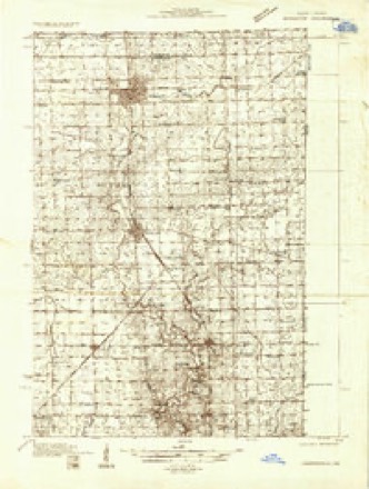
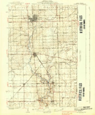
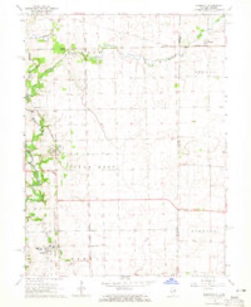
Topographic sheets covering this place
8 surveys from 13 printed sheetsMatched by testing this settlement's coordinate against the published boundary of every sheet in the United States Geological Survey's historical collection. Each opens the scanned sheet at the Survey.
- 1933 USGS Hoopeston quadrangle1:48000
- 1938 USGS Hoopeston quadrangle1:62500, 3 printings
- 1953 USGS Danville quadrangle1:250000, 3 printings
- 1955 USGS Danville quadrangle1:250000
- 1956 USGS Danville quadrangle1:250000
- 1964 USGS Bismarck quadrangle1:24000, 2 printings
- 1984 USGS Danville quadrangle1:100000
- 1987 USGS Danville quadrangle1:100000





In the county-history sources
21,866 words on this townshipHistory of Vermilion County, Together with Historic Notes on the Northwest, Gleaned from Early Authors, Old Maps and Manuscripts, Private and Official Correspondence, and Other Authentic, Though, for the Most Part, Out-of-the-way Sources, published 1879 names this settlement in its chapter on Newell Township. These are the passages that mention it, exactly as the scans read.
In the summer and fall of 1832 John Johnson worked on the Wabash, rafting logs. He came home on foot Saturday nights, a distance of thirty miles, bringing on his back provisions for his family. The hard situation of all things was so grievously borne by many that, could they have returned, they would gladly have accepted any occasion. About all they possessed was required of them to reach the place, and then it was only through much fortitude that they could remain, even after it seemed impossible for them to depart. It may seem strange to the later generation in Newell township that any discontent should ever have been excited by the course of life here, and ever; but many bitter thoughts and burning tears of women have indelibl}" impressed on the memories of many venerable ones now living, in the midst of every comfort, the simple story of their trials. Sickness added more, perhaps, to the discouragements of those who were, heart-sick in their new homes than any other thing. The prevalent diseases were ague, typhoid fever, milk sickness and congestive chills. Usually in summer and fall, sickness prevailed to a melancholy extent throughout the country ; very often, whole families were down together. Dr. John Woods was the first regular physician. James Makemson borrowed books and studied physic with the view to treat his own family, and his success soon became so conspicuous that his neighbors began to employ him, and in a little time he had a good practice and reputation.
Passage source: History of Vermilion County, Together with Historic Notes on the Northwest, Gleaned from Early Authors, Old Maps and Manuscripts, Private and Official Correspondence, and Other Authentic, Though, for the Most Part, Out-of-the-way Sources, published 1879.
Machine-read from a century-old scan, so expect the errors a machine makes: misspelled names, dropped words, stray characters.
Fires near this place
16 since 2004Regional context, not property-specific evidence. The federal wildfire occurrence database lists 16 fires within 5 miles of Bismarck between 2004 and 2011, burning about 175 acres in total. None started naturally. 1 was recorded as arson. Distance is straight-line from the map coordinates, so a fire counted here may appear on a neighbouring settlement's page as well.
| Reported cause | Fires |
|---|---|
| Missing data/not specified/undetermined | 8 |
| Debris and open burning | 4 |
| Recreation and ceremony | 2 |
| Equipment and vehicle use | 1 |
| Arson/incendiarism | 1 |
The most recent of them, most recent first, with the day each was reported and the service that recorded it.
| Date | Cause | Size | Reported by | Name on the report |
|---|---|---|---|---|
| 11 September 2010 | Missing data/not specified/undetermined | 2.0 acres | Illinois Division of Forestry Resources | MORRIS |
| 2 July 2004 | Recreation and ceremony | 1.0 acres | Illinois State Fire Marshal's Office | not named |
| 22 March 2011 | Missing data/not specified/undetermined | 1.0 acres | Illinois Division of Forestry Resources | 16100 |
| 22 March 2004 | Arson/incendiarism | 2.0 acres | Illinois State Fire Marshal's Office | not named |
| 20 March 2004 | Debris and open burning | 2.0 acres | Illinois State Fire Marshal's Office | not named |
| 20 March 2004 | Recreation and ceremony | under an acre | Illinois State Fire Marshal's Office | not named |
| 19 March 2011 | Missing data/not specified/undetermined | under an acre | Illinois Division of Forestry Resources | TIERMAN |
| 28 February 2004 | Missing data/not specified/undetermined | under an acre | Illinois State Fire Marshal's Office | not named |
Settlements close enough to share some of these fires:
Mines and quarries near this place
2 within 5 milesRegional context, not property-specific evidence. The federal mineral resources record lists 2 workings within 5 miles of Bismarck: 1 producer, 1 past producer. 1 still produces. What was taken out: Sand and Gravel, Construction. Distance is straight-line from the map coordinates, so a quarry counted here may appear on a neighbouring settlement's page as well.
| Where | Site | Commodity | Status | Recorded |
|---|---|---|---|---|
| Allison Gravel Pit | Sand and Gravel, Construction | Past Producer | ||
| Lonnas Pit | Sand and Gravel, Construction | Producer |
Storms near this place
22 since 2001Regional context, not property-specific evidence. The National Weather Service names Bismarck in 22 storm reports between 2001 and 2025: 9 hail, 8 thunderstorm wind, 2 flood, 1 flash flood. No death or injury is recorded in these reports. Each account below is quoted exactly as the forecast office filed it, from the NOAA Storm Events Database, and each date opens the federal record of that event.
| When | Event | Place named | Harm | What the report says |
|---|---|---|---|---|
| May 2017 | Thunderstorm Wind | Bismarck | $600,000 | Numerous trees, power poles, and power lines were blown down. |
| June 2014 | Thunderstorm Wind | Bismarck | $75,000 | Numerous trees were blown down onto power lines or across roads from Danville to Bismarck. |
| July 2015 | Thunderstorm Wind | Bismarck | $3,000 | A tree and power lines were blown down at 2650 N about 4 miles west of Bismarck. |
| June 2019 | Lightning | Bismarck | $2,000 | A house was struck by lightning, causing a small fire. |
| May 2025 | Tornado (EF0) | Bismarck | - | A tornado touched down southeast of the intersection of East 2800 North Road and North 2050 East Road about 3 miles east of Bismarck at 5:39 PM CDT. The tornado tracked northeastward, causing some tree damage along East 2800 North Road and damaging the roof of an outbuilding before dissipating northeast of IL-119 just shy of the Indiana border at 5:41 PM CDT. |
| August 2022 | Thunderstorm Wind | Bismarck | - | Trees were blown down in Bismarck. |
| August 2019 | Thunderstorm Wind | Bismarck | - | Several trees were blown down in Bismarck. |
| May 2019 | Thunderstorm Wind | Bismarck | - | A power pole was blown down. |
| May 2017 | Flood | Bismarck | - | Rain amounts of 2.00 to 3.00 inches in about a two hour period during the evening hours, on already saturated ground, resulted in flash flooding across central and southern Vermilion County. Several streets from Danville to Westville were impassable. Numerous rural roads and highways in the southern part of the county from Sidell to Ridge Farm were inundated, including U.S. Highway 150/Illinois Route 1. An additional 1.00 to 2.00 inches of rain occurred on April 30th, keeping many roads flooded. As a result, areal flooding continued until the late morning hours of May 1st. |
| April 2017 | Flash Flood | Bismarck | - | Rain amounts of 2.00 to 3.00 inches in about a two hour period during the evening hours, on already saturated ground, resulted in flash flooding across central and southern Vermilion County. Several streets from Danville to Westville were impassable. Numerous rural roads and highways in the southern part of the county from Sidell to Ridge Farm were inundated, including U.S. Highway 150/Illinois Route 1. |
| April 2017 | Flood | Bismarck | - | Rain amounts of 2.00 to 3.00 inches in about a two hour period during the evening hours, on already saturated ground, resulted in flash flooding across central and southern Vermilion County. Several streets from Danville to Westville were impassable. Numerous rural roads and highways in the southern part of the county from Sidell to Ridge Farm were inundated, including U.S. Highway 150/Illinois Route 1. An additional 1.00 to 2.00 inches of rain occurred on April 30th, keeping many roads flooded. As a result, areal flooding continued until the late morning hours of May 1st. |
| April 2001 | Thunderstorm Wind | Bismarck | - | Numerous reports of damage were received in this area. Half of a 80-100 foot tree fell into a screened in porch and garage. A pole barn was destroyed 4 miles north northwest of Danville. Other reports around the area involved trees, tree limbs and power lines down. Dime size hail, several inches deep, was also reported just north of Danville. Minor damage was also noted to 3 residences and 2 outbuildings. Also, in Georgetown the winds caused minor damage to the high school roof. No damage figures were available at this time. |
| May 2025 | Hail | Bismarck | - | no account filed |
| July 2023 | Hail | Bismarck | - | no account filed |
| June 2023 | Thunderstorm Wind | Bismarck | - | no account filed |
| June 2019 | Hail | Bismarck | - | no account filed |
| April 2017 | Hail | Bismarck | - | no account filed |
| July 2014 | Hail | Bismarck | - | no account filed |
| June 2012 | Hail | Bismarck | - | no account filed |
| June 2012 | Hail | Bismarck | - | no account filed |
| June 2006 | Hail | Bismarck | - | no account filed |
| April 2003 | Hail | Bismarck | - | no account filed |
Nearest settlements
The eight closest, with where each one stands in the county. Distances are straight-line, computed from the Geographic Names Information System coordinates.
| Map | Place | Distance | Sheets |
|---|---|---|---|
| Myersville (historical) | 1.7 miles | 12 | |
| Moores Corner | 2.3 miles | 12 | |
| Village of Alvan (Alvin) | 3.1 miles | 13 | |
| Barlow Park | 3.2 miles | 13 | |
| Grumle Corner | 3.4 miles | 19 | |
| Rayville | 4.0 miles | 12 | |
| West Newell | 4.2 miles | 19 | |
| Vernal | 4.8 miles | 12 |
Elsewhere
Matched on this settlement's Geographic Names Information System number rather than its name, so it cannot be a different place of the same name in another state.
| Wikipedia article on Bismarck | An encyclopaedic summary. Its text is share-alike, so it is linked here rather than copied. |
| Wikidata item Q1875878 | The structured record the population and elevation above come from. Public domain (CC0). |
Provenance
This settlement is recorded in the Geographic Names Information System as feature 424535. The sheet list is computed by point-in-boundary test against the United States Geological Survey's historical topographic inventory. Both are works of the United States government and carry no copyright under 17 U.S.C. 105.
Wildfire. Short, Karen C. 2022. Spatial wildfire occurrence data for the United States, 1992-2020 [FPA_FOD_20221014]. 6th Edition. Fort Collins, CO: Forest Service Research Data Archive. https://doi.org/10.2737/RDS-2013-0009.6 Collected with United States Government funding and usable without additional permissions or fees.
Mines and quarries. USGS Mineral Resources Data System (MRDS) https://mrdata.usgs.gov/mrds/ A work of the United States government, no copyright under 17 U.S.C. 105.
Storms. NOAA National Centers for Environmental Information, Storm Events Database https://www.ncei.noaa.gov/stormevents/ A work of the United States government, no copyright under 17 U.S.C. 105. Narratives are quoted verbatim from the National Weather Service report and are not edited or summarised.