 Block
Myersville, Illinois
12 topographic sheets cover this place, the earliest surveyed in 1933 and the latest in 1987. It stands in Newell Township. It lies in ZIP code area 61834. It stands on Painter Creek. The Survey maps it on the Henning quadrangle. The federal gazetteer marks this settlement historical: it is no longer a populated place, though the surveys that recorded it still are.
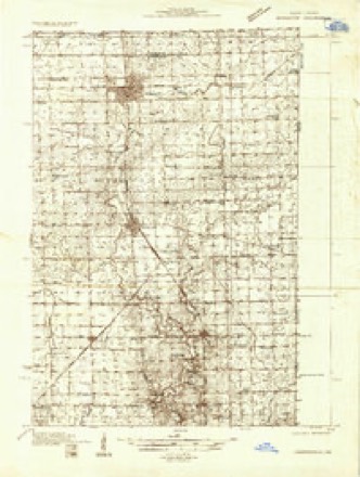
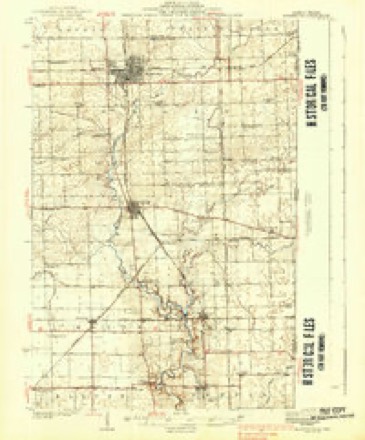
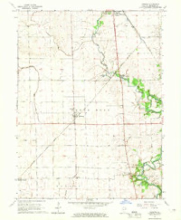
Topographic sheets covering this place
8 surveys from 12 printed sheetsMatched by testing this settlement's coordinate against the published boundary of every sheet in the United States Geological Survey's historical collection. Each opens the scanned sheet at the Survey.
- 1933 USGS Hoopeston quadrangle1:48000
- 1938 USGS Hoopeston quadrangle1:62500, 3 printings
- 1953 USGS Danville quadrangle1:250000, 3 printings
- 1955 USGS Danville quadrangle1:250000
- 1956 USGS Danville quadrangle1:250000
- 1964 USGS Henning quadrangle1:24000
- 1984 USGS Danville quadrangle1:100000
- 1987 USGS Danville quadrangle1:100000





In the county-history sources
21,866 words on this townshipHistory of Vermilion County, Together with Historic Notes on the Northwest, Gleaned from Early Authors, Old Maps and Manuscripts, Private and Official Correspondence, and Other Authentic, Though, for the Most Part, Out-of-the-way Sources, published 1879 names this settlement in its chapter on Newell Township. These are the passages that mention it, exactly as the scans read.
The pioneers were early attracted to this section of country. Its rich soil, pure water, abundant timber, and picturesque configuration, afforded strong inducements to them to accept with cheerfulness the deprivations of the border. The earlier settlers came mostly from Ohio and Kentucky. In those theaters of stirring experience they had been trained to vigorous exercise and ingenious resource. Their capital - steady and industrious habits, strong wills and constitutions - was the best for the times and the circumstances; with little else, they came to build homes and to gather around them the ordinary conveniences of civilized life. To leave comfortable firesides and happy associations and emigrate to this wild region, was no trifling episode in their lives. It was not unmixed with trials and difficulties, which abounded with disheartening constancy. The splendor and mazy activities of the present day so monopolize our interest that we cannot content ourselves, while looking back, to dwell on the picture long enough to get a distinct view of objects. The failure, therefore, nigh universal, to comprehend and appreciate the personal sacrifices of these resolute men and women, is not surprising. But the fact, however, is the same - that they laid the foundations of the local inheritance and prosperity of this generation. To the Le Neves must be accorded the honor of making the first beginning in Newell township. In the fall of 1823, Obadiah Le Neve journeyed on horse-back from Vincennes to St. Louis, and thence into Northeast Missouri, and on his homeward trip made a circuit in northern Illinois. With very correct judgment he pronounced the region enclosed in the present limits of Newell township the best that he had seen. Obtaining the numbers of the following tracts - W. \ N.W. \ Sec. 23, and E. \ N.E. \ Sec. 24, town 20 N., range 11 W., 3d principal meridian - he returned home, and a public land sale shortly after occurring, he purchased those pieces. Just prior to Christmas, in the year 1824, Obadiah and John Le Neve left their relations in Lawrence (then Crawford) county, Illinois, and with a team loaded with provisions and a small outfit of bedding, they set out for their future home. A third person accompanied to take the team back. On arriving at their destination, they rived a few rails and laid up a square, chinking and filling the interstices with pulled grass, and covering one half of the rude structure with puncheons. The Indians were numerous, and came to their camp with freedom, and behaved in the most friendly manner. They never disturbed anything while the men were away, though they often came about the place during their absence. They proved themselves honest and conscionable neighbors. When the pioneers spread their homely meals, the Indians, if any were present, were invited to the repast, and they always accepted with the best familiarity which hunger and gratitude could prompt. The immigrants had other neighbors far less companionable. These were the wolves that came about in great numbers, making the woods resonant with their hideous nocturnal serenade. The two brothers had come to prepare for their ultimate removal, and during the whole winter, which they spent in this neighborhood, were splitting rails. Toward the latter part of February they began to prepare for their departure. They first erected a cabin on section 14, town 20, about forty rods west of where John Le Neve has always lived. This was for occupation by Ben. Buttertield, who was expected to arrive soon with his family. He came near the close of the month, and two or three days later the Le Neves went back. The actual settlement of Newell township was thus begun by Buttertield, in February, 1825. In the course of the summer and fall quite numerous additions were made to the number of inhabitants, as the following list will show: John Current arrived from Virginia. The Howards - Henry, Lackland, Amos, Aaron and Nathan - and William and James Delay emigrated from Ohio. Jeremiah Delay, son of James Delay, probably came at the same time. Oliver Miller settled on Stony Creek in section 14. The Le Neves returned in November or December. Samuel and John Adams and Joseph Martin came together, from Harrison county, Kentucky. The first located on section 22, town 20, where he has always resided. William Newell, from the same place, settled on section 23, just east of Adams. John Lamb and his son Simeon (Quakers), natives of North Carolina, came from Indiana. John Goodener, Elijah Hale and John Swisher settled in the timber between Samuel Adams' and Solomon Rodrick's. Three brothers of John Swisher - Samuel, Lewis and Jacob - also lived in the same neighborhood, but the date of their settlement cannot be given. All these persons were from Ohio. George Ware came to Vermilion county this year. He made a farm on section 16 in this township. The next year Adam Starr came up from Georgetown. Samuel Swinford, Richard Blair, William Adams, Edward Martin and James Newell came from Harrison county, Kentucky. The last came the year before to examine the country, and entered land on section 10, on the 5th day of October. Abraham and Frederick Stipp, from Virginia, settled on section 9. John Watson settled in the south part of the township. In 1827 William Current, from Virginia, settled on section 36, town 20. David Tickle, Jacob and George Swisher, and Eli Hewitt, came from Ken- tucky. Nathaniel Taylor settled in the Le Neve neighborhood, and afterward went to Denmark. Joseph Gundy began improvements near Myersville, but did not bring his family until the next year. Luke Wiles, from Indiana, settled across the Fork from Myersville. In 1828 Hugh Bolton and Solomon Rodrick emigrated from Ohio. The latter settled where he now lives, on section 34, town 20. Dr. John Woods, a native of New York, located in the southeast part of the township as early as this year. It is believed that his father-in-law, Supply Butterfield, came not far from this time. Those from Kentucky were Thomas Hendren, Jehu Chandler, Jacob Eckler, James Duncan and his sons Asa, Alpha, Darius and James. In 1829 Ralph Martin and his step-son John P. Lindsey, Henry Ferguerson, William Cunningham and his minor sons James and Joseph, Harrison Oliver, George W. Smith, Samuel Oliver and his son Bushrod, John Shafer, and James and Andrew Makemson. arrived from Kentucky. Ambrose Andrews and his family, including his son Ambrose Phelps, just then of age, Nathaniel Glaze and family, Thomas Carter and family, Jacob Bumgardner, William Longshore, Robert Thornsburg, and John Stalcup, came together. Abram and Josiah Henkle, Henry Wood, Peter Starr, a native of North Carolina, William G. Blair, a native of Kentucky, Andrew Davison and his sons James and Robert, Virginians, all came from Ohio. Samuel Torrence came this year or earlier. In 1830, George Stipp, Robert Price, Richard Brewer, William J. Barger, and Consider Scott, a native of New York, came from Ohio. Valentine Leonard and his sons-in-law, Charles S. Young, John Young and Otho Allison, emigrated from Kentucky. The next year Caleb Worley arrived from Kentucky, and George French from Indiana. Louis Neely came in 1832; also Daniel P. Huffman came from Kentucky. John Campbell, and Samuel Campbell, jr., migrated from New York in 1833. In the following year Harper J. and Joseph Campbell, brothers to these, and Samuel Campbell, sr., located in this township. Clarendon E. Loring, a native of Maine, came from Indiana. Zachariah Robertson, Jacob Huffman, John Deck and John Rutledge, arrived from Kentucky. Michael Deck probably came at the same time. Jacob Deck, a Pennsylvanian, settled here in 1835. John Stipp, a brother to those who had already located in the township, and John Williams, recently from England, came about this time. The following is a list of early settlers who came perhaps not later than 1835: Armenus Miller, Michael and James Leonard, Edward Morgan, Samuel Briarly, Isaiah Treat, William Stevens, a preacher, Robert Layton, from Kentucky, Abel and Vatchel Newborough, Duncan Lindsey, a man named Long, and another named Moss. The latter built a tannery on section 26, town 20, but in 1834 sold his place to Samuel Campbell, sr., and settled in Danville township, where he built another tannery.
Passage source: History of Vermilion County, Together with Historic Notes on the Northwest, Gleaned from Early Authors, Old Maps and Manuscripts, Private and Official Correspondence, and Other Authentic, Though, for the Most Part, Out-of-the-way Sources, published 1879.
Henry Wood came from Ohio about 1829, arriving in October. He split rails and laid up a square, covering it with clapboards, which he also rived, and this he occupied for a house. Mrs. Wood, with her four children, used to stay alone in this place over night while her husband was away at the Wabash after provisions. The wolves and Indians abounded in the neighborhood, seemingly in equal numbers; but, fortunately for Mrs. Wood's equanimity of mind, the former exhibited the greater anxiety to cultivate acquaintance. By Christmas they had a more substantial habitation enclosed. Though neither door nor floor was made, nor chinking and daubing done, they were forced to occupy it. One day about midwinter the Henkles came over, and the three men chinked and daubed the house. That night it set in cold, and continued so a long time. The fire-place was planked up only as high as the mantel, and their experience with a "smoking chimney" was indeed distressing. In course of time, as opportunity was given, the floor was put down, the door hung, and the flue Raised to its proper height. This is a specimen of the experience of quite a number who came early. Those who came later were generally in better circumstances. They had means to enter a little piece of land for a home, some eighty, some one hundred and twenty, and a few one hundred and sixty acres. Until they had built and become settled they camped out and bunked down in the most convenient manner. As a rule, all had to struggle hard to get a living, and were content if they could make a few scanty improvements. Making rails became the staple employment for those who could spare any time from home, and they eagerly sought the opportunity to work for thirty-seven and a hall cents per hundred, and did not feel themselves unfortunate if they got but twenty-five.
Passage source: History of Vermilion County, Together with Historic Notes on the Northwest, Gleaned from Early Authors, Old Maps and Manuscripts, Private and Official Correspondence, and Other Authentic, Though, for the Most Part, Out-of-the-way Sources, published 1879.
Glaze, Barger and a few others were living in a cordon around the place. In 1838 Peter Chrisman, of Indiana, bought the mill site and commenced work on the building. He designed erecting a combined saw and grist mill, but when the first was up, and before the second was begun, his son, Joseph, was killed while prosecuting the work, which melancholy event so affected him that he left it unfinished. A sharp ridge lay transversely to the mill-race which the men were cutting, and it was determined to tunnel it to avoid removing so much earth. Young Chrisman had driven the digging too far without propping up the immense weight overhead, and it broke down, instantly crushing him to death. This occurred in February, 1839. The exact spot of this accident is pointed out at the north side of the bridge across the race. In the fall Chrisman sold the property to a man named Koontz, living in Indiana. He employed John and Samuel Myers, who were millwrights, to come and complete the work which was begun. They arrived in the spring of 1840, and not long afterward bought out Koontz. Early in 1841 they removed their families from Indiana. These brothers, besides running the saw-mill, at once put in a run of stones, and also set a carding-mill in operation. In June, 1843, they raised the grist-mill. This last is the only one remaining. They owned and operated it nearly twenty years. It has been a paying property. Joseph Smith, of Danville, is the present owner. William and Andrew Zeigler, of Attica, Indiana, built the first store and sold the first goods in the place. William Briggs succeeded them, and he in turn was bought out by Green & Gundy (Joseph Gundy) in the spring of 1852. Columbus Crossen started the first wagon shop, and Thomas L. Silvey was one of the earliest blacksmiths. Dr. John B. Holloway located here as early as 1844, and opened a drug store, but he was not an early settler. Early in 1854 Andrew Gundy took charge in his own name of the business previously carried on by Green & Gundy. In 1857 he retailed $36,000 worth of goods from the establishment. His business embraced corn and wool-buying, and the feeding of cattle and hogs, and this branch by itself considerably exceeded $100,000 that year. People came here for distances of seventy miles to trade and to get milling done. That intoxicating liquors were never sold in this place is the best possible evidence of the high social and moral character of the people. Joseph Gundy and the Myers owned the land, and they guarded the interests of the little community as men having a lively sense of their responsibility, and of the evils of this costly and unholy traffic. Myersville has always excelled in celebrations of our national holiday. The pretty location of the place upon the North Fork, the adjoining wood, and the public spirit of the citizens, have contributed to 'recommend it to everybody. The matrons of the place have always borne a prominent part in these affairs, and it is but just to add that their spirit and their services were indispensable. Aunt Sarah Holloway, Aunt Susan Header!, Aunt Katie Duncan, Mrs. Joseph Smith and Mrs. Ava Tuttle constitute this roll of honor. The first post-office established here was called Myers' Mills, but owing to some irregularity it was discontinued for awhile, and when it was reestablished was named Myersville. Prior to this change the village had always been designated by the first name. Before they had a post-office in this place the people got their mail at Samuel Gilbert's, in Ross township.
Passage source: History of Vermilion County, Together with Historic Notes on the Northwest, Gleaned from Early Authors, Old Maps and Manuscripts, Private and Official Correspondence, and Other Authentic, Though, for the Most Part, Out-of-the-way Sources, published 1879.
Machine-read from a century-old scan, so expect the errors a machine makes: misspelled names, dropped words, stray characters.
Read the whole chapter on Newell Township - it names this place 8 more 8 times.
Fires near this place
21 since 2004Regional context, not property-specific evidence. The federal wildfire occurrence database lists 21 fires within 5 miles of Myersville (historical) between 2004 and 2014, burning about 203 acres in total. None started naturally. 1 was recorded as arson. Distance is straight-line from the map coordinates, so a fire counted here may appear on a neighbouring settlement's page as well.
| Reported cause | Fires |
|---|---|
| Missing data/not specified/undetermined | 9 |
| Debris and open burning | 7 |
| Recreation and ceremony | 2 |
| Smoking | 1 |
| Equipment and vehicle use | 1 |
| Arson/incendiarism | 1 |
The most recent of them, most recent first, with the day each was reported and the service that recorded it.
| Date | Cause | Size | Reported by | Name on the report |
|---|---|---|---|---|
| 11 September 2010 | Missing data/not specified/undetermined | 2.0 acres | Illinois Division of Forestry Resources | MORRIS |
| 2 July 2004 | Recreation and ceremony | 1.0 acres | Illinois State Fire Marshal's Office | not named |
| 3 April 2011 | Debris and open burning | 3.0 acres | Illinois Division of Forestry Resources | 14503 |
| 3 April 2011 | Debris and open burning | 5.0 acres | Illinois Division of Forestry Resources | 15205 |
| 24 March 2014 | Smoking | under an acre | Illinois Division of Forestry Resources | JORDAN3 |
| 22 March 2011 | Missing data/not specified/undetermined | 1.0 acres | Illinois Division of Forestry Resources | 16100 |
| 22 March 2004 | Arson/incendiarism | 2.0 acres | Illinois State Fire Marshal's Office | not named |
| 20 March 2004 | Debris and open burning | 2.0 acres | Illinois State Fire Marshal's Office | not named |
Settlements close enough to share some of these fires:
Mines and quarries near this place
2 within 5 milesRegional context, not property-specific evidence. The federal mineral resources record lists 2 workings within 5 miles of Myersville (historical): 1 producer, 1 past producer. 1 still produces. What was taken out: Sand and Gravel, Construction. Distance is straight-line from the map coordinates, so a quarry counted here may appear on a neighbouring settlement's page as well.
| Where | Site | Commodity | Status | Recorded |
|---|---|---|---|---|
| Allison Gravel Pit | Sand and Gravel, Construction | Past Producer | ||
| Lonnas Pit | Sand and Gravel, Construction | Producer |
Nearest settlements
The eight closest, with where each one stands in the county. Distances are straight-line, computed from the Geographic Names Information System coordinates.
| Map | Place | Distance | Sheets |
|---|---|---|---|
| Moores Corner | 0.6 miles | 12 | |
| Bismarck | 1.7 miles | 13 | |
| Grumle Corner | 2.0 miles | 19 | |
| Rayville | 3.0 miles | 12 | |
| Vernal | 3.1 miles | 12 | |
| Barlow Park | 3.1 miles | 13 | |
| Village of Alvan (Alvin) | 3.4 miles | 13 | |
| Johnsonville | 4.1 miles | 19 |
Provenance
This settlement is recorded in the Geographic Names Information System as feature 1823633. The sheet list is computed by point-in-boundary test against the United States Geological Survey's historical topographic inventory. Both are works of the United States government and carry no copyright under 17 U.S.C. 105.
Wildfire. Short, Karen C. 2022. Spatial wildfire occurrence data for the United States, 1992-2020 [FPA_FOD_20221014]. 6th Edition. Fort Collins, CO: Forest Service Research Data Archive. https://doi.org/10.2737/RDS-2013-0009.6 Collected with United States Government funding and usable without additional permissions or fees.
Mines and quarries. USGS Mineral Resources Data System (MRDS) https://mrdata.usgs.gov/mrds/ A work of the United States government, no copyright under 17 U.S.C. 105.