 Block
Brookport, Illinois
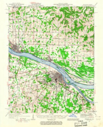
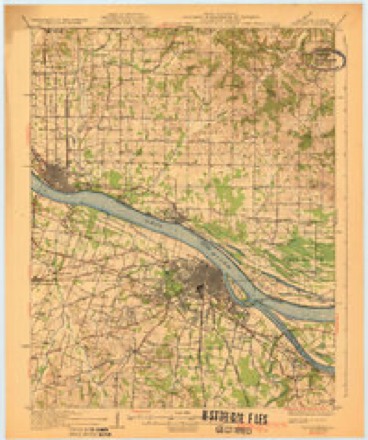
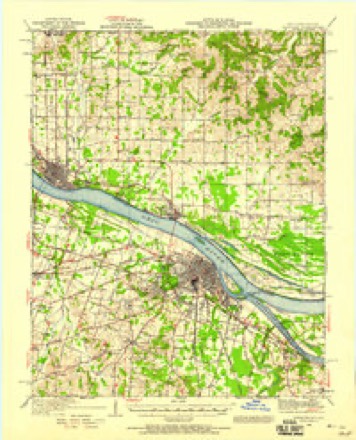
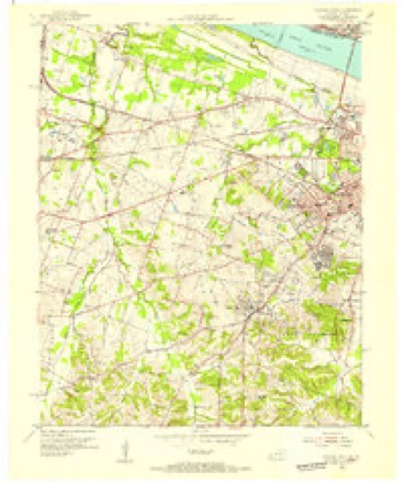
22 topographic sheets cover this place, the earliest surveyed in 1926 and the latest in 1987. It stands in East Brooklyn precinct. It lies in ZIP code area 62910. It stands on Mud Creek. The Survey maps it on the Paducah West quadrangle. 725 people lived here at the 2020 count. It stands 341 feet above sea level.
Population over time
2 figuresBrookport fell from 984 to 725 between 2010 and 2020. These are the recorded population figures Wikidata holds for this place, reached through the Geographic Names Information System number this page is keyed on rather than by name, so they belong to this place and not to another of the same name. Most are census counts, but not all are: an early figure may be a founding or settlement estimate, and an estimate published within five years of a census is left out. The change column is computed, and is left blank where more than 20 years separate a figure from the one before it, because a gap that long is not a change between two counts.
| Year | People | Change |
|---|---|---|
| 2010 | 984 | |
| 2020 | 725 | -259 (-26%) |
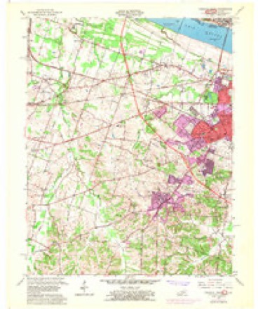
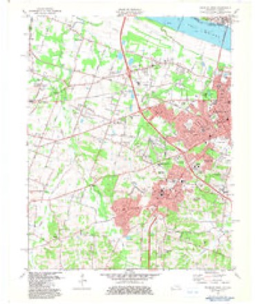
Topographic sheets covering this place
14 surveys from 22 printed sheetsMatched by testing this settlement's coordinate against the published boundary of every sheet in the United States Geological Survey's historical collection. Each opens the scanned sheet at the Survey.
- 1926 USGS Paducah quadrangle1:62500
- 1929 USGS Paducah quadrangle1:62500, 4 printings
- 1940 USGS Paducah quadrangle1:62500
- 1949 USGS Paducah quadrangle1:250000, 2 printings
- 1950 USGS Paducah quadrangle1:250000
- 1954 USGS Paducah quadrangle1:250000, 2 printings
- 1954 USGS Paducah West quadrangle1:24000
- 1958 USGS Paducah West quadrangle1:24000, 2 printings
- 1961 USGS Paducah quadrangle1:250000, 2 printings
- 1964 USGS Paducah quadrangle1:250000, 2 printings
- 1982 USGS Paducah West quadrangle1:24000
- 1984 USGS Paducah quadrangle1:100000
- 1986 USGS Paducah quadrangle1:100000
- 1987 USGS Paducah quadrangle1:250000






Fires near this place
26 since 1997Regional context, not property-specific evidence. The federal wildfire occurrence database lists 26 fires within 5 miles of Brookport between 1997 and 2013, burning about 86 acres in total. 1 started naturally. 2 were recorded as arson. Distance is straight-line from the map coordinates, so a fire counted here may appear on a neighbouring settlement's page as well.
| Reported cause | Fires |
|---|---|
| Missing data/not specified/undetermined | 14 |
| Debris and open burning | 7 |
| Arson/incendiarism | 2 |
| Smoking | 1 |
| Recreation and ceremony | 1 |
| Natural | 1 |
The most recent of them, most recent first, with the day each was reported and the service that recorded it.
| Date | Cause | Size | Reported by | Name on the report |
|---|---|---|---|---|
| 25 September 1999 | Missing data/not specified/undetermined | 5.0 acres | Kentucky Division of Forestry | not named |
| 23 September 1999 | Smoking | 3.0 acres | Kentucky Division of Forestry | not named |
| 18 August 2012 | Debris and open burning | under an acre | Illinois Division of Forestry Resources | HANNA |
| 8 July 2012 | Natural | under an acre | Illinois Division of Forestry Resources | MAGIO |
| 7 July 2012 | Debris and open burning | 5.0 acres | Illinois Division of Forestry Resources | MORRIS |
| 2 July 2012 | Missing data/not specified/undetermined | 2.0 acres | Illinois Division of Forestry Resources | UNIONVILLE |
| 19 July 2011 | Debris and open burning | under an acre | Illinois Division of Forestry Resources | BUSCLAS |
| 26 June 2012 | Debris and open burning | under an acre | Illinois Division of Forestry Resources | R OWENS |
Settlements close enough to share some of these fires:
Storms near this place
60 of 65 shownRegional context, not property-specific evidence. The National Weather Service names Brookport in 65 storm reports between 1995 and 2025: 46 flood, 8 thunderstorm wind, 5 hail, 2 flash flood. The reports record 3 deaths and 33 injuries. Each account below is quoted exactly as the forecast office filed it, from the NOAA Storm Events Database, and each date opens the federal record of that event.
| When | Event | Place named | Harm | What the report says |
|---|---|---|---|---|
| November 2013 | Tornado (EF3) | Brookport | 3 killed, 33 hurt, $5,500,000 | The tornado crossed the Ohio River from McCracken County, Kentucky into Massac County, Illinois. Video of the tornado taken by a barge operator as it crossed the Ohio River indicated it was completely rain-wrapped. This long-track tornado attained its peak intensity as it came onshore into Brookport, a small community along the Ohio River. Peak winds here were estimated near 145 mph. About a half dozen mobile homes were obliterated. Dozens of mobile homes were destroyed, many of which were blown 100 feet or more. Three mobile home residents were killed. A 62-year-old woman died at a local hospital within hours of sustaining blunt force trauma injuries in the tornado. A 58-year-old woman died at her residence as a result of blunt force trauma injuries. A 56-year-old man also died of blunt force trauma injuries sustained at his residence. An exact injury count was unavailable, but local hospitals reported over two dozen injuries. The Metropolis hospital reported 15 victims were brought to the emergency room, with no patient admissions. Three patients were transferred to other hospitals by air or ambulance. Injuries ranged from cuts and scrapes to broken bones and head injuries. One home was leveled. Dozens of homes, garages, storage buildings, businesses, and other buildings were structurally damaged. Emergency management officials reported 233 residences were affected from Brookport east to the Pope County line. 130 of those homes were habitable with minor to moderate damage, 27 were uninhabitable, and 76 homes were destroyed. 184 were located in the city of Brookport, and 49 were outside the city limits. Several cars and a school bus were tossed around. Hundreds if not thousands of trees were snapped and uprooted. The tornado caused some minor damage to guard rails on the Ohio River bridge that carries traffic from Paducah to Brookport on U.S. Highway 45. The tornado continued east along Unionville Road, eventually crossing into Pope County. The total path length of this tornado was 42 miles. The parent supercell tracked from southeast Missouri across the Mississippi River through the Paducah area, then east to the Kentucky Lake area of western Kentucky. |
| May 2011 | Flood | Brookport | $2,000,000 | Major flooding continued on the Ohio River from April. At the Brookport river gage, the flood crest of 57.00 feet on the night of May 5 was about 3.5 feet higher than the 1997 flood. This was still several feet lower than the record crest set in 1937. The activation of the New Madrid Floodway by the U.S. Army Corps of Engineers spared Massac County from an even higher crest that would have inundated even larger areas of Metropolis. With the detonation of the Mississippi River levee at Birds Point, Missouri, the Ohio River stopped rising or rose much more slowly at the Brookport gage. A voluntary evacuation of the city of Brookport was requested due to potential problems with its levees. Most residents east of downtown Metropolis living between U.S. Highway 45 and the river were forced to evacuate as their homes flooded. Some dwellings on the other side of Route 45 were flooded. Several businesses along U.S. Highway 45, mostly car dealerships and restaurants, were forced to close as water crept across the highway near Fort Massac State Park. The highway remained open but reduced to two lanes. A massive sandbagging operation was conducted to attempt to protect many homes and businesses along U.S. 45 from Interstate 24 to the downtown area of Metropolis, as well as Joppa. A couple of nursing homes were evacuated. Schools were closed. Shelters were opened for those who were displaced. A hotel-casino along the Metropolis riverfront was closed for over a month. |
| March 2011 | Flood | Brookport | $200,000 | no account filed |
| March 2018 | Flood | Brookport | $100,000 | Moderate flooding continued on the Ohio River from late February. At the Brookport river gage, the river crested at 52.8 feet on the 2nd. Flood stage there is 37 feet. This flood crest was less than a foot below the March, 1997 flood. Isolated evacuations of some lowland residents were conducted. In the city of Metropolis, several streets were closed, a few residences were evacuated, and a casino riverboat was closed for a week or more. The closure of the casino had a significant impact on the local economy. Flooding of the casino's parking lot and entrance prompted the closure. There was little property damage to the casino itself. Some riverside parks were flooded, including large parts of Fort Massac State Park. |
| January 1996 | Thunderstorm Wind | Brookport | $40,000 | no account filed |
| July 2016 | Thunderstorm Wind | Brookport | $35,000 | A mobile home was destroyed a few miles north of Brookport. The occupants escaped safely. Numerous trees were blown down east of Brookport, resulting in some impassable roads. |
| May 2005 | Thunderstorm Wind | Brookport | $15,000 | Some shingles were blown off a house, and the metal roof was blown off an older farm building. Three very large oak trees were blown down, along with power lines. Two trucks were damaged from debris. |
| December 2013 | Flood | Brookport | $10,000 | Widespread flooding of creeks and fields was reported. Numerous roads around the county had water over them. Eight inches of water covered parts of a main street in Metropolis. A lake overflowed its embankment. Massac Creek rose out of its banks and threatened to flood homes just north of Metropolis. A sewage backup occurred at a church. The total rainfall for the calendar day was 9.57 inches at a meteorologist's residence in the central part of Massac County. |
| April 2014 | Flood | Brookport | $5,000 | Minor flooding occurred along the Ohio River. Low-lying woods near the river were flooded, including sections of Fort Massac State Park. Boat ramps and other river access points were underwater. |
| October 1998 | Thunderstorm Wind | Brookport | $5,000 | A number of trees and power lines were blown down. No structural damage was reported. |
| March 2021 | Flood | Brookport | $3,000 | Minor flooding occurred on the Ohio River. Low-lying fields and woods in the flood plain were underwater. Portions of Fort Massac State Park were flooded, closing some of the river access roads. |
| April 1998 | Thunderstorm Wind | Brookport | $3,000 | Trees were snapped. |
| May 2013 | Flood | Brookport | $2,000 | Continuing from April into May, minor flooding occurred on the Ohio River. There was minor flooding of low-lying fields and woodlands near the river, including parts of Fort Massac State Park in Metropolis. River access roads and boat ramps were flooded. |
| March 2025 | Thunderstorm Wind | Brookport | $1,000 | A tree was blown down onto a house in Brookport. |
| March 2016 | Flood | Brookport | $1,000 | Minor flooding continued from February along the Ohio River. Small portions of Fort Massac State Park in Metropolis were flooded. There was flooding of low-lying bottomland woods and fields. |
| March 2015 | Flood | Brookport | $1,000 | Minor flooding occurred on the Ohio River. At the Brookport river gage, the river crested at 47.30 feet on the 17th. Flood stage is 37 feet. Floodwaters entered a neighborhood in Metropolis, closing a few side streets and inundating one mobile home. Some water entered Brookport. Very few structures were affected, though water reached the foundation of at least one house. Large areas of agricultural land were flooded countywide, but planting was not yet underway. Much of Fort Massac State Park was flooded. This flood crest was just several inches below the flood of March, 2008. |
| December 2013 | Flood | Brookport | $1,000 | Minor flooding occurred along the Ohio River. Low-lying fields and woodlands were flooded, including riverside parks. River access roads were flooded. |
| December 2011 | Flood | Brookport | $1,000 | Minor flooding occurred on the Ohio River. Bottomland fields and some parks were inundated, including flood-prone sections of Fort Massac State Park in Metropolis. A few county roads along the river were affected. River recreation facilities such as boat ramps were affected. |
| March 2008 | Flood | Brookport | $1,000 | Minor flooding of the Ohio River occurred. At the Brookport gage, the river crested at 47.70 feet on March 25. Flood stage there is 37 feet. Floodwaters entered a neighborhood in Metropolis, closing a few side streets and inundating one mobile home. Long-term deterioration of the Brookport floodwall resulted in large volumes of water entering the town. City pumps were manned 24 hours a day for weeks to lower water levels in the town. Very few structures were affected, though water reached the foundation of at least one house. Large areas of agricultural land were flooded countywide, but planting was not yet underway. Much of Fort Massac State Park was flooded. |
| February 2025 | Flood | Brookport | - | Low-lying fields and woods in the flood plain near Paducah were underwater. Portions of Fort Massac State Park were flooded, closing some of the river access roads. The river crested at 43.2 feet at Paducah just above the moderate flood level of 43 feet. |
| January 2023 | Flood | Brookport | - | Two to three inches of water were over Unionville Road. A weather observer in the Cocorahs network near Unionville measured a 24-hour total of 3.09 inches. |
| June 2022 | Hail | Brookport | - | Dime to quarter size hail fell at the Ohio River bridge in Brookport. |
| March 2020 | Flood | Brookport | - | Moderate flooding occurred on the Ohio River. At the river gage at Paducah, KY, the river crested at 44.91 feet on the 31st. Flood stage is 39 feet. Riverside parks and campgrounds were inundated. Extensive flooding of low-lying woods and fields occurred. Some rural county roads were closed. Very few if any structures were affected, though water approached streets in Metropolis riverfront areas. The flooding continued into April. |
| January 2020 | Flood | Brookport | - | Minor flooding occurred on the Ohio River. Sections of Fort Massac State Park in bottomlands near the river were flooded. Low-lying woods and fields were flooded. |
| February 2018 | Flood | Brookport | - | The Ohio River rose above flood stage around mid-month and continued rising through the end of the month. Low-lying county roads were closed. Sections of Fort Massac State Park were flooded and closed in Metropolis. |
| March 2018 | Flood | Brookport | - | The Ohio River rose above flood stage on the 30th and continued rising through the end of the month. The flooding during late March was minor, consisting of flooded bottomland woods and fields. Small portions of Fort Massac State Park at Metropolis were flooded. |
| May 2017 | Flood | Brookport | - | An extended period of minor flooding occurred on the Ohio River. Portions of Fort Massac State Park in Metropolis were flooded, closing the main road through the park. Low-lying woods were flooded, along with a few side roads. |
| April 2017 | Flood | Brookport | - | Minor flooding occurred along the Ohio River as the month ended. Low-lying woods and fields near the river were under water. Portions of Fort Massac State Park were flooded, prompting the closure of the riverfront area of the park. |
| February 2016 | Flood | Brookport | - | Minor flooding occurred along the Ohio River. Small portions of Fort Massac State Park were flooded. There was flooding of low-lying bottomland woods and fields. The river continued rising into March. |
| July 2015 | Flood | Brookport | - | Minor flooding occurred along the Ohio River. The flooding affected mainly bottomland woods, including parts of Fort Massac State Park. |
| April 2015 | Flood | Brookport | - | Minor flooding occurred along the Ohio River. Mainly agricultural bottomland and low-lying areas were under water, including sections of Fort Massac State Park. |
| December 2015 | Flood | Brookport | - | The Ohio River began its rise above flood stage late in the month. There was considerable flooding of low-lying fields and woodlands. Parts of Fort Massac State Park and some river access roads were underwater. At Brookport, a chronic failure of a flapper gate in the floodwall allowed water to enter the city. Sandbagging and pumping operations were required to minimize the impact to property. In Metropolis, water approached the city streets closest to the river. Floodwater entered the access road and parking lot of a riverboat casino, causing some inconvenience. The flooding continued into January. |
| January 2014 | Flood | Brookport | - | Minor flooding lingered along the Ohio River through the first few days of 2014. Low-lying fields and woodlands were flooded, including riverside parks. River access roads were flooded. |
| January 2013 | Flood | Brookport | - | Minor flooding occurred along the Ohio River near Brookport. Some low-lying parks and woodlands near the river were underwater. |
| February 2013 | Flood | Brookport | - | Minor flooding occurred along the Ohio River. Low-lying woods and fields, as well as riverside access roads, were inundated. Small portions of Fort Massac State Park in Metropolis were flooded. |
| April 2013 | Flood | Brookport | - | Minor flooding occurred along the Ohio River near Brookport, affecting low-lying fields, woods, and river access points. The river continued rising into early May. |
| October 2013 | Heavy Rain | Brookport | - | A secondary road was underwater in some places. |
| March 2013 | Flood | Brookport | - | Minor flooding occurred along the Ohio River in the Brookport and Metropolis areas. Low-lying fields and woodlands were underwater, including small parts of Fort Massac State Park in Metropolis. |
| January 2012 | Flood | Brookport | - | Minor flooding occurred along the Ohio River. Low-lying woods and fields near the river were flooded. Some low parts of Fort Massac State Park were flooded. |
| June 2012 | Hail | Brookport | - | Six miles north of Brookport, a farmer reported measuring a hailstone three inches in diameter. At Unionville, quarter-size hail was reported. |
| February 2012 | Flood | Brookport | - | Minor flooding occurred along the Ohio River. Low-lying woods and fields near the river were flooded. Some low parts of Fort Massac State Park were flooded. |
| June 2011 | Flood | Brookport | - | The Ohio River fell below flood stage at Brookport for the first time since February 28. The flooding in June was relatively very minor. Some low-lying fields and parks along the river were flooded. |
| April 2011 | Flood | Brookport | - | A voluntary evacuation of the city of Brookport was requested due to potential problems with its levees. Residents of Metropolis living in flood-prone areas within a few blocks of the river were asked to evacuate. This included all houses that were affected by the March, 1997 flood. A massive sandbagging operation was conducted to attempt to protect many homes and businesses along U.S. 45 from Interstate 24 to the downtown area of Metropolis, as well as Joppa. Shelters were opened for those who were displaced. A hotel-casino along the Metropolis riverfront was closed. |
| March 2010 | Flood | Brookport | - | Minor flooding of the Ohio River occurred at Brookport. At the Brookport river gage, where flood stage is 37 feet, the river crested at 37.70 feet on the 21st. Low-lying fields and woodlands near the river were flooded. Some flooding of river access roads and parks occurred. |
| February 2010 | Flood | Brookport | - | Minor flooding occurred along the Ohio River. At the Brookport gage, the river crested at 41.20 feet on the 3rd. After falling a little, the river rose slowly again to 39.10 feet on the 12th. Flood stage at Brookport is 37 feet. Some bottomland fields, river boat launches, and river access roads were under water. |
| May 2010 | Flood | Brookport | - | Minor flooding of the Ohio River occurred in the Brookport and Metropolis areas. Due to a floodgate that was inadvertently left open in the Brookport floodwall, sandbagging was required to hold floodwaters out of homes. Several residences were threatened. Bottomlands along the river were inundated, including small portions of Fort Massac State Park in Metropolis. Boat ramps and roads were closed in the park. |
| January 2010 | Flood | Brookport | - | Minor flooding occurred on the Ohio River. At the Brookport gage, the river crested at 41.20 feet on the 28th. Flood stage there is 37 feet. Low-lying portions of Fort Massac State Park were flooded. Some low-lying fields near the river were inundated. The river remained above flood stage into early February. |
| May 2009 | Flood | Brookport | - | Minor flooding of the Ohio River occurred. At the Brookport gage, where flood stage is 37 feet, the river crested at 45.0 feet on the 12th. Agricultural bottomland and low-lying areas were flooded. Portions of Fort Massac State Park in Metropolis were underwater. |
| February 2008 | Flood | Brookport | - | The Ohio River crested at 39.60 feet at Brookport on the 18th. Flood stage is 37 feet. Minor flooding of low-lying bottomlands and fields occurred. |
| January 2007 | Flood | Brookport | - | At Brookport, where flood stage is 37 feet, the Ohio River crested at 39.3 feet on the 16th. This resulted in minor flooding. Bottomland fields and woodlands were flooded, along with some river access roads. |
| June 2007 | Flash Flood | Brookport | - | Street flooding occurred in southeast portions of the county. |
| May 2004 | Funnel Cloud | Brookport | - | A funnel cloud was observed crossing the Ohio River from Paducah into Massac County, Illinois. This funnel cloud had earlier briefly touched down in West Paducah. |
| September 2001 | Hail | Brookport | - | Dime size hail fell at Brookport Lock and Dam on the Ohio River. |
| May 2000 | Funnel Cloud | Brookport | - | A supercell thunderstorm which began near Carbondale and produced baseball size hail as it moved southeast across Johnson County became tornadic over Massac County. Although no touchdowns were reported, a funnel cloud was observed quite close to the ground. |
| July 1995 | Thunderstorm Wind | Brookport | - | Trees and power lines were blown down. |
| April 2020 | Flood | Brookport | - | no account filed |
| February 2020 | Flood | Brookport | - | no account filed |
| January 2019 | Flood | Brookport | - | no account filed |
| January 2019 | Flood | Brookport | - | no account filed |
| May 2018 | Hail | Brookport | - | no account filed |
Nearest settlements
The eight closest, with where each one stands in the county. Distances are straight-line, computed from the Geographic Names Information System coordinates.
| Map | Place | Distance | Sheets |
|---|---|---|---|
| Shady Grove | 3.4 miles | 24 | |
| Unionville | 4.4 miles | 24 | |
| Massac City | 4.9 miles | 23 | |
| Metropolis | 5.7 miles | 23 | |
| Midway | 8.0 miles | 23 | |
| Round Knob | 10.2 miles | 23 | |
| Choat | 10.9 miles | 19 | |
| Joppa | 12.7 miles | 19 |
Elsewhere
Matched on this settlement's Geographic Names Information System number rather than its name, so it cannot be a different place of the same name in another state.
| Wikipedia article on Brookport | An encyclopaedic summary. Its text is share-alike, so it is linked here rather than copied. |
| Wikidata item Q577049 | The structured record the population and elevation above come from. Public domain (CC0). |
Provenance
This settlement is recorded in the Geographic Names Information System as feature 424673. The sheet list is computed by point-in-boundary test against the United States Geological Survey's historical topographic inventory. Both are works of the United States government and carry no copyright under 17 U.S.C. 105.
Wildfire. Short, Karen C. 2022. Spatial wildfire occurrence data for the United States, 1992-2020 [FPA_FOD_20221014]. 6th Edition. Fort Collins, CO: Forest Service Research Data Archive. https://doi.org/10.2737/RDS-2013-0009.6 Collected with United States Government funding and usable without additional permissions or fees.
Storms. NOAA National Centers for Environmental Information, Storm Events Database https://www.ncei.noaa.gov/stormevents/ A work of the United States government, no copyright under 17 U.S.C. 105. Narratives are quoted verbatim from the National Weather Service report and are not edited or summarised.