 Block
Metropolis, Illinois
23 topographic sheets cover this place, the earliest surveyed in 1926 and the latest in 1996. It stands in Metropolis No. 2 precinct. It lies in ZIP code area 62960. It stands on Mud Creek. The Survey maps it on the Metropolis quadrangle. 5,969 people lived here at the 2020 count. It stands 308 feet above sea level.
Research this city
On record in Metropolis
Buildings and businesses the archive holds for this place. Each opens its own page, with the source record it came from.
On the National Register 2 records
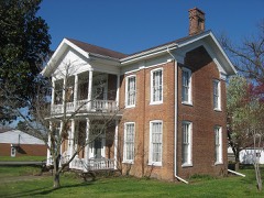 Elijah P. Curtis Houselisted 1978
 Fort Massac Sitelisted 1971
Population over time
2 figuresMetropolis fell from 6,537 to 5,969 between 2010 and 2020. These are the recorded population figures Wikidata holds for this place, reached through the Geographic Names Information System number this page is keyed on rather than by name, so they belong to this place and not to another of the same name. Most are census counts, but not all are: an early figure may be a founding or settlement estimate, and an estimate published within five years of a census is left out. The change column is computed, and is left blank where more than 20 years separate a figure from the one before it, because a gap that long is not a change between two counts.
| Year | People | Change |
|---|---|---|
| 2010 | 6,537 | |
| 2020 | 5,969 | -568 (-9%) |
Topographic sheets covering this place
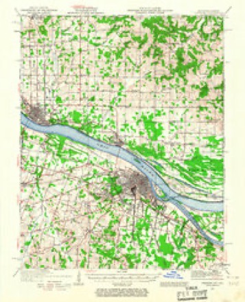
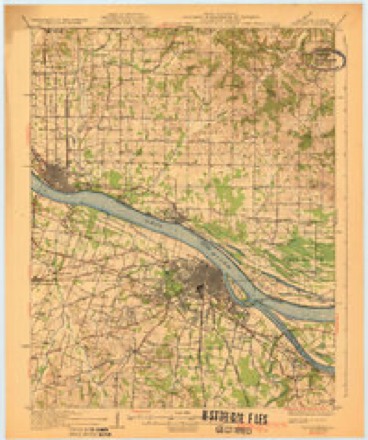
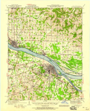
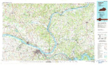
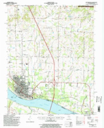
15 surveys from 23 printed sheetsMatched by testing this settlement's coordinate against the published boundary of every sheet in the United States Geological Survey's historical collection. Each opens the scanned sheet at the Survey.
- 1926 USGS Paducah quadrangle1:62500
- 1929 USGS Paducah quadrangle1:62500, 4 printings
- 1940 USGS Paducah quadrangle1:62500
- 1949 USGS Paducah quadrangle1:250000, 2 printings
- 1950 USGS Paducah quadrangle1:250000
- 1954 USGS Metropolis quadrangle1:24000
- 1954 USGS Paducah quadrangle1:250000, 2 printings
- 1961 USGS Paducah quadrangle1:250000, 2 printings
- 1964 USGS Paducah quadrangle1:250000, 2 printings
- 1967 USGS Metropolis quadrangle1:24000
- 1982 USGS Metropolis quadrangle1:24000, 2 printings
- 1984 USGS Paducah quadrangle1:100000
- 1986 USGS Paducah quadrangle1:100000
- 1987 USGS Paducah quadrangle1:250000
- 1996 USGS Metropolis quadrangle1:24000






Fires near this place
43 since 1997Regional context, not property-specific evidence. The federal wildfire occurrence database lists 43 fires within 5 miles of Metropolis between 1997 and 2016, burning about 420 acres in total. 1 started naturally. 1 was recorded as arson. Distance is straight-line from the map coordinates, so a fire counted here may appear on a neighbouring settlement's page as well.
| Reported cause | Fires |
|---|---|
| Missing data/not specified/undetermined | 19 |
| Debris and open burning | 11 |
| Railroad operations and maintenance | 4 |
| Recreation and ceremony | 4 |
| Equipment and vehicle use | 3 |
| Arson/incendiarism | 1 |
| Natural | 1 |
The most recent of them, most recent first, with the day each was reported and the service that recorded it.
| Date | Cause | Size | Reported by | Name on the report |
|---|---|---|---|---|
| 29 September 2008 | Recreation and ceremony | 1.0 acres | Kentucky Division of Forestry | not named |
| 20 September 2004 | Missing data/not specified/undetermined | 1.0 acres | Kentucky Division of Forestry | not named |
| 11 September 2012 | Missing data/not specified/undetermined | under an acre | Illinois Division of Forestry Resources | CREEK |
| 7 August 2012 | Equipment and vehicle use | 5.0 acres | Illinois Division of Forestry Resources | KRUSER |
| 6 August 2012 | Debris and open burning | 5.0 acres | Illinois Division of Forestry Resources | BUNTING |
| 30 August 2011 | Equipment and vehicle use | 1.0 acres | Illinois Division of Forestry Resources | MERMET FLATS |
| 30 August 1999 | Missing data/not specified/undetermined | 5.0 acres | Kentucky Division of Forestry | not named |
| 23 August 2010 | Missing data/not specified/undetermined | 6.0 acres | Illinois Division of Forestry Resources | BRAMER |
Settlements close enough to share some of these fires:
Mines and quarries near this place
3 within 5 milesRegional context, not property-specific evidence. The federal mineral resources record lists 3 workings within 5 miles of Metropolis: 3 past producers. None of them still produces. What was taken out: Sand and Gravel, Construction, Stone. Distance is straight-line from the map coordinates, so a quarry counted here may appear on a neighbouring settlement's page as well.
| Where | Site | Commodity | Status | Recorded |
|---|---|---|---|---|
| Massac County Pit | Stone, Sand and Gravel, Construction | Past Producer | ||
| Federal Sand & Gravel Dredge | Sand and Gravel, Construction | Past Producer | ||
| Metropolis Pit | Sand and Gravel, Construction | Past Producer |
Storms near this place
60 of 93 shownRegional context, not property-specific evidence. The National Weather Service names Metropolis in 93 storm reports between 1993 and 2025: 45 thunderstorm wind, 18 hail, 12 flood, 5 flash flood. The reports record 6 injuries. Each account below is quoted exactly as the forecast office filed it, from the NOAA Storm Events Database, and each date opens the federal record of that event.
| When | Event | Place named | Harm | What the report says |
|---|---|---|---|---|
| July 2016 | Tornado (EF1) | Metropolis | 2 hurt, $350,000 | A funnel cloud crossed the Ohio River from Kentucky, then touched down on the southwest edge of Metropolis a few blocks from the Ohio River. The most significant damage occurred along a residential street next to the city's elementary school. The school had window and roofing damage. The primary school received more serious structural damage, likely in excess of 100,000 dollars. Nearby homes sustained roof damage, and numerous large trees were uprooted or snapped. Power poles were down. The city fire department responded to six fire calls and three medical calls directly related to the storm. A tree fell on a car, resulting in minor injuries to the driver. On the east edge of Metropolis, the tornado ripped the roof off of a maintenance shed. The tornado moved through Fort Massac State Park and exited the park on U.S. Highway 45 just west of Interstate 24. A motel just west of the interstate sustained minor to moderate roof damage. The path ended near the intersection of Highway 45 and I-24. A photograph was taken of the funnel cloud over Metropolis, but the bottom part of the funnel was behind trees and buildings. Widespread power outages lasted for at least 12 hours. Peak winds were estimated near 105 mph. |
| July 2007 | Lightning | Metropolis | 2 hurt | Two persons were injured when lightning struck as they baled hay. The first person was hooking up a tractor to another piece of equipment when the lightning struck, causing burns on the arm. A second person standing further away was knocked unconscious. Neither person was critically injured. |
| January 1999 | Thunderstorm Wind | Metropolis | 1 hurt, $40,000 | A mobile home was overturned, injuring an elderly female inside. The victim was trapped inside her home for about 20 minutes until fire officials cut an opening to reach her. She was treated and released from a local hospital with bruises and scratches. The trailer was tied down with anchors. In addition, a shed and home in the nearby area sustained damage. Numerous trees were down. The damage path appeared to cross Interstate 24 midway between Metropolis and Round Knob. |
| April 1999 | Tornado (F0) | Metropolis | 1 hurt, $10,000 | A weak tornado briefly touched down in the vicinity of U.S. 45 between Joppa and Metropolis. The tornado occurred just outside of a coal terminal. A 9-by-9 foot guard shack on the coal terminal property was destroyed when the roof was blown off followed by the walls collapsing. A guard inside the shack was treated at a hospital for cuts caused by flying glass. A house across the street had very minor structural damage on its east side, with debris blown from the north to the west side of the house. The tornado was likely at tree-top level. A coal terminal worker reported seeing a "funnel." This tornado was associated with a severe thunderstorm complex that originated over the Mississippi River counties of western Kentucky and moved northeast. |
| March 2017 | Thunderstorm Wind | Metropolis | $400,000 | Numerous trees were blown down and widespread minor roof damage occurred, mainly in the southern part of the county. Between Metropolis and Brookport, a large metal shed was blown apart, and a tree landed on a house. The house roof sustained minor to moderate damage. In Metropolis, a window was blown out of a downtown museum. A portion of the roof was blown off a Metropolis city business, and a shed was destroyed. There were numerous reports of downed tree limbs on Metropolis city streets and some county roads. The west part of Metropolis was without power. One tree fell onto a house in Brookport. The house was heavily damaged, and the family was displaced. A mobile home was partially unroofed in Brookport. |
| November 2005 | Thunderstorm Wind | Metropolis | $250,000 | A microburst with wind speeds of 60-70 mph damaged a one-block area at 4th and Ferry Streets in downtown Metropolis. One brick wall of a large commercial structure crumbled, and the roof was damaged. The structure, which was built in 1867, was damaged beyond repair and torn down. An adjacent store suffered roof damage. A building across the street received some roof damage, and a window was blown out. A nearby church received roof damage. A carport was blown into a church. |
| May 2003 | Tornado (F2) | Metropolis | $80,000 | The roofs of several houses were severely damaged or blown off. One business was destroyed. Several barns and outbuildings were destroyed. Numerous large trees were blown down, along with seven power poles. Peak winds were estimated near 125 MPH. The damage path began due north of Metropolis and crossed Illinois Route 145 about 7 miles north-northeast of Metropolis. Route 145 and several smaller roads were closed due to large trees blown across them. This damage was located in nearly the exact location where damaging thunderstorm winds occurred about 48 hours earlier, on the evening of May 4. |
| January 2013 | Thunderstorm Wind | Metropolis | $70,000 | The rubber roof was lifted from the county courthouse. The roof was partially removed from a second structure. Power lines were blown down. A large awning was blown off, and two plate glass windows were blown out in the downtown area. A trained spotter measured a wind gust to 68 mph. |
| June 2010 | Thunderstorm Wind | Metropolis | $60,000 | In Metropolis, large tree limbs were blown down. A metal carport was blown over. A trained spotter measured a wind gust to 60 mph on the Interstate 24 bridge over the Ohio River. The most concentrated area of damage appeared to be on the north side of Metropolis, where numerous large limbs were down, some whole trees were uprooted, and sections of a large fence were blown down. On Interstate 24 at the Metropolis exit, a tractor-trailer rig hauling half of a mobile office was blown off the road. The half of the mobile office was destroyed. |
| May 2013 | Thunderstorm Wind | Metropolis | $50,000 | A severe storm crossed the Ohio River from Paducah, Kentucky. Numerous large tree limbs were blown down in Metropolis, from near Fort Massac State Park to a few miles north of Metropolis. The top of a pine tree fell onto a car. A few trees were uprooted. The damage path appeared to be several miles wide. One residence had shingles blown off the house. |
| February 2011 | Heavy Rain | Metropolis | $50,000 | Viaducts were flooded along three streets in Metropolis, and one of them was impassable. A partially underground home near Joppa gave way to floodwaters and was deemed a total loss. A spotter near Round Knob measured over 4 inches, most of which fell in the previous twelve hours. |
| March 1997 | Flash Flood | Metropolis | $50,000 | no account filed |
| June 2012 | Lightning | Metropolis | $40,000 | Lightning struck the Metropolis Police Department, causing extensive damage to radio equipment and other electronics. |
| October 2013 | Thunderstorm Wind | Metropolis | $30,000 | A large tree fell against a house, severely damaging trusses separating the front wall of the house from the side wall. |
| September 2012 | Thunderstorm Wind | Metropolis | $30,000 | In Metropolis, a window was blown out of a house. Power lines and tree limbs were blown down. An awning was torn off a cafe, and there was siding and gutter damage to houses. A large tree was down across a main street just north of town. |
| May 2007 | Thunderstorm Wind | Metropolis | $25,000 | Numerous trees and power lines were blown down. Shingles were blown off a number of homes. |
| June 2019 | Thunderstorm Wind | Metropolis | $20,000 | A semi was blown over on the Interstate 24 bridge over the Ohio River. Near Brookport, at least a half-dozen trees were snapped along the Ohio River. |
| May 2003 | Thunderstorm Wind | Metropolis | $20,000 | Numerous large trees were blown down. Four telephone poles were broken. Minor damage occurred to less than a dozen homes. Nearly the exact same locations were struck by a considerably more destructive tornado about 48 hours later, on May 6. |
| June 1998 | Thunderstorm Wind | Metropolis | $20,000 | A tree 2 to 3 feet in diameter fell on a house. Two trailers were damaged by wind. |
| March 2006 | Thunderstorm Wind | Metropolis | $15,000 | A wind gust to 59 MPH was measured at the Metropolis airport. In Metropolis, a construction trailer at the riverfront casino was blown over. A tree fell on a house on Route 145. Trees and power lines were down east of Metropolis. |
| May 2006 | Thunderstorm Wind | Metropolis | $15,000 | Several trees were blown down, mainly on the west side of town. One large tree limb landed on a house on U.S. Route 45. Another building was damaged by a downed large tree limb. Power lines were downed. |
| July 2023 | Thunderstorm Wind | Metropolis | $10,000 | Numerous trees and power lines were down. |
| May 2011 | Thunderstorm Wind | Metropolis | $10,000 | A tree was blown down on a mobile home. A wind gust was measured to 63 mph. |
| May 2002 | Thunderstorm Wind | Metropolis | $10,000 | A thunderstorm downburst struck a small area on the east side of Metropolis. About 10 trees were blown down, including one that fell on a house and another on power lines. A carport was blown about 100 feet into some woods. A sign was damaged at a car dealership. |
| May 1997 | Flash Flood | Metropolis | $10,000 | As much as 4 inches of rain was estimated to have fallen near Unionville in 3 hours time. In Metropolis, one inch of rain fell in 30 minutes, causing significant street flooding. |
| January 2016 | Flood | Metropolis | $6,000 | Flooding of the Ohio River continued into January. At the Brookport river gage, the river crested at 48.2 feet on the last day of December. Flood stage there is 37 feet. There was considerable flooding of low-lying fields and woodlands. Parts of Fort Massac State Park and some river access roads were underwater. At Brookport, a chronic failure of a flapper gate in the floodwall allowed water to enter the city. Sandbagging and pumping operations were required to minimize the impact to property. In Metropolis, water approached the city streets closest to the river. The water stopped just short of requiring street closures and evacuations. Floodwater entered the access road and parking lot of a Metropolis riverboat casino, causing some inconvenience. |
| May 2025 | Thunderstorm Wind | Metropolis | $5,000 | Power flashes were observed in Metropolis. |
| March 2000 | Thunderstorm Wind | Metropolis | $5,000 | Shingles were blown off a house, and the porch was damaged. |
| May 1999 | Thunderstorm Wind | Metropolis | $5,000 | Scattered trees and power lines were blown down. |
| July 1997 | Thunderstorm Wind | Metropolis | $5,000 | Tree limbs and power lines were down. A gust to 57 MPH was measured. |
| April 2018 | Flood | Metropolis | $5,000 | no account filed |
| July 1996 | Thunderstorm Wind | Metropolis | $5,000 | no account filed |
| March 2017 | Thunderstorm Wind | Metropolis | $4,000 | Downed tree limbs and power lines were reported on a street on the north end of town. |
| April 2004 | Thunderstorm Wind | Metropolis | $4,000 | no account filed |
| December 2008 | Thunderstorm Wind | Metropolis | $3,000 | High tension power lines were down along a side street. Wind gusts were estimated near 60 mph by law enforcement officers. |
| April 1997 | Thunderstorm Wind | Metropolis | $3,000 | no account filed |
| July 2023 | Thunderstorm Wind | Metropolis | $2,000 | A tree limb was down on power lines. |
| June 2018 | Thunderstorm Wind | Metropolis | $2,000 | Large tree limbs were blown down, blocking Highway 145 and a couple of side roads north of Metropolis. |
| August 2016 | Flash Flood | Metropolis | $2,000 | A railroad viaduct was flooded in Metropolis. A vehicle became partially submerged in the floodwater and was towed out. Portions of County Road 1 were flooded in and near the city of Metropolis. Water was over numerous other streets and intersections in the city. |
| January 2012 | Thunderstorm Wind | Metropolis | $2,000 | A large tree was blown down by a measured wind gust of 60 mph. |
| February 2023 | Thunderstorm Wind | Metropolis | $1,000 | A large tree was blown down. |
| April 2020 | Thunderstorm Wind | Metropolis | $1,000 | Tree limbs up to three inches in diameter were blown down. |
| August 2019 | Thunderstorm Wind | Metropolis | $1,000 | Power lines were down. Power outages were reported. |
| March 1996 | Thunderstorm Wind | Metropolis | $1,000 | no account filed |
| April 1993 | Thunderstorm Wind | Metropolis | $500 | Trees were blown down in Metropolis and 0.75-inch hail fell 5 miles north of Metropolis. |
| April 1994 | Thunderstorm Wind | Metropolis | $50 | Several trees were blown down on the southwest side of Metropolis. |
| February 2025 | Flood | Metropolis | - | Heavy rainfall led to minor flooding of the usual trouble spots in Metropolis, including standing water on one lane of US Highway 45/10th Street. |
| May 2025 | Hail | Metropolis | - | Hail estimated to one inch diameter fell in Metropolis on the north side of a supercell storm. |
| February 2022 | Flood | Metropolis | - | The Ohio River rose above flood stage late in the month and remained there into March. The crest occurred in March. |
| March 2022 | Flood | Metropolis | - | Moderate flooding occurred on the Ohio River. The river crested at 44.58 feet at the Paducah, KY river gage on the 2nd, which is about 5.5 feet above flood stage. Bottomlands along the river were inundated, including small portions of Fort Massac State Park in Metropolis. Boat ramps and roads were closed in the park. |
| March 2020 | Hail | Metropolis | - | A photograph was posted on social media. |
| January 2020 | Flash Flood | Metropolis | - | Six to eight inches of water was flowing over a 30 to 40 foot section of road at the entrance to a subdivision. |
| March 2019 | Hail | Metropolis | - | Several reports of dime to nickel-size hail were received. |
| May 2013 | Heavy Rain | Metropolis | - | Street flooding was reported. |
| June 2011 | Heavy Rain | Metropolis | - | Rainfall from the storm was 1.35 inches. The storm lasted less than an hour. |
| October 2010 | Thunderstorm Wind | Metropolis | - | A wind gust to 69 mph was measured on the north side of the city. |
| April 2009 | Funnel Cloud | Metropolis | - | A rotating wall cloud was observed by trained spotters and an off-duty meteorologist crossing the Ohio River from western McCracken County, KY into the Metropolis area. The wall cloud briefly produced a funnel cloud for a minute or two over the east side of Metropolis. |
| April 2009 | Hail | Metropolis | - | Quarter size hail was reported. Most of the hail was pea to nickel size. Most of the hail reports were on the east side of town. |
| April 2008 | Flood | Metropolis | - | Minor flooding of the Ohio River occurred at Brookport and Metropolis. The river remained above flood stage from early March through late April. The crest in April was 47.40 feet on the 11th. Flood stage at Brookport is 37 feet. Fort Massac State Park was partially underwater. Due to long-term deterioration of the Brookport floodwall and levee system, a network of pumps was manned 24 hours per day to keep the town dry. |
| April 2006 | Thunderstorm Wind | Metropolis | - | Power poles were down. |
Nearest settlements
The eight closest, with where each one stands in the county. Distances are straight-line, computed from the Geographic Names Information System coordinates.
| Map | Place | Distance | Sheets |
|---|---|---|---|
| Massac City | 0.9 miles | 23 | |
| Choat | 5.6 miles | 19 | |
| Brookport | 5.7 miles | 22 | |
| Round Knob | 6.6 miles | 23 | |
| Joppa | 7.1 miles | 19 | |
| Midway | 8.0 miles | 23 | |
| Shady Grove | 9.0 miles | 24 | |
| Unionville | 10.0 miles | 24 |
Elsewhere
Matched on this settlement's Geographic Names Information System number rather than its name, so it cannot be a different place of the same name in another state.
| Wikipedia article on Metropolis | An encyclopaedic summary. Its text is share-alike, so it is linked here rather than copied. |
| Wikidata item Q304036 | The structured record the population and elevation above come from. Public domain (CC0). |
Provenance
This settlement is recorded in the Geographic Names Information System as feature 413456. The sheet list is computed by point-in-boundary test against the United States Geological Survey's historical topographic inventory. Both are works of the United States government and carry no copyright under 17 U.S.C. 105.
Wildfire. Short, Karen C. 2022. Spatial wildfire occurrence data for the United States, 1992-2020 [FPA_FOD_20221014]. 6th Edition. Fort Collins, CO: Forest Service Research Data Archive. https://doi.org/10.2737/RDS-2013-0009.6 Collected with United States Government funding and usable without additional permissions or fees.
Mines and quarries. USGS Mineral Resources Data System (MRDS) https://mrdata.usgs.gov/mrds/ A work of the United States government, no copyright under 17 U.S.C. 105.
Storms. NOAA National Centers for Environmental Information, Storm Events Database https://www.ncei.noaa.gov/stormevents/ A work of the United States government, no copyright under 17 U.S.C. 105. Narratives are quoted verbatim from the National Weather Service report and are not edited or summarised.