 Block
Byron, Illinois
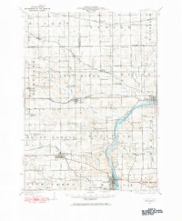
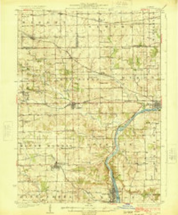
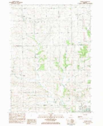
14 topographic sheets cover this place, the earliest surveyed in 1922 and the latest in 1983. It stands in Byron Township. It lies in ZIP code area 61010. It stands on Mill Creek. The Survey maps it on the Seward quadrangle.
On record in Byron
Buildings and businesses the archive holds for this place. Each opens its own page, with the source record it came from.
On the National Register 1 record
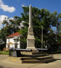 Soldier's Monumentlisted 1985
Topographic sheets covering this place
8 surveys from 14 printed sheetsMatched by testing this settlement's coordinate against the published boundary of every sheet in the United States Geological Survey's historical collection. Each opens the scanned sheet at the Survey.
- 1922 USGS Oregon quadrangle1:62500
- 1924 USGS Oregon quadrangle1:62500, 3 printings
- 1954 USGS Rockford quadrangle1:250000
- 1955 USGS Rockford quadrangle1:250000
- 1958 USGS Rockford quadrangle1:250000, 4 printings
- 1963 USGS Rockford quadrangle1:250000
- 1981 USGS Rockford quadrangle1:100000, 2 printings
- 1983 USGS Seward quadrangle1:24000





In the county-history sources
11,616 words on this townshipThe History of Ogle County, Illinois, Containing a History of the County, Its Cities, Towns, Etc., a Biographical Directory of Its Citizens, War Record of Its Volunteers in the Late Rebellion, General and Local Statistics ... History of the Northwest, History of Illinois ... Etc, published 1878 names this settlement in its chapter on Byron Township. These are the passages that mention it, exactly as the scans read.
This village, situated on a horse -shoe bend of the Rock River in the northern part of the county, is one of the earliest settled localities, is favored by features of unusual value to its development, and will, without doubt, become one of the best towns on the river. For many years it labored under great disadvantages, having no railroad or capital to improve its water power, and in 1877, being visited by a conflagration which leveled to the ground the new growth which it had attained under the stimulus of the railroad.
Passage source: The History of Ogle County, Illinois, Containing a History of the County, Its Cities, Towns, Etc., a Biographical Directory of Its Citizens, War Record of Its Volunteers in the Late Rebellion, General and Local Statistics ... History of the Northwest, History of Illinois ... Etc, published 1878.
About the first of July, 1835, Jared W. Sanford came up Rock River from Dixon, on horseback, en roufe (or Rockford - then called "Midway." Noting the excellent water privilege a mile west of the present site of Byron, on Leaf River, he laid claim to it by planting there a claim-stake, and proceeded on up the river. His brother, Joseph, and Perry Norton were then working on Kent's mill at Midway, and when told of the beautiful country south, they were induced to go down and examine it.
Passage source: The History of Ogle County, Illinois, Containing a History of the County, Its Cities, Towns, Etc., a Biographical Directory of Its Citizens, War Record of Its Volunteers in the Late Rebellion, General and Local Statistics ... History of the Northwest, History of Illinois ... Etc, published 1878.
Mr. Norton still resides one and a half miles north of Byron, and is the oldest living resident. An account of his trip to the " far West," as it was then called, may be of some interest, showing, as it does, the vast changes time has made. From ocean to ocean is now but a pleasant ride of seven days, in palace coaches. Mr. Norton was from April 26 to May 26, 1835, in traveling from New York to Galena. The route was : to Buffalo by canal, to Detroit bv steamboat, across Michigan to Chicago by stage - all passage seats to Chicago were taken fifteen days in advance, such was the multitude seeking Western homes - from Chicago to Ottawa by stage. Ottawa had one tavern, one store, a few dwellings on the south side of the Illinois River, one on the north, and one between the Fox and Illinois Rivers. He went to Paw Paw Grove by private conveyance, and thence to Dixon on foot. Dixon consisted of a tavern, kept by a man named Black, in the old fort of the Black Hawk War, and five or six dwellings. He then went by stage to Galena, where he hired out to a Mr. Brush, agent for Germanicus Kent, of Midway. He arrived there on the eighth day of June. Rockford then consisted of two families and eight or ten young men ; Mr. Kent on the west, and Mr. Haight on the east side of the river. Mr. Kent had begun improvements there in the Fall of 1834; had commenced building a dam across the creek, near the Holland (now the Tinker) place. During the season of Mr. Norton's arrival immigration became more general ; among the settlers were Montague Dunbar, Fox Wood and family, Boswell and family,Thatcher Blake, still a resident of Rockford, and Joseph Sanford, who came in the Fall or Winter of 1834.
Passage source: The History of Ogle County, Illinois, Containing a History of the County, Its Cities, Towns, Etc., a Biographical Directory of Its Citizens, War Record of Its Volunteers in the Late Rebellion, General and Local Statistics ... History of the Northwest, History of Illinois ... Etc, published 1878.
Machine-read from a century-old scan, so expect the errors a machine makes: misspelled names, dropped words, stray characters.
Read the whole chapter on Byron Township - it names this place 49 more 49 times.
Fires near this place
1 since 2019Regional context, not property-specific evidence. The federal wildfire occurrence database lists 1 fire within 5 miles of Byron in 2019, burning about 2 acres in total. None started naturally. None was recorded as arson. Distance is straight-line from the map coordinates, so a fire counted here may appear on a neighbouring settlement's page as well.
| Reported cause | Fires |
|---|---|
| Missing data/not specified/undetermined | 1 |
The most recent of them, most recent first, with the day each was reported and the service that recorded it.
| Date | Cause | Size | Reported by | Name on the report |
|---|---|---|---|---|
| 18 March 2019 | Missing data/not specified/undetermined | 2.0 acres | Illinois Division of Forestry Resources | 1900028 |
Settlements close enough to share some of these fires:
Mines and quarries near this place
10 of 12 shownRegional context, not property-specific evidence. The federal mineral resources record lists 12 workings within 5 miles of Byron: 10 past producers, 2 producers. 2 still produce. What was taken out: Stone, Crushed/Broken, Sand and Gravel, Construction. Distance is straight-line from the map coordinates, so a quarry counted here may appear on a neighbouring settlement's page as well.
| Where | Site | Commodity | Status | Recorded |
|---|---|---|---|---|
| Byron Materials Pit | Sand and Gravel, Construction | Past Producer | ||
| Aschelford Quarry | Stone, Crushed/Broken | Producer | ||
| Farmco Quarry No. 1 | Stone, Crushed/Broken | Producer | ||
| Larsons Quarry | Stone, Crushed/Broken | Past Producer | ||
| Lumpkin Quarry | Stone, Crushed/Broken | Past Producer | ||
| Steven Property | Stone, Crushed/Broken | Past Producer | ||
| Unnamed Limestone Quarry | Stone, Crushed/Broken | Past Producer | ||
| Unnamed Limestone Quarry | Stone, Crushed/Broken | Past Producer | ||
| Unnamed Limestone Quarry | Stone, Crushed/Broken | Past Producer | ||
| Unnamed Limestone Quarry | Stone, Crushed/Broken | Past Producer |
Storms near this place
31 since 1996Regional context, not property-specific evidence. The National Weather Service names Byron in 31 storm reports between 1996 and 2026: 18 thunderstorm wind, 6 hail, 3 flood, 1 lightning. The reports record 1 injury. Each account below is quoted exactly as the forecast office filed it, from the NOAA Storm Events Database, and each date opens the federal record of that event.
| When | Event | Place named | Harm | What the report says |
|---|---|---|---|---|
| June 2004 | Lightning | Byron | 1 hurt | A house was struck by lightning and one person was injured. |
| April 2002 | Hail | Byron | $5,000 | no account filed |
| June 2008 | Thunderstorm Wind | Byron | $1,000 | Large tree limbs and power lines were blown down on North River Drive. |
| April 2026 | Thunderstorm Wind | Byron | - | Emergency management reported a tree down northeast of Byron. |
| July 2024 | Thunderstorm Wind | Byron | - | A photo shared on social media showed utility poles blown down along German Church Road near a golf course. |
| April 2024 | Thunderstorm Wind | Byron | - | A local partner shared photos and reports of damage to soffits and fencing in a neighborhood along Southfield Lane in Byron. A garage door was reportedly blown in, as well. |
| July 2024 | Tornado (EF0) | Byron | - | A tornado with estimated peak winds of 80 mph touched down in a corn field just southeast of the intersection of Lightsville Road and Conger Road, as seen in high resolution satellite imagery. The tornado moved southeast and then turned to the east as it moved through Bryon where it produced tree damage. Roofing material was blown off of a car wash near the corner of Route 2 and Colfax Street. The tornado crossed the Rock River and ended just east of Hales Corner Road. |
| August 2022 | Flash Flood | Byron | - | Standing water was reported at the Route 2 railroad underpass around 4:30 am CST which worsened to a depth of four feet an hour later. A private weather station measured 5.29 inches of rain 3 miles east northeast of Bryon. |
| August 2021 | Thunderstorm Wind | Byron | - | Multiple reports of tree damage were received in the vicinity of Byron. |
| November 2020 | Thunderstorm Wind | Byron | - | Whole trees were blown down and power lines were damaged. |
| March 2019 | Flood | Byron | - | Major river flooding occurred along portions of the Rock River near Bryon. The river crested at 16.64 feet on March 16th. Moderate flood stage is 14 feet and major flood stage is 16 feet. This crest of 16.64 feet was the third highest on record at Bryon. |
| September 2019 | Thunderstorm Wind | Byron | - | Power lines were blown down on 3rd Street. |
| September 2019 | Flood | Byron | - | Water one foot deep was reported underneath the railroad viaduct on Route 2 where a vehicle was stalled. Water over one foot deep was reported on 2nd Avenue. |
| October 2018 | Flood | Byron | - | Moderate flooding occurred along portions of the Rock River near Bryon. The river crested at 15.39 feet on October 8th. Moderate flood stage is 14 feet and major flood stage is 16 feet. This crest of 15.39 feet was the 6th highest on record at Byron. |
| August 2016 | Thunderstorm Wind | Byron | - | Large tree reported blocking part of roadway on Illinois Route 2 near Byron. Time estimated from radar. |
| June 2016 | Hail | Byron | - | Quarter sized hail near Barker Rd. |
| June 2011 | Thunderstorm Wind | Byron | - | Trees and power lines were reported down by Ogle County Sheriff. |
| July 2010 | Thunderstorm Wind | Byron | - | Numerous tree limbs up to 4 inches in diameter were blown down. |
| August 2009 | Heavy Rain | Byron | - | Rainfall of 2.38 inches was reported in the past 24 hours. |
| July 2008 | Thunderstorm Wind | Byron | - | Trees were blown down. |
| June 2007 | Thunderstorm Wind | Byron | - | Six inch tree limbs blown down. |
| July 2006 | Thunderstorm Wind | Byron | - | Trees were blown down. |
| February 1999 | Thunderstorm Wind | Byron | - | Tree limbs and wires were downed near Byron and Mt. Morris. |
| June 1998 | Thunderstorm Wind | Byron | - | Thunderstorm winds blew down trees and limbs and damaged a motel. |
| May 2018 | Hail | Byron | - | no account filed |
| June 2014 | Hail | Byron | - | no account filed |
| March 2007 | Hail | Byron | - | no account filed |
| April 2006 | Hail | Byron | - | no account filed |
| July 2003 | Thunderstorm Wind | Byron | - | no account filed |
| September 2000 | Thunderstorm Wind | Byron | - | no account filed |
| April 1996 | Thunderstorm Wind | Byron | - | no account filed |
Nearest settlements
The eight closest, with where each one stands in the county. Distances are straight-line, computed from the Geographic Names Information System coordinates.
| Map | Place | Distance | Sheets |
|---|---|---|---|
| Byron Hills Estates | 1.2 miles | 14 | |
| Loose Pulley Junction | 1.7 miles | 14 | |
| Von Glen Acres | 2.1 miles | 15 | |
| Stillman Valley | 4.3 miles | 15 | |
| Myrtle | 6.1 miles | 14 | |
| Paynes Point | 7.6 miles | 15 | |
| Leaf River | 7.8 miles | 14 | |
| Lightsville | 8.0 miles | 14 |
Provenance
This settlement is recorded in the Geographic Names Information System as feature 405322. The sheet list is computed by point-in-boundary test against the United States Geological Survey's historical topographic inventory. Both are works of the United States government and carry no copyright under 17 U.S.C. 105.
Wildfire. Short, Karen C. 2022. Spatial wildfire occurrence data for the United States, 1992-2020 [FPA_FOD_20221014]. 6th Edition. Fort Collins, CO: Forest Service Research Data Archive. https://doi.org/10.2737/RDS-2013-0009.6 Collected with United States Government funding and usable without additional permissions or fees.
Mines and quarries. USGS Mineral Resources Data System (MRDS) https://mrdata.usgs.gov/mrds/ A work of the United States government, no copyright under 17 U.S.C. 105.
Storms. NOAA National Centers for Environmental Information, Storm Events Database https://www.ncei.noaa.gov/stormevents/ A work of the United States government, no copyright under 17 U.S.C. 105. Narratives are quoted verbatim from the National Weather Service report and are not edited or summarised.