 Block
Carthage, Illinois
12 topographic sheets cover this place, the earliest surveyed in 1918 and the latest in 1985. It stands in Taylor Township. It lies in ZIP code area 61061. The Survey maps it on the Daysville quadrangle.
Topographic sheets covering this place
6 surveys from 12 printed sheetsMatched by testing this settlement's coordinate against the published boundary of every sheet in the United States Geological Survey's historical collection. Each opens the scanned sheet at the Survey.
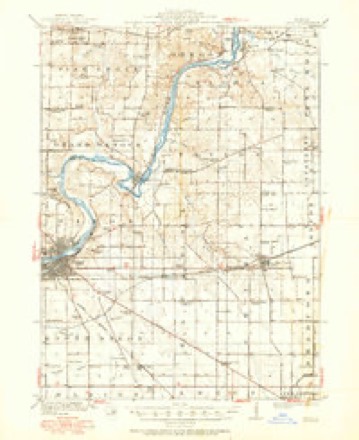
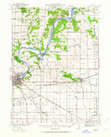
- 1918 USGS Dixon quadrangle1:62500, 3 printings
- 1950 USGS Dixon quadrangle1:62500, 2 printings
- 1958 USGS Aurora quadrangle1:250000, 3 printings
- 1961 USGS Aurora quadrangle1:250000
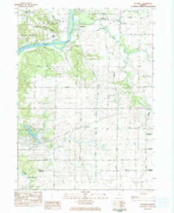
- 1983 USGS Daysville quadrangle1:24000
- 1985 USGS Dixon quadrangle1:100000, 2 printings



In the county-history sources
1,043 words on this townshipThe History of Ogle County, Illinois, Containing a History of the County, Its Cities, Towns, Etc., a Biographical Directory of Its Citizens, War Record of Its Volunteers in the Late Rebellion, General and Local Statistics ... History of the Northwest, History of Illinois ... Etc, published 1878 names this settlement in its chapter on Taylor Township. These are the passages that mention it, exactly as the scans read.
ARXOIiD EliKHA, Farmer; Sec. 2 ; P. 0. Taylor ; born in St. Lawrence Co., N. Y., in 1812 ; came to this Co. in 1844, and settled on his present estate of 170 acres, valued at $10,500 ; Mr. A. was the first Collector elected after the organization of the town and collected the first tax ; was also Supervisor two years and is prominently known throughout the town and county ; there was but one house between his home and Franklin when he settled, and at that time carried all his produce to Chicago ; married Aseneth Earl in 1841 ; she was born in Augusta, Ontario, in 1815; have four children living - Amelia, Maria, Ellen and Melissa ; lost one child - William, born Sept. 18, 1842; enlisted Aug. 9, 1862, in Co. K, 92d I. S. V., and served until Aug. 16, 1863, when he died at Decherd, Tenn.
Passage source: The History of Ogle County, Illinois, Containing a History of the County, Its Cities, Towns, Etc., a Biographical Directory of Its Citizens, War Record of Its Volunteers in the Late Rebellion, General and Local Statistics ... History of the Northwest, History of Illinois ... Etc, published 1878.
Machine-read from a century-old scan, so expect the errors a machine makes: misspelled names, dropped words, stray characters.
Fires near this place
2 since 2019Regional context, not property-specific evidence. The federal wildfire occurrence database lists 2 fires within 5 miles of Carthage between 2019 and 2020, burning about 3 acres in total. None started naturally. None was recorded as arson. Distance is straight-line from the map coordinates, so a fire counted here may appear on a neighbouring settlement's page as well.
| Reported cause | Fires |
|---|---|
| Missing data/not specified/undetermined | 1 |
| Debris and open burning | 1 |
The most recent of them, most recent first, with the day each was reported and the service that recorded it.
| Date | Cause | Size | Reported by | Name on the report |
|---|---|---|---|---|
| 22 April 2020 | Missing data/not specified/undetermined | 2.0 acres | Illinois Division of Forestry Resources | 20-0327 |
| 20 April 2019 | Debris and open burning | 1.0 acres | Illinois Division of Forestry Resources | 19-0317 |
Settlements close enough to share some of these fires:
Mines and quarries near this place
5 within 5 milesRegional context, not property-specific evidence. The federal mineral resources record lists 5 workings within 5 miles of Carthage: 4 past producers, 1 producer. 1 still produces. What was taken out: Stone, Crushed/Broken. Distance is straight-line from the map coordinates, so a quarry counted here may appear on a neighbouring settlement's page as well.
| Where | Site | Commodity | Status | Recorded |
|---|---|---|---|---|
| Ashton Quarry | Stone, Crushed/Broken | Producer | ||
| Sanner Quarry | Stone, Crushed/Broken | Past Producer | ||
| Unnamed Limestone Quarry | Stone, Crushed/Broken | Past Producer | ||
| Unnamed Limestone Quarry | Stone, Crushed/Broken | Past Producer | ||
| W. Karper Quarry | Stone, Crushed/Broken | Past Producer |
Storms near this place
2 since 2015Regional context, not property-specific evidence. The National Weather Service names Carthage in 2 storm reports between 2015 and 2017: 2 tornado. No death or injury is recorded in these reports. Each account below is quoted exactly as the forecast office filed it, from the NOAA Storm Events Database, and each date opens the federal record of that event.
| When | Event | Place named | Harm | What the report says |
|---|---|---|---|---|
| April 2015 | Tornado (EF4) | Carthage | $10,000,000 | This is the second segment of the Rochelle-Fairdale EF-4 tornado. At its strongest, peak winds were estimated to be 200 mph which occurred during this segment of the storm. The tornado entered Ogle County just west of IL-38 and moved northeast where it ripped the roof off of a small barn. A neighborhood was hit on S Skare Court where damage was consistent with EF-3. Some of the homes had large sections of the roofs ripped off while some less well constructed homes (nails instead of bolts) had collapsed walls. The tornado continued northeast and intensified to EF-4 where several well constructed homes along South Richard Road and East Kuehl Court were completely destroyed with the slab swept clean. Several outbuildings were destroyed along East Hemstock Road and South Center Road. A residence on East Bethal Road received heavy damage with most of the outer walls collapsing. The tornado once again intensified to EF-4 near IL-251 and IL-64 where well constructed homes were swept clean off their foundation. A farmstead just northeast of the aforementioned intersection was also swept clean to the foundation. A heavy barn was thrown and rolled on East Lindenwood Road. In total, around 30 homes were damaged or destroyed around Rochelle. The tornado continued into Dekalb County just north of East Quarry Road. (Tornado 2b of 7). |
| February 2017 | Tornado (EF1) | Carthage | - | The tornado toppled farm equipment, collapsed outbuildings, damaged roofs of homes, and broke large branches out of trees. Straight line winds estimated to be up to 80 MPH produced additional damage 1 to 1.5 miles beyond the tornado path. (Tornado #5 of 7). |
Nearest settlements
The eight closest, with where each one stands in the county. Distances are straight-line, computed from the Geographic Names Information System coordinates.
| Map | Place | Distance | Sheets |
|---|---|---|---|
| Lost Nation | 2.9 miles | 12 | |
| Daysville | 4.5 miles | 12 | |
| Watertown | 4.7 miles | 12 | |
| Honey Creek | 5.2 miles | 12 | |
| Grand Detour | 5.4 miles | 12 | |
| Chana | 6.5 miles | 10 | |
| Oregon | 6.7 miles | 14 | |
| Kyte Side Estates | 8.6 miles | 10 |
Elsewhere
Matched on this settlement's Geographic Names Information System number rather than its name, so it cannot be a different place of the same name in another state.
| Wikidata item Q33428806 | The structured record the population and elevation above come from. Public domain (CC0). |
Provenance
This settlement is recorded in the Geographic Names Information System as feature 422530. The sheet list is computed by point-in-boundary test against the United States Geological Survey's historical topographic inventory. Both are works of the United States government and carry no copyright under 17 U.S.C. 105.
Wildfire. Short, Karen C. 2022. Spatial wildfire occurrence data for the United States, 1992-2020 [FPA_FOD_20221014]. 6th Edition. Fort Collins, CO: Forest Service Research Data Archive. https://doi.org/10.2737/RDS-2013-0009.6 Collected with United States Government funding and usable without additional permissions or fees.
Mines and quarries. USGS Mineral Resources Data System (MRDS) https://mrdata.usgs.gov/mrds/ A work of the United States government, no copyright under 17 U.S.C. 105.
Storms. NOAA National Centers for Environmental Information, Storm Events Database https://www.ncei.noaa.gov/stormevents/ A work of the United States government, no copyright under 17 U.S.C. 105. Narratives are quoted verbatim from the National Weather Service report and are not edited or summarised.