 Block
Grand Detour, Illinois
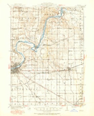
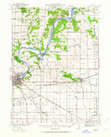
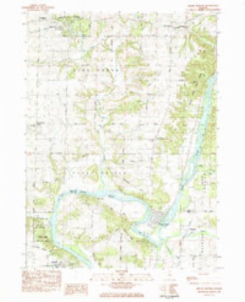
12 topographic sheets cover this place, the earliest surveyed in 1918 and the latest in 1985. It stands in Grand Detour Township. It lies in ZIP code area 61021. The Survey maps it on the Grand Detour quadrangle.
On record in Grand Detour
Buildings and businesses the archive holds for this place. Each opens its own page, with the source record it came from.
On the National Register 2 records
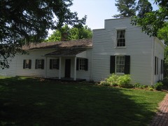 John Deere House and ShopNational Historic Landmark · listed 1966
- St. Peter's Episcopal Churchlisted 2026
Topographic sheets covering this place
6 surveys from 12 printed sheetsMatched by testing this settlement's coordinate against the published boundary of every sheet in the United States Geological Survey's historical collection. Each opens the scanned sheet at the Survey.
- 1918 USGS Dixon quadrangle1:62500, 3 printings
- 1950 USGS Dixon quadrangle1:62500, 2 printings
- 1958 USGS Aurora quadrangle1:250000, 3 printings
- 1961 USGS Aurora quadrangle1:250000
- 1983 USGS Grand Detour quadrangle1:24000
- 1985 USGS Dixon quadrangle1:100000, 2 printings



In the county-history sources
25,103 words on this townshipThe History of Ogle County, Illinois, Containing a History of the County, Its Cities, Towns, Etc., a Biographical Directory of Its Citizens, War Record of Its Volunteers in the Late Rebellion, General and Local Statistics ... History of the Northwest, History of Illinois ... Etc, published 1878 names this settlement in its chapter on Grand Detour Township. These are the passages that mention it, exactly as the scans read.
Religious. - On the 8th day of July, 1837, a meeting was held at the residence of E. H. Shaw for the purpose of organizing a Congregational society. Revs. Colvin W. Babbitt and E. Hazzard were present at the organization, and the former became the first pastor. The society, as formed, consisted of twelve members, two only of whom are now living - Mrs. Esther G. Sawyer, of Grand de Tour, and Mrs. Susan Hamilton, of Moline. Five of the number rest in the village cemetery. E. E. Gardner was the first clerk, and Reuben Pritchard and Samuel Anthony, the first deacons.
Passage source: The History of Ogle County, Illinois, Containing a History of the County, Its Cities, Towns, Etc., a Biographical Directory of Its Citizens, War Record of Its Volunteers in the Late Rebellion, General and Local Statistics ... History of the Northwest, History of Illinois ... Etc, published 1878.
The Congregational Church was the first to be erected in Grand de Tour, and cost nine hundred dollars. It was commenced April 18 and dedicated November 12, 1848. Rev. L. H. Loss, of Rockford, preached the dedication sermon. The first trustees, Ruel Peabody, N. C. Tyrrell and G. W. Southwick, were appointed April 12, 1848. On the 21st day of that month W. G. Dana and wife, members of the church, presented the lot on which the building stands. The building committee were F. W. Southwick, J. M. Gould and R. M. Pearson, the latter of whom was the first pastor. The lumber was bought in Chicago and hauled out by Ruel Peabody. The society is now disorganized and the church used as a society and town hall.
Passage source: The History of Ogle County, Illinois, Containing a History of the County, Its Cities, Towns, Etc., a Biographical Directory of Its Citizens, War Record of Its Volunteers in the Late Rebellion, General and Local Statistics ... History of the Northwest, History of Illinois ... Etc, published 1878.
The first number of the second volume was dated January 27, 1843, showing that omissions had been made during the year previous. It was " published by the proprietors," but fails to state who the proprietors were. In February the commencement of the Winnebago Foru?n^ a new Whig paper at Rockford, was noticed. In the latter part of March an act was published in the .Register incorporating Solon Cumins, Wm. G. Dana and Williard A House, and their associates and successors, as the " Grand de Tour Manufacturing Company," with $100,000 (?) capital.
Passage source: The History of Ogle County, Illinois, Containing a History of the County, Its Cities, Towns, Etc., a Biographical Directory of Its Citizens, War Record of Its Volunteers in the Late Rebellion, General and Local Statistics ... History of the Northwest, History of Illinois ... Etc, published 1878.
Machine-read from a century-old scan, so expect the errors a machine makes: misspelled names, dropped words, stray characters.
Read the whole chapter on Grand Detour Township - it names this place 14 more 14 times.
Fires near this place
2 since 2011Regional context, not property-specific evidence. The federal wildfire occurrence database lists 2 fires within 5 miles of Grand Detour between 2011 and 2020, burning about 3 acres in total. None started naturally. None was recorded as arson. Distance is straight-line from the map coordinates, so a fire counted here may appear on a neighbouring settlement's page as well.
| Reported cause | Fires |
|---|---|
| Missing data/not specified/undetermined | 2 |
The most recent of them, most recent first, with the day each was reported and the service that recorded it.
| Date | Cause | Size | Reported by | Name on the report |
|---|---|---|---|---|
| 22 April 2020 | Missing data/not specified/undetermined | 2.0 acres | Illinois Division of Forestry Resources | 20-0327 |
| 30 March 2011 | Missing data/not specified/undetermined | 1.0 acres | Illinois Division of Forestry Resources | YOCUM |
Settlements close enough to share some of these fires:
Mines and quarries near this place
10 of 18 shownRegional context, not property-specific evidence. The federal mineral resources record lists 18 workings within 5 miles of Grand Detour: 14 past producers, 3 occurrences, 1 producer. 1 still produces. What was taken out: Stone, Crushed/Broken, Sand and Gravel, Construction, Limestone, General. Distance is straight-line from the map coordinates, so a quarry counted here may appear on a neighbouring settlement's page as well.
| Where | Site | Commodity | Status | Recorded |
|---|---|---|---|---|
| Dixon Quarry & Cement Plant | Limestone, General | Producer | ||
| Medusa Quarry | Sand and Gravel, Construction | Past Producer | ||
| Hallquist Quarry | Stone, Crushed/Broken | Past Producer | ||
| Limestone Prospect | Stone, Crushed/Broken | Occurrence | ||
| Limestone Prospect | Stone, Crushed/Broken | Occurrence | ||
| Limestone Prospect | Stone, Crushed/Broken | Occurrence | ||
| Sandusky Quarry | Stone, Crushed/Broken | Past Producer | ||
| Sanner Quarry | Stone, Crushed/Broken | Past Producer | ||
| Steder Quarry | Stone, Crushed/Broken | Past Producer | ||
| Unnamed Limestone Quarry | Stone, Crushed/Broken | Past Producer |
Storms near this place
3 since 2010Regional context, not property-specific evidence. The National Weather Service names Grand Detour in 3 storm reports between 2010 and 2026: 1 thunderstorm wind, 1 hail, 1 tornado. No death or injury is recorded in these reports. Each account below is quoted exactly as the forecast office filed it, from the NOAA Storm Events Database, and each date opens the federal record of that event.
| When | Event | Place named | Harm | What the report says |
|---|---|---|---|---|
| April 2026 | Tornado (EF1) | Grand Detour | - | An NWS damage survey confirmed that a brief EF-1 tornado with estimated peak winds of 105 mph impacted a few properties along Ridge Road in southern Ogle County. One house had two-thirds of its roof removed by the tornado and several trees were damaged by the tornado as well. |
| March 2024 | Hail | Grand Detour | - | A photo shared on social media showed quarter size hail near Grand Detour. |
| June 2010 | Thunderstorm Wind | Grand Detour | - | Numerous trees were blown down. |
Nearest settlements
The eight closest, with where each one stands in the county. Distances are straight-line, computed from the Geographic Names Information System coordinates.
| Map | Place | Distance | Sheets |
|---|---|---|---|
| Lost Nation | 2.6 miles | 12 | |
| Carthage | 5.4 miles | 12 | |
| Pennsylvania Corners | 5.4 miles | 12 | |
| Woosung | 6.9 miles | 11 | |
| Daysville | 7.8 miles | 12 | |
| Stratford | 8.1 miles | 12 | |
| Watertown | 8.7 miles | 12 | |
| Oregon | 9.2 miles | 14 |
Provenance
This settlement is recorded in the Geographic Names Information System as feature 409255. The sheet list is computed by point-in-boundary test against the United States Geological Survey's historical topographic inventory. Both are works of the United States government and carry no copyright under 17 U.S.C. 105.
Wildfire. Short, Karen C. 2022. Spatial wildfire occurrence data for the United States, 1992-2020 [FPA_FOD_20221014]. 6th Edition. Fort Collins, CO: Forest Service Research Data Archive. https://doi.org/10.2737/RDS-2013-0009.6 Collected with United States Government funding and usable without additional permissions or fees.
Mines and quarries. USGS Mineral Resources Data System (MRDS) https://mrdata.usgs.gov/mrds/ A work of the United States government, no copyright under 17 U.S.C. 105.
Storms. NOAA National Centers for Environmental Information, Storm Events Database https://www.ncei.noaa.gov/stormevents/ A work of the United States government, no copyright under 17 U.S.C. 105. Narratives are quoted verbatim from the National Weather Service report and are not edited or summarised.