 Block
Castleton, Illinois
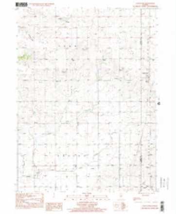
12 topographic sheets cover this place, the earliest surveyed in 1933 and the latest in 1998. It stands in Penn Township. It lies in ZIP code area 61426. The Survey maps it on the Castleton quadrangle. It stands 787 feet above sea level.
Topographic sheets covering this place
7 surveys from 12 printed sheetsMatched by testing this settlement's coordinate against the published boundary of every sheet in the United States Geological Survey's historical collection. Each opens the scanned sheet at the Survey.
- 1933 USGS Camp Grove quadrangle1:48000
- 1945 USGS Bradford quadrangle1:62500, 3 printings
- 1958 USGS Aurora quadrangle1:250000, 3 printings
- 1961 USGS Aurora quadrangle1:250000
- 1983 USGS Castleton quadrangle1:24000
- 1985 USGS Kewanee quadrangle1:100000, 2 printings
- 1998 USGS Castleton quadrangle1:24000


In the county-history sources
34,273 words on this townshipStark County and Its Pioneers, published 1876 names this settlement in its chapter on Penn Township. These are the passages that mention it, exactly as the scans read.
And in recalling our past educational history, the names of S. G. Wright and R. C J)unn must ever come to mind. The former from his first residence here in bS41, always interested himself in procuring competent teachers, and boarded many of them in his own family at rates to suit the pitial^ly small salaries their lalxjr commanded in those days. He was elected school commissioner in LS.jO, and held the office for five years. During this term he convened the first "teachers' institute" ever convened in our county, and introduced a regular system of visiting and reporting .schools, with good result.
Passage source: Stark County and Its Pioneers, published 1876.
INIr. Wright leaving the county in 1850, Mr. Dunn was chosen as his successor in office, and took up the work with his customary energy - perfecting the plan of our institutes, often presiding at their sessions, taking i>art in their exercises, and drawing to them whatever talent he could invite from adjoining counties.
Passage source: Stark County and Its Pioneers, published 1876.
But when taking into consideration the present status of our principal schools, as given somewhat in detail in connection with the history of our towns, we have perhaps devoted space enough to the general view of this interest, all important as it is. And if county has done well in thj past, may we not hope that with increasing wealth and facilities it may do better in the future, and by a wise and enlightened policy, not only place a good education within reach of every child \vithin our bounds, ))ut by em)»loying teachers of superior attainments win for our county a proud lame in tlie educational annals of our state.
Passage source: Stark County and Its Pioneers, published 1876.
Machine-read from a century-old scan, so expect the errors a machine makes: misspelled names, dropped words, stray characters.
Read the whole chapter on Penn Township - it names this place 22 more 22 times.
Mines and quarries near this place
1 within 5 milesRegional context, not property-specific evidence. The federal mineral resources record lists 1 working within 5 miles of Castleton: 1 past producer. None of them still produces. What was taken out: Sand and Gravel, Construction. Distance is straight-line from the map coordinates, so a quarry counted here may appear on a neighbouring settlement's page as well.
| Where | Site | Commodity | Status | Recorded |
|---|---|---|---|---|
| Castleton Pit | Sand and Gravel, Construction | Past Producer |
Storms near this place
7 since 2001Regional context, not property-specific evidence. The National Weather Service names Castleton in 7 storm reports between 2001 and 2022: 4 hail, 2 tornado, 1 flash flood. No death or injury is recorded in these reports. Each account below is quoted exactly as the forecast office filed it, from the NOAA Storm Events Database, and each date opens the federal record of that event.
| When | Event | Place named | Harm | What the report says |
|---|---|---|---|---|
| February 2017 | Tornado (EF1) | Castleton | $100,000 | A tornado touched down 0.8 miles southwest of Castleton at 4:12 PM CST. The tornado then tracked northeastward...damaging trees, an outbuilding, and a few homes before crossing into extreme southwestern Bureau County in the National Weather Service Davenport County Warning Area (CWA) at 4:19 PM CST. |
| June 2022 | Flash Flood | Castleton | - | Water was flowing across the roadway at the intersection of Illinois 17 and Illinois 40 just west of Camp Grove. |
| September 2012 | Tornado (EF0) | Castleton | - | A tornado touched down in a field 3.9 miles southeast of Castleton in Stark County at 1:11 PM CDT. The tornado traveled northwestward for 1.1 miles, crossing Illinois 40 before dissipating 2.8 miles southeast of Castleton at 1:14 PM CDT. No damage was reported. |
| April 2001 | Hail | Castleton | - | Hail of at least 1" in diameter fell for over 10 minutes prior to the 3 inch report. |
| July 2015 | Hail | Castleton | - | no account filed |
| June 2009 | Hail | Castleton | - | no account filed |
| April 2003 | Hail | Castleton | - | no account filed |
Nearest settlements
The eight closest, with where each one stands in the county. Distances are straight-line, computed from the Geographic Names Information System coordinates.
| Map | Place | Distance | Sheets |
|---|---|---|---|
| Waldron (historical) | 2.6 miles | 10 | |
| Modena | 3.3 miles | 10 | |
| Bradford | 4.8 miles | 12 | |
| Wyoming | 5.3 miles | 10 | |
| Lombardville | 7.6 miles | 12 | |
| Osceola | 7.6 miles | 10 | |
| Elmira | 7.9 miles | 10 | |
| Morse | 8.4 miles | 12 |
Elsewhere
Matched on this settlement's Geographic Names Information System number rather than its name, so it cannot be a different place of the same name in another state.
| Wikipedia article on Castleton | An encyclopaedic summary. Its text is share-alike, so it is linked here rather than copied. |
| Wikidata item Q5050618 | The structured record the population and elevation above come from. Public domain (CC0). |
Provenance
This settlement is recorded in the Geographic Names Information System as feature 405694. The sheet list is computed by point-in-boundary test against the United States Geological Survey's historical topographic inventory. Both are works of the United States government and carry no copyright under 17 U.S.C. 105.
Mines and quarries. USGS Mineral Resources Data System (MRDS) https://mrdata.usgs.gov/mrds/ A work of the United States government, no copyright under 17 U.S.C. 105.
Storms. NOAA National Centers for Environmental Information, Storm Events Database https://www.ncei.noaa.gov/stormevents/ A work of the United States government, no copyright under 17 U.S.C. 105. Narratives are quoted verbatim from the National Weather Service report and are not edited or summarised.