 Block
Chauncey, Illinois
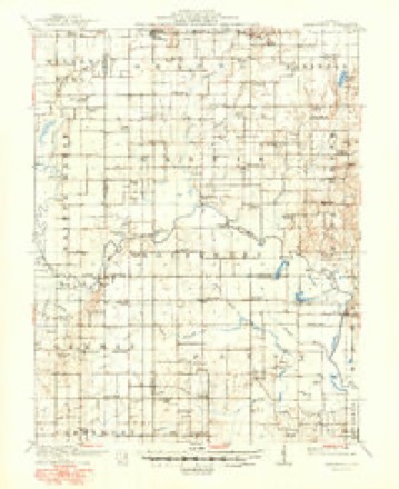
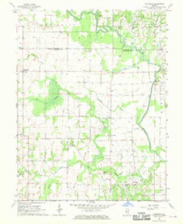
12 topographic sheets cover this place, the earliest surveyed in 1910 and the latest in 1986. It stands in Petty Township. It lies in ZIP code area 62466. The Survey maps it on the Chauncey quadrangle. It stands 489 feet above sea level.
Topographic sheets covering this place
6 surveys from 12 printed sheetsMatched by testing this settlement's coordinate against the published boundary of every sheet in the United States Geological Survey's historical collection. Each opens the scanned sheet at the Survey.
- 1910 USGS Hardinville quadrangle1:62500, 2 printings
- 1956 USGS Vincennes quadrangle1:250000, 4 printings
- 1957 USGS Vincennes quadrangle1:250000
- 1958 USGS Vincennes quadrangle1:250000, 2 printings
- 1968 USGS Chauncey quadrangle1:24000
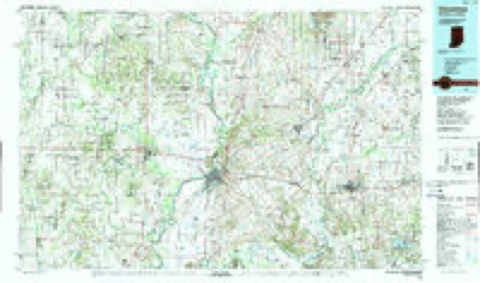
- 1986 USGS Vincennes quadrangle1:100000, 2 printings
In the county-history sources
9,117 words on this townshipCombined History of Edwards, Lawrence and Wabash Counties, Illinois. With Illustrations ... and Biographical Sketches of Some of Their Prominent Men and Pioneers, published 1883 names this settlement in its chapter on Petty Township. These are the passages that mention it, exactly as the scans read.
John Brigman and William Murphy settled in the township prior to 1838. The latter gentleman made an improvement in section 18, township 4, range 12. Sarah James, a widow, with a daughter, came from Indiana in 1834 In 1838 she was married to Edward Fyffe, who settled on the southwest quarter of section 28, township 4, range 13, where he died. The Petty family, from whom the township received its name, arrived in 1838, or '39. Josiah Petty, familiarly known as " old Uncle Jeff," settled in the west half of the southwest quarter of section 11. Joseph Petty, from Perry county, Ohio, with five children, Peter, Mary Ann, Balser, George and William, settled on the northeast quarter of the northeast quarter of section 15, where he resided permanently. In 1838, John Decker, from Indiana, settled on the southwest quarter of the northwest quarter of section 28, township 4, range 13, where he remained permanently, and reared a family of eight children. Samuel James, about 1840, settled and improved a farm on the east half of the southeast quarter of sec tion 30, township 4, range 13. The principal improvements of the township, especially north of Paragin slough, have been made since 1850. At that time Richard Grier, Nathan Fitz, Ferdinand Kyger, William Munn, Nancy Watts, Christian Loss and the Jackson family were living in that region. The west half of the southwest quarter of section 33, township 5, range 13, occupied, at present, by David Watte, is one of the earliest settlements in its neighborhood. There was also an early improvement on the east half of section 32, township 5, range 13. A well marks the site of a former improvement in David Brown's field east of Chauncey. Christopher Dollahan once lived there.
Passage source: Combined History of Edwards, Lawrence and Wabash Counties, Illinois. With Illustrations ... and Biographical Sketches of Some of Their Prominent Men and Pioneers, published 1883.
Was so named by Peter Smith, for the second son of Wna. H. Brown. It contains about seventy inhabitants, and is situated on the adjacent corners of sections 28, 29, 32 and 33 T. 5, R. 13. John Bach built the first house, a log dwelling, in 1856. He immediately put up a blacksmith shop and began work. Luther Watts sold the first goods in the Daniel Grass building, moved from a point three miles southeast of Chauncey, in the fall of 1860. Daniels and Waggoner opened the first grocery store, in 1866. A wagon shop was put up in 1867, and wagon making was carried on some two years. Daniel Patton established a drug store in 1879.
Passage source: Combined History of Edwards, Lawrence and Wabash Counties, Illinois. With Illustrations ... and Biographical Sketches of Some of Their Prominent Men and Pioneers, published 1883.
Machine-read from a century-old scan, so expect the errors a machine makes: misspelled names, dropped words, stray characters.
Storms near this place
30 since 1996Regional context, not property-specific evidence. The National Weather Service names Chauncey in 30 storm reports between 1996 and 2025: 12 flash flood, 8 thunderstorm wind, 6 hail, 4 flood. No death or injury is recorded in these reports. Each account below is quoted exactly as the forecast office filed it, from the NOAA Storm Events Database, and each date opens the federal record of that event.
| When | Event | Place named | Harm | What the report says |
|---|---|---|---|---|
| June 2010 | Thunderstorm Wind | Chauncey | $75,000 | Numerous trees, tree limbs, and power lines were blown down in and around Chauncey and Sumner. Several of the trees and tree limbs fell onto homes. In addition, shingles were blown off some homes in Chauncey and a 60 foot emergency communication tower was torn off the fire department building in Sumner. |
| April 2011 | Thunderstorm Wind | Chauncey | $30,000 | The top of a communications tower was broken off in Chauncey. |
| July 2012 | Thunderstorm Wind | Chauncey | $18,000 | Trees were blown down...knocking out power in Chauncey. |
| May 2010 | Thunderstorm Wind | Chauncey | $5,000 | A few trees were blown down south of Chauncey. |
| June 2025 | Thunderstorm Wind | Chauncey | - | An antenna was blown down at the Chauncey Fire Department. |
| August 2022 | Flash Flood | Chauncey | - | Water was flowing across the roadway at the intersection of Chauncey Road and Petty School Lane. |
| February 2019 | Flood | Chauncey | - | Rainfall amounts of 2.50 to 4.00 inches on a frozen ground resulted in widespread areal flooding in much of Lawrence County on February 7th. Many county roads were flooded and impassable. Parts of State Highways, 1, 33 and 250 were also flooded with mud and rock debris on the roads. Several streets in Lawrenceville were closed due to the flooding. Several rescues were made by first responders; one of which was an elderly person in a home surrounded by water, and multiple motorists who attempted to drive through flooded roads in Lawrenceville. |
| June 2018 | Flash Flood | Chauncey | - | Heavy rain of 3.00 to 4.00 inches, falling onto already saturated ground, resulted in flash flooding in a large part of Lawrence County from the late evening of June 11th into the early morning of June 12th. The heaviest rain and most significant flooding was in central part of Lawrence County from Sumner to Bridgeport, and in the vicinity of St. Francisville in southeast Lawrence County, where several rural roads were closed. Much of the flooding subsided just after 4:00 am CDT. |
| September 2018 | Flash Flood | Chauncey | - | Several bands of rain associated with the remnants of Tropical Storm Gordon impacted Lawrence County from September 7th through the 8th. The ground was saturated with nearly 4.50 to 6.50 inches of rain when a particularly heavy band of rain moved into southeast Illinois during the afternoon of September 8th. An additional 1.00 to 1.50 inches of rain in less than three hours produced flash flooding in Lawrence County in the early afternoon. Many county roads were covered with water, and most streets in Lawrenceville were flooded. |
| May 2017 | Flash Flood | Chauncey | - | Heavy rainfall of 1.00 to 2.00 inches during the early morning hours of May 4th, on already saturated ground, resulted in flash flooding across much of Lawrence County. Officials reported that most rural roads were impassable and numerous creeks rapidly flooded. The heaviest rain was reported in northwest Lawrence County near Chauncey. |
| May 2017 | Flood | Chauncey | - | Heavy rainfall of 1.00 to 2.00 inches during the early morning hours of May 4th, on already saturated ground, resulted in flash flooding across much of Lawrence County. Officials reported that most rural roads were impassable and numerous creeks rapidly flooded. The heaviest rain was reported in northwest Lawrence County near Chauncey. Additional rainfall around 1.00 inch later in the day May 4th into May 5th caused creeks and roads to stay flooded for nearly 48 hours. Flood waters subsided by the afternoon on May 6th. |
| May 2017 | Flash Flood | Chauncey | - | The third heavy rain event to occur in less than two weeks resulted in rapid flash flooding in northern Lawrence County. Rainfall amounts ranged from 2.00 to 2.50 inches during the late evening of May 10th and very early morning of May 11th in areas where ditches were already full of water and soils were saturated. Numerous rural roads from Chauncey toward Birds, through Lawrenceville to Sumner were closed due to flooding. Several streets in Lawrenceville were also flooded during the morning hours. |
| May 2017 | Flood | Chauncey | - | The third heavy rain event to occur in less than two weeks resulted in rapid flash flooding in northern Lawrence County. Rainfall amounts ranged from 2.00 to 2.50 inches during the late evening of May 10th and very early morning of May 11th in areas where ditches were already full of water and soils were saturated. Numerous rural roads from Chauncey toward Birds, through Lawrenceville to Sumner were closed due to flooding. Several streets in Lawrenceville were also flooded during the morning hours. An additional 0.50 to 0.75 inch of rain during the early morning hours of May 11th kept flood waters from receding until early afternoon. |
| April 2017 | Flash Flood | Chauncey | - | Rain amounts of 2.00 to 3.00 inches in about a two hour period during the evening hours, on already saturated ground, resulted in flash flooding across northwest Lawrence County. Numerous rural roads, highways and creeks in the county were flooded, particularly in the vicinity of Chauncey. |
| June 2015 | Flood | Chauncey | - | Several periods of rainfall occurred as a result of the remnants of Tropical Storm Bill. Rainfall totals ranged from 2.00 to 3.00 on already saturated ground in extreme northwest Lawrence County. Flooding of rural roads was reported, especially near the Richland County line and north of U.S. Highway 50. The periods of rainfall persisted through the rest of June 19th and into June 20th. This caused roadways and creeks to remain flooded. The flooding subsided by the morning of June 20th. |
| June 2015 | Flash Flood | Chauncey | - | Several periods of rainfall occurred as a result of the remnants of Tropical Storm Bill. Rainfall totals ranged from 2.00 to 3.00 on already saturated ground in extreme northwest Lawrence County. Flooding of rural roads was reported, especially near the Richland County line and north of U.S. Highway 50. |
| July 2013 | Flash Flood | Chauncey | - | Periods of heavy rain on already saturated ground produced flash flooding in northwest and western Lawrence County. Observers reported 3.00 to 5.00 inches of rain during the morning. Most rural roads were impassable as a result. |
| June 2011 | Flash Flood | Chauncey | - | Thunderstorms produced 4.00 to 6.00 of rain in much of Lawrence County during the early morning hours of June 18th. U.S. Highway 50 was inundated in several locations, streets were flooded in a large part of Lawrenceville, Illinois Routes 33 and 1 were flooded over, and almost all rural roads were impassable due to the high water. |
| June 2010 | Flash Flood | Chauncey | - | Around 2.00 of rain in 90 minutes resulted in flash flooding of roads in a small part of northern Lawrence County. Rural roads from Chauncey to Birds, as well as a portion of State Highway 1, were impassable due to the heavy rain and flooding. |
| May 2009 | Flash Flood | Chauncey | - | Very heavy rain of 3.00 to 4.00 inches within 2 hours caused extensive flash flooding of rural roads across northern and central Lawrence County. |
| May 2009 | Flash Flood | Chauncey | - | Heavy rain of 2.00 to 3.00 inches within two hours produced significant flash flooding of most roads across northern Lawrence County. Many rural roads were closed to traffic due to high water. |
| May 2004 | Thunderstorm Wind | Chauncey | - | Numerous trees and power lines were blown down. One tree in Chauncey fell on an unoccupied car damaging it. Another fell on a garage causing moderate damage 5 miles west of Birds. |
| August 2000 | Thunderstorm Wind | Chauncey | - | Two large trees were blown down on roads in the area from high winds. |
| June 2019 | Hail | Chauncey | - | no account filed |
| April 2011 | Hail | Chauncey | - | no account filed |
| June 2009 | Hail | Chauncey | - | no account filed |
| April 2007 | Hail | Chauncey | - | no account filed |
| June 2006 | Hail | Chauncey | - | no account filed |
| May 2002 | Hail | Chauncey | - | no account filed |
| April 1996 | Thunderstorm Wind | Chauncey | - | no account filed |
Nearest settlements
The eight closest, with where each one stands in the county. Distances are straight-line, computed from the Geographic Names Information System coordinates.
| Map | Place | Distance | Sheets |
|---|---|---|---|
| Applegate | 4.9 miles | 12 | |
| Westport | 5.9 miles | 12 | |
| Charlottsville (historical) | 6.1 miles | 12 | |
| Petrolia | 7.1 miles | 12 | |
| Sumner | 8.2 miles | 13 | |
| Hadley | 8.2 miles | 13 | |
| Bridgeport | 10.7 miles | 13 | |
| Birds | 10.8 miles | 13 |
Elsewhere
Matched on this settlement's Geographic Names Information System number rather than its name, so it cannot be a different place of the same name in another state.
| Wikipedia article on Chauncey | An encyclopaedic summary. Its text is share-alike, so it is linked here rather than copied. |
| Wikidata item Q5088202 | The structured record the population and elevation above come from. Public domain (CC0). |
Provenance
This settlement is recorded in the Geographic Names Information System as feature 405994. The sheet list is computed by point-in-boundary test against the United States Geological Survey's historical topographic inventory. Both are works of the United States government and carry no copyright under 17 U.S.C. 105.
Storms. NOAA National Centers for Environmental Information, Storm Events Database https://www.ncei.noaa.gov/stormevents/ A work of the United States government, no copyright under 17 U.S.C. 105. Narratives are quoted verbatim from the National Weather Service report and are not edited or summarised.