 Block
Chesterfield, Illinois
11 topographic sheets cover this place, the earliest surveyed in 1932 and the latest in 1985. It stands in Chesterfield Township. It lies in ZIP code area 62630. The Survey maps it on the Hettick quadrangle. 170 people lived here at the 2020 count. It stands 595 feet above sea level.
Population over time
2 figuresChesterfield fell from 188 to 170 between 2010 and 2020. These are the recorded population figures Wikidata holds for this place, reached through the Geographic Names Information System number this page is keyed on rather than by name, so they belong to this place and not to another of the same name. Most are census counts, but not all are: an early figure may be a founding or settlement estimate, and an estimate published within five years of a census is left out. The change column is computed, and is left blank where more than 20 years separate a figure from the one before it, because a gap that long is not a change between two counts.
| Year | People | Change |
|---|---|---|
| 2010 | 188 | |
| 2020 | 170 | -18 (-10%) |
Topographic sheets covering this place
5 surveys from 11 printed sheetsMatched by testing this settlement's coordinate against the published boundary of every sheet in the United States Geological Survey's historical collection. Each opens the scanned sheet at the Survey.
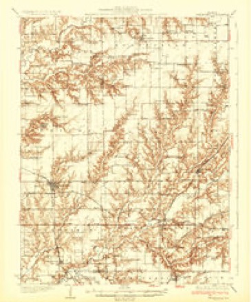
- 1932 USGS Greenfield quadrangle1:62500, 3 printings
- 1948 USGS Quincy quadrangle1:250000, 2 printings
- 1956 USGS Quincy quadrangle1:250000, 3 printings
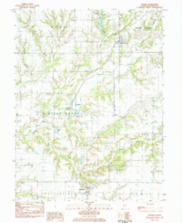
- 1983 USGS Hettick quadrangle1:24000
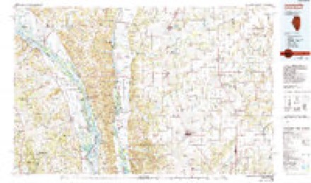
- 1985 USGS Jerseyville quadrangle1:100000, 2 printings


In the county-history sources
1,148 words on this townshipHistory of Macoupin County, Illinois : Biographical and Pictorial, published 1911 names this settlement in its chapter on Chesterfield Township. These are the passages that mention it, exactly as the scans read.
Chesterfield township is situated in the western tier of townships, and is bounded on the north by Western Mound, on the east by Polk, on the south by Shipman and on the west by Jersey county. Macoupin creek enters the township at section 25, and flowing in a northwesterly direction passes out at section 6. Coop's creek empties into it near the center of the township and Sugar creek empties into it near the east line. It is mostly prairie land but some parts are quite broken.
Passage source: History of Macoupin County, Illinois : Biographical and Pictorial, published 1911.
The first settlement in the township dates back as early as 1827 and at this time was settled mostly by English emigrants. From that time until 1829, there came here from Kentucky, Abram and Richard Smith, Bennett Tilley and George Nettles, all of whom settled north of the creek a short distance from where the village of Chesterfield now stands. In 1831, John, Henry, Samuel, Jesse, Jacob and Josiah Rhoacls, six brothers, with their families, settled in the southwestern part of the township at what was known as Rhoacls' Point, the present site of Medora. About this same time John Loper settled here on section 21. John Gelder also came with his family in 1831 and settled on section 10. Others of the early settlers were Daniel and Thomas Morfoot, of English birth. Josiah Collins and family. John Reddick and family and Lewis Elliott.
Passage source: History of Macoupin County, Illinois : Biographical and Pictorial, published 1911.
Machine-read from a century-old scan, so expect the errors a machine makes: misspelled names, dropped words, stray characters.
Read the whole chapter on Chesterfield Township - it names this place 2 more 2 times.
Fires near this place
1 since 2007Regional context, not property-specific evidence. The federal wildfire occurrence database lists 1 fire within 5 miles of Chesterfield in 2007, burning about 15 acres in total. None started naturally. None was recorded as arson. Distance is straight-line from the map coordinates, so a fire counted here may appear on a neighbouring settlement's page as well.
| Reported cause | Fires |
|---|---|
| Missing data/not specified/undetermined | 1 |
The most recent of them, most recent first, with the day each was reported and the service that recorded it.
| Date | Cause | Size | Reported by | Name on the report |
|---|---|---|---|---|
| 17 September 2007 | Missing data/not specified/undetermined | 15 acres | Illinois Division of Forestry Resources | not named |
Settlements close enough to share some of these fires:
Storms near this place
7 since 2001Regional context, not property-specific evidence. The National Weather Service names Chesterfield in 7 storm reports between 2001 and 2018: 4 hail, 2 lightning, 1 thunderstorm wind. No death or injury is recorded in these reports. Each account below is quoted exactly as the forecast office filed it, from the NOAA Storm Events Database, and each date opens the federal record of that event.
| When | Event | Place named | Harm | What the report says |
|---|---|---|---|---|
| July 2001 | Lightning | Chesterfield | $100,000 | A lightning strike caused an estimated $100,000.00 damage to grain bins at a grain elevator business in Chesterfield. |
| July 2016 | Thunderstorm Wind | Chesterfield | - | Thunderstorm winds blew down several large trees, numerous tree limbs and power lines in an area from Chesterfield to Carlinville. |
| April 2006 | Hail | Chesterfield | - | The County Sheriff reported 3/4 inch hail. |
| September 2005 | Lightning | Chesterfield | - | A man died in his home from smoke inhalation due to a fire that was started by a lightning strike. The 89 year old man was found in the rubble of the home which was completely destroyed by the fire. |
| December 2018 | Hail | Chesterfield | - | no account filed |
| May 2011 | Hail | Chesterfield | - | no account filed |
| May 2006 | Hail | Chesterfield | - | no account filed |
Nearest settlements
The eight closest, with where each one stands in the county. Distances are straight-line, computed from the Geographic Names Information System coordinates.
| Map | Place | Distance | Sheets |
|---|---|---|---|
| Reader | 3.7 miles | 11 | |
| Hagaman | 3.9 miles | 11 | |
| Challacombe | 4.0 miles | 12 | |
| Enos | 4.3 miles | 11 | |
| Comer | 5.6 miles | 14 | |
| Summerville | 5.6 miles | 12 | |
| Macoupin | 6.3 miles | 12 | |
| Medora | 7.0 miles | 12 |
Elsewhere
Matched on this settlement's Geographic Names Information System number rather than its name, so it cannot be a different place of the same name in another state.
| Wikipedia article on Chesterfield | An encyclopaedic summary. Its text is share-alike, so it is linked here rather than copied. |
| Wikidata item Q2217065 | The structured record the population and elevation above come from. Public domain (CC0). |
Provenance
This settlement is recorded in the Geographic Names Information System as feature 422545. The sheet list is computed by point-in-boundary test against the United States Geological Survey's historical topographic inventory. Both are works of the United States government and carry no copyright under 17 U.S.C. 105.
Wildfire. Short, Karen C. 2022. Spatial wildfire occurrence data for the United States, 1992-2020 [FPA_FOD_20221014]. 6th Edition. Fort Collins, CO: Forest Service Research Data Archive. https://doi.org/10.2737/RDS-2013-0009.6 Collected with United States Government funding and usable without additional permissions or fees.
Storms. NOAA National Centers for Environmental Information, Storm Events Database https://www.ncei.noaa.gov/stormevents/ A work of the United States government, no copyright under 17 U.S.C. 105. Narratives are quoted verbatim from the National Weather Service report and are not edited or summarised.