 Block
Chillicothe, Illinois
19 topographic sheets cover this place, the earliest surveyed in 1893 and the latest in 1990. It stands in Chillicothe Township. It lies in ZIP code area 61523. It stands on Senachwine Creek. The Survey maps it on the Chillicothe quadrangle. 6,128 people lived here at the 2020 count. It stands 528 feet above sea level.
On record in Chillicothe
Buildings and businesses the archive holds for this place. Each opens its own page, with the source record it came from.
On the National Register 1 record
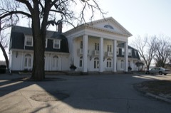 Peoria Automobile Clublisted 1995
Population over time
4 figuresChillicothe grew from 663 to 6,128 between 1860 and 2020. These are the recorded population figures Wikidata holds for this place, reached through the Geographic Names Information System number this page is keyed on rather than by name, so they belong to this place and not to another of the same name. Most are census counts, but not all are: an early figure may be a founding or settlement estimate, and an estimate published within five years of a census is left out. The change column is computed, and is left blank where more than 20 years separate a figure from the one before it, because a gap that long is not a change between two counts.
| Year | People | Change |
|---|---|---|
| 1860 | 663 | |
| 2000 | 5,996 | |
| 2010 | 6,097 | +101 (+2%) |
| 2020 | 6,128 | +31 (+1%) |
Topographic sheets covering this place
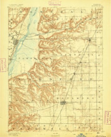
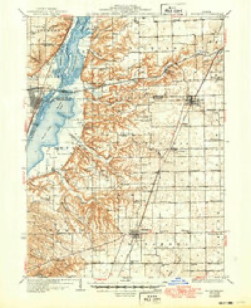
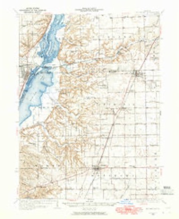
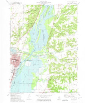
10 surveys from 19 printed sheetsMatched by testing this settlement's coordinate against the published boundary of every sheet in the United States Geological Survey's historical collection. Each opens the scanned sheet at the Survey.
- 1893 USGS Metamora quadrangle1:62500, 4 printings
- 1937 USGS Metamora quadrangle1:62500, 3 printings
- 1948 USGS Metamora quadrangle1:62500
- 1958 USGS Peoria quadrangle1:250000, 4 printings
- 1961 USGS Peoria quadrangle1:250000
- 1963 USGS Peoria quadrangle1:250000
- 1972 USGS Chillicothe quadrangle1:24000, 2 printings
- 1985 USGS Peoria quadrangle1:100000
- 1989 USGS Peoria quadrangle1:100000
- 1990 USGS Peoria quadrangle1:250000






In the county-history sources
3,549 words on this townshipThe History of Peoria County, Illinois. Containing a History of the Northwest--history of Illinois--history of the County, Its Early Settlement, Growth, Development, Resources, Etc., Etc. .., published 1880 names this settlement in its chapter on Chillicothe Township. These are the passages that mention it, exactly as the scans read.
The first cabin erected on the present town site was Ijy Jef. Hickson, a blacksmith, some time before the town was laid out, and stood on the bank of the river, where he also buill a shop and pursued his trade. The second cabin Wiis built aud occupied by Esq. E. Jones, now of Marshall county, iminedi.itely after the town plat was surveyed. He put a small stock of goods in one room of his double log cabin, and was the pioneer merchant of the place. Mr. Jones was also elected the first justice of the peace. He conducted the store for seven or eight years. About 18.38, Mr. Lehart came to Chillicothe ami erected a small frame house of one room, wiiich his family occupied ; and he kept a store in a cabin on Water Street, for several years, then removed to Indiana. In 18.35, James M. Brown - tiien a 3'oung single man - came from Ross county, (Ihio, and soon after built a story and a half frame house on First Street, containing four rooms on each floor, and opened a tavern, to which he gave the euphonious title of " AnK-rican House." A part of the old building still stands on the site. It was first kept by William Dunlap - afterwards Mr. Brown's father-in-law - for aliout five years, during which time liis house was a stopping ])oint on the Pioria and Chicago stage Jine.
Passage source: The History of Peoria County, Illinois. Containing a History of the Northwest--history of Illinois--history of the County, Its Early Settlement, Growth, Development, Resources, Etc., Etc. .., published 1880.
The second tavern i)uilding was erected by John Hayes, and stood opposite to Messrs. Mathews & Holman's store. It was a frame structure containing ten to fifteen rooms, and known as the "Chillicothe House." Mr. Hayes kept it for a number of years. It was destroyed by fire in April, 1873.
Passage source: The History of Peoria County, Illinois. Containing a History of the Northwest--history of Illinois--history of the County, Its Early Settlement, Growth, Development, Resources, Etc., Etc. .., published 1880.
The prosperity of Chillicothe h.is been somewhat impeded by several disastrous fires, which have at various times destroj'ed some of the most valuable jtroperty of the place. In the Fall of 18(34. tlie grain elevator at the depot burned ; in 1869, Wood A* Hosmcr's large steam mill and two large warehouses on the river bank were burned ; and in 1873, a large store and several dwellings on the corner of Elm and Second Streets, went up in thin air.
Passage source: The History of Peoria County, Illinois. Containing a History of the Northwest--history of Illinois--history of the County, Its Early Settlement, Growth, Development, Resources, Etc., Etc. .., published 1880.
Machine-read from a century-old scan, so expect the errors a machine makes: misspelled names, dropped words, stray characters.
Read the whole chapter on Chillicothe Township - it names this place 9 more 9 times.
Fires near this place
1 since 2012Regional context, not property-specific evidence. The federal wildfire occurrence database lists 1 fire within 5 miles of Chillicothe in 2012, burning about 10 acres in total. None started naturally. None was recorded as arson. Distance is straight-line from the map coordinates, so a fire counted here may appear on a neighbouring settlement's page as well.
| Reported cause | Fires |
|---|---|
| Missing data/not specified/undetermined | 1 |
The most recent of them, most recent first, with the day each was reported and the service that recorded it.
| Date | Cause | Size | Reported by | Name on the report |
|---|---|---|---|---|
| 15 March 2012 | Missing data/not specified/undetermined | 10 acres | Illinois Division of Forestry Resources | WEIGARD |
Settlements close enough to share some of these fires:
Mines and quarries near this place
4 within 5 milesRegional context, not property-specific evidence. The federal mineral resources record lists 4 workings within 5 miles of Chillicothe: 3 producers, 1 past producer. 3 still produce. What was taken out: Sand and Gravel, Construction. Distance is straight-line from the map coordinates, so a quarry counted here may appear on a neighbouring settlement's page as well.
| Where | Site | Commodity | Status | Recorded |
|---|---|---|---|---|
| Chillicothe Sand & Gravel Pit | Sand and Gravel, Construction | Producer | ||
| Chillicothe Sand Pit | Sand and Gravel, Construction | Producer | ||
| Mitzelfelt Pit | Sand and Gravel, Construction | Past Producer | ||
| Riverside Materials Pit | Sand and Gravel, Construction | Producer |
Storms near this place
38 since 1993Regional context, not property-specific evidence. The National Weather Service names Chillicothe in 38 storm reports between 1993 and 2025: 16 thunderstorm wind, 16 hail, 3 flash flood, 3 flood. The reports record 1 death. Each account below is quoted exactly as the forecast office filed it, from the NOAA Storm Events Database, and each date opens the federal record of that event.
| When | Event | Place named | Harm | What the report says |
|---|---|---|---|---|
| May 2013 | Flood | North Chillicothe | 1 killed, $28,000,000 | High impact flooding on the Illinois River continued from April.||Numerous homes along the Illinois River in Chillicothe, Rome, Mossville and Mapleton suffered flood damage due to record river levels. Several businesses were damaged, and numerous streets were flooded, along the Illinois River in downtown Peoria. A total of 505 homes and businesses were damaged by the flooding in Peoria County. Early in the morning on May 4th a man drowned when he drove his vehicle into the floodwaters northeast of downtown Peoria. High impact flooding subsided when the river level at Peoria fell below a stage of 22 feet on May 8th. |
| September 2014 | Thunderstorm Wind | North Chillicothe | $150,000 | Several trees were blown down, including one that damaged a car and part of a house. |
| July 2008 | Thunderstorm Wind | Chillicothe | $30,000 | A tree was blown over onto a house and two cars. Numerous tree limbs down throughout town. |
| August 2020 | Thunderstorm Wind | Chillicothe | $20,000 | A tree was blown onto a house in Chillicothe. |
| June 2013 | Thunderstorm Wind | Chillicothe | $20,000 | A 70-foot tall tree was blown down onto a car and numerous tree branches were knocked down around town as well. |
| June 2010 | Thunderstorm Wind | Chillicothe | $10,000 | Power lines were blown down in Chillicothe. |
| June 2009 | Thunderstorm Wind | Chillicothe | $10,000 | Numerous large tree branches were blown down in Chillicothe. |
| August 1993 | Thunderstorm Wind | Chillicothe | $5,000 | Large trees and power lines were blown down. |
| March 2025 | Thunderstorm Wind | Chillicothe | - | A 61 mph wind gust was measured by the emergency manager. |
| August 2024 | Thunderstorm Wind | Chillicothe | - | A few large tree branches were blown down in front of the fire department building. |
| June 2024 | Thunderstorm Wind | Chillicothe | - | Several 3-inch diameter tree limbs were blown down. |
| August 2022 | Hail | Chillicothe | - | Quarter sized hail mixed with smaller hail. |
| August 2022 | Hail | Chillicothe | - | Nickel sized hail lasted around 3 to 4 minutes. |
| April 2020 | Flash Flood | North Chillicothe | - | Two feet of water was flowing across Yankee Lane and Rt 29 just north of Chillicothe. |
| July 2020 | Thunderstorm Wind | Chillicothe | - | Multiple trees and tree branches were blown down. |
| June 2017 | Thunderstorm Wind | Chillicothe | - | An 8-inch diameter tree branch was blown down. |
| June 2017 | Flash Flood | Chillicothe | - | Torrential rainfall of 2.00 to 3.00 inches was reported within a 90 minute period during the evening hours, which resulted in rapid flash flooding. Numerous streets from the northwest side of Peoria to Dunlap, and in the village of Chillicothe were flooded. Several county highways were also impassable from Kickapoo to Mossville. |
| June 2017 | Flood | Chillicothe | - | Torrential rainfall of 2.00 to 3.00 inches was reported within a 90 minute period during the evening hours, which resulted in rapid flash flooding. Numerous streets from the northwest side of Peoria to Dunlap, and in the village of Chillicothe were flooded. Several county highways were also impassable from Kickapoo to Mossville. Additional rainfall during the late evening and overnight hours kept many roads flooded. The flooding subsided by daybreak on June 18th. |
| October 2017 | Thunderstorm Wind | North Chillicothe | - | A 12-inch diameter tree branch was blown down. |
| April 2013 | Flood | North Chillicothe | - | Numerous homes along the Illinois river in Chillicothe, Rome, Mossville and Mapleton suffered damage due to record river levels. Several businesses along the Illinois River in downtown Peoria were also damaged by the flooding. The river stage at Peoria climbed to a record level of 29.35 feet on April 23rd at 19:30 local time, which was nearly 12 feet above flood stage. High impact flooding continued into the month of May 2013. |
| June 2010 | Flash Flood | North Chillicothe | - | Rainfall amounts of 1.50 to 2.00 during the evening fell on saturated ground from previous flooding. This resulted in widespread flash flooding across nearly all of Peoria County, including the city of Peoria. Many streets in Peoria were flooded, which caused vehicles to become stranded and forced up manhole coveres. Outside of the city, many rural roads were impassable, as were portions of State Highway 8, 28, 90, 91 and 116. |
| July 2006 | Thunderstorm Wind | Chillicothe | - | Numerous trees and tree limbs were blown down along a line from Chillicothe to Rome to Peoria. |
| May 2004 | Thunderstorm Wind | Chillicothe | - | Thunderstorm winds blew an aluminum shed and a plastic storage shed into a nearby field. Also, numerous tree limbs were blown down. |
| June 1995 | Thunderstorm Wind | Chillicothe | - | Numerous trees and power lines were downed as a severe thunderstorm moved across the county. |
| March 2024 | Hail | Chillicothe | - | no account filed |
| April 2020 | Hail | North Chillicothe | - | no account filed |
| April 2020 | Hail | Chillicothe | - | no account filed |
| July 2020 | Hail | North Chillicothe | - | no account filed |
| September 2019 | Hail | North Chillicothe | - | no account filed |
| May 2018 | Hail | Chillicothe | - | no account filed |
| February 2017 | Hail | Chillicothe | - | no account filed |
| April 2015 | Hail | Chillicothe | - | no account filed |
| June 2009 | Hail | Chillicothe | - | no account filed |
| June 2009 | Hail | Chillicothe | - | no account filed |
| June 2009 | Hail | Chillicothe | - | no account filed |
| April 2006 | Hail | Chillicothe | - | no account filed |
| May 2003 | Hail | Chillicothe | - | no account filed |
| May 2000 | Hail | Chillicothe | - | no account filed |
Nearest settlements
The eight closest, with where each one stands in the county. Distances are straight-line, computed from the Geographic Names Information System coordinates.
| Map | Place | Distance | Sheets |
|---|---|---|---|
| North Chillicothe | 1.0 miles | 20 | |
| Coughlin | 1.9 miles | 19 | |
| Rome | 2.8 miles | 20 | |
| North Hampton | 2.9 miles | 20 | |
| South Rome | 5.7 miles | 23 | |
| Edelstein | 7.7 miles | 21 | |
| West Hallock | 8.1 miles | 21 | |
| Mossville | 8.5 miles | 23 |
Elsewhere
Matched on this settlement's Geographic Names Information System number rather than its name, so it cannot be a different place of the same name in another state.
| Wikipedia article on Chillicothe | An encyclopaedic summary. Its text is share-alike, so it is linked here rather than copied. |
| Wikidata item Q575467 | The structured record the population and elevation above come from. Public domain (CC0). |
Provenance
This settlement is recorded in the Geographic Names Information System as feature 406065. The sheet list is computed by point-in-boundary test against the United States Geological Survey's historical topographic inventory. Both are works of the United States government and carry no copyright under 17 U.S.C. 105.
Wildfire. Short, Karen C. 2022. Spatial wildfire occurrence data for the United States, 1992-2020 [FPA_FOD_20221014]. 6th Edition. Fort Collins, CO: Forest Service Research Data Archive. https://doi.org/10.2737/RDS-2013-0009.6 Collected with United States Government funding and usable without additional permissions or fees.
Mines and quarries. USGS Mineral Resources Data System (MRDS) https://mrdata.usgs.gov/mrds/ A work of the United States government, no copyright under 17 U.S.C. 105.
Storms. NOAA National Centers for Environmental Information, Storm Events Database https://www.ncei.noaa.gov/stormevents/ A work of the United States government, no copyright under 17 U.S.C. 105. Narratives are quoted verbatim from the National Weather Service report and are not edited or summarised.