 Block
Collinsville, Illinois
16 topographic sheets cover this place, the earliest surveyed in 1907 and the latest in 1991. It stands in Collinsville Township. It lies in ZIP code area 62234. The Survey maps it on the Collinsville quadrangle. 24,366 people lived here at the 2020 count. It stands 554 feet above sea level.
On record in Collinsville
Buildings and businesses the archive holds for this place. Each opens its own page, with the source record it came from.
On the National Register 7 records
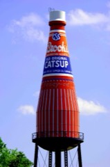 Brooks Catsup Bottle Water Towerlisted 2002
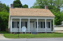 Daniel Dove Collins Houselisted 2002
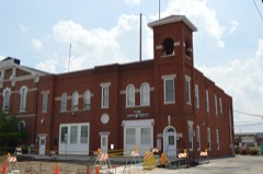 Collinsville City Hall and Fire Stationlisted 2004
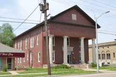 Collinsville Masonic Temple Lodge #712 A.F. & A.M.listed 2005
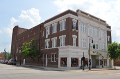 Miners Institute Buildinglisted 1985
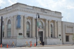 State Bank Buildinglisted 2010
- Collinsville Township High Schoollisted 2023
Population over time
2 figuresCollinsville fell from 25,579 to 24,366 between 2010 and 2020. These are the recorded population figures Wikidata holds for this place, reached through the Geographic Names Information System number this page is keyed on rather than by name, so they belong to this place and not to another of the same name. Most are census counts, but not all are: an early figure may be a founding or settlement estimate, and an estimate published within five years of a census is left out. The change column is computed, and is left blank where more than 20 years separate a figure from the one before it, because a gap that long is not a change between two counts.
| Year | People | Change |
|---|---|---|
| 2010 | 25,579 | |
| 2020 | 24,366 | -1,213 (-5%) |
Topographic sheets covering this place
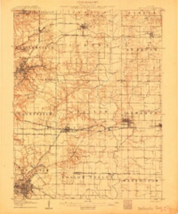
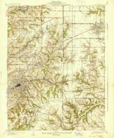
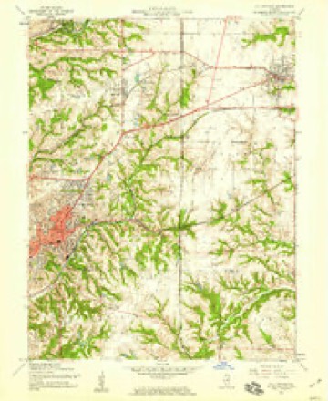
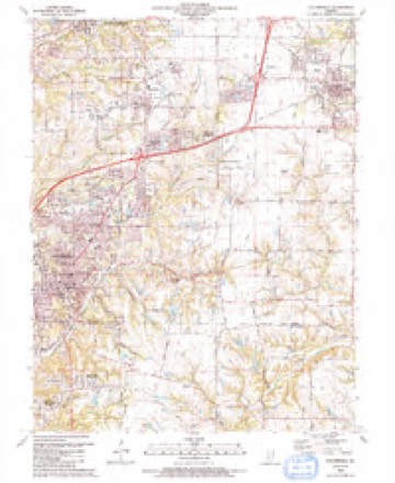
7 surveys from 16 printed sheetsMatched by testing this settlement's coordinate against the published boundary of every sheet in the United States Geological Survey's historical collection. Each opens the scanned sheet at the Survey.
- 1907 USGS Belleville quadrangle1:62500, 3 printings
- 1937 USGS Collinsville quadrangle1:24000, 2 printings
- 1954 USGS Collinsville quadrangle1:24000, 4 printings
- 1958 USGS Belleville quadrangle1:250000, 3 printings
- 1962 USGS Belleville quadrangle1:250000
- 1985 USGS Carlyle Lake quadrangle1:100000, 2 printings
- 1991 USGS Collinsville quadrangle1:24000


In the county-history sources
7,805 words on this townshipHistory of Madison County, Illinois ... With Biographical Sketches .., published 1882 names this settlement in its chapter on Collinsville Township. These are the passages that mention it, exactly as the scans read.
The original town plat was laid out by the representatives of Wm. B. Collins, deceased, Joseph L. Darrow and Horace Look. It constituted a part of the N. E. i of thirtythree, jind a part of the X. W. i of section thirty-four, of three-eight or Collinsville township. The plat was recorded in the office of county clerk May 12, 1837. Since this date there have been seventeen additions made to the plat.
Passage source: History of Madison County, Illinois ... With Biographical Sketches .., published 1882.
The first settler on the present site of Collinsville was John A. Cook, who entered land,, erected a log cabin, and made some improvements in the eastern part of section thirty four, about 1816. "In 1817 three brothers, Augustus, Anson and Michael Collins, from Litchfield, Connecticut, purchased the premises of Mr. Cook, and immediately commenced improvements. They soon erected a distillery, of logs, with two s' ills - one of thirty gallons' and the other of sixty gallons' capacity - a frame store-house, a large, double-decked ox-grist and saw mill, cooper, blacksmith, wagon and carpenter shops, tan yard, and several dwellings. Thus was laid the foundation of the present city of Collinsville. To this place these brothers first gave the name Unionville, which was subsequently changed to its present name." The following letter from the pen of the late Rev. Thomas Lipjiincott, gives a good description of the place at the time of his visit :
Passage source: History of Madison County, Illinois ... With Biographical Sketches .., published 1882.
Litchfield, Connecticut, and were united in the enterprise. I do not know if they had then laid out a village, which they called Unionville, but they did so then or afterwards. At the time of this visit I only saw one of the brothers, who was at work on a large frame house - large, even now - which they were erecting preparatory to the coming of their venerable parents and sisters. The names of the.se brothers were Augustus, Anson, Michael, William B.,and Frederick Collins. A noble band of brothers. While actively and energetically driving their business in the most economical and profitable way, and rapidly accumulating wealth, they were far from being unmindful of the higher interests, social and spiritual, of themselves and those around them. One of their fir^t cares was the erection of a commodious (for those days) and well arranged place of worship ; which also served the purpose of a school-house. Only one of the brothers, Augustus, was then married. In due time thrte others became so. William B. Collins married a daughter of Mr. Hertzogg, of St. Louis, then running a mill in the American B jttom ; Michael, a daughter of Captain Blakeman, and Frederick, a daughter of Captaiu Allm, both of Marine settlement. I said they were growing wealthy. Each attended to a special department, and all worked in unison. It was their aim and boast to have the products of their labor of the best quality. Their whisky was considered first rate, and their inclined wheel ox-mill flour commanded an extra price in eastern markets. Not only had they a store at their own establishment on the Cantine creek, but opened a depot at St. Louis for their commodities. They obtained a post-office, but iuasmuch as there was one place by the name of Unionville in the State, the Postmaster General changed the name of this, which, being accepted by them, thencelbrth was known as Collinsville." * * * * " They were convinced at length that the distilling business was ivrong, was unchristian, and ceased operations; and, instead of selling the machinery, as they might have done for a round sum, they totally demolished the building, broke up the generators, took the huge tanks to their dwellings for cisterns, and sold the wash-tubs to farmers for granaries. I have seen these double hogsheads or tubs at different farm houses, full of wheat or other small grain, while yet there were few or no barns in the county. The partners then separated ; Augustus soon died ; several went to the Illinois river and established mills, &c. at Naples ; and Wm. B. Collins remained alone at Collinsville, carrying on the business - minus the distillery - until his death. ***** All are now gone, including the oldest son, Amos M. Collins of Hartford, the well-known philanthropist and Christian, but the youngest brother, Frederick, who resides in Quincy, and a sister, the widow of him who has been ever known among Presbyterians as the apostle to the great west, the venerated Solomon Giddiugs." ***** All the members of this family are now deceased.
Passage source: History of Madison County, Illinois ... With Biographical Sketches .., published 1882.
Machine-read from a century-old scan, so expect the errors a machine makes: misspelled names, dropped words, stray characters.
Read the whole chapter on Collinsville Township - it names this place 9 more 9 times.
Fires near this place
17 since 2008Regional context, not property-specific evidence. The federal wildfire occurrence database lists 17 fires within 5 miles of Collinsville between 2008 and 2014, burning about 11 acres in total. None started naturally. None was recorded as arson. Distance is straight-line from the map coordinates, so a fire counted here may appear on a neighbouring settlement's page as well.
| Reported cause | Fires |
|---|---|
| Missing data/not specified/undetermined | 9 |
| Debris and open burning | 8 |
The most recent of them, most recent first, with the day each was reported and the service that recorded it.
| Date | Cause | Size | Reported by | Name on the report |
|---|---|---|---|---|
| 10 September 2008 | Debris and open burning | under an acre | Illinois Division of Forestry Resources | 10 BARCLAY |
| 29 July 2008 | Missing data/not specified/undetermined | 1.0 acres | Illinois Division of Forestry Resources | WETZEL |
| 26 July 2010 | Debris and open burning | under an acre | Illinois Division of Forestry Resources | LEVEL |
| 6 May 2008 | Debris and open burning | under an acre | Illinois Division of Forestry Resources | EDMISTON |
| 6 March 2011 | Debris and open burning | 1.0 acres | Illinois Division of Forestry Resources | TALLEUR |
| 24 March 2014 | Missing data/not specified/undetermined | 1.0 acres | Illinois Division of Forestry Resources | ACHALWACHS |
| 24 March 2009 | Debris and open burning | under an acre | Illinois Division of Forestry Resources | LONG |
| 23 March 2011 | Missing data/not specified/undetermined | under an acre | Illinois Division of Forestry Resources | CAMPMEYER |
Settlements close enough to share some of these fires:
Mines and quarries near this place
6 within 5 milesRegional context, not property-specific evidence. The federal mineral resources record lists 6 workings within 5 miles of Collinsville: 3 prospects, 2 occurrences, 1 past producer. None of them still produces. What was taken out: Fire Clay (Refractory), Silica, Aluminum, Iron, Titanium, Aluminum, Iron, Silica, Titanium, Clay. Distance is straight-line from the map coordinates, so a quarry counted here may appear on a neighbouring settlement's page as well.
| Where | Site | Commodity | Status | Recorded |
|---|---|---|---|---|
| Collinsville Pit | Stone | Past Producer | ||
| Little Canteen Shale Exposure | Clay | Prospect | ||
| Madison County Fireclay | Aluminum, Iron, Silica, Titanium | Prospect | ||
| Southwestern Illinois Area Underc | Silica, Aluminum, Iron, Titanium | Prospect | ||
| Madison County Fireclay | Fire Clay (Refractory) | Occurrence | ||
| Southwestern Illinois Area Underclay | Fire Clay (Refractory) | Occurrence |
Storms near this place
44 since 1996Regional context, not property-specific evidence. The National Weather Service names Collinsville in 44 storm reports between 1996 and 2026: 23 hail, 18 thunderstorm wind, 2 lightning, 1 tornado. The reports record 1 injury. Each account below is quoted exactly as the forecast office filed it, from the NOAA Storm Events Database, and each date opens the federal record of that event.
| When | Event | Place named | Harm | What the report says |
|---|---|---|---|---|
| August 1996 | Lightning | Collinsville | 1 hurt | no account filed |
| May 1996 | Thunderstorm Wind | Collinsville | $15,000 | no account filed |
| March 2026 | Thunderstorm Wind | Collinsville | - | A TV meteorologist noted several gusts over 60 mph in his station's Storm Runner vehicle. |
| April 2023 | Tornado (EFU) | Collinsville | - | A tornado briefly touched down just to the west of Collinsville, IL. The only evidence of this tornado was a video provided via local media. Duration was likely less than 1 minute, no damage or injuries. The tornado was rated EFU with an estimated path length of 0.16 miles and an estimated path width of 25 yards. |
| April 2019 | Hail | Collinsville | - | Another severe storm moved through the southern half of Madison County dropping large hail between Collinsville and Troy. The largest hail stones reported were 2 inches in diameter. |
| May 2018 | Thunderstorm Wind | Collinsville | - | Several large tree limbs were blown down onto a house and car causing moderate damage. |
| June 2018 | Thunderstorm Wind | Collinsville | - | Thunderstorm winds blew down several trees throughout Collinsville. The worst damage occurred near St. Johns Cemetery where several large trees and headstones were toppled. |
| February 2017 | Thunderstorm Wind | Collinsville | - | Thunderstorm winds blew down several trees and power lines in Collinsville and just south of Pontoon Beach. One house sustained siding damage from the winds. |
| February 2017 | Hail | Collinsville | - | A wide swath of large hail, up to two inches in diameter, fell across Madison County from the Collinsville/Pontoon Beach area northeastward through Maryville, Glen Carbon, Edwardsville, Troy and Marine. |
| June 2015 | Thunderstorm Wind | Collinsville | - | Thunderstorm winds snapped an 18 inch diameter ash tree about 10 feet up from the base. |
| April 2014 | Thunderstorm Wind | Collinsville | - | Thunderstorm winds blew down a tree across a road two miles south of St. Jacob. |
| August 2014 | Thunderstorm Wind | Collinsville | - | Thunderstorm winds blew down a large tree onto a power line. |
| April 2011 | Thunderstorm Wind | Collinsville | - | Thunderstorm winds blew down a two foot diameter tree limb as well as numerous smaller limbs. |
| May 2008 | Hail | Collinsville | - | Amateur radio spotters reported nickel size hail. |
| May 2008 | Hail | Collinsville | - | A trained spotter reported 1 inch hail. |
| May 2007 | Hail | Collinsville | - | Storm spotters reported hail in Collinsville ranging from pea size to 1 inch. |
| April 2006 | Hail | Collinsville | - | The Collinsville Police reported nickel size hail. |
| July 2006 | Thunderstorm Wind | Collinsville | - | Numerous large trees, tree limbs and power lines were blown down. Several of the trees caused minor to moderate roof damage. |
| July 2004 | Lightning | Collinsville | - | A lightning strike started several fires at a home in Collinsville. The home suffered extensive damage. |
| July 2004 | Thunderstorm Wind | Collinsville | - | The local fire department reported numerous large tree limbs and power lines down across town. |
| June 2001 | Thunderstorm Wind | Collinsville | - | Thunderstorm wind gusts caused scattered damage across Collinsville. Trees and power lines were downed leaving about 2500 customers without power. |
| July 2001 | Thunderstorm Wind | Collinsville | - | Local law enforcement reported numerous trees and power lines down. |
| June 2000 | Thunderstorm Wind | Collinsville | - | The Collinsville Police reported a large tree down blocking a street on the east side of town. |
| October 2000 | Hail | Collinsville | - | The Collinsville Police reported 3/4 inch hail on the south side side of town. |
| March 2025 | Hail | Collinsville | - | no account filed |
| March 2021 | Hail | Collinsville | - | no account filed |
| May 2016 | Hail | Collinsville | - | no account filed |
| April 2014 | Hail | Collinsville | - | no account filed |
| September 2012 | Hail | Collinsville | - | no account filed |
| January 2012 | Hail | Collinsville | - | no account filed |
| April 2011 | Hail | Collinsville | - | no account filed |
| June 2009 | Hail | Collinsville | - | no account filed |
| January 2008 | Hail | Collinsville | - | no account filed |
| February 2006 | Hail | Collinsville | - | no account filed |
| February 2006 | Hail | Collinsville | - | no account filed |
| July 2006 | Hail | Collinsville | - | no account filed |
| August 2005 | Thunderstorm Wind | Collinsville | - | no account filed |
| May 2004 | Hail | Collinsville | - | no account filed |
| May 2004 | Hail | Collinsville | - | no account filed |
| May 2004 | Hail | Collinsville | - | no account filed |
| August 2000 | Thunderstorm Wind | Collinsville | - | no account filed |
| August 2000 | Thunderstorm Wind | Collinsville | - | no account filed |
| June 1998 | Thunderstorm Wind | Collinsville | - | no account filed |
| April 1997 | Hail | Collinsville | - | no account filed |
Nearest settlements
The eight closest, with where each one stands in the county. Distances are straight-line, computed from the Geographic Names Information System coordinates.
| Map | Place | Distance | Sheets |
|---|---|---|---|
| Meadow Heights | 1.5 miles | 16 | |
| Donkville | 1.9 miles | 16 | |
| Lumaghi Heights | 1.9 miles | 16 | |
| Troy Crossing | 2.8 miles | 16 | |
| Lakeview Acres | 3.4 miles | 16 | |
| State Park Place | 3.4 miles | 21 | |
| Pleasant Ridge | 3.6 miles | 16 | |
| Formosa Junction | 3.9 miles | 16 |
Elsewhere
Matched on this settlement's Geographic Names Information System number rather than its name, so it cannot be a different place of the same name in another state.
| Wikipedia article on Collinsville | An encyclopaedic summary. Its text is share-alike, so it is linked here rather than copied. |
| Wikidata item Q577845 | The structured record the population and elevation above come from. Public domain (CC0). |
Provenance
This settlement is recorded in the Geographic Names Information System as feature 426305. The sheet list is computed by point-in-boundary test against the United States Geological Survey's historical topographic inventory. Both are works of the United States government and carry no copyright under 17 U.S.C. 105.
Wildfire. Short, Karen C. 2022. Spatial wildfire occurrence data for the United States, 1992-2020 [FPA_FOD_20221014]. 6th Edition. Fort Collins, CO: Forest Service Research Data Archive. https://doi.org/10.2737/RDS-2013-0009.6 Collected with United States Government funding and usable without additional permissions or fees.
Mines and quarries. USGS Mineral Resources Data System (MRDS) https://mrdata.usgs.gov/mrds/ A work of the United States government, no copyright under 17 U.S.C. 105.
Storms. NOAA National Centers for Environmental Information, Storm Events Database https://www.ncei.noaa.gov/stormevents/ A work of the United States government, no copyright under 17 U.S.C. 105. Narratives are quoted verbatim from the National Weather Service report and are not edited or summarised.