 Block
Cornland, Illinois
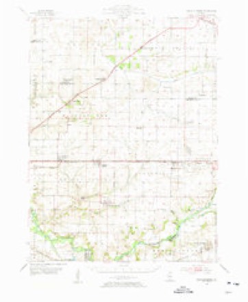
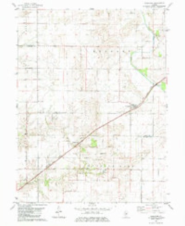
11 topographic sheets cover this place, the earliest surveyed in 1954 and the latest in 1985. It stands in Elkhart Township. It lies in ZIP code area 62519. The Survey maps it on the Cornland quadrangle. 89 people lived here at the 2020 count. It stands 604 feet above sea level.
Population over time
2 figuresCornland fell from 93 to 89 between 2010 and 2020. These are the recorded population figures Wikidata holds for this place, reached through the Geographic Names Information System number this page is keyed on rather than by name, so they belong to this place and not to another of the same name. Most are census counts, but not all are: an early figure may be a founding or settlement estimate, and an estimate published within five years of a census is left out. The change column is computed, and is left blank where more than 20 years separate a figure from the one before it, because a gap that long is not a change between two counts.
| Year | People | Change |
|---|---|---|
| 2010 | 93 | |
| 2020 | 89 | -4 (-4%) |
Topographic sheets covering this place
5 surveys from 11 printed sheetsMatched by testing this settlement's coordinate against the published boundary of every sheet in the United States Geological Survey's historical collection. Each opens the scanned sheet at the Survey.
- 1954 USGS Mechanicsburg quadrangle1:62500, 2 printings
- 1958 USGS Decatur quadrangle1:250000, 3 printings
- 1961 USGS Decatur quadrangle1:250000, 2 printings
- 1982 USGS Cornland quadrangle1:24000, 2 printings
- 1985 USGS Springfield quadrangle1:100000, 2 printings



In the county-history sources
6,814 words on this townshipHistory of Logan County, Illinois, Together with Sketches of Its Cities, Villages, and Towns, Educational, Religious, Civil, Military, and Political History, Portraits of Prominent Person, and Biographies of Representative Citizens : Also a Condensed History of Illinois, Embodying Accounts of Prehistoric Races, Indian Wars, and a Brief Review of Its Civil and Political History, published 1886 names this settlement in its chapter on Elkhart Township. These are the passages that mention it, exactly as the scans read.
Thomas W. Capps, general merchant and postmaster at Cornland, was born in Springfield, Illinois, in 1838, and has always lived in Sangamon and Logan counties. He is a son of John Capps, who settled at Mount Pulaski about 1850, where he was engaged in the mercantile trade a number of years, when he removed to Decatur and engaged in business. He subsequently settled in Sangamon County, where he still resides. He was boru in England, and when a young man came to the United States, locating in Springfield about 1830. Thomas W. is the only one of his father's family living in Logan County. Mr. Capps was again married in 1870, to M. E. Van Hise, a daughter of D. Van Hise, and to this union was boru one son - Earl V., a native of Sangamon County. He was again married in 1876 to Mary E. Day, a daughter of Joshua Day, and to this union has been born one daughter - Nina D., born in Cornland. Mr. Capps established his present mercantile business at Cornland in 1875, which he has since followed with the exception of one year. He has held the position of postmaster since 1877. In 1862 he enlisted in the Sixty-eighth Illinois Infantry in which he served seven months, when the regiment was dislLl charged, the terra of enlistment having expired. He then reenlisted in the United States navy, serving till the close of the war. He was in both the Mississippi and South Grnlf squadrons, and was with Admiral Farragut at the capture of Mobile, and after the war he was engaged in the mercantile trade at Illiopoiis two years.
Joshua Day ^ of Cornland, Elkhart Township, is one of the pioneers of Logan County. He is a native of Massachusetts, born in Chester, Hampden County, in 1817, and was a son of Ira Day. There were eleven children in his father's family, eight sons and three daughters. Joshua came to Illinois in 1837, and to Logan County in 1838, having resided for a short time in Hancock Township. He purchased his first land in Logan County of John D. Gillett, an uncle of John D. Gillett, of this township. Mr. Day is now engaged in the mercantile trade in Cornland. His first wife was Hannah "Wiley, and his second was Hannah Cheney, who died in June, 1882. Mr. Day has eight children, three sons and five daughters, all but one married. Mr. Day has been a resident of Illinois for thirty-eight years, and but few are now left in Logan County who came as early as he.
William Dolvin, grocer of Elkhart, is a native of Harrison County, Ohio, where he was born in 1819. He was reared to manhood on a farm in his native county, and there received an academic education. He began teaching at the age of twenty-three years, and followed that profession for twenty-six years. He taught sixteen years in his native county, and in 1858 came to Sangamon County, Illinois, where he taught ten years, and since June, 1868, he has been a resident of Logan County. A younger brother, John Dolvin, who came with him to Illinois, also followed teaching, having taught in Ohio and Illinois for twenty-eight years. The latter was married in 1883 to Emma Hobkirk, a former pupil, who died about a year after her marriage. He now lives at Spencer, Clay County, Iowa, where he owns several farms. He is a very successful farmer, although he lost his right arm at the age of sixteen years. William Dolvin was married in the spring of 1867 to Mary A. Smith, a native of Sangamon County, Illinois, daughter of Philip Smith, one of the prominent and wealthy old settlers of Central Illinois. Her father was a native of North Carolina, and her mother of Kentucky. Mr. and Mrs. Dolvin have two daughters - Ida B. and Olive L., the former born in Sangamon County in 1868, and the latter in Elkhart in 1870. Mr. Dolvin has a beau- tiful residence in Elkhart where he has built up a fine mercantile trade. He has dealt considerably in Western lands, which he sells at an advance on the purchase price. At present he is the owner of two fine farms in Iowa. In politics he is a staunch Republican. He has never aspired toofiicial positions, but has served as justice of the peace, and held other township oflices. Mr. l")olvin and his wife are members of the Christian church at Elkhart. His father, Richard Dolvin, was a native of Virginia, removing to Ohio when a young man, where he married Phoebe Edwards, our subject's mother, whe was also a native of Virginia. They had a family of eleven children, all of whom lived to be over twenty one years old, William being the third child. Richard Dolvin was one of the early settlers of Harrison County, and became one of the prominent farmers of that part of Ohio, where he lived till his death.
Machine-read from a century-old scan, so expect the errors a machine makes: misspelled names, dropped words, stray characters.
Read the whole chapter on Elkhart Township - it names this place 2 more 2 times.
Fires near this place
2 since 2005Regional context, not property-specific evidence. The federal wildfire occurrence database lists 2 fires within 5 miles of Cornland between 2005 and 2010, burning about 2 acres in total. None started naturally. None was recorded as arson. Distance is straight-line from the map coordinates, so a fire counted here may appear on a neighbouring settlement's page as well.
| Reported cause | Fires |
|---|---|
| Recreation and ceremony | 1 |
| Debris and open burning | 1 |
The most recent of them, most recent first, with the day each was reported and the service that recorded it.
| Date | Cause | Size | Reported by | Name on the report |
|---|---|---|---|---|
| 15 March 2005 | Recreation and ceremony | under an acre | Illinois State Fire Marshal's Office | not named |
| 17 November 2010 | Debris and open burning | 1.0 acres | Illinois Division of Forestry Resources | 10368 |
Settlements close enough to share some of these fires:
Storms near this place
16 since 2000Regional context, not property-specific evidence. The National Weather Service names Cornland in 16 storm reports between 2000 and 2024: 5 hail, 4 tornado, 4 thunderstorm wind, 3 flash flood. No death or injury is recorded in these reports. Each account below is quoted exactly as the forecast office filed it, from the NOAA Storm Events Database, and each date opens the federal record of that event.
| When | Event | Place named | Harm | What the report says |
|---|---|---|---|---|
| June 2005 | Thunderstorm Wind | Cornland | $100,000 | A line of severe thunderstorms caused damage across much of southeast Logan county. Many trees and power lines were blown down. Several buildings in Latham had their roofs blown off, including an apartment house. A barn in Mount Pulaski and a machine shed in Chestnut were destroyed. No injuries were reported. |
| June 2008 | Thunderstorm Wind | Cornland | $90,000 | Numerous trees and power lines were blown down from Cornland, to Mount Pulaski, to Chestnut. Also, a grain bin and machine shed were destroyed, and a car wash lost part of its roof in Mount Pulaski. |
| June 2011 | Thunderstorm Wind | Cornland | $15,000 | Power lines were blown down across Illinois Route 54 west of Cornland. |
| July 2024 | Thunderstorm Wind | Cornland | - | A tree was blown down and blocked Route 54. |
| March 2023 | Tornado (EF2) | Cornland | - | This tornado crossed into southern Logan County from Sangamon County at 6:32pm CDT. It continued northeastward across mainly open fields damaging farm outbuildings and causing shingle damage to several homes in the town of Latham before it dissipated on the south side of Latham at 6:46pm CDT. |
| June 2021 | Tornado (EF0) | Cornland | - | A tornado touched down in a field about 0.4 miles southwest of Cornland at 3:35 PM CDT. The tornado damaged the corn crop west of 1000th Avenue and north of State Highway 54 before quickly dissipating by 3:36 PM CDT. |
| June 2013 | Flash Flood | Cornland | - | Slow moving thunderstorms, which produced 1.50 to 2.00 inches of rain on already saturated ground in a two hour period during the late evening of May 31st across southeast Logan County, resulted in flash flooding which continued into the early morning of June 1st. The flash flooding made many rural roads impassable. State Route 121 near Latham was closed much of the night and early morning due to the flooding. |
| May 2013 | Flash Flood | Cornland | - | Slow moving thunderstorms produced 1.50 to 2.00 inches of rain on already saturated ground in a two hour period during the late evening across southeast Logan County. This rapidly produced flash flooding which made many rural roads impassable. State Route 121 near Latham was closed much of the night due to the flooding. The flash flooding continued through the night, and into June 1st. |
| May 2009 | Hail | Cornland | - | Nickel-sized hail was accompanied by 50 to 55 mph winds and heavy rain. |
| March 2006 | Tornado (F2) | Cornland | - | The tornado touched down 4 miles east of Cornland, and was on the ground for 2.5 miles before lifting 2.5 miles southwest of Mt. Pulaski. The tornado snapped numerous trees and power poles, and a 400 foot microwave tower was toppled. No injuries or fatalities were reported. |
| April 2006 | Hail | Cornland | - | In addition to the hail, estimated 60 mph wind gusts snapped two power poles and damaged two outbuildings. |
| June 2003 | Tornado (F0) | Cornland | - | A tornado briefly touched down in a field. No damage or injuries were reported. |
| May 2002 | Flash Flood | Cornland | - | Illinois Route 54 just northeast of Cornland was briefly flooded due to heavy rains. |
| May 2009 | Hail | Cornland | - | no account filed |
| April 2003 | Hail | Cornland | - | no account filed |
| April 2000 | Hail | Cornland | - | no account filed |
Nearest settlements
The eight closest, with where each one stands in the county. Distances are straight-line, computed from the Geographic Names Information System coordinates.
| Map | Place | Distance | Sheets |
|---|---|---|---|
| Lake Fork | 3.6 miles | 10 | |
| Mount Fulcher | 6.9 miles | 17 | |
| Elkhart | 7.2 miles | 14 | |
| Mount Pulaski | 8.1 miles | 14 | |
| Broadwell | 9.3 miles | 14 | |
| Narita | 10.2 miles | 11 | |
| Fogarty | 10.8 miles | 14 | |
| Chestervale | 11.5 miles | 14 |
Elsewhere
Matched on this settlement's Geographic Names Information System number rather than its name, so it cannot be a different place of the same name in another state.
| Wikipedia article on Cornland | An encyclopaedic summary. Its text is share-alike, so it is linked here rather than copied. |
| Wikidata item Q3471963 | The structured record the population and elevation above come from. Public domain (CC0). |
Provenance
This settlement is recorded in the Geographic Names Information System as feature 406600. The sheet list is computed by point-in-boundary test against the United States Geological Survey's historical topographic inventory. Both are works of the United States government and carry no copyright under 17 U.S.C. 105.
Wildfire. Short, Karen C. 2022. Spatial wildfire occurrence data for the United States, 1992-2020 [FPA_FOD_20221014]. 6th Edition. Fort Collins, CO: Forest Service Research Data Archive. https://doi.org/10.2737/RDS-2013-0009.6 Collected with United States Government funding and usable without additional permissions or fees.
Storms. NOAA National Centers for Environmental Information, Storm Events Database https://www.ncei.noaa.gov/stormevents/ A work of the United States government, no copyright under 17 U.S.C. 105. Narratives are quoted verbatim from the National Weather Service report and are not edited or summarised.