 Block
Decatur, Illinois
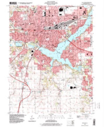
14 topographic sheets cover this place, the earliest surveyed in 1929 and the latest in 1998. It stands in Decatur Township. It lies in ZIP code area 62523. It stands on Ward Branch. The Survey maps it on the Decatur quadrangle. 70,522 people lived here at the 2020 count. It stands 676 feet above sea level.
Research this city
On record in Decatur
Buildings and businesses the archive holds for this place. Each opens its own page, with the source record it came from.
On the National Register 9 records
 Decatur Downtown Historic Districtlisted 1985
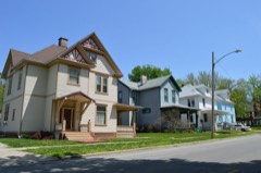 Decatur Historic Districtlisted 1976
 James Millikin Houselisted 1974
 Roosevelt Junior High Schoollisted 2002
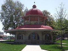 Transfer Houselisted 2002
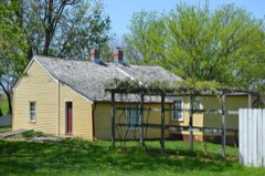 Trobaugh-Good Houselisted 1996
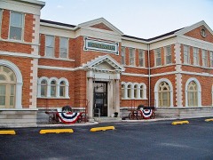 Wabash Railroad Station and Railway Express Agencylisted 1994
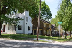 West End Historic Districtlisted 2002
- Garfield Schoollisted 2024
Population over time
2 figuresDecatur fell from 76,122 to 70,522 between 2010 and 2020. These are the recorded population figures Wikidata holds for this place, reached through the Geographic Names Information System number this page is keyed on rather than by name, so they belong to this place and not to another of the same name. Most are census counts, but not all are: an early figure may be a founding or settlement estimate, and an estimate published within five years of a census is left out. The change column is computed, and is left blank where more than 20 years separate a figure from the one before it, because a gap that long is not a change between two counts.
| Year | People | Change |
|---|---|---|
| 2010 | 76,122 | |
| 2020 | 70,522 | -5,600 (-7%) |
Topographic sheets covering this place
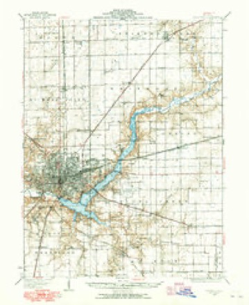
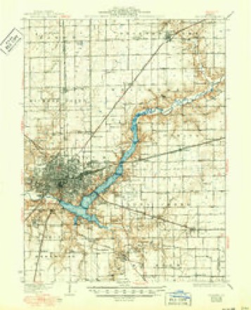
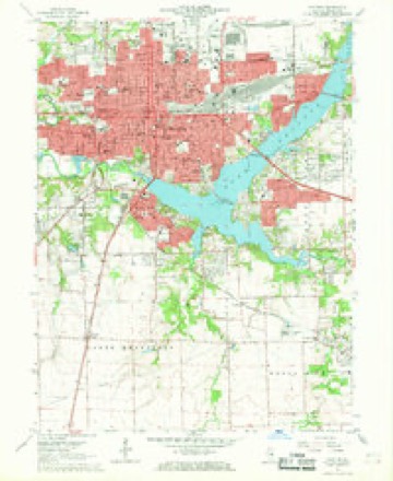
7 surveys from 14 printed sheetsMatched by testing this settlement's coordinate against the published boundary of every sheet in the United States Geological Survey's historical collection. Each opens the scanned sheet at the Survey.
- 1929 USGS Decatur quadrangle1:62500
- 1933 USGS Decatur quadrangle1:62500, 3 printings
- 1958 USGS Decatur quadrangle1:250000, 3 printings
- 1961 USGS Decatur quadrangle1:250000, 2 printings
- 1967 USGS Decatur quadrangle1:24000, 2 printings
- 1985 USGS Decatur quadrangle1:100000, 2 printings
- 1998 USGS Decatur quadrangle1:24000



What happened here
An account from the chapter on Decatur township. The inset identifies its exact source book and publication year.
Inlet Pipe
It was deemed necessary, as a precautionary measure, to connect the reservoir directly with the river, so that if, in case of a long protracted fire or drought, or any other unforeseen emergency, the water should fail to filter into the reservoir fast enough to supply the demand, access to the river could still be had by such connection ; consequently a 24-inch cast iron conduit pipe, provided with a Ludlow Gate, was laid from about the center of the current of the river into the reservoir, resting on the river bed and falling one foot in 110 feet to the reservoir.
In the county-history sources
721,469 words on this townshipHistory of Macon County, Illinois, from Its Organization to 1876, published 1876 names this settlement in its chapter on Decatur Township. These are the passages that mention it, exactly as the scans read.
We next find him assisting in the construction of the frigate "United States," which he afterwards commanded, and which became famous in our country's naval history. He went with Commodore Barry on board the United States on a cruise through the west Indies, to suppress the depredations of the French privateers. On this voyage several successful encounters were had with French vessels in the vicinity of Martinique, in all of which Decatur, then but twenty years of age, manifested the bold, daring disposition of his future life, and ren- than the surrounding country, and vice vei-sa ; but that has not been the case with Macon county ;ind the city of Decatur. They have kept step by step in their advancement in wealth, improvements, popuhition and general prosperity. Political demagogues are sometimes, for their own seltish purposes, disposed to array the city against the country or the country against the city, as the case maybe; but to the true obser\er their interests are one and inseparable, as a moment's reflection will demonstrate. The man that takes no interest in his countv town and its advancement is an dered signal services for wliich he was made lieutenant. He was next engaged in cruising along the coast from Georgia to Cape Cod, protecting our commercial interests. He then made two voyages across the ocean, after which a treaty of peace was declared between the United States and France, which put an end to the naval prospects of Decatur for the time being.
Passage source: History of Macon County, Illinois, from Its Organization to 1876, published 1876.
The United States soon after sent a squadron to the Mediterranean to stop the depredations of the Tripolines and Algerines upon our commerce. Decatur was commissioned first lieutenant under Capt. Bainbridge, on board the Essex, which was stationed to guard the coasts and port of Tripoli, where he remained until 1802, when the Essex was relieved by the Chesapeake, under Com. Morris, when he returned home. After spending a few weeks at home his restless spirit induced him to join the New York, under Capt. James Barrow, with whom he again set sail for the Mediterranean in Sept., 1S02. He remained but a short time and returned home, where he was put in charge of the Argus, on which he sailed to Gibraltar, where he assumed command of the schooner Enterprise, with which, on the 23d of October, 1803, he captured the Tripoline craft Mostico, with 70 prisoners. In the early part of 1S04, Captain Bainbridge, being a prisoner in the City of Tripoli, and the gallant old ship Philadelphia having been captured, which, with its forty guns, well manned, effectually guarded the harbor of Tripoli, it was determined that this ship should be burned, but who was to undertake the hazardous experiment.'' Decatur volunteered his services. With his little schooner hitrepid, with but a few guns, assisted by the Siren, he set sail for Tripoli, where he arrived July 4, 1S04. They cautiously approached the harbor where the Philadelphia lay anchored, and oh a dark night the Intrepid, with Decatur at the helm, came up to within a few yards of their coveted prize before being discovered. They lashed the Intrepid to the towering form of the Philadelphia and Decatur and his brave men jumped on deck of the latter, drew their swords and rushed upon the panic stricken crew, and in five minutes killed and drove them pell-mell into the water. The cables of the Philadelphia were cut and she was set on fire, floating at the mercy of the winds. "As the streaming flame circled around mast and boom, flinging its lurid glare over the waste of water, the old vessel floated along until her final explosion. The exultant shouts of her captors penetrated the prison walls of Tripoli and proclaimed speedy liberation."
Passage source: History of Macon County, Illinois, from Its Organization to 1876, published 1876.
The land on which the original To%v)i of Decatur was located was entered by Parmenius Smallwood, Easton Whitton and Chas. Prentice, for which, at the time of the location of the towi;i, they had received no patent from the government. On the 2oth day of June, 1S29, they entered into bond with the then county commis-
Passage source: History of Macon County, Illinois, from Its Organization to 1876, published 1876.
Machine-read from a century-old scan, so expect the errors a machine makes: misspelled names, dropped words, stray characters.
Read the whole chapter on Decatur Township - it names this place 65 more 65 times.
Mines and quarries near this place
4 within 5 milesRegional context, not property-specific evidence. The federal mineral resources record lists 4 workings within 5 miles of Decatur: 3 past producers, 1 producer. 1 still produces. What was taken out: Sand and Gravel, Construction, Stone. Distance is straight-line from the map coordinates, so a quarry counted here may appear on a neighbouring settlement's page as well.
| Where | Site | Commodity | Status | Recorded |
|---|---|---|---|---|
| Macon County Pit | Stone | Past Producer | ||
| Chastain Construction Co. Pit | Sand and Gravel, Construction | Past Producer | ||
| Decatur Sand & Gravel Dredge No. 1 | Sand and Gravel, Construction | Producer | ||
| Pit #2 Decatur Hydraulic | Sand and Gravel, Construction | Past Producer |
Storms near this place
60 of 101 shownRegional context, not property-specific evidence. The National Weather Service names Decatur in 101 storm reports between 1995 and 2026: 63 thunderstorm wind, 28 hail, 5 flash flood, 4 tornado. The reports record 10 injuries. Each account below is quoted exactly as the forecast office filed it, from the NOAA Storm Events Database, and each date opens the federal record of that event.
| When | Event | Place named | Harm | What the report says |
|---|---|---|---|---|
| April 1996 | Tornado (F1) | Decatur | 9 hurt, $1,500,000 | no account filed |
| May 2006 | Lightning | Decatur | 1 hurt | A man was slightly injured by lightning on the east side of Decatur when the car he was riding in was struck. |
| May 2013 | Tornado (EF1) | Decatur | $500,000 | A tornado touched down at 10:03 PM CDT on the northwest side of Decatur near the intersection of Division Street and Summit Avenue. The tornado tracked northeastward through Graceland Cemetery, across Oakland Avenue, and just south of the Decatur Memorial Hospital before dissipating near East Maywood Court at 10:07 PM CDT. Numerous trees and tree branches were blown down along the path of the tornado, with the most significant tree damage occurring in Graceland Cemetery. The Plaza TV shop on Oakland Avenue lost its roof and suffered broken windows and siding damage. Other minor roofing damage occurred along the path of the tornado, with numerous trees and tree branches knocked down for several blocks south of the tornado as well. No injuries were reported. |
| February 1996 | Thunderstorm Wind | Decatur | $250,000 | no account filed |
| July 2016 | Thunderstorm Wind | Decatur | $140,000 | Twenty five trees and hundreds of large tree branches were blown down across the city of Decatur. |
| May 1995 | Thunderstorm Wind | Decatur | $135,000 | A Decatur Sanitary District storage building was destroyed by thunderstorm winds. Four detached garages were blown down and three businesses had minor roof damage. Also, numerous trees and power lines were blown down. Damage was estimated around $135,000. |
| July 2020 | Thunderstorm Wind | Decatur | $125,000 | Numerous trees and power lines were blown down throughout Decatur. |
| October 2010 | Thunderstorm Wind | Decatur | $75,000 | An outbuilding roof was peeled half way off and the west wall of a church was pushed in and damaged at 2954 West Ash Avenue. |
| October 2007 | Thunderstorm Wind | Decatur | $60,000 | Trees were blown down on Lake Shore Drive. A hospital roof was damaged, and debris broke car windows. |
| November 2016 | Thunderstorm Wind | Decatur | $50,000 | Numerous tree limbs and power lines were blown down on the south side of Decatur. |
| April 2011 | Thunderstorm Wind | Decatur | $45,000 | A shed and 2 large trees were blown down. 3 houses and 2 garages suffered minor damage. |
| August 2009 | Thunderstorm Wind | Decatur | $40,000 | Numerous trees and power lines were blown down across Decatur. |
| August 2014 | Thunderstorm Wind | Decatur | $35,000 | Several trees and power lines were blown down across Decatur. |
| July 2018 | Thunderstorm Wind | Decatur | $32,000 | A tree was blown over onto a house. |
| May 2013 | Thunderstorm Wind | Decatur | $30,000 | Multiple tree limbs were blown down on Regal Avenue in Decatur. |
| May 2013 | Thunderstorm Wind | Decatur | $20,000 | Numerous large tree branches were blown down. |
| July 2008 | Thunderstorm Wind | Decatur | $20,000 | Trees and power lines were blown down in Decatur. |
| July 2008 | Thunderstorm Wind | Decatur | $20,000 | Several power poles were broken by high winds. |
| August 2009 | Thunderstorm Wind | Decatur | $15,000 | Several trees were blown onto power lines in Decatur. |
| August 2009 | Thunderstorm Wind | Decatur | $15,000 | Several tents were damaged by estimated 60 mph winds at the Farm Progress Show in Decatur. |
| October 2010 | Thunderstorm Wind | Decatur | $10,000 | A semi truck was blown over on I-72 at mile marker 136. |
| October 2010 | Thunderstorm Wind | Decatur | $5,000 | A pavillion was blown over. |
| May 2007 | Thunderstorm Wind | Decatur | $3,000 | A tree was blown over on top of a house.| |
| July 2016 | Thunderstorm Wind | Decatur | $2,000 | A large tree was blown over on Summit Avenue in Decatur. |
| June 2015 | Thunderstorm Wind | Decatur | $2,000 | A tree was blown down across Grand Avenue in Decatur. |
| March 2026 | Thunderstorm Wind | Decatur | - | Power lines were blown down on Florida Court. |
| May 2025 | Thunderstorm Wind | Decatur | - | Numerous tree branches and power lines were blown down throughout Decatur. |
| July 2025 | Flash Flood | Decatur | - | Street flooding was occurring along South Shores Drive in Decatur. |
| December 2025 | Thunderstorm Wind | Decatur | - | A few tree branches were blown down. |
| January 2023 | Tornado (EF1) | Decatur | - | A tornado touched down on the northeast side of Decatur at 6:00 PM CST. The tornado tracked northeastward, causing damage to an abandoned bowling alley on North 22nd Street. Several of the wall panels on the southeast side of the building were removed and blown to the northeast. A trained spotter watched the tornado cross 22nd Street before lifting at 6:01 PM CST. |
| March 2023 | Thunderstorm Wind | Decatur | - | A 150-year old Magnolia tree was snapped at the base at the Millikin Homestead. |
| August 2023 | Thunderstorm Wind | Decatur | - | Several tree branches were blown down. |
| June 2023 | Thunderstorm Wind | Decatur | - | Several large trees were snapped. |
| June 2023 | Thunderstorm Wind | Decatur | - | A 3-inch diameter tree branch was snapped. |
| June 2023 | Thunderstorm Wind | Decatur | - | Four-inch diameter tree limbs were blown down west of Millikin University. |
| June 2023 | Thunderstorm Wind | Decatur | - | Several tree branches were blown down. |
| August 2022 | Thunderstorm Wind | Decatur | - | Power lines were blown down in Decatur. |
| August 2022 | Thunderstorm Wind | Decatur | - | Several tree branches were blown down in Decatur. |
| August 2022 | Thunderstorm Wind | Decatur | - | A large tree was blown onto a house, causing structural damage. |
| April 2020 | Thunderstorm Wind | Decatur | - | Several power lines were blown down across Decatur. |
| April 2020 | Thunderstorm Wind | Decatur | - | A two and a half foot-diameter tree was uprooted and several large tree branches were blown down in Fairview Park in Decatur. |
| August 2020 | Thunderstorm Wind | Decatur | - | A 12-inch diameter tree branch was blown down. |
| May 2019 | Thunderstorm Wind | Decatur | - | Numerous tree branches were blown down in Fairview Park on the west side of Decatur. |
| May 2019 | Thunderstorm Wind | Decatur | - | A tree was blown onto a house. |
| May 2019 | Thunderstorm Wind | Decatur | - | A large tree was blown onto a house on Harper Avenue. |
| August 2019 | Thunderstorm Wind | Decatur | - | Several tree limbs were blown down. |
| June 2018 | Thunderstorm Wind | Decatur | - | A large tree was snapped in the 1400 block of West Riverview Street in Decatur. |
| June 2009 | Thunderstorm Wind | Decatur | - | A large tree and power lines were blown down at St. Mary's Hospital in Decatur. |
| July 2008 | Hail | Decatur | - | One inch diameter hail fell for 15 to 20 minutes. |
| March 2007 | Thunderstorm Wind | Decatur | - | Numerous trees and power lines were blown down on the east side of town. |
| October 2007 | Hail | Decatur | - | Golf ball sized hail was reported on the east side of Lake Decatur. |
| March 2006 | Thunderstorm Wind | Decatur | - | In addition, penny size hail was reported. |
| January 2005 | Flash Flood | Decatur | - | Very heavy rain caused roads to flood east of Decatur. A portion of Illinois Route 105 was closed for a few hours due to flooding. |
| June 2005 | Flash Flood | Decatur | - | Route 36 was closed due to water flowing across it. Numerous viaducts in city were flooded. |
| July 2005 | Thunderstorm Wind | Decatur | - | Several tree limbs blown down. |
| June 2004 | Flash Flood | Decatur | - | A foot of water was reported over 22nd Street near Garfield in Decatur. |
| April 2003 | Thunderstorm Wind | Decatur | - | Several trees were blown down. |
| May 2002 | Thunderstorm Wind | Decatur | - | A phoneline pole was snapped in half by thunderstorm winds. |
| July 2002 | Thunderstorm Wind | Decatur | - | Numerous trees, tree limbs, and power lines were blown down. A few homes had minor roof damage due to fallen trees and tree limbs. No injuries reported. |
| July 2002 | Thunderstorm Wind | Decatur | - | Thunderstorm winds blew a carport over and moved it 20 yards. |
Nearest settlements
The eight closest, with where each one stands in the county. Distances are straight-line, computed from the Geographic Names Information System coordinates.
| Map | Place | Distance | Sheets |
|---|---|---|---|
| Longview Place | 0.9 miles | 14 | |
| Wyckles Corners | 3.9 miles | 11 | |
| Larkdale | 4.0 miles | 14 | |
| Wyckles | 4.0 miles | 11 | |
| Turpin | 4.0 miles | 14 | |
| Bulldog Crossing | 4.3 miles | 11 | |
| Elwin | 4.4 miles | 14 | |
| Faries Park (historical) | 4.6 miles | 14 |
Elsewhere
Matched on this settlement's Geographic Names Information System number rather than its name, so it cannot be a different place of the same name in another state.
| Wikipedia article on Decatur | An encyclopaedic summary. Its text is share-alike, so it is linked here rather than copied. |
| Wikidata item Q506325 | The structured record the population and elevation above come from. Public domain (CC0). |
Provenance
This settlement is recorded in the Geographic Names Information System as feature 407044. The sheet list is computed by point-in-boundary test against the United States Geological Survey's historical topographic inventory. Both are works of the United States government and carry no copyright under 17 U.S.C. 105.
Mines and quarries. USGS Mineral Resources Data System (MRDS) https://mrdata.usgs.gov/mrds/ A work of the United States government, no copyright under 17 U.S.C. 105.
Storms. NOAA National Centers for Environmental Information, Storm Events Database https://www.ncei.noaa.gov/stormevents/ A work of the United States government, no copyright under 17 U.S.C. 105. Narratives are quoted verbatim from the National Weather Service report and are not edited or summarised.