 Block
Elkhorn Grove, Illinois
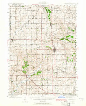
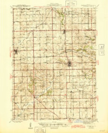
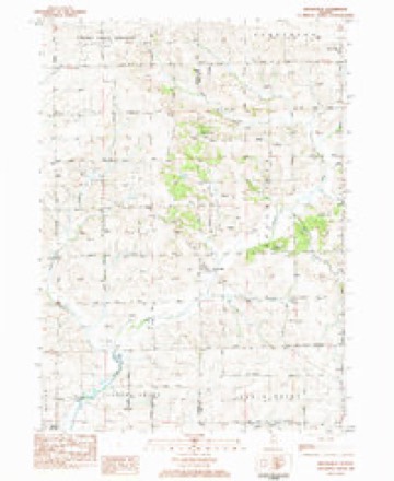
14 topographic sheets cover this place, the earliest surveyed in 1942 and the latest in 1983. It stands in Elkhorn Grove Township. It lies in ZIP code area 61051. It stands on Middle Creek. The Survey maps it on the Brookville quadrangle. It stands 728 feet above sea level.
Topographic sheets covering this place
8 surveys from 14 printed sheetsMatched by testing this settlement's coordinate against the published boundary of every sheet in the United States Geological Survey's historical collection. Each opens the scanned sheet at the Survey.
- 1942 USGS Forreston quadrangle1:62500, 2 printings
- 1945 USGS Forreston quadrangle1:62500, 2 printings
- 1954 USGS Rockford quadrangle1:250000
- 1955 USGS Rockford quadrangle1:250000
- 1958 USGS Rockford quadrangle1:250000, 4 printings
- 1963 USGS Rockford quadrangle1:250000
- 1981 USGS Rockford quadrangle1:100000, 2 printings
- 1983 USGS Brookville quadrangle1:24000





In the county-history sources
560 words on this townshipThe History of Carroll County, Illinois, Containing a History of the County-its Cities, Towns, Etc., a Biographical Directory ... War Record ... Statistics, Portraits of Early Settlers and Prominent Men ... History of the Northwest ... Illinois ... Miscellaneous Matters, Etc, published 1878 names this settlement in its chapter on Elkhorn Grove Township. These are the passages that mention it, exactly as the scans read.
The Elkhorn Grove mills are situated on Elkhorn Creek, section 31, in Elkhorn Grove Township. They are owned by Fisher and J. F. Allison. They were originally erected in 1866, at a cost of $7,000. They have a capacity of one hundred and forty-four bushels per day, equal to nearly thirty barrels. In Februar}', 1872, when the upper story of the mill was weighted down with grain, there came a fearful wind storm that so racked the mill that the joists gave way, letting the entire floor and its contents down upon the stove, from which a fire started that destroyed the entire building. Dr. W. K. Palmer, William L". Johnson, Matt. Deiterlee and Joseph Lukens, the miller, were in the store room at the time. Lukens escaped through the flume. Dr. Palmer was killed by the falling of the floor, and was horribly burned before his body could be rescued. Deiterlee was slightly burned, and Johnson badly burned about the head, neck, face and hands. They had been wedged in by the falling mass, and were unable to extricate themselves from the burning ^/^/;;7> until the increasing heat gave them unnatural strength, when they got away, more dead than alive. Lukens was so frightened as to be unable to render them any assistance. In addition, he was in bad health, and Dr. Palmer had called to treat him professionally. The loss to Fisher Allison was about $6,000, and to the customers of the mill about $1,500. There was no insurance on the mill and the customers made no claim against Mr. Allison for damages. The mills were rebuilt the following Fall, by Fisher Allison, his son, Joseph F., the present county treasurer, becoming a partner in their re-erection and^ subsequent management.
Passage source: The History of Carroll County, Illinois, Containing a History of the County-its Cities, Towns, Etc., a Biographical Directory ... War Record ... Statistics, Portraits of Early Settlers and Prominent Men ... History of the Northwest ... Illinois ... Miscellaneous Matters, Etc, published 1878.
The Elkhorn Grove Mutual Fire Insurance Company was organized in the Town of Elkhorn Grove, Carroll County, April 17, 1769, electing nine directors for the term of one year as follows : Henry Smith, M. Z. Landon, Lewis Reynolds, Naaman VVoodin, A. H. Healy, Joseph Steffins, John H. Haws, William Lowry and Fisher Allison, they choosing from their number Henry Smith, president; William Lowry, secretary, and Joseph Steffins, treasurer. The present officers are : M. Z. Landon, A. H. Kealz, Lewis Reynolds, William Lowry, Aaron Huff, Joseph Snook, Hiram McNamer, Naaman Woodin and L. S. Thorp, directors ; Miles Z. Landon, president ; L. S. Thorp, secretary ; Naaman Woodin, treasurer ; William Lowry, agent. The company has issued sixtynine policies, covering an insurance of $101,941.01, up to January 5, 1878, and have sustained one small loss of $350, which was promptly paid. The total cost to the policy holders, in fees and assessments, has not exceeded $8,00 as an average, an exceedingly favorable commentary on the wisdom of our state legislature in enacting a law enabling the citizens of the towns to organize themselves as an insurance company.
Passage source: The History of Carroll County, Illinois, Containing a History of the County-its Cities, Towns, Etc., a Biographical Directory ... War Record ... Statistics, Portraits of Early Settlers and Prominent Men ... History of the Northwest ... Illinois ... Miscellaneous Matters, Etc, published 1878.
Machine-read from a century-old scan, so expect the errors a machine makes: misspelled names, dropped words, stray characters.
Read the whole chapter on Elkhorn Grove Township - it names this place 1 more 1 time.
Mines and quarries near this place
5 within 5 milesRegional context, not property-specific evidence. The federal mineral resources record lists 5 workings within 5 miles of Elkhorn Grove: 3 past producers, 2 producers. 2 still produce. What was taken out: Stone, Crushed/Broken. Distance is straight-line from the map coordinates, so a quarry counted here may appear on a neighbouring settlement's page as well.
| Where | Site | Commodity | Status | Recorded |
|---|---|---|---|---|
| Derrer Quarry Protable #1 | Stone, Crushed/Broken | Producer | ||
| Eller Quarry | Stone, Crushed/Broken | Producer | ||
| Russels Quarry | Stone, Crushed/Broken | Past Producer | ||
| Shank Quarry | Stone, Crushed/Broken | Past Producer | ||
| Unnamed Limestone Quarry | Stone, Crushed/Broken | Past Producer |
Nearest settlements
The eight closest, with where each one stands in the county. Distances are straight-line, computed from the Geographic Names Information System coordinates.
| Map | Place | Distance | Sheets |
|---|---|---|---|
| Hitt | 0.9 miles | 11 | |
| South Elkhorn | 3.1 miles | 11 | |
| Milledgeville | 3.7 miles | 11 | |
| Hazelhurst | 4.0 miles | 11 | |
| Chadwick | 8.3 miles | 14 | |
| Lanark | 8.3 miles | 14 | |
| Kittredge | 8.9 miles | 14 | |
| Shannon | 10.1 miles | 14 |
Elsewhere
Matched on this settlement's Geographic Names Information System number rather than its name, so it cannot be a different place of the same name in another state.
| Wikidata item Q5364266 | The structured record the population and elevation above come from. Public domain (CC0). |
Provenance
This settlement is recorded in the Geographic Names Information System as feature 422663. The sheet list is computed by point-in-boundary test against the United States Geological Survey's historical topographic inventory. Both are works of the United States government and carry no copyright under 17 U.S.C. 105.
Mines and quarries. USGS Mineral Resources Data System (MRDS) https://mrdata.usgs.gov/mrds/ A work of the United States government, no copyright under 17 U.S.C. 105.