 Block
Milledgeville, Illinois
11 topographic sheets cover this place, the earliest surveyed in 1934 and the latest in 1985. It stands in Wysox Township. It lies in ZIP code area 61051. The Survey maps it on the Milledgeville quadrangle. 1,026 people lived here at the 2020 count. It stands 761 feet above sea level.
On record in Milledgeville
Buildings and businesses the archive holds for this place. Each opens its own page, with the source record it came from.
On the National Register 1 record
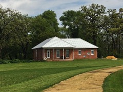 Joseph Steffens Houselisted 1985
Population over time
2 figuresMilledgeville fell from 1,032 to 1,026 between 2010 and 2020. These are the recorded population figures Wikidata holds for this place, reached through the Geographic Names Information System number this page is keyed on rather than by name, so they belong to this place and not to another of the same name. Most are census counts, but not all are: an early figure may be a founding or settlement estimate, and an estimate published within five years of a census is left out. The change column is computed, and is left blank where more than 20 years separate a figure from the one before it, because a gap that long is not a change between two counts.
| Year | People | Change |
|---|---|---|
| 2010 | 1,032 | |
| 2020 | 1,026 | -6 (-1%) |
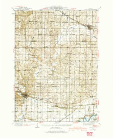
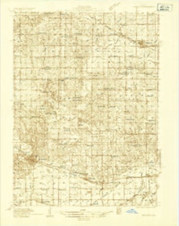
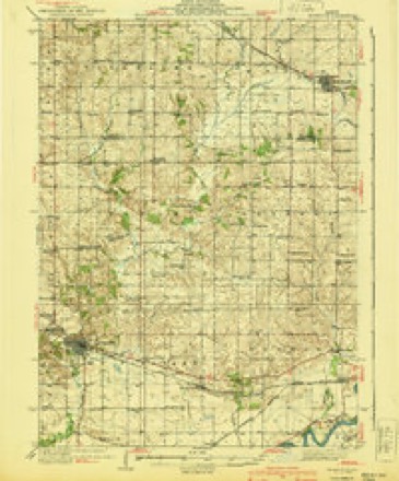
Topographic sheets covering this place
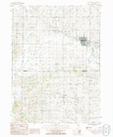
7 surveys from 11 printed sheetsMatched by testing this settlement's coordinate against the published boundary of every sheet in the United States Geological Survey's historical collection. Each opens the scanned sheet at the Survey.
- 1934 USGS Morrison quadrangle1:62500
- 1934 USGS Morrison quadrangle1:48000
- 1940 USGS Morrison quadrangle1:62500, 2 printings
- 1958 USGS Aurora quadrangle1:250000, 3 printings
- 1961 USGS Aurora quadrangle1:250000
- 1985 USGS Dixon quadrangle1:100000, 2 printings
- 1985 USGS Milledgeville quadrangle1:24000



In the county-history sources
15,656 words on this townshipThe History of Carroll County, Illinois, Containing a History of the County-its Cities, Towns, Etc., a Biographical Directory ... War Record ... Statistics, Portraits of Early Settlers and Prominent Men ... History of the Northwest ... Illinois ... Miscellaneous Matters, Etc, published 1878 names this settlement in its chapter on Wysox Township. These are the passages that mention it, exactly as the scans read.
ATHEKTOX DAXIKIi V. Farmer; Sec. o-i ; P. O. Milledgeville ; born Steuben Co., N. Y.. March 14, 1846; came to this Co. with his parents when six years of age, in 1851 ; came by wagon most of the way, and arrived in Nov., 1851; lived in Town of Woodland many years; owns farm of forty acres ; was in the army, Co. D, 153d I. V. I. ; married Louise 1 aylor, from N. Y. State, in Feb., 1869.
Passage source: The History of Carroll County, Illinois, Containing a History of the County-its Cities, Towns, Etc., a Biographical Directory ... War Record ... Statistics, Portraits of Early Settlers and Prominent Men ... History of the Northwest ... Illinois ... Miscellaneous Matters, Etc, published 1878.
BULiL. ABXER, Carpenter, Joiner and Cabinet Maker; Sec. 13; P. O. Milledgeville; born in Danby, Vt., May 7, 1827; moved to York State ; came to this state, to Whiteside Co. in 1845; lived there twelve years, and came to Carroll Co. in 1857; has worked his trade here twenty years; enlisted in 55th Regt. 1. V. I.; married Julia Dodd, daughter of Dr. Dodd, one of the early settlers ; they have four children : Emeline, Annie, Frank, Anson.
Passage source: The History of Carroll County, Illinois, Containing a History of the County-its Cities, Towns, Etc., a Biographical Directory ... War Record ... Statistics, Portraits of Early Settlers and Prominent Men ... History of the Northwest ... Illinois ... Miscellaneous Matters, Etc, published 1878.
BUSEI.L, 1>. C. Farmer, Sec. 14; P. O. Milledgeville; born in Carroll Co., New Hampshire, June 20, 1837; lived there 18 years ; came to Lee Co., 111., m 1855, and came to Carroll Co., 111., in 1856, with his parents; engaged in farming and stock raising; has 2UU acres land; has held office School Treasurer some years, and also represents this town in Board Supervisors, Carroll Co; married Miss Gertrude Tavlor, from Bradford Co., Penn., Feb. 7, 187U; they have two children: Ella A., born April 15, 1872, Emeline, Dec. 6, 1875. James L. Busell, father of above, was born N. H. and came to this Co., 185tJ ; died March, 1857; his widow is living wdth her son, their only child living.
Passage source: The History of Carroll County, Illinois, Containing a History of the County-its Cities, Towns, Etc., a Biographical Directory ... War Record ... Statistics, Portraits of Early Settlers and Prominent Men ... History of the Northwest ... Illinois ... Miscellaneous Matters, Etc, published 1878.
Machine-read from a century-old scan, so expect the errors a machine makes: misspelled names, dropped words, stray characters.
Read the whole chapter on Wysox Township - it names this place 42 more 42 times.
Mines and quarries near this place
3 within 5 milesRegional context, not property-specific evidence. The federal mineral resources record lists 3 workings within 5 miles of Milledgeville: 2 producers, 1 past producer. 2 still produce. What was taken out: Stone, Crushed/Broken. Distance is straight-line from the map coordinates, so a quarry counted here may appear on a neighbouring settlement's page as well.
| Where | Site | Commodity | Status | Recorded |
|---|---|---|---|---|
| Derrer Quarry Protable #1 | Stone, Crushed/Broken | Producer | ||
| Eller Quarry | Stone, Crushed/Broken | Producer | ||
| Shank Quarry | Stone, Crushed/Broken | Past Producer |
Storms near this place
41 since 1994Regional context, not property-specific evidence. The National Weather Service names Milledgeville in 41 storm reports between 1994 and 2024: 32 thunderstorm wind, 5 hail, 2 tornado, 1 heavy rain. No death or injury is recorded in these reports. Each account below is quoted exactly as the forecast office filed it, from the NOAA Storm Events Database, and each date opens the federal record of that event.
| When | Event | Place named | Harm | What the report says |
|---|---|---|---|---|
| April 2010 | Thunderstorm Wind | Milledgeville | $750,000 | Wind gusts estimated to be 70 mph caused a west-facing wall of a church to collapse in Milledgeville, IL around 858 pm April 5. In addition, several 3 foot diameter trees were blown down. Numerous power lines were also knocked down resulting in a power outage to much of the town. Most of the damage was across the northwest part of town and extended about 0.5 miles to the north. |
| April 2010 | Thunderstorm Wind | Milledgeville | $100,000 | Wind gusts estimated to be 60 mph damaged some outbuildings about 1 mile west of Milledgeville, IL around 845 pm April 5. |
| April 2010 | Thunderstorm Wind | Milledgeville | $50,000 | Wind gusts estimated to be 70 mph blew down several large trees in Milledgeville, IL around 855 pm April 5. The fallen trees knocked down power lines and destroyed the end of a machine shed. |
| May 1999 | Heavy Rain | Milledgeville | $20,000 | Localized heavy rain caused basement walls in 2 separate houses to collapse. Up to 4 feet of mud poured into the basements. Damage to each house and the contents was estimated at $10,000. |
| June 2010 | Thunderstorm Wind | Milledgeville | $5,000 | Wind gusts downed tree limbs in Milledgeville. |
| August 2008 | Thunderstorm Wind | Milledgeville | $5,000 | Wind gusts estimated to be 65 mph blew down some large branches and power lines in Milledgeville, IL at 650 pm August 4. |
| April 2006 | Hail | Milledgeville | $5,000 | also reported by law enforcement. Hail covered the ground. |
| August 2005 | Thunderstorm Wind | Milledgeville | $3,000 | A wind gust estimated at 57 knots (65 mph) resulted in 8-10 inch diameter limbs downed that landed up to 10 feet away from their parent tree. A garage door was pushed in on a residence. |
| March 2006 | Hail | Milledgeville | $3,000 | no account filed |
| August 2006 | Thunderstorm Wind | Milledgeville | $2,000 | A storm survey discovered 6 to 8 inch diameter limbs down on the west side of highway 40. |
| June 2007 | Thunderstorm Wind | Milledgeville | $1,000 | Power lines were blown down. |
| June 1998 | Thunderstorm Wind | Milledgeville | $500 | Strong thunderstorm winds downed several trees. |
| May 2024 | Thunderstorm Wind | Milledgeville | - | Trees blown down. Time estimated from radar data. |
| April 2023 | Hail | Milledgeville | - | The Milledgeville Fire Department hail ranging in size from pea to quarter. |
| July 2022 | Thunderstorm Wind | Milledgeville | - | A trained spotter reported damage from wind driven hail at this location. The wind driven hail caused two pieces of siding to fall off along with damage to a window and many dents in the remaining siding. |
| August 2021 | Thunderstorm Wind | Milledgeville | - | A spotter estimated 55 to 60 mph gust. |
| May 2020 | Tornado (EFU) | Milledgeville | - | A tornado developed ENE of Morrison, IL in Whiteside County, shortly before 2:30 pm. The tornado followed an intermittent path northeast before hitting a farmstead near the Whiteside/Carroll County border. This tornado entered Carroll County about 2 miles WSW of Hazelhurst, and travelled a little more than 2 miles before dissipating. The tornado was rated EF1 in Whiteside County, with maximum winds estimated around 100 mph. The tornado was designated as EF-U in Carroll County, as there was no observable damage. The tornado was on the ground for about 24 minutes along an intermittent 12 mile path. |
| September 2018 | Thunderstorm Wind | Milledgeville | - | A severe thunderstorm with straight line winds estimated around 100 mph caused significant damage in the Milledgeville, Illinois area. Damage began around 3 miles SW of Milledgeville, and continued through the town. Damage included numerous large trees uprooted and snapped, significant structural damage to large metal outbuildings, near destruction of a barn with cement block walls, and a large steel storage tank that was moved several feet. Damage swath was about 3 miles long. |
| September 2018 | Thunderstorm Wind | Milledgeville | - | The county emergency manager reported multiple large trees and power lines down, and an empty grain bin blown over railroad tracks. |
| September 2018 | Thunderstorm Wind | Milledgeville | - | A trained spotter reported a large tree uprooted in the town of Milledgeville. |
| September 2018 | Thunderstorm Wind | Milledgeville | - | A trained spotter estimated max wind gusts of around 60 mph. |
| July 2017 | Thunderstorm Wind | Milledgeville | - | A public report was received of 3 inch in diameter tree branches down. |
| June 2016 | Thunderstorm Wind | Milledgeville | - | Emergency manager reports a large tree limb down at a residence. The time is estimated from radar. |
| June 2014 | Thunderstorm Wind | Milledgeville | - | The emergency manager reported 60 mph winds. |
| August 2012 | Thunderstorm Wind | Milledgeville | - | The Emergency Manager estimated wind speeds of 40 to 60 MPH along with a report of two buildings down at the Fairgrounds. |
| June 2012 | Thunderstorm Wind | Milledgeville | - | Wind gusts estimated to be 60 mph were observed in Milledgeville, IL at 745 pm CDT June 29. |
| June 2012 | Thunderstorm Wind | Milledgeville | - | Wind gusts estimated to be 70 mph blew down several trees and limbs in Milledgeville, IL at 749 pm CDT June 29. |
| May 2011 | Thunderstorm Wind | Milledgeville | - | Wind gusts estimated to be 60 mph blew down some branches just east of Milledgeville, IL at 613 pm CDT May 22. |
| May 2011 | Thunderstorm Wind | Milledgeville | - | Wind gusts estimated to be 60 mph blew down some 8 to 10 inch diameter tree limbs in Milledgeville, IL at 638 pm CDT May 22. |
| April 2010 | Thunderstorm Wind | Milledgeville | - | Wind gusts estimated to be 70 mph uprooted some 3 foot diameter trees about 1 mile north of Milledgeville, IL around 845 pm April 5. |
| May 2009 | Flash Flood | Milledgeville | - | Heavy rains caused the flash flooding of a low lying railroad underpass in Milledgeville, IL during the evening of May 13. |
| June 2008 | Thunderstorm Wind | Milledgeville | - | Wind gusts estimated to be 65 mph blew down about six 8 to 10 inch diameter tree limbs in Milledgeville, IL at 6:25 pm June 12. |
| June 2008 | Thunderstorm Wind | Milledgeville | - | Wind gusts estimated to be 60 mph blew down some two inch diameter tree branches in Milledgeville, IL at 7:00 pm June 12. |
| August 2008 | Thunderstorm Wind | Milledgeville | - | Wind gusts estimated to be 60 mph were observed in Milledgeville, IL at 630 pm August 4. Sustained wind speeds of 40 mph were observed for about ten minutes. |
| August 2008 | Thunderstorm Wind | Milledgeville | - | Wind gusts estimated to be 60 mph blew down some trees and branches in the vicinity of Milledgeville, IL at 620 pm August 4. A power outage was also observed. A trained spotter also contributed to this report. |
| May 1999 | Tornado (F0) | Milledgeville | - | Law enforcement officials reported a brief tornado. No damage was reported. |
| June 1994 | Thunderstorm Wind | Milledgeville | - | Winds of 60 to 70 mph blew tres down. |
| April 2023 | Hail | Milledgeville | - | no account filed |
| May 2015 | Hail | Milledgeville | - | no account filed |
| June 1996 | Thunderstorm Wind | Milledgeville | - | no account filed |
| May 1996 | Thunderstorm Wind | Milledgeville | - | no account filed |
Nearest settlements
The eight closest, with where each one stands in the county. Distances are straight-line, computed from the Geographic Names Information System coordinates.
| Map | Place | Distance | Sheets |
|---|---|---|---|
| Hitt | 3.0 miles | 11 | |
| South Elkhorn | 3.3 miles | 11 | |
| Elkhorn Grove | 3.7 miles | 14 | |
| Hazelhurst | 4.7 miles | 11 | |
| Chadwick | 7.1 miles | 14 | |
| Fair Haven | 8.3 miles | 11 | |
| Lanark | 10.1 miles | 14 | |
| Ideal | 11.4 miles | 11 |
Elsewhere
Matched on this settlement's Geographic Names Information System number rather than its name, so it cannot be a different place of the same name in another state.
| Wikipedia article on Milledgeville | An encyclopaedic summary. Its text is share-alike, so it is linked here rather than copied. |
| Wikidata item Q2475740 | The structured record the population and elevation above come from. Public domain (CC0). |
Provenance
This settlement is recorded in the Geographic Names Information System as feature 413566. The sheet list is computed by point-in-boundary test against the United States Geological Survey's historical topographic inventory. Both are works of the United States government and carry no copyright under 17 U.S.C. 105.
Mines and quarries. USGS Mineral Resources Data System (MRDS) https://mrdata.usgs.gov/mrds/ A work of the United States government, no copyright under 17 U.S.C. 105.
Storms. NOAA National Centers for Environmental Information, Storm Events Database https://www.ncei.noaa.gov/stormevents/ A work of the United States government, no copyright under 17 U.S.C. 105. Narratives are quoted verbatim from the National Weather Service report and are not edited or summarised.