 Block
Cedarville, Illinois
13 topographic sheets cover this place, the earliest surveyed in 1939 and the latest in 1981. It stands in Buckeye Township. It lies in ZIP code area 61032. It stands on Coon Creek. The Survey maps it on the Orangeville quadrangle. 663 people lived here at the 2020 count. It stands 866 feet above sea level.
On record in Cedarville
Buildings and businesses the archive holds for this place. Each opens its own page, with the source record it came from.
On the National Register 1 record
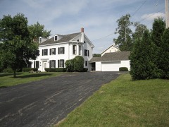 John H. Addams Homesteadlisted 1979
Population over time
3 figuresCedarville fell from 719 to 663 between 2000 and 2020. These are the recorded population figures Wikidata holds for this place, reached through the Geographic Names Information System number this page is keyed on rather than by name, so they belong to this place and not to another of the same name. Most are census counts, but not all are: an early figure may be a founding or settlement estimate, and an estimate published within five years of a census is left out. The change column is computed, and is left blank where more than 20 years separate a figure from the one before it, because a gap that long is not a change between two counts.
| Year | People | Change |
|---|---|---|
| 2000 | 719 | |
| 2010 | 741 | +22 (+3%) |
| 2020 | 663 | -78 (-11%) |
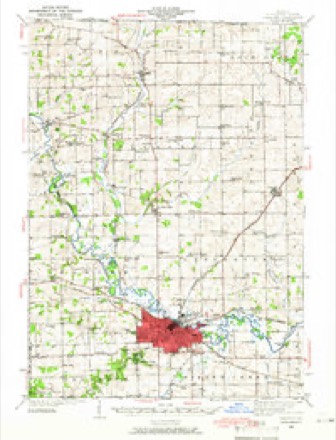
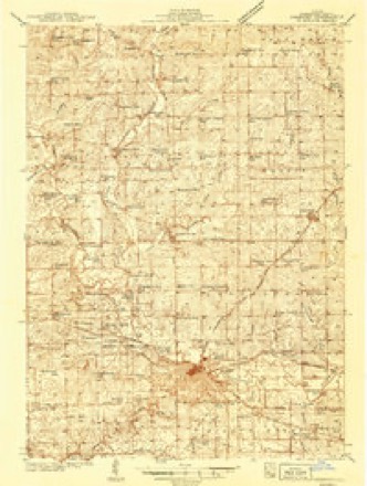
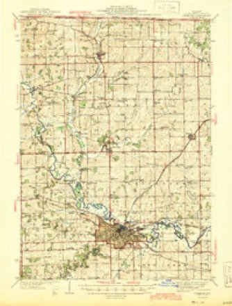
Topographic sheets covering this place
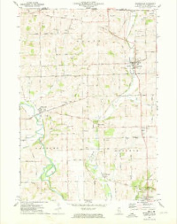
9 surveys from 13 printed sheetsMatched by testing this settlement's coordinate against the published boundary of every sheet in the United States Geological Survey's historical collection. Each opens the scanned sheet at the Survey.
- 1939 USGS Freeport quadrangle1:62500
- 1939 USGS Freeport quadrangle1:48000
- 1944 USGS Freeport quadrangle1:62500
- 1954 USGS Rockford quadrangle1:250000
- 1955 USGS Rockford quadrangle1:250000
- 1958 USGS Rockford quadrangle1:250000, 4 printings
- 1963 USGS Rockford quadrangle1:250000
- 1971 USGS Orangeville quadrangle1:24000
- 1981 USGS Rockford quadrangle1:100000, 2 printings





In the county-history sources
18,391 words on this townshipThe History of Stephenson County, Illinois : Containing ... Biographical Sketches ... War Record ... Statistics ... Portraits of Early Settlers ... History of the Northwest, History of Illinois, &c. .., published 1880 names this settlement in its chapter on Buckeye Township. These are the passages that mention it, exactly as the scans read.
Previous to the adoption of the act empowering the incorporation of townships. Buckeye Township was known as Center Precinct, which comprehended the territory that has since been subdivided into Buckeye, Dakota, Harlem and Lancaster Townships. This wajS the case as late as August, 1838, for, on the 6th of that month, an election was held at the house of Josiah Clingman, in Center Precinct, for State officers, at which John Edwards received twentyfive votes for Governor, and Stephen A. Douglas seven votes for Congress ; Ira
Passage source: The History of Stephenson County, Illinois : Containing ... Biographical Sketches ... War Record ... Statistics ... Portraits of Early Settlers ... History of the Northwest, History of Illinois, &c. .., published 1880.
The earliest settlement made in the present township of which there are any data to deduce conclusions, was during the year 1835. In the spring, John Goddard came to the southern portion of the township, and, in the fall of the same year, David Jones and Levi Lucas came, the former making claim to a large tract of land contiguous to what is now known as Buckeye Center, where he built a cabin and began houfekeeping. There was little beyond the hope of what the future might give birth to to encourage the lonely lives of these pioneers, yet they accepted the gauge of life as they found it, and survived to realize many of the promises reserved for after years. In addition to these, George Trotter, Richard Parriott and Henry and William Hollenback came about this time.
Passage source: The History of Stephenson County, Illinois : Containing ... Biographical Sketches ... War Record ... Statistics ... Portraits of Early Settlers ... History of the Northwest, History of Illinois, &c. .., published 1880.
In 1836, the roster of inhabitants was increased by the arrival of a few families, including William Robey, who had made a claim there the previous year, Jehu Pile, Andrew St. John, Ira, Job and Daniel Holly and others. Parrott and Pile located near the present town of Cedarville, while the balance entered claims in the northwestern part of the township.
Passage source: The History of Stephenson County, Illinois : Containing ... Biographical Sketches ... War Record ... Statistics ... Portraits of Early Settlers ... History of the Northwest, History of Illinois, &c. .., published 1880.
Machine-read from a century-old scan, so expect the errors a machine makes: misspelled names, dropped words, stray characters.
Read the whole chapter on Buckeye Township - it names this place 56 more 56 times.
Fires near this place
10 since 2010Regional context, not property-specific evidence. The federal wildfire occurrence database lists 10 fires within 5 miles of Cedarville between 2010 and 2017, burning about 11 acres in total. None started naturally. None was recorded as arson. Distance is straight-line from the map coordinates, so a fire counted here may appear on a neighbouring settlement's page as well.
| Reported cause | Fires |
|---|---|
| Debris and open burning | 4 |
| Missing data/not specified/undetermined | 4 |
| Smoking | 2 |
The most recent of them, most recent first, with the day each was reported and the service that recorded it.
| Date | Cause | Size | Reported by | Name on the report |
|---|---|---|---|---|
| 14 May 2013 | Smoking | 1.0 acres | Illinois Division of Forestry Resources | 13-0000039 |
| 14 May 2013 | Debris and open burning | 4.0 acres | Illinois Division of Forestry Resources | 13-0000038 |
| 7 April 2014 | Debris and open burning | 1.0 acres | Illinois Division of Forestry Resources | 14-0000028 |
| 27 April 2010 | Missing data/not specified/undetermined | under an acre | Illinois Division of Forestry Resources | 1031 |
| 15 April 2016 | Debris and open burning | under an acre | Illinois Division of Forestry Resources | 16-0000025 |
| 1 April 2010 | Smoking | under an acre | Illinois Division of Forestry Resources | 1024 |
| 21 March 2017 | Debris and open burning | under an acre | Illinois Division of Forestry Resources | 17-0000028 |
| 8 November 2010 | Missing data/not specified/undetermined | under an acre | Illinois Division of Forestry Resources | 10100 |
Settlements close enough to share some of these fires:
Mines and quarries near this place
10 of 16 shownRegional context, not property-specific evidence. The federal mineral resources record lists 16 workings within 5 miles of Cedarville: 14 past producers, 1 producer, 1 occurrence. 1 still produces. What was taken out: Stone, Crushed/Broken. Distance is straight-line from the map coordinates, so a quarry counted here may appear on a neighbouring settlement's page as well.
| Where | Site | Commodity | Status | Recorded |
|---|---|---|---|---|
| Duth Quarry | Stone, Crushed/Broken | Past Producer | ||
| Economy Pit | Stone, Crushed/Broken | Producer | ||
| Jaeger Pit | Stone, Crushed/Broken | Past Producer | ||
| Limestone Prospect | Stone, Crushed/Broken | Occurrence | ||
| Mills Quarry | Stone, Crushed/Broken | Past Producer | ||
| Unnamed Limestone Quarry | Stone, Crushed/Broken | Past Producer | ||
| Unnamed Limestone Quarry | Stone, Crushed/Broken | Past Producer | ||
| Unnamed Limestone Quarry | Stone, Crushed/Broken | Past Producer | ||
| Unnamed Limestone Quarry | Stone, Crushed/Broken | Past Producer | ||
| Unnamed Limestone Quarry | Stone, Crushed/Broken | Past Producer |
Storms near this place
8 since 2002Regional context, not property-specific evidence. The National Weather Service names Cedarville in 8 storm reports between 2002 and 2011: 3 heavy rain, 2 hail, 1 funnel cloud, 1 flash flood. No death or injury is recorded in these reports. Each account below is quoted exactly as the forecast office filed it, from the NOAA Storm Events Database, and each date opens the federal record of that event.
| When | Event | Place named | Harm | What the report says |
|---|---|---|---|---|
| June 2004 | Flash Flood | Cedarville | $20,000 | Culvert washed out on Scioto Mills Rd between Beaver and Cedarville Rds. |
| August 2003 | Hail | Cedarville | $10,000 | no account filed |
| June 2004 | Thunderstorm Wind | Cedarville | $1,000 | Trees down at intersection of Charoaise Rd and Red Oad Rd |
| August 2011 | Heavy Rain | Cedarville | - | Report relayed by media and reported to have fallen in 30 minutes. |
| June 2004 | Heavy Rain | Cedarville | - | Water ponding in low lying areas |
| June 2004 | Heavy Rain | Cedarville | - | In past hour; culverts full |
| May 2002 | Funnel Cloud | Cedarville | - | no account filed |
| May 2002 | Hail | Cedarville | - | no account filed |
Nearest settlements
The eight closest, with where each one stands in the county. Distances are straight-line, computed from the Geographic Names Information System coordinates.
| Map | Place | Distance | Sheets |
|---|---|---|---|
| Scioto Mills | 2.3 miles | 15 | |
| Red Oak | 2.3 miles | 13 | |
| Willow Lake | 3.0 miles | 15 | |
| Buckhorn Corners | 3.4 miles | 13 | |
| Damascus | 3.9 miles | 15 | |
| Buena Vista | 4.2 miles | 13 | |
| West Junction | 4.4 miles | 15 | |
| Afolkey | 5.0 miles | 13 |
Elsewhere
Matched on this settlement's Geographic Names Information System number rather than its name, so it cannot be a different place of the same name in another state.
| Wikipedia article on Cedarville | An encyclopaedic summary. Its text is share-alike, so it is linked here rather than copied. |
| Wikidata item Q2671185 | The structured record the population and elevation above come from. Public domain (CC0). |
Provenance
This settlement is recorded in the Geographic Names Information System as feature 405764. The sheet list is computed by point-in-boundary test against the United States Geological Survey's historical topographic inventory. Both are works of the United States government and carry no copyright under 17 U.S.C. 105.
Wildfire. Short, Karen C. 2022. Spatial wildfire occurrence data for the United States, 1992-2020 [FPA_FOD_20221014]. 6th Edition. Fort Collins, CO: Forest Service Research Data Archive. https://doi.org/10.2737/RDS-2013-0009.6 Collected with United States Government funding and usable without additional permissions or fees.
Mines and quarries. USGS Mineral Resources Data System (MRDS) https://mrdata.usgs.gov/mrds/ A work of the United States government, no copyright under 17 U.S.C. 105.
Storms. NOAA National Centers for Environmental Information, Storm Events Database https://www.ncei.noaa.gov/stormevents/ A work of the United States government, no copyright under 17 U.S.C. 105. Narratives are quoted verbatim from the National Weather Service report and are not edited or summarised.