 Block
Georgetown, Illinois
15 topographic sheets cover this place, the earliest surveyed in 1947 and the latest in 1986. It stands in Georgetown Township. It lies in ZIP code area 61846. The Survey maps it on the Georgetown quadrangle. 3,143 people lived here at the 2020 count. It stands 669 feet above sea level.
Population over time
2 figuresGeorgetown fell from 3,474 to 3,143 between 2010 and 2020. These are the recorded population figures Wikidata holds for this place, reached through the Geographic Names Information System number this page is keyed on rather than by name, so they belong to this place and not to another of the same name. Most are census counts, but not all are: an early figure may be a founding or settlement estimate, and an estimate published within five years of a census is left out. The change column is computed, and is left blank where more than 20 years separate a figure from the one before it, because a gap that long is not a change between two counts.
| Year | People | Change |
|---|---|---|
| 2010 | 3,474 | |
| 2020 | 3,143 | -331 (-10%) |
Topographic sheets covering this place
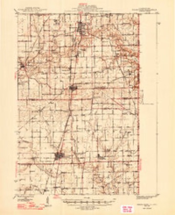
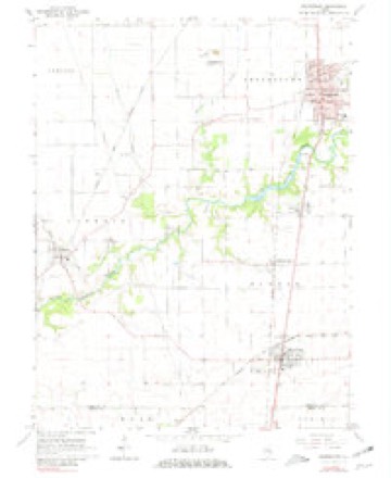
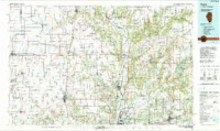
7 surveys from 15 printed sheetsMatched by testing this settlement's coordinate against the published boundary of every sheet in the United States Geological Survey's historical collection. Each opens the scanned sheet at the Survey.
- 1947 USGS Ridge Farm quadrangle1:62500, 3 printings
- 1953 USGS Indianapolis quadrangle1:250000, 4 printings
- 1956 USGS Indianapolis quadrangle1:250000
- 1957 USGS Indianapolis quadrangle1:250000, 2 printings
- 1962 USGS Indianapolis quadrangle1:250000
- 1966 USGS Georgetown quadrangle1:24000, 2 printings
- 1986 USGS Paris quadrangle1:100000, 2 printings




In the county-history sources
29,804 words on this townshipHistory of Vermilion County, Together with Historic Notes on the Northwest, Gleaned from Early Authors, Old Maps and Manuscripts, Private and Official Correspondence, and Other Authentic, Though, for the Most Part, Out-of-the-way Sources, published 1879 names this settlement in its chapter on Georgetown Township. These are the passages that mention it, exactly as the scans read.
Georgetown township lies in that portion of the county which is south and east of the center. It is in the second tier of townships from the south boundary line of the county, and has the Indiana state line on its eastern border. It embraces all of congressional township 18 north, range 11 west, and the fraction of 18-10 which lies between the former and the state line, and six sections in the southeast corner of 18-12. The Yermilion River runs across its northeastern corner for about five miles, and so deep down is its bed that the surrounding country is easily and perfectly drained into it. The Little Vermilion makes a short turn into its southern border, running through sections 33 and 34. The "State Road," from Vincennes to Chicago, runs across the township, and the "Salt-works Road," on which the products of the salt springs were carried into eastern Indiana (long before commercial intercourse had become so perfected that salt, boiled at Syracuse, could be transported to Danville and sold cheaper than it could be made here), ran diagonally across it. The Danville & Southwestern railroad runs through the town almost parallel with the " State Road," and has on it the two stations of Georgetown and Westville.
Passage source: History of Vermilion County, Together with Historic Notes on the Northwest, Gleaned from Early Authors, Old Maps and Manuscripts, Private and Official Correspondence, and Other Authentic, Though, for the Most Part, Out-of-the-way Sources, published 1879.
The township was originally nearly all timber, there being only about one-third of it along its western border and in its center, which was prairie. Some of the earliest settlements in the count}7 were made within its borders, and considerable farms were cleared before people learned that they could live on the prairie. Coal is known to be under pretty much all of the territory comprising this town ; and along the streams which flow into the Yermilion, its outcroppings have been freely worked. It was one of the tirst to be generally settled ; the abundance of its timber, the water supply, the general make of the land, and its proximity to the salt-works, - which was the center of settlement at that day, - drew to it those who first came to the county to make their pioneer homes.
Passage source: History of Vermilion County, Together with Historic Notes on the Northwest, Gleaned from Early Authors, Old Maps and Manuscripts, Private and Official Correspondence, and Other Authentic, Though, for the Most Part, Out-of-the-way Sources, published 1879.
The first one to make a home here was Henry Johnson, who settled on section 36 (18-12), just two miles west of the village of Georgetown, in 1820. It was the same year in which Butler made his home at worthies were the pioneers of this county, and were here at nearly the same date. Mr. Johnson has been long gone from here, but he is remembered as a man of generous impulses, and as a neighbor was little, if any, less than a "Good Samaritan." It is told of him (and in the light of the present day it seems hard to believe) that he would not take interest of his neighbors to whom he loaned money for a time, simply because he did not believe it was right to do it. Very soon after him came his brother-in-law, Absalom Starr, who took up his claim the following year, 1821, on the same section, south of Johnson's, where the then Mrs. Starr (now Mrs. Jones) yet resides. For fiftyeight years this good woman has lived here, performing all the arduous duties which mothers in the pioneer days were called on to do, and has seen the wild home of the red man converted into the busy abode of progressive civilization. Without seeming to realize it, she is now a wonder and a surprise, and is to-day the oldest living resident of Vermilion county, the story of whose life, trials, labors, triumphs and good deeds would make of itself a volume of fair proportions and enduring interest.
Passage source: History of Vermilion County, Together with Historic Notes on the Northwest, Gleaned from Early Authors, Old Maps and Manuscripts, Private and Official Correspondence, and Other Authentic, Though, for the Most Part, Out-of-the-way Sources, published 1879.
Machine-read from a century-old scan, so expect the errors a machine makes: misspelled names, dropped words, stray characters.
Read the whole chapter on Georgetown Township - it names this place 110 more 110 times.
Storms near this place
33 since 1995Regional context, not property-specific evidence. The National Weather Service names Georgetown in 33 storm reports between 1995 and 2024: 19 thunderstorm wind, 11 hail, 2 flash flood, 1 tornado. No death or injury is recorded in these reports. Each account below is quoted exactly as the forecast office filed it, from the NOAA Storm Events Database, and each date opens the federal record of that event.
| When | Event | Place named | Harm | What the report says |
|---|---|---|---|---|
| May 1995 | Thunderstorm Wind | Georgetown | $140,000 | Thunderstorm winds tore the roof off of a gym in Mary Miller Junior High and did significant structural damage to an adjoining administration building. Damage was estimated around $140,000. |
| July 2013 | Thunderstorm Wind | Georgetown | $85,000 | Numerous trees were blown down in Georgetown, including one that fell onto a house. |
| June 2018 | Thunderstorm Wind | Georgetown | $35,000 | A large tree was blown onto a house, causing major damage to the house. |
| July 2011 | Thunderstorm Wind | Georgetown | $30,000 | Numerous trees were blown down in Georgetown. |
| June 2011 | Thunderstorm Wind | Georgetown | $20,000 | Several trees were blown down in Georgetown. |
| June 2015 | Thunderstorm Wind | Georgetown | $15,000 | A tree and power lines were blown onto a car on Whittier Street in Georgetown. |
| July 2008 | Thunderstorm Wind | Georgetown | $15,000 | Numerous power lines were blown down in Georgetown. |
| July 2017 | Thunderstorm Wind | Georgetown | $10,000 | Trees were blown down on Route 1 blocking the road into Georgetown. |
| June 2010 | Thunderstorm Wind | Georgetown | $10,000 | Power lines were blown down. |
| June 2015 | Thunderstorm Wind | Georgetown | $4,000 | A few large tree branches were blown down in Georgetown. |
| June 2011 | Thunderstorm Wind | Georgetown | $2,000 | A large tree was blown down across Route 1 south of Georgetown. |
| July 2014 | Thunderstorm Wind | Georgetown | $1,500 | A large tree was blown down blocking Route 1 just south of Georgetown. |
| March 2023 | Thunderstorm Wind | Georgetown | - | Two power poles were blown down near 750 North Road. |
| June 2023 | Thunderstorm Wind | Georgetown | - | Trees were blown onto houses. |
| June 2023 | Thunderstorm Wind | Georgetown | - | Several trees were blown down, blocking roads. |
| June 2022 | Thunderstorm Wind | Georgetown | - | A 6-inch diameter tree limb was blown down. |
| August 2009 | Thunderstorm Wind | Georgetown | - | Widespread damage was reported at the Georgetown Fair. Numerous tents were destroyed and several buildings were damaged. |
| July 2008 | Hail | Georgetown | - | Three quarter inch hail fell 3 miles south of Georgetown. |
| May 2003 | Tornado (F0) | Georgetown | - | A tornado briefly touched down in a field. No damage or injuries were reported. |
| May 2003 | Thunderstorm Wind | Georgetown | - | Several trees and power poles were blown down. |
| April 2002 | Flash Flood | Georgetown | - | Very heavy rain fell over extreme southern portions of Vermilion County. Illinois Route 1 and several secondary roads were closed due to high water. Numerous basements were flooded in Georgetown with some residents evacuated. No injuries were reported. Also several township roads in the area were washed out. |
| August 2000 | Thunderstorm Wind | Georgetown | - | Trees and power lines were reported down in Georgetown and in Ridge Farm. |
| March 2024 | Hail | Georgetown | - | no account filed |
| May 2019 | Hail | Georgetown | - | no account filed |
| August 2019 | Hail | Georgetown | - | no account filed |
| June 2016 | Hail | Georgetown | - | no account filed |
| May 2015 | Hail | Georgetown | - | no account filed |
| May 2009 | Hail | Georgetown | - | no account filed |
| April 2007 | Hail | Georgetown | - | no account filed |
| June 2006 | Hail | Georgetown | - | no account filed |
| May 2000 | Hail | Georgetown | - | no account filed |
| May 1998 | Flash Flood | Georgetown | - | no account filed |
| May 1996 | Hail | Georgetown | - | no account filed |
Nearest settlements
The eight closest, with where each one stands in the county. Distances are straight-line, computed from the Geographic Names Information System coordinates.
| Map | Place | Distance | Sheets |
|---|---|---|---|
| Busenville | 2.3 miles | 15 | |
| Olivet | 2.3 miles | 15 | |
| Midway | 2.8 miles | 20 | |
| Meeks | 3.2 miles | 16 | |
| Steelton | 3.3 miles | 20 | |
| Unionville | 3.4 miles | 20 | |
| Vermilion Grove | 3.6 miles | 15 | |
| Himrod | 4.5 miles | 19 |
Elsewhere
Matched on this settlement's Geographic Names Information System number rather than its name, so it cannot be a different place of the same name in another state.
| Wikipedia article on Georgetown | An encyclopaedic summary. Its text is share-alike, so it is linked here rather than copied. |
| Wikidata item Q577709 | The structured record the population and elevation above come from. Public domain (CC0). |
Provenance
This settlement is recorded in the Geographic Names Information System as feature 408956. The sheet list is computed by point-in-boundary test against the United States Geological Survey's historical topographic inventory. Both are works of the United States government and carry no copyright under 17 U.S.C. 105.
Storms. NOAA National Centers for Environmental Information, Storm Events Database https://www.ncei.noaa.gov/stormevents/ A work of the United States government, no copyright under 17 U.S.C. 105. Narratives are quoted verbatim from the National Weather Service report and are not edited or summarised.