 Block
Gibson City, Illinois
14 topographic sheets cover this place, the earliest surveyed in 1928 and the latest in 1990. It stands in Drummer Township. It lies in ZIP code area 60936. The Survey maps it on the Gibson City West quadrangle. 3,475 people lived here at the 2020 count. It stands 751 feet above sea level.
On record in Gibson City
Buildings and businesses the archive holds for this place. Each opens its own page, with the source record it came from.
On the National Register 1 record
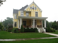 Alfred Phillips Houselisted 1999
Population over time
2 figuresGibson City grew from 3,407 to 3,475 between 2010 and 2020. These are the recorded population figures Wikidata holds for this place, reached through the Geographic Names Information System number this page is keyed on rather than by name, so they belong to this place and not to another of the same name. Most are census counts, but not all are: an early figure may be a founding or settlement estimate, and an estimate published within five years of a census is left out. The change column is computed, and is left blank where more than 20 years separate a figure from the one before it, because a gap that long is not a change between two counts.
| Year | People | Change |
|---|---|---|
| 2010 | 3,407 | |
| 2020 | 3,475 | +68 (+2%) |
Topographic sheets covering this place
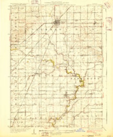
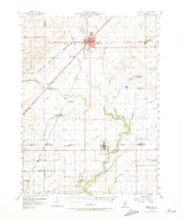
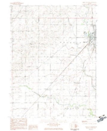
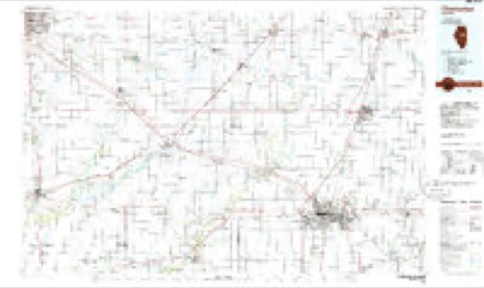
8 surveys from 14 printed sheetsMatched by testing this settlement's coordinate against the published boundary of every sheet in the United States Geological Survey's historical collection. Each opens the scanned sheet at the Survey.
- 1928 USGS Gibson City quadrangle1:62500, 2 printings
- 1957 USGS Gibson City quadrangle1:62500, 2 printings
- 1958 USGS Peoria quadrangle1:250000, 4 printings
- 1961 USGS Peoria quadrangle1:250000
- 1963 USGS Peoria quadrangle1:250000
- 1982 USGS Gibson City West quadrangle1:24000
- 1985 USGS Champaign quadrangle1:100000, 2 printings
- 1990 USGS Peoria quadrangle1:250000




In the county-history sources
3,038 words on this townshipThe county-history sources names this settlement in its chapter on Drummer Township. These are the passages that mention it, exactly as the scans read.
Machine-read from a century-old scan, so expect the errors a machine makes: misspelled names, dropped words, stray characters.
Read the whole chapter on Drummer Township - it names this place 1 more 1 time.
Mines and quarries near this place
4 within 5 milesRegional context, not property-specific evidence. The federal mineral resources record lists 4 workings within 5 miles of Gibson City: 2 past producers, 2 producers. 2 still produce. What was taken out: Sand and Gravel, Construction. Distance is straight-line from the map coordinates, so a quarry counted here may appear on a neighbouring settlement's page as well.
| Where | Site | Commodity | Status | Recorded |
|---|---|---|---|---|
| Jordon Pit | Sand and Gravel, Construction | Past Producer | ||
| Mc Call Pit | Sand and Gravel, Construction | Producer | ||
| Tucker Pit | Sand and Gravel, Construction | Producer | ||
| Utterback Pit | Sand and Gravel, Construction | Past Producer |
Storms near this place
59 since 1994Regional context, not property-specific evidence. The National Weather Service names Gibson City in 59 storm reports between 1994 and 2026: 31 thunderstorm wind, 12 hail, 7 tornado, 4 flood. No death or injury is recorded in these reports. Each account below is quoted exactly as the forecast office filed it, from the NOAA Storm Events Database, and each date opens the federal record of that event.
| When | Event | Place named | Harm | What the report says |
|---|---|---|---|---|
| June 2010 | Thunderstorm Wind | Gibson City | $750,000 | Numerous trees up to two feet in diameter, tree limbs and power lines were blown down in Gibson City. Some trees and tree limbs fell onto houses. A semi tanker trailer was pushed over on its side. A large grain bin under construction was knocked off its foundation. Damage to the grain bin itself was estimated at $750,000. |
| July 2014 | Flash Flood | Gibson City | $500,000 | Water 12 to 18 inches deep was reported on most streets and adjacent property across northern portions of Gibson City. Basements were flooded and 18 inches of water flooded the water treatment plant. A storm total of 4.75 inches of rain was measured. |
| April 2013 | Tornado (EF0) | Gibson City | $15,000 | Witnesses described a tornado briefly touching down and hitting a barn, killing two horses, then lifting back up. Six power poles were also blown down. Emergency managers found debris as far as approximately six miles away. |
| June 2013 | Thunderstorm Wind | Gibson City | $10,000 | A 20 by 24 foot section of roofing shingles was taken off a church on the northwest side of Gibson City. Numerous 18 to 24 inch diameter trees were blown over or snapped throughout town. Some of the trees were snapped at the base while others were snapper higher. |
| April 1994 | Hail | Gibson City | $5,000 | High winds and hail damaged siding, windows and automobiles. |
| June 2013 | Thunderstorm Wind | Gibson City | $3,000 | A row of power lines were blown down into a field south of Route 9 along County Road 300E. A Large tree was uprooted across Route 54. |
| March 2006 | Thunderstorm Wind | Gibson City | $3,000 | At State Road 9 and County Road 1100E several large evergreens were uprooted and part of the roof of an outbuilding was blown off. Further down SR 9, between 1100E and 1200E, a few utility poles and power lines were blown down. Near SR 9 and 1200E a farm house had windows broken and siding damaged by wind. A pickup truck also had windows broken. |
| June 2017 | Thunderstorm Wind | Gibson City | $2,000 | Numerous trees and tree limbs were blown down along with some power lines. One tree was blocking the road near Church and 8th Streets. Most of the damage was concentrated between 8th and 14th streets, east of Sangamon Street. |
| May 2003 | Tornado (F0) | Gibson City | $2,000 | A weak tornado touched down three miles north of Gibson City near Route 47 and SR 900N. The tornado damaged some out buildings and a couple farms and debris was blown across a field. |
| April 2026 | Tornado (EF1) | Gibson City | - | An EF-1 tornado touched down on the west side of Gibson City, producing significant roofing damage to several buildings along 8th Street. The tornado continued ENE for several miles, producing primarily tree damage before lifting approximately three miles ENE of Gibson City. |
| May 2025 | Thunderstorm Wind | Gibson City | - | A tree was blown down into the roadway near Melvin Street and 15th Street. |
| December 2025 | Tornado (EF0) | Gibson City | - | A tornado with estimated peak winds of 85 mph touched down just southwest of the intersection of E 300 North Road and N 450 E Road. The tornado crossed the intersection and peeled a west-facing section of metal roof eastward off an agricultural office building. While no condensation funnel was evident, eyewitnesses reported visible rotation in the clouds passing over the facility and debris from the impacted building getting lofted and swirled around in the air before being deposited in a field east of the facility where the tornado ended. This was the only damage reported from this tornado. |
| June 2024 | Thunderstorm Wind | Gibson City | - | An Ambient weather station measured a 63 mph gust northeast of Gibson City. |
| June 2024 | Thunderstorm Wind | Gibson City | - | Numerous trees and power lines were downed across Gibson City. A stoplight had also been blown off its pole and panels were blown out of a fence. |
| August 2024 | Flood | Gibson City | - | Several roads and intersections were covered by floodwater around Gibson City. 6 of water was reported on 12th St at Sangamon Ave, 10th St east of downtown was impassable, and there was water up to the doorsteps of apartment buildings on State St. |
| June 2023 | Thunderstorm Wind | Gibson City | - | Trees were blown down. |
| July 2022 | Thunderstorm Wind | Gibson City | - | A tree was blown down on Pine Street. |
| July 2022 | Thunderstorm Wind | Gibson City | - | A tree was blown down onto power lines. |
| August 2021 | Thunderstorm Wind | Gibson City | - | Tree damage was reported in Gibson City including tree limbs and power lines blown down and one small tree snapped at its base. |
| October 2021 | Flood | Gibson City | - | Street flooding was reported in Gibson City. |
| September 2021 | Thunderstorm Wind | Gibson City | - | Widespread tree and powerline damage was reported in Gibson City. The roof of the hospital was damaged and a baseball dugout was destroyed. |
| December 2021 | Thunderstorm Wind | Gibson City | - | A roof was partially blown off a residential building and a couple of trees were blown down. |
| May 2019 | Thunderstorm Wind | Gibson City | - | A large tree was blown down on Lott Blvd. Numerous tree limbs were blown down. Power was reported out for much of Gibson City. |
| July 2018 | Thunderstorm Wind | Gibson City | - | A tree was blown down. |
| May 2018 | Funnel Cloud | Gibson City | - | A funnel cloud was observed about five miles north of Gibson City. |
| May 2018 | Funnel Cloud | Gibson City | - | A funnel cloud was observed about one mile east of Gibson City. |
| June 2018 | Thunderstorm Wind | Gibson City | - | A large, partially rotted tree limb fell onto a garage. |
| June 2017 | Thunderstorm Wind | Gibson City | - | A large section of a tree was snapped off and blown across a road. |
| June 2015 | Thunderstorm Wind | Gibson City | - | Medium sized tree limbs were snapped off of trees throughout town. |
| May 2014 | Flash Flood | Gibson City | - | An estimated 1.5 feet of flowing water was reported over Route 47 north of Gibson city with flooding reported on the roads in Gibson City. A CoCoRaHS observer measured 2.25 inches of rain in Gibson City. |
| June 2013 | Flood | Gibson City | - | Heavy rain caused 8 to 12 inches of water to build up on most roads in Gibson City. |
| July 2012 | Hail | Gibson City | - | Quarter size hail was reported at 623 East 1st Street. |
| July 2012 | Tornado (EF0) | Gibson City | - | A trained spotter reported that a very brief tornado touched down on the east side of Illinois Route 47 approximately two miles south of Gibson City. No damage occurred. |
| April 2011 | Flood | Gibson City | - | Standing water up to 18 inches deep was reported in some intersections in Gibson City. Stormtotal rainfall amounts included 1.90 inches in Paxton and 1.05 inches in Piper City. |
| June 2010 | Thunderstorm Wind | Gibson City | - | Several trees were blown down blocking Route 9 between Gibson City and Paxton. |
| July 2009 | Flash Flood | Gibson City | - | Significant street flooding was reported in Gibson City with many roads covered with water. |
| August 2009 | Thunderstorm Wind | Gibson City | - | Small tree limbs were blown down. |
| December 2008 | Thunderstorm Wind | Gibson City | - | A wind gust to 63 mph was measured southwest of Gibson City. |
| June 2008 | Thunderstorm Wind | Gibson City | - | Trees and tree limbs were blown down. |
| May 2007 | Thunderstorm Wind | Gibson City | - | Tree limbs were blown down. |
| March 2006 | Thunderstorm Wind | Gibson City | - | A gust was measured to 60 mph. |
| June 2005 | Thunderstorm Wind | Gibson City | - | Five utility poles were blown over along Route 54. |
| September 2005 | Thunderstorm Wind | Gibson City | - | Partial tree was blown down along with tree limbs south of Gibson City. |
| May 2004 | Thunderstorm Wind | Gibson City | - | Tree limbs were down. A drive-in movie theater movie screen was damaged and signs were blown down. |
| July 2003 | Thunderstorm Wind | Gibson City | - | The wind pushed a utility pole over and small trees were blown over. |
| August 2001 | Hail | Gibson City | - | A slow moving thunderstorm moved across southern Ford county during the early afternoon on August 18th, producing hail as large as half dollars across most of southern Ford county. |
| August 2021 | Hail | Gibson City | - | no account filed |
| March 2017 | Hail | Gibson City | - | no account filed |
| May 2014 | Hail | Gibson City | - | no account filed |
| May 2014 | Hail | Gibson City | - | no account filed |
| June 2013 | Hail | Gibson City | - | no account filed |
| July 2009 | Hail | Gibson City | - | no account filed |
| April 2006 | Hail | Gibson City | - | no account filed |
| June 2005 | Hail | Gibson City | - | no account filed |
| May 2003 | Thunderstorm Wind | Gibson City | - | no account filed |
| July 2003 | Thunderstorm Wind | Gibson City | - | no account filed |
| May 2000 | Tornado (F0) | Gibson City | - | no account filed |
| May 2000 | Tornado (F0) | Gibson City | - | no account filed |
| June 1998 | Hail | Gibson City | - | no account filed |
Nearest settlements
The eight closest, with where each one stands in the county. Distances are straight-line, computed from the Geographic Names Information System coordinates.
Elsewhere
Matched on this settlement's Geographic Names Information System number rather than its name, so it cannot be a different place of the same name in another state.
| Wikipedia article on Gibson City | An encyclopaedic summary. Its text is share-alike, so it is linked here rather than copied. |
| Wikidata item Q576014 | The structured record the population and elevation above come from. Public domain (CC0). |
Provenance
This settlement is recorded in the Geographic Names Information System as feature 408990. The sheet list is computed by point-in-boundary test against the United States Geological Survey's historical topographic inventory. Both are works of the United States government and carry no copyright under 17 U.S.C. 105.
Mines and quarries. USGS Mineral Resources Data System (MRDS) https://mrdata.usgs.gov/mrds/ A work of the United States government, no copyright under 17 U.S.C. 105.
Storms. NOAA National Centers for Environmental Information, Storm Events Database https://www.ncei.noaa.gov/stormevents/ A work of the United States government, no copyright under 17 U.S.C. 105. Narratives are quoted verbatim from the National Weather Service report and are not edited or summarised.