 Block
Haldane, Illinois
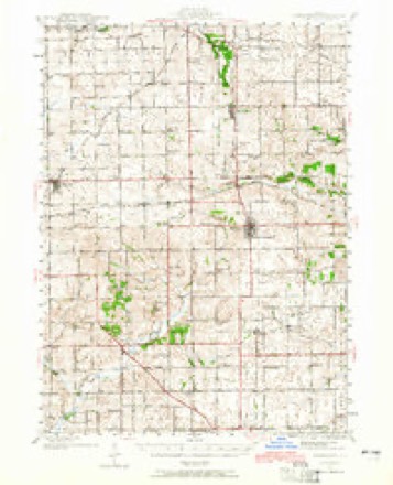
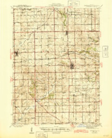
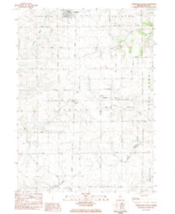
14 topographic sheets cover this place, the earliest surveyed in 1942 and the latest in 1983. It stands in Lincoln Township. It lies in ZIP code area 61030. The Survey maps it on the Forreston South quadrangle.
Topographic sheets covering this place
8 surveys from 14 printed sheetsMatched by testing this settlement's coordinate against the published boundary of every sheet in the United States Geological Survey's historical collection. Each opens the scanned sheet at the Survey.
- 1942 USGS Forreston quadrangle1:62500, 2 printings
- 1945 USGS Forreston quadrangle1:62500, 2 printings
- 1954 USGS Rockford quadrangle1:250000
- 1955 USGS Rockford quadrangle1:250000
- 1958 USGS Rockford quadrangle1:250000, 4 printings
- 1963 USGS Rockford quadrangle1:250000
- 1981 USGS Rockford quadrangle1:100000, 2 printings
- 1983 USGS Forreston South quadrangle1:24000





In the county-history sources
4,932 words on this townshipThe History of Ogle County, Illinois, Containing a History of the County, Its Cities, Towns, Etc., a Biographical Directory of Its Citizens, War Record of Its Volunteers in the Late Rebellion, General and Local Statistics ... History of the Northwest, History of Illinois ... Etc, published 1878 names this settlement in its chapter on Lincoln Township. These are the passages that mention it, exactly as the scans read.
CURRY IVARREX, Farmer and Stock Raiser; Sec. 27; P. O. Haldane; born in Tompkins Co., N. Y., Feb. 21, 1827 ; came to this Co. in the Spring of 1857; owns 160 acres of land, valued at $8,000; is a Greenbacker; has held the offices of Supervisor, Justice of the Peace and School Trustee ; takes a leading interest in all the business of the town; married Mahalah Wilson in 1847 ; born Dec. 18, 1829; has seven children: Trulove, Amos, William. Daniel, James, Maggie and Warren ; Mr. C. enlisted in 1864 in Co. D, 179th I. V. I. ; was in the Army of the Potomac in the Battle of Hatch's Run and at the surrender of Gen. Lee to Grant ; was also at the storming of Ft. Steadman ; left the army at Alexandria ; mustered out at Elmira, N. Y., in 1865.
Passage source: The History of Ogle County, Illinois, Containing a History of the County, Its Cities, Towns, Etc., a Biographical Directory of Its Citizens, War Record of Its Volunteers in the Late Rebellion, General and Local Statistics ... History of the Northwest, History of Illinois ... Etc, published 1878.
EICHHOL.TZ S. Farmer and Stock Raiser; P. O. Haldane; born in Blair Co., Pa., Jan. 18, 1837; came to this Co. in Spring, 1856; Democrat; belongs to the Lutheran Church ; held the office of Alderman two terms in Polo ; married Jennie Updegraff in Fall 1865; born in Northumberland Co., May 9, 1841 ; has three children : Harry St. Almond, born Aug. 24, 1866, Levi Benton, Aug. 16, 1868, Idelette Pearl. April 21, 1875 ; he enlisted Sept. 18, 1862, in 92d I. V. I.; belonged to Kilpatrick's command ; was with Sherman on his march through Georgia; was in battles of Trienne, Chattanooga, Mission Ridge, Ringgold, Resaca, Atlanta and Brownsville ; was wounded in battle, at Atlanta, in the shoulder; also, at Bentonville, in the hip; his father, Henry Eichholtz, came from Blair Co., Pa., in 1856; owned 323 acres, valued at $20,000 ; Mr. C. S. Eichholtz is now in Wichita, Sedgwick Co., Kausaa.
Passage source: The History of Ogle County, Illinois, Containing a History of the County, Its Cities, Towns, Etc., a Biographical Directory of Its Citizens, War Record of Its Volunteers in the Late Rebellion, General and Local Statistics ... History of the Northwest, History of Illinois ... Etc, published 1878.
GOOD CHRIJSTIAlSr, Farmer and Stock Raiser ; Sees. 19 and 20 ; P. O. Haldane; born in Lancaster Co., Pa., Jan. 28, 1833 ; came to this Co. in Spring of 1857 ; has 307 acres land, valued at $65 per acre - $22,955 ; Republican ; belongs to the Evangelical Church; held the offices of Highway Commissioner and School Director ; married Mary Warfel ; she was born in Lancaster Co., Pa., Sept. 18, 1829; died Aug. 11, I860; married Elizabeth Schnee Feb. 18, 1862 ; she was born in Union Co., Pa., March 24,1843; have six children: Hiram, born Aug. 15, 1855 ; Emma, Jan. 15, 1857; Peter, Sept. 12, 1858; Catherine, July 30, 1860; May (second wife) Dec. 16, 1862; George J., July 25, 1868; has some fine blooded cattle, and turns off about sixty head of fat cattle and about the same number of hogs every year; he has a beau-
Passage source: The History of Ogle County, Illinois, Containing a History of the County, Its Cities, Towns, Etc., a Biographical Directory of Its Citizens, War Record of Its Volunteers in the Late Rebellion, General and Local Statistics ... History of the Northwest, History of Illinois ... Etc, published 1878.
Machine-read from a century-old scan, so expect the errors a machine makes: misspelled names, dropped words, stray characters.
Read the whole chapter on Lincoln Township - it names this place 6 more 6 times.
Fires near this place
2 since 2009Regional context, not property-specific evidence. The federal wildfire occurrence database lists 2 fires within 5 miles of Haldane between 2009 and 2014, burning about 37 acres in total. None started naturally. None was recorded as arson. Distance is straight-line from the map coordinates, so a fire counted here may appear on a neighbouring settlement's page as well.
| Reported cause | Fires |
|---|---|
| Missing data/not specified/undetermined | 1 |
| Fireworks | 1 |
The most recent of them, most recent first, with the day each was reported and the service that recorded it.
| Date | Cause | Size | Reported by | Name on the report |
|---|---|---|---|---|
| 19 April 2014 | Fireworks | under an acre | Illinois Division of Forestry Resources | HOUGH1 |
| 11 April 2009 | Missing data/not specified/undetermined | 36 acres | Illinois Division of Forestry Resources | PIEPER |
Settlements close enough to share some of these fires:
Mines and quarries near this place
7 within 5 milesRegional context, not property-specific evidence. The federal mineral resources record lists 7 workings within 5 miles of Haldane: 7 past producers. None of them still produces. What was taken out: Stone, Crushed/Broken, Limestone, General. Distance is straight-line from the map coordinates, so a quarry counted here may appear on a neighbouring settlement's page as well.
| Where | Site | Commodity | Status | Recorded |
|---|---|---|---|---|
| Pine Creek Rock | Limestone, General | Past Producer | ||
| Ed Schnulle Quarry | Stone, Crushed/Broken | Past Producer | ||
| Mt. Morris Limestone Quarry | Stone, Crushed/Broken | Past Producer | ||
| Seifken Quarry | Stone, Crushed/Broken | Past Producer | ||
| Swalve Quarry | Stone, Crushed/Broken | Past Producer | ||
| Unnamed Limestone Quarry | Stone, Crushed/Broken | Past Producer | ||
| Unnamed Limestone Quarry | Stone, Crushed/Broken | Past Producer |
Storms near this place
3 since 2008Regional context, not property-specific evidence. The National Weather Service names Haldane in 3 storm reports between 2008 and 2023: 1 thunderstorm wind, 1 flash flood, 1 flood. No death or injury is recorded in these reports. Each account below is quoted exactly as the forecast office filed it, from the NOAA Storm Events Database, and each date opens the federal record of that event.
| When | Event | Place named | Harm | What the report says |
|---|---|---|---|---|
| August 2008 | Thunderstorm Wind | Haldane | $15,000 | A police car and a second car, parked next to each other near Route 26 and Haldane Road, were damaged when a tree fell onto them. Many trees were damaged in Haldane and a large antenna was blown down along Route 26. |
| April 2023 | Flood | Haldane | - | Water was reported flowing over Route 26 between Forreston and Polo. |
| August 2022 | Flash Flood | Haldane | - | Route 26 was closed near Route 64 with water flowing over the road. |
Nearest settlements
The eight closest, with where each one stands in the county. Distances are straight-line, computed from the Geographic Names Information System coordinates.
| Map | Place | Distance | Sheets |
|---|---|---|---|
| Maryland | 1.4 miles | 14 | |
| Forreston | 4.4 miles | 14 | |
| Polo | 5.3 miles | 11 | |
| Buffalo Grove | 5.7 miles | 11 | |
| Brookville | 5.9 miles | 14 | |
| Stratford | 6.3 miles | 12 | |
| Harper | 6.7 miles | 14 | |
| Adeline | 7.1 miles | 14 |
Provenance
This settlement is recorded in the Geographic Names Information System as feature 409620. The sheet list is computed by point-in-boundary test against the United States Geological Survey's historical topographic inventory. Both are works of the United States government and carry no copyright under 17 U.S.C. 105.
Wildfire. Short, Karen C. 2022. Spatial wildfire occurrence data for the United States, 1992-2020 [FPA_FOD_20221014]. 6th Edition. Fort Collins, CO: Forest Service Research Data Archive. https://doi.org/10.2737/RDS-2013-0009.6 Collected with United States Government funding and usable without additional permissions or fees.
Mines and quarries. USGS Mineral Resources Data System (MRDS) https://mrdata.usgs.gov/mrds/ A work of the United States government, no copyright under 17 U.S.C. 105.
Storms. NOAA National Centers for Environmental Information, Storm Events Database https://www.ncei.noaa.gov/stormevents/ A work of the United States government, no copyright under 17 U.S.C. 105. Narratives are quoted verbatim from the National Weather Service report and are not edited or summarised.