 Block
Mount Morris, Illinois
14 topographic sheets cover this place, the earliest surveyed in 1922 and the latest in 1983. It stands in Mount Morris Township. It lies in ZIP code area 61054. The Survey maps it on the Mount Morris quadrangle. 2,861 people lived here at the 2020 count. It stands 909 feet above sea level.
On record in Mount Morris
Buildings and businesses the archive holds for this place. Each opens its own page, with the source record it came from.
On the National Register 3 records
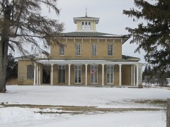 Samuel M. Hitt Houselisted 1985
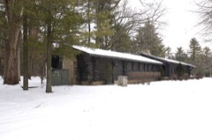 White Pines State Park Lodge and Cabinslisted 1985
- Mount Morris Downtown Historic Districtlisted 2022
Population over time
2 figuresMount Morris fell from 2,998 to 2,861 between 2010 and 2020. These are the recorded population figures Wikidata holds for this place, reached through the Geographic Names Information System number this page is keyed on rather than by name, so they belong to this place and not to another of the same name. Most are census counts, but not all are: an early figure may be a founding or settlement estimate, and an estimate published within five years of a census is left out. The change column is computed, and is left blank where more than 20 years separate a figure from the one before it, because a gap that long is not a change between two counts.
| Year | People | Change |
|---|---|---|
| 2010 | 2,998 | |
| 2020 | 2,861 | -137 (-5%) |
Topographic sheets covering this place
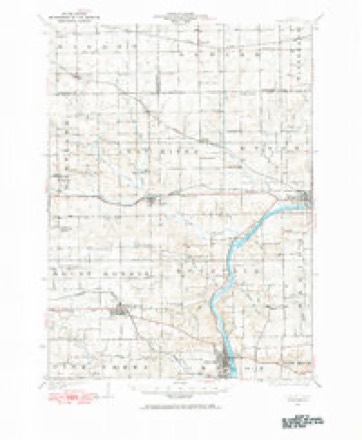
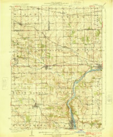
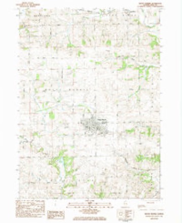
8 surveys from 14 printed sheetsMatched by testing this settlement's coordinate against the published boundary of every sheet in the United States Geological Survey's historical collection. Each opens the scanned sheet at the Survey.
- 1922 USGS Oregon quadrangle1:62500
- 1924 USGS Oregon quadrangle1:62500, 3 printings
- 1954 USGS Rockford quadrangle1:250000
- 1955 USGS Rockford quadrangle1:250000
- 1958 USGS Rockford quadrangle1:250000, 4 printings
- 1963 USGS Rockford quadrangle1:250000
- 1981 USGS Rockford quadrangle1:100000, 2 printings
- 1983 USGS Mount Morris quadrangle1:24000





In the county-history sources
12,108 words on this townshipThe History of Ogle County, Illinois, Containing a History of the County, Its Cities, Towns, Etc., a Biographical Directory of Its Citizens, War Record of Its Volunteers in the Late Rebellion, General and Local Statistics ... History of the Northwest, History of Illinois ... Etc, published 1878 names this settlement in its chapter on Mount Morris Township. These are the passages that mention it, exactly as the scans read.
SCHOOLS. The First School. - The Maryland colonists who first settled at Mount Morris were determined that their children should not want for educational privileges, and a school house was as necessary as a "cabin." When Samuel M.
Passage source: The History of Ogle County, Illinois, Containing a History of the County, Its Cities, Towns, Etc., a Biographical Directory of Its Citizens, War Record of Its Volunteers in the Late Rebellion, General and Local Statistics ... History of the Northwest, History of Illinois ... Etc, published 1878.
The school numbered twenty-six pupils, and a record of their names, so far as they are now remembered by Mr. Allen, will be interesting to their descendants in the present and in the future. Among this little group were Margaret C. Hitt (now Mrs. D. J. Pinckney), John W. Hitt (now an influential citizen of Mount Morris, and for several years past Supervisor of the town), George Hitt (since dead), Andrew M. Hitt, Joseph Hitt, John Hitt (now Deputy Collector of Customs, Chicago), Robert S. Hitt (of Chicago), Robert R. Hitt (now Secretary of Legation at Paris), Martin R. M. Wallace (Judge Wallace of Chicago), Elizabeth Reynolds, Caroline M. Reynolds, Ann E. Swingley (Mrs. Phelps), Urilla Swingley, John H. Swingley, Upton Swingley, Nathaniel A. Ankeny, Augustus H. Ankeny (afterward a leading citizen of Clinton, Iowa), Ann M. Ankeny (Mrs. Wm. Watts), Clinton Helm (an eminent physician at Rockford), James C. T. Phelps (now of Rochelle on the farm his father made), James Reynolds, Peter Householder, the Worden boys, and Richard McClain's children. Rock River Seminary was located here in the Spring of 1839, under the auspices of the Methodist Church, and the first term commenced in November, 1840. A more extended sketch of this important institution will be found on page 468. Mr. Allen taught school in the school house above mentioned during that Spring and Summer.
Passage source: The History of Ogle County, Illinois, Containing a History of the County, Its Cities, Towns, Etc., a Biographical Directory of Its Citizens, War Record of Its Volunteers in the Late Rebellion, General and Local Statistics ... History of the Northwest, History of Illinois ... Etc, published 1878.
When the seminary was completed, the north portion of the basement was finished for religious purposes. Methodist services were held here until the erection of the new Seminary, when the east end of the two lower stories of that building was fitted up as a chapel. This was then considered to be a very elegant church room for a Western village. It was dedicated by Rev. J. V. Watson, assisted by Rev. Mr. Hinman.
Passage source: The History of Ogle County, Illinois, Containing a History of the County, Its Cities, Towns, Etc., a Biographical Directory of Its Citizens, War Record of Its Volunteers in the Late Rebellion, General and Local Statistics ... History of the Northwest, History of Illinois ... Etc, published 1878.
Machine-read from a century-old scan, so expect the errors a machine makes: misspelled names, dropped words, stray characters.
Read the whole chapter on Mount Morris Township - it names this place 8 more 8 times.
Fires near this place
8 since 2008Regional context, not property-specific evidence. The federal wildfire occurrence database lists 8 fires within 5 miles of Mount Morris between 2008 and 2014, burning about 49 acres in total. None started naturally. None was recorded as arson. Distance is straight-line from the map coordinates, so a fire counted here may appear on a neighbouring settlement's page as well.
| Reported cause | Fires |
|---|---|
| Missing data/not specified/undetermined | 7 |
| Fireworks | 1 |
The most recent of them, most recent first, with the day each was reported and the service that recorded it.
| Date | Cause | Size | Reported by | Name on the report |
|---|---|---|---|---|
| 6 May 2010 | Missing data/not specified/undetermined | 1.0 acres | Illinois Division of Forestry Resources | ROADWAY |
| 6 April 2008 | Missing data/not specified/undetermined | 1.0 acres | Illinois Division of Forestry Resources | CARILLO |
| 30 April 2011 | Missing data/not specified/undetermined | 5.0 acres | Illinois Division of Forestry Resources | MOON |
| 19 April 2014 | Fireworks | under an acre | Illinois Division of Forestry Resources | HOUGH1 |
| 16 April 2009 | Missing data/not specified/undetermined | 2.0 acres | Illinois Division of Forestry Resources | DEKONING |
| 11 April 2009 | Missing data/not specified/undetermined | 36 acres | Illinois Division of Forestry Resources | PIEPER |
| 13 March 2012 | Missing data/not specified/undetermined | 3.0 acres | Illinois Division of Forestry Resources | HORST |
| 10 October 2008 | Missing data/not specified/undetermined | under an acre | Illinois Division of Forestry Resources | DAVIS |
Settlements close enough to share some of these fires:
Mines and quarries near this place
10 of 14 shownRegional context, not property-specific evidence. The federal mineral resources record lists 14 workings within 5 miles of Mount Morris: 12 past producers, 1 producer, 1 plant. 2 still produce. What was taken out: Stone, Crushed/Broken, Sand and Gravel, Industrial/Frac Sand. Distance is straight-line from the map coordinates, so a quarry counted here may appear on a neighbouring settlement's page as well.
| Where | Site | Commodity | Status | Recorded |
|---|---|---|---|---|
| Oregon Quarry & Plant | Sand and Gravel, Industrial/Frac Sand | Producer | ||
| A. Right Quarry | Stone, Crushed/Broken | Past Producer | ||
| Ed Schnulle Quarry | Stone, Crushed/Broken | Past Producer | ||
| J. Horst Quarry | Stone, Crushed/Broken | Past Producer | ||
| Mt. Morris Limestone Quarry | Stone, Crushed/Broken | Past Producer | ||
| Oregon Construction Co. Quarry | Stone, Crushed/Broken | Past Producer | ||
| Pieper Quarry | Stone, Crushed/Broken | Past Producer | ||
| R. Little Quarry | Stone, Crushed/Broken | Past Producer | ||
| Saint Clair Quarry and Mill | Stone, Crushed/Broken | Plant | ||
| Sheely No. 2 Quarry | Stone, Crushed/Broken | Past Producer |
Nearest settlements
The eight closest, with where each one stands in the county. Distances are straight-line, computed from the Geographic Names Information System coordinates.
| Map | Place | Distance | Sheets |
|---|---|---|---|
| Stratford | 4.9 miles | 12 | |
| Leaf River | 5.4 miles | 14 | |
| Oregon | 5.8 miles | 14 | |
| Maryland | 6.2 miles | 14 | |
| Lightsville | 6.8 miles | 14 | |
| Adeline | 7.1 miles | 14 | |
| Daysville | 7.5 miles | 12 | |
| Haldane | 7.6 miles | 14 |
Elsewhere
Matched on this settlement's Geographic Names Information System number rather than its name, so it cannot be a different place of the same name in another state.
| Wikipedia article on Mount Morris | An encyclopaedic summary. Its text is share-alike, so it is linked here rather than copied. |
| Wikidata item Q2369711 | The structured record the population and elevation above come from. Public domain (CC0). |
Provenance
This settlement is recorded in the Geographic Names Information System as feature 414000. The sheet list is computed by point-in-boundary test against the United States Geological Survey's historical topographic inventory. Both are works of the United States government and carry no copyright under 17 U.S.C. 105.
Wildfire. Short, Karen C. 2022. Spatial wildfire occurrence data for the United States, 1992-2020 [FPA_FOD_20221014]. 6th Edition. Fort Collins, CO: Forest Service Research Data Archive. https://doi.org/10.2737/RDS-2013-0009.6 Collected with United States Government funding and usable without additional permissions or fees.
Mines and quarries. USGS Mineral Resources Data System (MRDS) https://mrdata.usgs.gov/mrds/ A work of the United States government, no copyright under 17 U.S.C. 105.