 Block
Hanover, Illinois
18 topographic sheets cover this place, the earliest surveyed in 1911 and the latest in 1984. It stands in Hanover Township. It lies in ZIP code area 61041. It stands on Duke Creek. The Survey maps it on the Hanover quadrangle. 863 people lived here at the 2020 count. It stands 627 feet above sea level.
Population over time
2 figuresHanover grew from 844 to 863 between 2010 and 2020. These are the recorded population figures Wikidata holds for this place, reached through the Geographic Names Information System number this page is keyed on rather than by name, so they belong to this place and not to another of the same name. Most are census counts, but not all are: an early figure may be a founding or settlement estimate, and an estimate published within five years of a census is left out. The change column is computed, and is left blank where more than 20 years separate a figure from the one before it, because a gap that long is not a change between two counts.
| Year | People | Change |
|---|---|---|
| 2010 | 844 | |
| 2020 | 863 | +19 (+2%) |
Topographic sheets covering this place
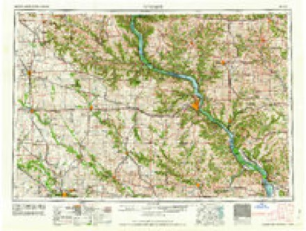
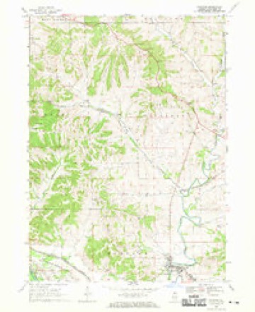
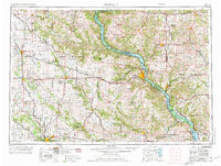
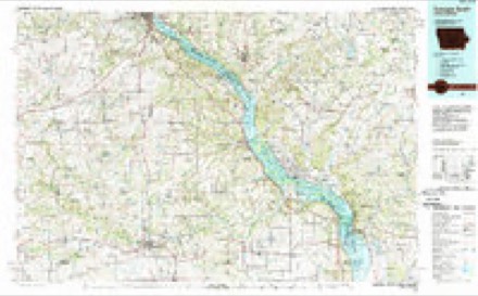
8 surveys from 18 printed sheetsMatched by testing this settlement's coordinate against the published boundary of every sheet in the United States Geological Survey's historical collection. Each opens the scanned sheet at the Survey.
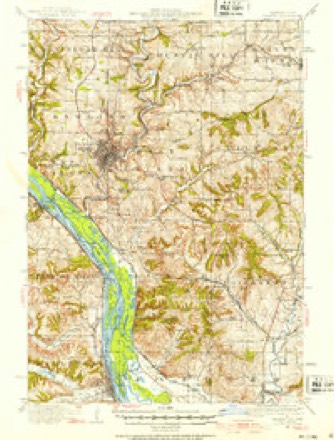
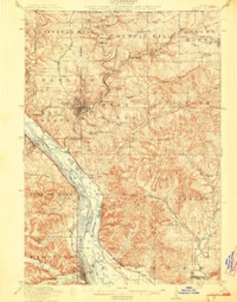
- 1911 USGS Galena quadrangle1:62500, 3 printings
- 1913 USGS Galena quadrangle1:62500, 3 printings
- 1959 USGS Dubuque quadrangle1:250000
- 1961 USGS Dubuque quadrangle1:250000
- 1962 USGS Dubuque quadrangle1:250000, 2 printings
- 1968 USGS Hanover quadrangle1:24000, 3 printings
- 1976 USGS Dubuque quadrangle1:250000
- 1984 USGS Dubuque South quadrangle1:100000, 4 printings
In the county-history sources
7,025 words on this townshipThe History of Jo Daviess County, Illinois, Containing a History of the County, Its Cities, Towns, Etc., a Biographical Directory of Its Citizens, War Record of Its Volunteers in the Late Rebellion ... History of the Northwest, History of Illinois ... Constitution of the United States, published 1878 names this settlement in its chapter on Hanover Township. These are the passages that mention it, exactly as the scans read.
The Township of Hanover forms the southwest corner of the county. It is consequently out of the lead mining region, except, perhaps, its northwestern border. Geographically, the township presents a great variety of natural beauty. On the western side lies a low prairie of nine by two miles in size, which, from its barren nature, has been named the "Sand Prairie." This is washed on the west by the " Father of Waters," while on the opposite side rises the high bluffy chain of hills which extends up the river bank to Galena, broken only by the valleys of the Small Pox and Galena Rivers. A tradition was current among the noble red men of the forest that the bed of the Mississippi once passed on the eastern side of the prairie near the bluffs, and an examination of this location tends to confirm the story. It is known that, in the flood of 1828 the supposed river bed was filled with water from the Mississippi.
Passage source: The History of Jo Daviess County, Illinois, Containing a History of the County, Its Cities, Towns, Etc., a Biographical Directory of Its Citizens, War Record of Its Volunteers in the Late Rebellion ... History of the Northwest, History of Illinois ... Constitution of the United States, published 1878.
At the place where the Village of Hanover now stands, the voyagers encountered the Apple River Falls, and were obliged to carry their canoe around on the land. At this time, remarks our droll informant, there was here a large city called Wapello - inhabited by a tribe of Sacs and Foxes, and named after their chief. Appreciating the value of this location as a mill site, Fowler and Ames marked it with a claim stake, and proceeded up the river. The next Spring they returned, took up the claim and engaged in farming.
Passage source: The History of Jo Daviess County, Illinois, Containing a History of the County, Its Cities, Towns, Etc., a Biographical Directory of Its Citizens, War Record of Its Volunteers in the Late Rebellion ... History of the Northwest, History of Illinois ... Constitution of the United States, published 1878.
Those were indeed dark days of hardships and bitterness to the resolute men who established the beautiful, and now, peaceful homes of Hanover. After peace and confidence had been restored, settlers began to fill up the valleys more rapidly. In 1835, Wm. R., son of James Craig, opened the first general store at the village, in a log house, but in the ensuing year he built a storeroom, which now forms a part of Nathan Craig's residence. There was no other general store established until that of James W. White in 1845. Mr. Craig kept a public house from the time of his settlement but the first and only regular hotel was not built until 1847, by Joseph E. Milligan. It is called the "Hanover Hotel, " and now owned by George W. Clark. In 1835, Mr. Craig erected a chair factory between the two mills he had already built. He found the water power sufficient to drive the machinery of the three establishments. At this point the river is about 200 feet wide, having a natural fall over a rocky bed of eleven feet. The dam is two hundred and forty feet long and five feet high, securely bolted to the rock, making a head and fall of sixteen feet, with a reservoir or flowage extending nearly ten miles and affording, probably, the best and most secure water power in northwestern Illinois.
Passage source: The History of Jo Daviess County, Illinois, Containing a History of the County, Its Cities, Towns, Etc., a Biographical Directory of Its Citizens, War Record of Its Volunteers in the Late Rebellion ... History of the Northwest, History of Illinois ... Constitution of the United States, published 1878.
Machine-read from a century-old scan, so expect the errors a machine makes: misspelled names, dropped words, stray characters.
Read the whole chapter on Hanover Township - it names this place 40 more 40 times.
Fires near this place
9 since 2008Regional context, not property-specific evidence. The federal wildfire occurrence database lists 9 fires within 5 miles of Hanover between 2008 and 2012, burning about 123 acres in total. 1 started naturally. None was recorded as arson. Distance is straight-line from the map coordinates, so a fire counted here may appear on a neighbouring settlement's page as well.
| Reported cause | Fires |
|---|---|
| Missing data/not specified/undetermined | 4 |
| Equipment and vehicle use | 2 |
| Debris and open burning | 2 |
| Natural | 1 |
The most recent of them, most recent first, with the day each was reported and the service that recorded it.
| Date | Cause | Size | Reported by | Name on the report |
|---|---|---|---|---|
| 17 August 2012 | Missing data/not specified/undetermined | under an acre | Savanna District, Upper Mississippi National Wildlife Refuge | CAFETERIA FIRE |
| 7 July 2008 | Missing data/not specified/undetermined | 4.0 acres | Savanna District, Upper Mississippi National Wildlife Refuge | WHITTON GATE |
| 25 May 2008 | Natural | 75 acres | Savanna District, Upper Mississippi National Wildlife Refuge | 1700'S |
| 7 April 2011 | Equipment and vehicle use | 8.4 acres | Savanna District, Upper Mississippi National Wildlife Refuge | WHITTON GUARD HOUSE |
| 23 April 2010 | Debris and open burning | under an acre | Illinois Division of Forestry Resources | HANOVER |
| 23 April 2010 | Missing data/not specified/undetermined | under an acre | Illinois Division of Forestry Resources | HANOVER2 |
| 10 April 2009 | Debris and open burning | 34 acres | Savanna District, Upper Mississippi National Wildlife Refuge | PARCEL 8C |
| 9 October 2010 | Equipment and vehicle use | under an acre | Illinois Division of Forestry Resources | SCHUBERT |
Settlements close enough to share some of these fires:
Mines and quarries near this place
7 within 5 milesRegional context, not property-specific evidence. The federal mineral resources record lists 7 workings within 5 miles of Hanover: 4 past producers, 2 unknowns, 1 producer. 1 still produces. What was taken out: Lead, Stone, Crushed/Broken, Zinc, Limestone, General. Distance is straight-line from the map coordinates, so a quarry counted here may appear on a neighbouring settlement's page as well.
| Where | Site | Commodity | Status | Recorded |
|---|---|---|---|---|
| Kansas Mine | Lead, Zinc | Unknown | Galena, Sphalerite | |
| Nobis Quarry | Limestone, General | Past Producer | ||
| Bertsch Quarry | Stone, Crushed/Broken | Past Producer | ||
| Illinois Mine | Lead, Zinc | Unknown | Galena, Sphalerite | |
| Shelly Quarry | Stone, Crushed/Broken | Producer | ||
| Skene Mine | Lead, Zinc | Past Producer | 1901, 1907 | |
| Illinois Mine | Lead | Past Producer |
Storms near this place
29 since 1994Regional context, not property-specific evidence. The National Weather Service names Hanover in 29 storm reports between 1994 and 2026: 15 thunderstorm wind, 11 hail, 2 tornado, 1 flash flood. No death or injury is recorded in these reports. Each account below is quoted exactly as the forecast office filed it, from the NOAA Storm Events Database, and each date opens the federal record of that event.
| When | Event | Place named | Harm | What the report says |
|---|---|---|---|---|
| July 2006 | Thunderstorm Wind | Hanover | $3,000 | Trees down. Estimated 56 to 63 knot (65 to 75 mph) winds |
| July 2006 | Hail | Hanover | $2,000 | penny to quarter size hail |
| May 2000 | Thunderstorm Wind | Hanover | $1,000 | no account filed |
| May 2024 | Thunderstorm Wind | Hanover | - | Trees and power lines blown down around and in Hanover, Illinois. |
| July 2024 | Tornado (EF1) | North Hanover | - | A tornado developed just northeast of Hanover in Jo Daviess County, and tracked to the southeast around 50 mph along an intermittent path. The tornado caused significant roof damage to a home east of Hanover that was rated EF-1. The tornado then moved into Carroll County near S. Breyer Road, around 18:02 CST. The tornado caused EF-1 damage around Lake Carroll, including damage to a garage, gazebo, and boat dock, and numerous trees downed. The tornado then downed trees in Shannon before lifting around 18:16 CST. The tornado was rated EF-1 with maximum winds around 100 mph, in both Jo Daviess and Carroll Counties. |
| July 2024 | Thunderstorm Wind | Hanover | - | A public report of trees down in Hanover. The time of the event was estimated using radar. |
| August 2021 | Thunderstorm Wind | Hanover | - | A report of a large tree down in Hanover Illinois. |
| August 2018 | Thunderstorm Wind | Hanover | - | A State Official reported that a tree was blown down onto a portion of Highway 84 just southeast of Hanover. |
| April 2017 | Hail | Hanover | - | Broadcast media relayed a public report of quarter size hail. |
| June 2017 | Thunderstorm Wind | Hanover | - | Tree limbs were blown down, and the time estimated was from radar. |
| June 2014 | Hail | Hanover | - | The public reported hail the size of quarters, but mostly penny size. |
| June 2013 | Tornado (EF0) | Hanover | - | A NWS Survey Team determined that there was a brief tornado touchdown 3 miles south of Hanover with no significant damage. |
| June 2011 | Thunderstorm Wind | Hanover | - | Wind gusts estimated to be 70 mph blew down numerous trees near Hanover, IL at 927 pm CDT June 8. |
| June 2011 | Thunderstorm Wind | Hanover | - | Wind gusts estimated to be 65 mph blew a large maple tree down about 1 mile east southeast of Hanover, IL at 925 pm CDT June 8. Some lawn furniture was also blown around the yard of the residence. |
| September 2010 | Thunderstorm Wind | Hanover | - | Wind gusts estimated to be 60 to 70 mph were observed about 1 mile east northeast of Hanover, IL at 555 pm CDT September 12. |
| September 2010 | Thunderstorm Wind | Hanover | - | Wind gusts estimated to be 70 mph blew down some large tree branches about 1 mile east northeast of Hanover, IL at 555 pm CDT September 12. |
| June 2008 | Flash Flood | North Hanover | - | Heavy rains caused rapid rises of the Apple River during the late evening of June 12 and morning hours of June 13. The Apple river overflowed its banks and was covering W Lone Street just west of Elizabeth, IL around 11:00 pm June 12. The flash flood waters began to recede around mid morning June 13. |
| July 2008 | Thunderstorm Wind | Hanover | - | Wind gusts estimated to be 65 mph blew down some trees and tree limbs in Hanover, IL around 12:15 pm July 31. |
| May 2006 | Hail | Hanover | - | penny size hail covering the ground. |
| July 2006 | Thunderstorm Wind | Hanover | - | large trees bending over |
| May 2004 | Thunderstorm Wind | Hanover | - | 2 large trees down between Hanover and Elizabeth |
| April 1994 | Hail | Hanover | - | Thunderstorm winds damaged a porch in East Dubuque and knocked down trees at Menominee. Large hail damaged cars and siding at Elizabeth. |
| March 2026 | Hail | Hanover | - | no account filed |
| April 2026 | Hail | Hanover | - | no account filed |
| May 2013 | Hail | Hanover | - | no account filed |
| February 2009 | Hail | Hanover | - | no account filed |
| May 2004 | Hail | Hanover | - | no account filed |
| June 1999 | Hail | Hanover | - | no account filed |
| August 1998 | Thunderstorm Wind | Hanover | - | no account filed |
Nearest settlements
The eight closest, with where each one stands in the county. Distances are straight-line, computed from the Geographic Names Information System coordinates.
| Map | Place | Distance | Sheets |
|---|---|---|---|
| Pleasant Hill (historical) | 2.4 miles | 14 | |
| North Hanover | 2.6 miles | 18 | |
| Whitton | 2.6 miles | 15 | |
| Weston (historical) | 4.0 miles | 18 | |
| Woodland Valley Courts | 4.1 miles | 23 | |
| Brinksburg (historical) | 4.6 miles | 15 | |
| Elizabeth | 5.2 miles | 14 | |
| Rodden | 5.4 miles | 18 |
Elsewhere
Matched on this settlement's Geographic Names Information System number rather than its name, so it cannot be a different place of the same name in another state.
| Wikipedia article on Hanover | An encyclopaedic summary. Its text is share-alike, so it is linked here rather than copied. |
| Wikidata item Q2672128 | The structured record the population and elevation above come from. Public domain (CC0). |
Provenance
This settlement is recorded in the Geographic Names Information System as feature 409751. The sheet list is computed by point-in-boundary test against the United States Geological Survey's historical topographic inventory. Both are works of the United States government and carry no copyright under 17 U.S.C. 105.
Wildfire. Short, Karen C. 2022. Spatial wildfire occurrence data for the United States, 1992-2020 [FPA_FOD_20221014]. 6th Edition. Fort Collins, CO: Forest Service Research Data Archive. https://doi.org/10.2737/RDS-2013-0009.6 Collected with United States Government funding and usable without additional permissions or fees.
Mines and quarries. USGS Mineral Resources Data System (MRDS) https://mrdata.usgs.gov/mrds/ A work of the United States government, no copyright under 17 U.S.C. 105.
Storms. NOAA National Centers for Environmental Information, Storm Events Database https://www.ncei.noaa.gov/stormevents/ A work of the United States government, no copyright under 17 U.S.C. 105. Narratives are quoted verbatim from the National Weather Service report and are not edited or summarised.