 Block
Weston, Illinois
18 topographic sheets cover this place, the earliest surveyed in 1911 and the latest in 1984. It stands in Elizabeth Township. It lies in ZIP code area 61028. It stands on Furnace Creek. The Survey maps it on the Hanover quadrangle. The federal gazetteer marks this settlement historical: it is no longer a populated place, though the surveys that recorded it still are.
Topographic sheets covering this place
8 surveys from 18 printed sheetsMatched by testing this settlement's coordinate against the published boundary of every sheet in the United States Geological Survey's historical collection. Each opens the scanned sheet at the Survey.
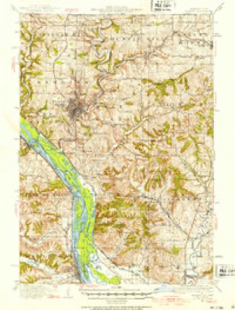
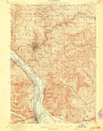
- 1911 USGS Galena quadrangle1:62500, 3 printings
- 1913 USGS Galena quadrangle1:62500, 3 printings
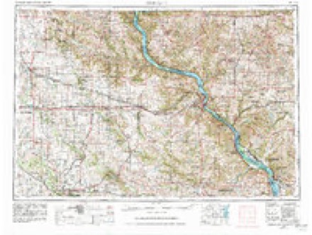
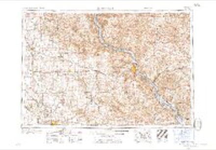
- 1959 USGS Dubuque quadrangle1:250000
- 1961 USGS Dubuque quadrangle1:250000
- 1962 USGS Dubuque quadrangle1:250000, 2 printings
- 1968 USGS Hanover quadrangle1:24000, 3 printings
- 1976 USGS Dubuque quadrangle1:250000
- 1984 USGS Dubuque South quadrangle1:100000, 4 printings
In the county-history sources
13,991 words on this townshipThe History of Jo Daviess County, Illinois, Containing a History of the County, Its Cities, Towns, Etc., a Biographical Directory of Its Citizens, War Record of Its Volunteers in the Late Rebellion ... History of the Northwest, History of Illinois ... Constitution of the United States, published 1878 names this settlement in its chapter on Elizabeth Township. These are the passages that mention it, exactly as the scans read.
But the village was not destined to prosper. As one of its proprietors remarked, " It sprung up like Jonah's gourd and died in the same manner." When the pockets of the earth were exhausted the miner shouldered his pick and sought other fields. The store was closed and in 1859 the post-office was discontinued. At present Mr. Wm. Goldthorp is the principal proprietor. Mr. Henry Green has a smelting furnace between Elizabeth and Weston, is one of the capitalists engaged in manufactures at Hanover, and lives on his farm near Elizabeth, where his beautiful residence and grounds are generally admired. At the time of the land sale at Dixon, in April 1847, Mr. Green was made the agent of the township residents and bid off their lands en masse.
Passage source: The History of Jo Daviess County, Illinois, Containing a History of the County, Its Cities, Towns, Etc., a Biographical Directory of Its Citizens, War Record of Its Volunteers in the Late Rebellion ... History of the Northwest, History of Illinois ... Constitution of the United States, published 1878.
In 1844, occurred the "Stone's field excitement," as it was called. Captain Stone owned land adjoining the Weston property on which he forbade prospecting. John Bennett, a German, and associates who were in the employ of Green, Goldthorp & Co., urgently requested permission to examine the land; but being refused, they went on the land at night and, before morning, mineral had been struck in three places. Then followed intense excitement. Mr. Stone endeavored to raise a company of armed men to protect his property, while miners flocked to the field in large numbers, all "armed to the teeth " with pistols, guns and knives. A bloody conflict was at one time imminent but Mr. Stone decided to accept the usual percentage, one sixth of all the mineral raised.
Passage source: The History of Jo Daviess County, Illinois, Containing a History of the County, Its Cities, Towns, Etc., a Biographical Directory of Its Citizens, War Record of Its Volunteers in the Late Rebellion ... History of the Northwest, History of Illinois ... Constitution of the United States, published 1878.
GOLDTHORP WM. Farmer; Sec. 22; P.O.Elizabeth; born in Yorkshire, England, April 5, 1812; came to America in 1829, settling at Philadelphia, Pa.; remained there three years; came to Jo Daviess Co. in 1832; went from Galena to Blue Mound, Wis., in 1833, mining there for 18 months ; made his first $500 at that place; went to Lost Grove; remained there for one year in smelting business; then went on to Fever River, where lie remained in the smelting business till 1844; moved to farm upon which he now resides ; married Ellen Ellis Nov. 12, 1831, at Philadelphia; she was born in Yorkshire, Eng. ; they have four children living: Elizabeth, Joseph E., Thos. R., and Araminta; has 1,380 acres of land ; was Postmaster for 15 years at Weston; has been School Director for many years.
Passage source: The History of Jo Daviess County, Illinois, Containing a History of the County, Its Cities, Towns, Etc., a Biographical Directory of Its Citizens, War Record of Its Volunteers in the Late Rebellion ... History of the Northwest, History of Illinois ... Constitution of the United States, published 1878.
Machine-read from a century-old scan, so expect the errors a machine makes: misspelled names, dropped words, stray characters.
Read the whole chapter on Elizabeth Township - it names this place 4 more 4 times.
Fires near this place
11 since 2008Regional context, not property-specific evidence. The federal wildfire occurrence database lists 11 fires within 5 miles of Weston (historical) between 2008 and 2010, burning about 17 acres in total. None started naturally. 1 was recorded as arson. Distance is straight-line from the map coordinates, so a fire counted here may appear on a neighbouring settlement's page as well.
| Reported cause | Fires |
|---|---|
| Missing data/not specified/undetermined | 7 |
| Debris and open burning | 2 |
| Equipment and vehicle use | 1 |
| Arson/incendiarism | 1 |
The most recent of them, most recent first, with the day each was reported and the service that recorded it.
| Date | Cause | Size | Reported by | Name on the report |
|---|---|---|---|---|
| 27 September 2010 | Arson/incendiarism | under an acre | Illinois Division of Forestry Resources | WURSTER |
| 12 September 2008 | Missing data/not specified/undetermined | under an acre | Illinois Division of Forestry Resources | ELECTRIC |
| 16 July 2010 | Debris and open burning | under an acre | Illinois Division of Forestry Resources | TREE |
| 5 April 2010 | Missing data/not specified/undetermined | 12 acres | Illinois Division of Forestry Resources | HASS |
| 23 April 2010 | Debris and open burning | under an acre | Illinois Division of Forestry Resources | HANOVER |
| 23 April 2010 | Missing data/not specified/undetermined | under an acre | Illinois Division of Forestry Resources | HANOVER2 |
| 2 April 2008 | Missing data/not specified/undetermined | 1.0 acres | Illinois Division of Forestry Resources | WHEELERIGHT |
| 25 March 2008 | Missing data/not specified/undetermined | 3.0 acres | Illinois Division of Forestry Resources | BALDERINI |
Settlements close enough to share some of these fires:
Mines and quarries near this place
10 of 11 shownRegional context, not property-specific evidence. The federal mineral resources record lists 11 workings within 5 miles of Weston (historical): 6 past producers, 3 unknowns, 2 producers. 2 still produce. What was taken out: Lead, Stone, Crushed/Broken, Zinc, Limestone, General. Distance is straight-line from the map coordinates, so a quarry counted here may appear on a neighbouring settlement's page as well.
| Where | Site | Commodity | Status | Recorded |
|---|---|---|---|---|
| Haggerty Mine | Zinc, Lead | Unknown | Galena, Sphalerite | |
| Kansas Mine | Lead, Zinc | Unknown | Galena, Sphalerite | |
| Nobis Quarry | Limestone, General | Past Producer | ||
| Bertsch Quarry | Stone, Crushed/Broken | Past Producer | ||
| Branegar #1 | Stone, Crushed/Broken | Producer | ||
| Brown Quarry | Stone, Crushed/Broken | Producer | ||
| Illinois Mine | Lead, Zinc | Unknown | Galena, Sphalerite | |
| Skene Mine | Lead, Zinc | Past Producer | 1901, 1907 | |
| Wishon Mine | Lead, Zinc | Past Producer | 1865, 1910 | |
| Haggerty Mine | Lead | Past Producer |
Nearest settlements
The eight closest, with where each one stands in the county. Distances are straight-line, computed from the Geographic Names Information System coordinates.
| Map | Place | Distance | Sheets |
|---|---|---|---|
| North Hanover | 1.6 miles | 18 | |
| Elizabeth | 2.2 miles | 14 | |
| Rodden | 3.2 miles | 18 | |
| Pleasant Hill (historical) | 3.6 miles | 14 | |
| Hanover | 4.0 miles | 18 | |
| Winston | 5.5 miles | 18 | |
| Derinda Center | 6.2 miles | 14 | |
| Whitton | 6.5 miles | 15 |
Provenance
This settlement is recorded in the Geographic Names Information System as feature 1815817. The sheet list is computed by point-in-boundary test against the United States Geological Survey's historical topographic inventory. Both are works of the United States government and carry no copyright under 17 U.S.C. 105.
Wildfire. Short, Karen C. 2022. Spatial wildfire occurrence data for the United States, 1992-2020 [FPA_FOD_20221014]. 6th Edition. Fort Collins, CO: Forest Service Research Data Archive. https://doi.org/10.2737/RDS-2013-0009.6 Collected with United States Government funding and usable without additional permissions or fees.
Mines and quarries. USGS Mineral Resources Data System (MRDS) https://mrdata.usgs.gov/mrds/ A work of the United States government, no copyright under 17 U.S.C. 105.